|
Arabi, Ethiopia
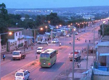
Arabi ( so, Araabi), is a town located in the Dembel district of the Sitti Zone, in the Somali region of Ethiopia Ethiopia, , om, Itiyoophiyaa, so, Itoobiya, ti, ኢትዮጵያ, Ítiyop'iya, aa, Itiyoppiya officially the Federal Democratic Republic of Ethiopia, is a landlocked country in the Horn of Africa. It shares borders with Eritrea to the .... It is located in the famous Harrawa Valley in the Gadabuursi country. History Arabi is an old settlement and is the final resting place of Ugaas Cabdi Ugaas Cali (died: 1664), Ugaas and leader of the Gadabuursi Dir clan. Arabi is located in the famous Harrawa Valley in the Gadabuursi country. The Ethiopian Administration for Refugee and Returnee Affairs and the UNHCR together opened a refugee camp in Arabi in the late 1980s and early 1990s to serve refugees of Gadabuursi origin. Demographics The town and region is primarily inhabited by the Bahabar 'Abdalle subclan of the Gadabuursi Dir clan.http://www.fsnau ... [...More Info...] [...Related Items...] OR: [Wikipedia] [Google] [Baidu] |
Somali Language
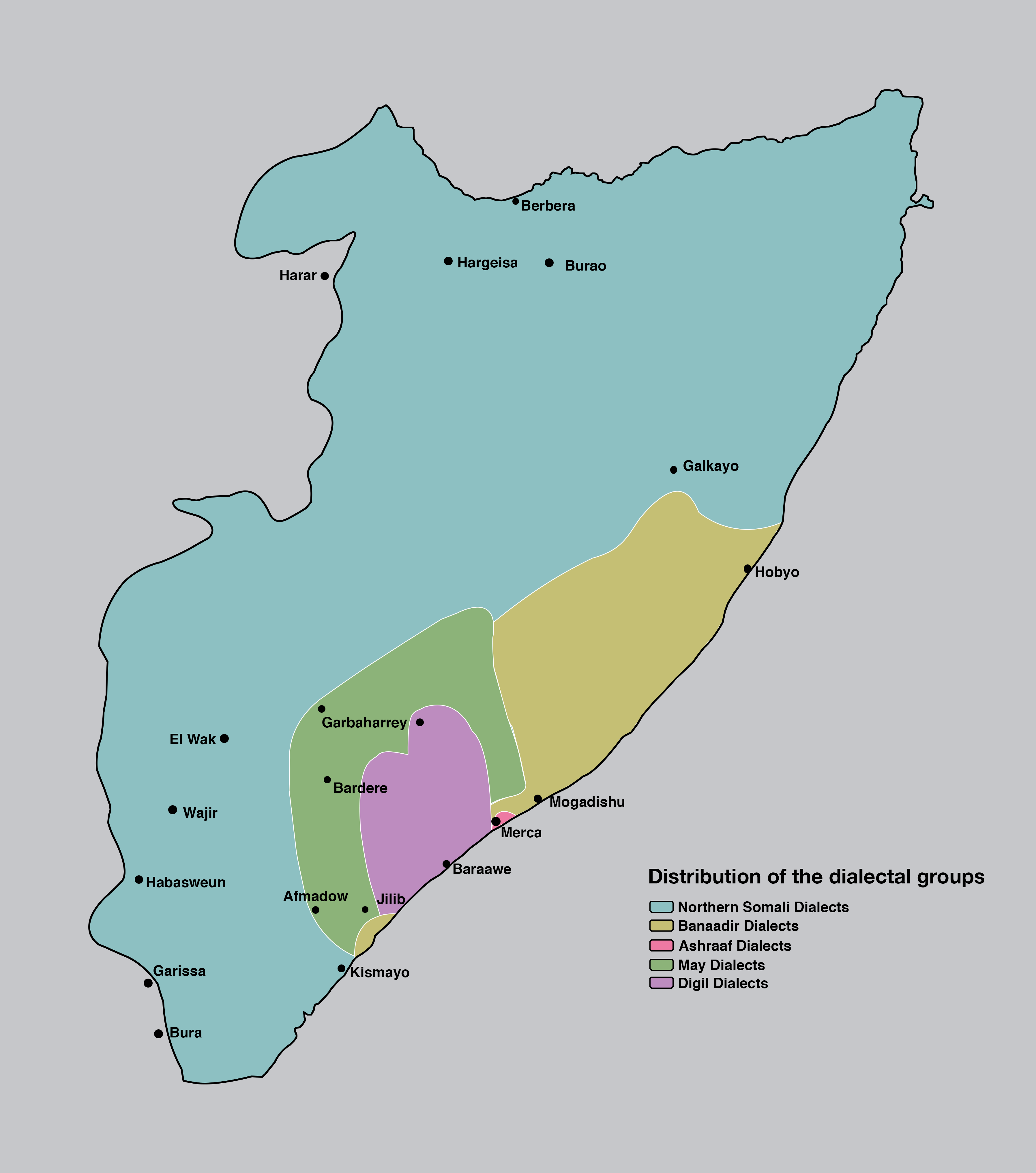
Somali (Latin script: ; Wadaad writing, Wadaad: ; Osmanya: 𐒖𐒍 𐒈𐒝𐒑𐒛𐒐𐒘 ) is an Afroasiatic languages, Afroasiatic language belonging to the Cushitic languages, Cushitic branch. It is spoken as a mother tongue by Somalis in Greater Somalia and the Somali diaspora. Somali is an official language in Somalia and Ethiopia, and a national language in Djibouti as well as in northeastern Kenya. The Somali language is written officially with the Somali Latin alphabet, Latin alphabet although the Arabic alphabet and several Somali scripts like Osmanya script, Osmanya, Kaddare script, Kaddare and the Gadabuursi Somali Script, Borama script are informally used.Lewis, I.M. (1958)The Gadabuursi Somali Script ''Bulletin of the School of Oriental and African Studies'', University of London, Vol. 21, pp. 134–156. Classification Somali is classified within the Cushitic branch of the Afroasiatic family, specifically, Lowland East Cushitic languages, Lowland East Cushitic in ... [...More Info...] [...Related Items...] OR: [Wikipedia] [Google] [Baidu] |
Administrative Divisions Of Ethiopia
Ethiopia is administratively divided into four levels: regions, zones, ''woredas'' (districts) and ''kebele'' (wards). The country comprises 11 regions and two city administrations under these regions, plenty of zones, woredas and neighbourhood administration: kebeles. In addition to the nine federal states within the country, there are two federal-level city administrations in Addis Ababa and Dire Dava. Current Region The first administrative division in Ethiopia is a ''region'', also called ''kilil'', or alternatively ''regional state''. The 1995 Constitution of Ethiopia established the regions based on ethno-linguistic territories. Previously, this ''level'' was called a province, and though many of the old province and new region names are the same, the entities are ''not'' identical and the words ''region'' and ''province'' are not interchangeable. , there were eleven regions. *Afar Region *Amhara Region *Benishangul-Gumuz * Gambela * Harari *Oromia *Sidama * Somali * ... [...More Info...] [...Related Items...] OR: [Wikipedia] [Google] [Baidu] |
Somali Region
The Somali Region ( so, Deegaanka Soomaalida, am, ሱማሌ ክልል, Sumalē Kilil, ar, المنطقة الصومالية), also known as Soomaali Galbeed (''Western Somalia'') and officially the Somali Regional State, is a regional state in eastern Ethiopia. Its territory is the largest after Oromia Region. The regional state borders the Ethiopian regions of Afar and Oromia and the chartered city Dire Dawa (Dire Dhawa) to the west, as well as Djibouti to the north, Somaliland to the northeast, Somalia to the south; and Kenya to the southwest. Jijiga is the capital of the Somali Region. The capital was formerly Gode, until Jijiga became the capital in 1995 on account of political considerations. The Somali regional government is composed of the executive branch, led by the President; the legislative branch, which comprises the State Council; and the judicial branch, which is led by the State Supreme Court. Overview The Somali Region formed a large part of the pre-19 ... [...More Info...] [...Related Items...] OR: [Wikipedia] [Google] [Baidu] |
Dembel (woreda)
Dembel is a woreda in Somali Region, Ethiopia. Part of the Shinile Zone, Dembel is bordered on the west by Shinile, on the north by Ayesha, and on the east and south by the Jijiga Zone. Towns in Dembel include Arabi, Dembel, Samakab, Sandalol, Biyobahay (Biobahie), Dure and Harmukale. Inhabitants of this woreda have engaged in crop farming since 1965; however, there has been a great decline in crop production from 1989 to 2001. That was primarily caused by clan conflicts and aggravated by severe droughts. Between 35-45% of the inhabitants are pastoralists, while 55-65% raise cereals (mostly sorghum) as well as raise livestock. Demographics Based on the 2017 Census conducted by the Central Statistical Agency of Ethiopia (CSA), this woreda has a total population of 106,611, of whom 56,531 are men and 50,080 women. While 18,360 are urban inhabitants, a further 88,251 were pastoralists. Based on the 2007 Census conducted by the Central Statistical Agency of Ethiopia (CSA), th ... [...More Info...] [...Related Items...] OR: [Wikipedia] [Google] [Baidu] |
Sitti Zone
Sitti Zone ( so, Gobolka Sitti), formerly known as Shinile, is a zone in Somali Region of Ethiopia. Located at the northwestern point of the Somali Region and stretching across the savanna north of the Ahmar Mountains, Sitti is bordered on the south by Dire Dawa and the Oromia Region, on the west by the Afar Region, on the north by Djibouti, on the east by Somaliland, and on the southeast by Fafan Zone. Other towns and cities in this zone include Aysha, Shinile, Dewele, Harewa, Adigale, Erer, Bike and Āfdem. Part of the northwestern corner is occupied by the Yangudi Rassa National Park, which is a notable local landmark. Climate The Sitti Zone has colder winters than the highlands, while the lowlands has mild winters. The region elevation is the major factor in temperature levels, with the higher areas, on average, as 17 °C (62 °F) cooler, day or night. Hot summer days are tempered by the low relative humidity and cooler evenings during summer months since, for ... [...More Info...] [...Related Items...] OR: [Wikipedia] [Google] [Baidu] |
East Africa Time
East Africa Time, or EAT, is a time zone used in eastern Africa. The time zone is three hours ahead of UTC ( UTC+03:00), which is the same as Moscow Time, Arabia Standard Time, Further-eastern European Time and Eastern European Summer Time. As this time zone is predominantly in the equatorial region, there is no significant change in day length throughout the year and so daylight saving time is not observed. East Africa Time is observed by the following countries: * * * * * * * * * See also *Moscow Time, an equivalent time zone covering Belarus, Turkey and most of European Russia, also at UTC+03:00 *Arabia Standard Time, an equivalent time zone covering Bahrain, Iraq, Kuwait, Qatar, Saudi Arabia and Yemen, also at UTC+03:00 *Eastern European Summer Time, an equivalent time zone covering European and Middle Eastern countries during daylight saving, also at UTC+03:00 *Israel Summer Time, an equivalent time zone covering the State of Israel during daylight saving, also at U ... [...More Info...] [...Related Items...] OR: [Wikipedia] [Google] [Baidu] |
Köppen Climate Classification
The Köppen climate classification is one of the most widely used climate classification systems. It was first published by German-Russian climatologist Wladimir Köppen (1846–1940) in 1884, with several later modifications by Köppen, notably in 1918 and 1936. Later, the climatologist Rudolf Geiger (1894–1981) introduced some changes to the classification system, which is thus sometimes called the Köppen–Geiger climate classification system. The Köppen climate classification divides climates into five main climate groups, with each group being divided based on seasonal precipitation and temperature patterns. The five main groups are ''A'' (tropical), ''B'' (arid), ''C'' (temperate), ''D'' (continental), and ''E'' (polar). Each group and subgroup is represented by a letter. All climates are assigned a main group (the first letter). All climates except for those in the ''E'' group are assigned a seasonal precipitation subgroup (the second letter). For example, ''Af'' indi ... [...More Info...] [...Related Items...] OR: [Wikipedia] [Google] [Baidu] |
Semi-arid Climate
A semi-arid climate, semi-desert climate, or steppe climate is a dry climate sub-type. It is located on regions that receive precipitation below potential evapotranspiration, but not as low as a desert climate. There are different kinds of semi-arid climates, depending on variables such as temperature, and they give rise to different biomes. Defining attributes of semi-arid climates A more precise definition is given by the Köppen climate classification, which treats steppe climates (''BSk'' and ''BSh'') as intermediates between desert climates (BW) and humid climates (A, C, D) in ecological characteristics and agricultural potential. Semi-arid climates tend to support short, thorny or scrubby vegetation and are usually dominated by either grasses or shrubs as it usually can't support forests. To determine if a location has a semi-arid climate, the precipitation threshold must first be determined. The method used to find the precipitation threshold (in millimeters): *multiply by ... [...More Info...] [...Related Items...] OR: [Wikipedia] [Google] [Baidu] |
Ethiopia
Ethiopia, , om, Itiyoophiyaa, so, Itoobiya, ti, ኢትዮጵያ, Ítiyop'iya, aa, Itiyoppiya officially the Federal Democratic Republic of Ethiopia, is a landlocked country in the Horn of Africa. It shares borders with Eritrea to the north, Djibouti to the northeast, Somalia to the east and northeast, Kenya to the south, South Sudan to the west, and Sudan to the northwest. Ethiopia has a total area of . As of 2022, it is home to around 113.5 million inhabitants, making it the 13th-most populous country in the world and the 2nd-most populous in Africa after Nigeria. The national capital and largest city, Addis Ababa, lies several kilometres west of the East African Rift that splits the country into the African and Somali tectonic plates. Anatomically modern humans emerged from modern-day Ethiopia and set out to the Near East and elsewhere in the Middle Paleolithic period. Southwestern Ethiopia has been proposed as a possible homeland of the Afroasiatic langua ... [...More Info...] [...Related Items...] OR: [Wikipedia] [Google] [Baidu] |
Harrawa Valley
The Harrawa Valley ( so, Dooxada Harawo) (also spelled: Harawwah, Harrawah, Harawa) is a long running valley located in the Gadabuursi country, north of Harar, Ethiopia. The Harrawa Valley is home to many of the principal and most well known settlements of the Gadabuursi Dir clan, such as Derwernache, Arabi, Dhamal, Hadawe and many other towns and villages. History The Harrawa Valley is considered to be, alongside the Awdal Region, at the heart of the Gadabuursi country. Richard Francis Burton (1856) describes the Harrawa Valley in the Gadabuursi country, as within sight of Harar in his book ''First Footsteps in East Africa'': "In front, backed by the dark hills of Harar, lay the Harawwah valley. The breadth is about fifteen miles: it runs from south-west to north-east, between the Highlands of the Girhi and the rolling ground of the Gudabirsi Somal, as far, it is said, as the Dankali country. Of old this luxuriant waste belonged to the former tribe; about twelve years ago ... [...More Info...] [...Related Items...] OR: [Wikipedia] [Google] [Baidu] |
Gadabuursi
The Gadabuursi ( Somali: ''Gadabuursi'', Arabic: جادابورسي), also known as ''Samaroon'' (Arabic: ''قبيلة سَمَرُون)'', is a northern Somali clan, a sub-division of the Dir clan family. The Gadabuursi are geographically spread out across three countries: Ethiopia, Somaliland and Djibouti. Among all of the Gadabuursi inhabited regions of the Horn of Africa, Ethiopia is the country where the majority of the clan reside. In Ethiopia, the Gadabuursi are mainly found in the Somali Region, but they also inhabit the Harar, Dire Dawa and Oromia regions. In Somaliland, the Gadabuursi are the predominant clan of the Awdal Region.Samatar, Abdi I. (2001) "Somali Reconstruction and Local Initiative: Amoud University," , p. 132. They are mainly found in cities and towns such as Borama, Baki, Lughaya, Zeila, Dilla, Jarahorato, Amud, Abasa, Fiqi Aadan, Quljeed, Boon and Harirad and Wajale, Magalo ad. In Ethiopia, the Gadabuursi are the predominant clan of the Awb ... [...More Info...] [...Related Items...] OR: [Wikipedia] [Google] [Baidu] |
Dir (clan)
The Dir ( so, Dir) is one of the largest and most prominent Somali clans in the Horn of Africa. They are also considered to be the oldest Somali stock to have inhabited the region. Its members inhabit Djibouti, Somalia, Ethiopia ( Somali, Harar, Dire Dawa, Oromia and Afar regions), and northeastern Kenya ( North Eastern Province).Ozzonia (2010), page 7. The Quranyo section of the Garre claim descent from Dirr, who are born of the Irrir Samal. Origins Like the great majority of Somali clans, the Dir trace their ancestry to Aqil ibn Abi Talib (),. a cousin of the prophet Muhammad () and an older brother of Ali ibn Abi Talib () and Ja'far ibn Abi Talib ().. They trace their lineage to Aqil through Samaale (the source of the name 'Somali'), the purported forefather of the northern pastoralist clans such as the Dir, the Hawiye, and –matrilineally through the Dir– the Isaaq and the Darod. Although these genealogical claims are historically untenable, they do reflect the longs ... [...More Info...] [...Related Items...] OR: [Wikipedia] [Google] [Baidu] |


