|
Altocumulus Castellanus
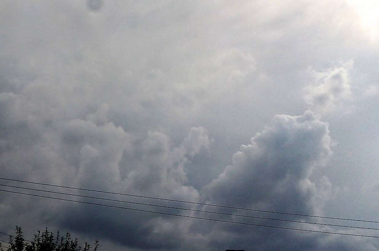
In meteorology, Altocumulus castellanus or Altocumulus castellatus (ACCAS) is a cloud type named for its tower-like projections that billow upwards from the base of the cloud. The base of the cloud can form as low as 2,000 metres (6,500 feet), or as high as 6,000 metres (20,000 feet). They are very similar to cumulus congestus clouds, but at a higher level and with the cloud heaps joined at the base. Castellanus clouds are evidence of mid-atmospheric instability and a high mid-altitude lapse rate. They may be a harbinger of heavy showers and thunderstorms and, if surface-based convection can connect to the mid-tropospheric unstable layer, continued development of Castellanus clouds can produce cumulonimbus clouds. Altocumulus castellanus clouds are typically accompanied by moderate turbulence as well as potential icing conditions In aviation, icing conditions are atmospheric conditions that can lead to the formation of water ice on an aircraft. Ice accretion and accumulation c ... [...More Info...] [...Related Items...] OR: [Wikipedia] [Google] [Baidu] |
Altocumulus Floccus
Altocumulus floccus is a cloud type named for its tuft-like, wooly appearance. The base of the cloud can form as low as , or as high as . They often form in clusters, or patches, and bases can vary in height with differing atmospheric conditions within the PBL. They are similar to Altocumulus castellanus, but often have a shallower vertical extent in comparison. Floccus clouds form when in the presence of conditional, often shallow, mid-level instability. On some occasions, such as the presence of a deeper unstable layer, these clouds can grow large enough to develop into thunderstorms A thunderstorm, also known as an electrical storm or a lightning storm, is a storm characterized by the presence of lightning and its acoustic effect on the Earth's atmosphere, known as thunder. Relatively weak thunderstorms are someti .... References Cumulus {{Cloud-stub ... [...More Info...] [...Related Items...] OR: [Wikipedia] [Google] [Baidu] |
Stratocumulus
A stratocumulus cloud, occasionally called a cumulostratus, belongs to a genus-type of clouds characterized by large dark, rounded masses, usually in groups, lines, or waves, the individual elements being larger than those in altocumulus, and the whole being at a lower height, usually below . Weak convective currents create shallow cloud layers because of drier, stable air above preventing continued vertical development. Historically, in English, this type of cloud has been referred to as a twain cloud for being a combination of two types of clouds. Description Occurrence Vast areas of subtropical and polar oceans are covered with massive sheets of stratocumulus. These may organize into distinctive patterns which are currently under active study. In subtropics, they cover the edges of the horse latitude climatological highs, and reduce the amount of solar energy absorbed in the ocean. When these drift over land the summer heat or winter cold is reduced. 'Dull weather' is a common ... [...More Info...] [...Related Items...] OR: [Wikipedia] [Google] [Baidu] |
Castellanus
A castellanus (or castellatus) (from latin ''castellanus'', castle) is a cloud that displays at least in its upper part cumuliform protuberances having the shape of turrets that give a battlement, crenellated aspect. Some of these turrets are higher than they are wide; they have a common base and seem to be arranged in a line. The castellanus characteristic is particularly obvious when the clouds are observed from the side (i.e., from a vantage point on a line perpendicular to the line of orientation). It is a cloud species attached to the cloud genus, cloud genera Cirrus castellanus, cirrus, Cirrocumulus castellanus, cirrocumulus, Altocumulus castellanus cloud, altocumulus and stratocumulus. Species of the clouds include cirrus castellanus, cirrocumulus castellanus, altocumulus castellanus and stratocumulus castellanus. Sometimes cumulus castellanus are referred to, but the type is not recognised by France's national meteorological service Météo-France, or by the American Mete ... [...More Info...] [...Related Items...] OR: [Wikipedia] [Google] [Baidu] |
Lapse Rate
The lapse rate is the rate at which an atmospheric variable, normally temperature in Earth's atmosphere, falls with altitude. ''Lapse rate'' arises from the word ''lapse'', in the sense of a gradual fall. In dry air, the adiabatic lapse rate is 9.8 °C/km (5.4 °F per 1,000 ft). It corresponds to the vertical component of the spatial gradient of temperature. Although this concept is most often applied to the Earth's troposphere, it can be extended to any gravitationally supported parcel of gas. Definition A formal definition from the ''Glossary of Meteorology'' is: :The decrease of an atmospheric variable with height, the variable being temperature unless otherwise specified. Typically, the lapse rate is the negative of the rate of temperature change with altitude change: :\Gamma = -\frac where \Gamma (sometimes L) is the lapse rate given in units of temperature divided by units of altitude, ''T'' is temperature, and ''z'' is altitude. Convection and adiabatic expansion ... [...More Info...] [...Related Items...] OR: [Wikipedia] [Google] [Baidu] |
Convection
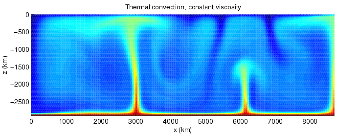
Convection is single or multiphase fluid flow that occurs spontaneously due to the combined effects of material property heterogeneity and body forces on a fluid, most commonly density and gravity (see buoyancy). When the cause of the convection is unspecified, convection due to the effects of thermal expansion and buoyancy can be assumed. Convection may also take place in soft solids or mixtures where particles can flow. Convective flow may be transient (such as when a multiphase mixture of oil and water separates) or steady state (see Convection cell). The convection may be due to gravitational, electromagnetic or fictitious body forces. Heat transfer by natural convection plays a role in the structure of Earth's atmosphere, its oceans, and its mantle. Discrete convective cells in the atmosphere can be identified by clouds, with stronger convection resulting in thunderstorms. Natural convection also plays a role in stellar physics. Convection is often categorised or d ... [...More Info...] [...Related Items...] OR: [Wikipedia] [Google] [Baidu] |
Troposphere
The troposphere is the first and lowest layer of the atmosphere of the Earth, and contains 75% of the total mass of the planetary atmosphere, 99% of the total mass of water vapour and aerosols, and is where most weather phenomena occur. From the planetary surface of the Earth, the average height of the troposphere is in the tropics; in the middle latitudes; and in the high latitudes of the polar regions in winter; thus the average height of the troposphere is . The term ''troposphere'' derives from the Greek words ''tropos'' (rotating) and '' sphaira'' (sphere) indicating that rotational turbulence mixes the layers of air and so determines the structure and the phenomena of the troposphere. The rotational friction of the troposphere against the planetary surface affects the flow of the air, and so forms the planetary boundary layer (PBL) that varies in height from hundreds of meters up to . The measures of the PBL vary according to the latitude, the landform, and th ... [...More Info...] [...Related Items...] OR: [Wikipedia] [Google] [Baidu] |
Cumulonimbus Cloud
Cumulonimbus (from Latin ''cumulus'', "heaped" and ''nimbus'', "rainstorm") is a dense, towering vertical cloud, typically forming from water vapor condensing in the lower troposphere that builds upward carried by powerful buoyant air currents. Above the lower portions of the cumulonimbus the water vapor becomes ice crystals, such as snow and graupel, the interaction of which can lead to hail and to lightning formation, respectively. When occurring as a thunderstorm these clouds may be referred to as thunderheads. Cumulonimbus can form alone, in clusters, or along squall lines. These clouds are capable of producing lightning and other dangerous severe weather, such as tornadoes, hazardous winds, and large hailstones. Cumulonimbus progress from overdeveloped cumulus congestus clouds and may further develop as part of a supercell. Cumulonimbus is abbreviated Cb. Appearance Towering cumulonimbus clouds are typically accompanied by smaller cumulus clouds. The cumulonimbus bas ... [...More Info...] [...Related Items...] OR: [Wikipedia] [Google] [Baidu] |
Turbulence
In fluid dynamics, turbulence or turbulent flow is fluid motion characterized by chaotic changes in pressure and flow velocity. It is in contrast to a laminar flow, which occurs when a fluid flows in parallel layers, with no disruption between those layers. Turbulence is commonly observed in everyday phenomena such as surf, fast flowing rivers, billowing storm clouds, or smoke from a chimney, and most fluid flows occurring in nature or created in engineering applications are turbulent. Turbulence is caused by excessive kinetic energy in parts of a fluid flow, which overcomes the damping effect of the fluid's viscosity. For this reason turbulence is commonly realized in low viscosity fluids. In general terms, in turbulent flow, unsteady vortices appear of many sizes which interact with each other, consequently drag due to friction effects increases. This increases the energy needed to pump fluid through a pipe. The onset of turbulence can be predicted by the dimensionless Rey ... [...More Info...] [...Related Items...] OR: [Wikipedia] [Google] [Baidu] |
Icing Conditions
In aviation, icing conditions are atmospheric conditions that can lead to the formation of water ice on an aircraft. Ice accretion and accumulation can affect the external surfaces of an aircraft – in which case it is referred to as ''airframe icing'' – or the engine, resulting in carburetor icing, air inlet icing or more generically ''engine icing''. These phenomena may possibly but do not necessarily occur together. Both airframe and engine icing have resulted in numerous fatal accidents in aviation history. Not all aircraft, especially general aviation aircraft, are certified for ''flight into known icing'' (FIKI) – that is flying into areas with icing conditions certain or likely to exist, based on pilot reports, observations, and forecasts. In order to be FIKI-certified, aircraft must be fitted with suitable ice protection systems to prevent accidents by icing. Definition Icing conditions exist when the air contains droplets of supercooled liquid water. They freeze ... [...More Info...] [...Related Items...] OR: [Wikipedia] [Google] [Baidu] |


.jpg)