Castellanus on:
[Wikipedia]
[Google]
[Amazon]
 A castellanus (or castellatus) (from
 All castellanus clouds show that there exists an unstable (or conditionally unstable) layer at their altitude but not necessarily under the cloud. Some scientists (Scorer, Corfidi) define a
castellanus as a cloud generated by the release of latent heat during the ascension of a saturated thermal column in an unstable (or conditionally unstable) layer at altitude. The cloud will have the appearance of a
 ''turkey tower'' . This unstable (or conditionally unstable) layer can be generated in different ways: (1) a large scale lifting ( synoptic scale) that under some circumstances makes the air unstable since the temperature at the base of the layer decreases more slowly than the temperature at the top of cloud due to adiabatic decompression, (2) a cooling of the cloud top that generates the same differential, and (3) an unstable (or conditionally unstable) airmass ''pocket'' . If they show such a tall and narrow growth, the dry air surrounding them will not perpetuate the
 Scientists note a common confusion between convective clouds generated solely (or at least primarily) by diurnal heating of the ground and the ''castellanus'', which is primarily a product of instability (or conditional instability) at the top of a cloud such as a cumulus, stratocumulus, or an altocumulus, the latter two genera being easily confused.
Moreover, the International Cloud Atlas (ICA) is not entirely precise regarding how to determine the genus of a convective cloud. Per the ICA (1975, p. 15–16), the base of a
 Castellanus (clouds made of very narrow columns) are notorious
as being unusable by
 '' ''rocket clouds''.''
The visual difference between a cumulus and a castellanus is that the former has a flat base while the latter generally has no clearly defined base. However, a visual observation of the cloud may not be sufficient, since in some cases the hybrid castellanus (pseudo cumulus) may have a flat base. The only sure way to distinguish between these two types of clouds is through an atmospheric sounding preceding the flight. If the base of these false cumulus is higher than the
 A castellanus (or castellatus) (from
 latin
Latin (, or , ) is a classical language belonging to the Italic branch of the Indo-European languages. Latin was originally a dialect spoken in the lower Tiber area (then known as Latium) around present-day Rome, but through the power of the ...
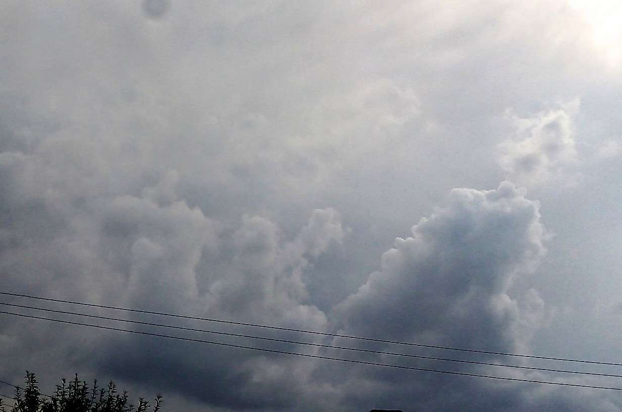
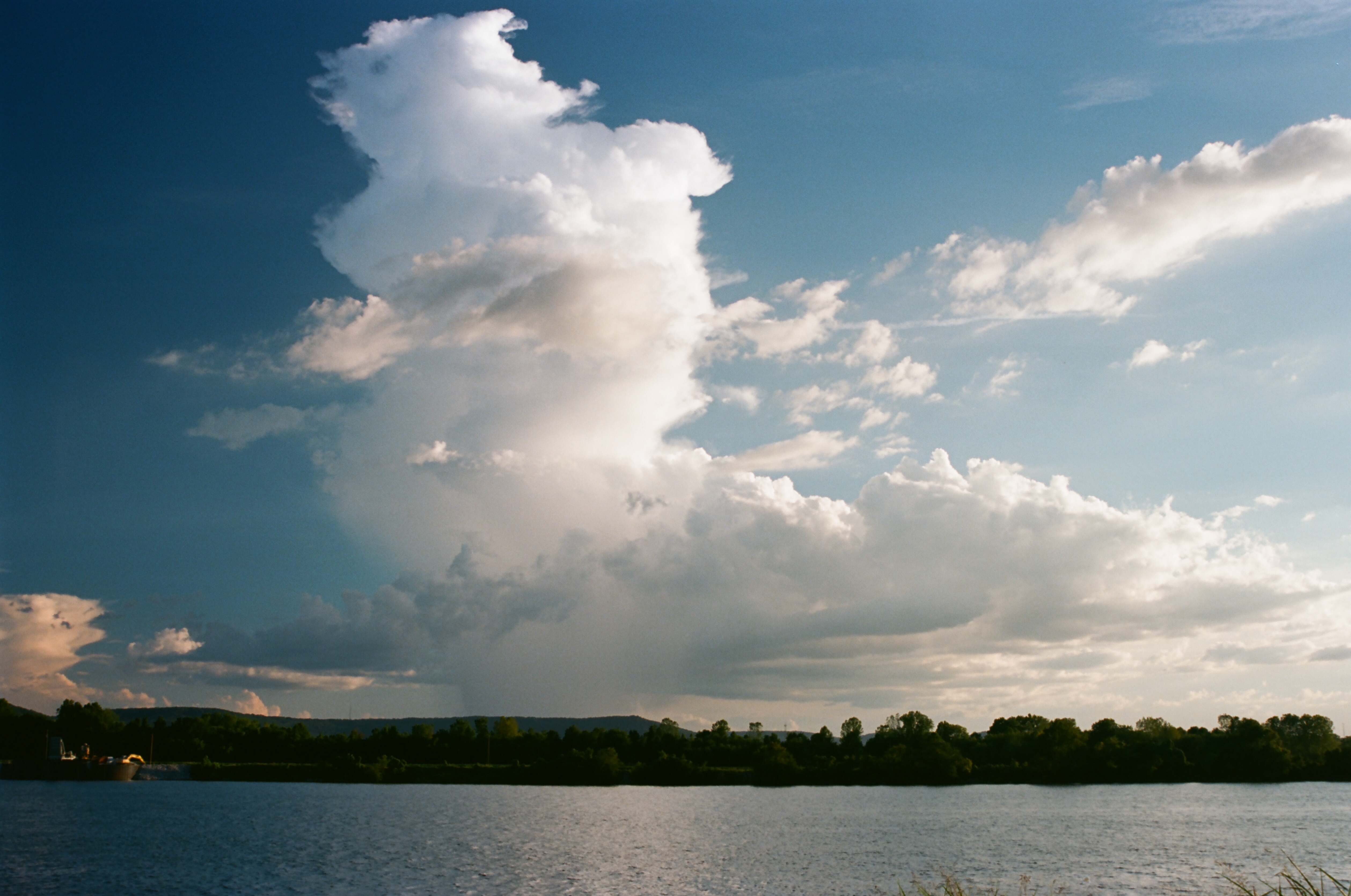
''castellanus'', castle) is a cloud that displays at least in its upper part cumuliform protuberances having the shape of turrets that give a crenellated aspect. Some of these turrets are higher than they are wide; they have a common base and seem to be arranged in a line. The castellanus characteristic is particularly obvious when the clouds are observed from the side (i.e., from a vantage point on a line perpendicular to the line of orientation).
It is a cloud species Cloud species are a set of fourteen terms used to describe the shape and structure of clouds. Each one has its name abbreviated to a three letter term.
References
See also
* List of cloud types
The list of cloud types groups all genera ...
attached to the cloud genera cirrus, cirrocumulus, altocumulus and stratocumulus.
Species of the clouds include cirrus castellanus, cirrocumulus castellanus
Cirrocumulus castellanus or Cirrocumulus castellatus is a type of cirrocumulus cloud. ''Castellanus'' is from the Latin meaning "of a castle". These clouds appear as round turrets that are rising from either a lowered line or sheet of clouds. Cirro ...
, altocumulus castellanus
In meteorology, Altocumulus castellanus or Altocumulus castellatus (ACCAS) is a cloud type named for its tower-like projections that billow upwards from the base of the cloud. The base of the cloud can form as low as 2,000 metres (6,500 feet), or ...
and stratocumulus castellanus
Stratocumulus castellanus or Stratocumulus castellatus is a type of stratocumulus cloud, castellanus is derived from Latin, meaning 'of a castle' This type of cloud appears as cumuliform turrets vertically rising from a common horizontal cloud b ...
. Sometimes cumulus castellanus
Cumulus castellanus (from Latin ''castellanus'', castle) is an unofficial name of a species of cumulus cloud that is distinctive because it displays multiple towers arising from its top, indicating significant vertical air movement. It is a misnom ...
are referred to, but the type is not recognised by France's national meteorological service Météo-France
Météo-France is the French national meteorological service.
Organisation
The organisation was established by decree in June 1993 and is a department of the Ministry of Transportation. It is headquartered in Paris but many domestic operatio ...
, or by the American Meteorological Society
The American Meteorological Society (AMS) is the premier scientific and professional organization in the United States promoting and disseminating information about the Atmospheric sciences, atmospheric, Oceanography, oceanic, and Hydrology, hydr ...
and World Meteorological Organisation. Those clouds some would classify as cumulus castellanus typically do not have a common base and are not arranged in a line, thus differing to some extent from the more universally-recognised castellanus types. Some scientists also think that the ''castellanus'' should be a full cloud genus
The list of cloud types groups all genera as ''high'' (cirro-, cirrus), ''middle'' (alto-), ''multi-level'' (nimbo-, cumulo-, cumulus), and ''low'' (strato-, stratus). These groupings are determined by the altitude level or levels in the troposphe ...
, and not just a cloud species Cloud species are a set of fourteen terms used to describe the shape and structure of clouds. Each one has its name abbreviated to a three letter term.
References
See also
* List of cloud types
The list of cloud types groups all genera ...
. The Federal Aviation Administration
The Federal Aviation Administration (FAA) is the largest transportation agency of the U.S. government and regulates all aspects of civil aviation in the country as well as over surrounding international waters. Its powers include air traffic m ...
''implicitly'' considers a castellanus as a full cloud genus.
Physics
 All castellanus clouds show that there exists an unstable (or conditionally unstable) layer at their altitude but not necessarily under the cloud. Some scientists (Scorer, Corfidi) define a
castellanus as a cloud generated by the release of latent heat during the ascension of a saturated thermal column in an unstable (or conditionally unstable) layer at altitude. The cloud will have the appearance of a
 advection
In the field of physics, engineering, and earth sciences, advection is the transport of a substance or quantity by bulk motion of a fluid. The properties of that substance are carried with it. Generally the majority of the advected substance is al ...
over a stable airmass, etc.
Castellanus can arise from clouds formed by either surface-based convection (e.g., cumulus) or elevated convection (e.g., altocumulus). Most of the convection in the towers, however, is due to instability (or conditional instability) at cloud height – not to convection below the cloud. The air surrounding the cloud is rapidly entrained into the towers. Cloud physics show that if a cloud does not contain enough humidity, the water vapour contained inside the cloud will only condense at a higher level, where the temperature of the ascending parcel reaches its saturation point. This will consequently dry out the cloud from the base and eventually result in its disappearance if this dry air does not condense below the cloud top.
Conversely, if the air surrounding the cloud is nearly saturated and a thick, unstable (or conditionally unstable) layer exists above the initial cloud, convection will be able to continue. Then a tower, that will become wider and wider, will build up that will in some cases become a cumulonimbus.
The evolution of a ''castellanus'' thus depends on the amount of humidity and the characteristics of the unstable (or conditionally unstable) layer. Scattered clouds in the sky are generally found in relatively dry air with a more humid convection
Convection is single or multiphase fluid flow that occurs spontaneously due to the combined effects of material property heterogeneity and body forces on a fluid, most commonly density and gravity (see buoyancy). When the cause of the convec ...
which will result in the cloud dissipation. However, a more extended cloud layer shows a higher relative humidity
Humidity is the concentration of water vapor present in the air. Water vapor, the gaseous state of water, is generally invisible to the human eye. Humidity indicates the likelihood for precipitation, dew, or fog to be present.
Humidity depe ...
in the layer; a scenario more likely to be associated with over-development of the towers.
Nomenclature
The species ''castellanus'' is defined in the International Cloud Atlas, which had its last official release in 1975. It is based on ground visual observation of cloud shape. In practice, the shape of a castellanus is related to the physical process producing it: local instability (or conditional instability) at the top of the cloud that breaks the temperature inversion and is the cause of the formation of towers, this being confirmed by vertical soundings. However, although the species castellanus applies to different genera of convective clouds at different levels, the most current cloud type is thealtocumulus castellanus
In meteorology, Altocumulus castellanus or Altocumulus castellatus (ACCAS) is a cloud type named for its tower-like projections that billow upwards from the base of the cloud. The base of the cloud can form as low as 2,000 metres (6,500 feet), or ...
, the base of which is in the medium level. This is reinforced by the fact that pilot's manuals interchangeably talk about either ''castellanus'' or ''altocumulus castellanus'', restricting the meaning of the word ''catellanus''.
To alleviate this confusion, scientists Richard S. Scorer
Richard Segar Scorer (30 August 1919 – 21 May 2011) was a British meteorologist. He was a contributor to the theory on mountain waves. Scorer also worked on the cloud physics and his exchanges with the American meteorologist Joanne Simpson hel ...
and Corfidi propose a cloud classification based only on physical criteria obtained from vertical soundings and observations from meteorological satellite
A weather satellite or meteorological satellite is a type of Earth observation satellite that is primarily used to monitor the weather and climate of the Earth. Satellites can be polar orbiting (covering the entire Earth asynchronously), or geo ...
s to reclassify the ''castellanus'' as a cloud genus at the same level as a ''cumulus'' or a ''cirrus''. Corfidi has long criticized the resistance from official bodies to this change. However, the 2016 version of the International Cloud Atlas will not change the status of the castellanus. The same scientists have a similar opinion about lenticular clouds that can exist at different levels that are not recognized as a full cloud genus but only as a species.
Criticism specifics
 Scientists note a common confusion between convective clouds generated solely (or at least primarily) by diurnal heating of the ground and the ''castellanus'', which is primarily a product of instability (or conditional instability) at the top of a cloud such as a cumulus, stratocumulus, or an altocumulus, the latter two genera being easily confused.
Moreover, the International Cloud Atlas (ICA) is not entirely precise regarding how to determine the genus of a convective cloud. Per the ICA (1975, p. 15–16), the base of a
 cumulus cloud
Cumulus clouds are clouds which have flat bases and are often described as "puffy", "cotton-like" or "fluffy" in appearance. Their name derives from the Latin ''cumulo-'', meaning ''heap'' or ''pile''. Cumulus clouds are low-level clouds, gener ...
is usually between the surface and . This height limit originates from observations in temperate climates where the surface temperature and humidity are about average. It does not take into account how the cloud is formed. In the American West, the base of cumulus clouds can reach , since the combination of a low dew point
The dew point is the temperature to which air must be cooled to become saturated with water vapor, assuming constant air pressure and water content. When cooled below the dew point, moisture capacity is reduced and airborne water vapor will cond ...
() and high temperature (up to ) will yield a very high convective condensation level The convective condensation level (CCL) represents the height (or pressure) where an air parcel becomes saturated when heated from below and lifted adiabatically due to buoyancy.
In the atmosphere, assuming a constant water vapor mixing ratio, the ...
. While the ICA allows that a cumulus cloud can have a base higher than (by saying that cumulus clouds ''usually'' have their bases at or below this height), guidance given on page 16 of the ICA could lead to misclassification of a high cumulus cloud. This guidance says that a cloud's genus can be determined "by making a choice from among the genera normally encountered in the etage (height range) corresponding to its height." This could lead the observer to rule out cumulus as a possible genus for a cloud that has all the ICA-described characteristics of a cumulus except that its base is above the "Low" etage (surface to ). The observer, conscientiously trying to comply with ICA classification guidance, might then misidentify this cloud as an altocumulus (perhaps altocumulus floccus
Altocumulus floccus is a cloud type named for its tuft-like, wooly appearance. The base of the cloud can form as low as , or as high as . They often form in clusters, or patches, and bases can vary in height with differing atmospheric conditions ...
), although the instability creating it is at a different level compared to an altocumulus.
To complicate matters even further, convective clouds of type castellanus can be generated by updrafts originating at intermediate altitudes with respect to the levels defined in the Atlas; it makes a continuum of possible altitudes. These intermediate-altitude convective clouds will have flat bases except when generating precipitation. Moreover, the altitude of their bases can be higher than the level of condensation by convection or even higher than the level of free convection; it depends on the altitude where the forcing occurs. This phenomenon may occur when a cumulonimbus is in the vicinity. The latter will produce an outflow downstream of the cumulonimbus. The outflow boundary behaves like a pseudo cold front that generates a mechanical forcing where the outflow meets the surrounding air. The lifting enables the formation of convective towers at the level of the top of the outflow in preexisting clouds if the air is conditionally unstable.
An example of this phenomenon is shown in the adjacent figure and corresponds to Figure 2 of a paper written by Corfidi; the thunderstorm is located to the east of the picture. The picture's caption in Corfidi's paper refers to the cloud as a ''castellanus'' and not as a '' cumulus mediocris altocumulogenitus'' as the draft International Cloud Atlas would suggest.
Soaring
glider
Glider may refer to:
Aircraft and transport Aircraft
* Glider (aircraft), heavier-than-air aircraft primarily intended for unpowered flight
** Glider (sailplane), a rigid-winged glider aircraft with an undercarriage, used in the sport of glidin ...
pilots. In order for a cloud to have a usable thermal, the updraft column needs to exist under the cloud, in which case the cloud will have a flat base. An altocumulus castellanus
In meteorology, Altocumulus castellanus or Altocumulus castellatus (ACCAS) is a cloud type named for its tower-like projections that billow upwards from the base of the cloud. The base of the cloud can form as low as 2,000 metres (6,500 feet), or ...
, however, can be identified by the lack of a well-defined base. As said above, a hybrid cloud between cumulus and castellanus can be used by a glider pilot.
Castellanus that are unfavorable to soaring can be easily identified and are nicknamed convective condensation level The convective condensation level (CCL) represents the height (or pressure) where an air parcel becomes saturated when heated from below and lifted adiabatically due to buoyancy.
In the atmosphere, assuming a constant water vapor mixing ratio, the ...
, the pilot is probably close to unwanted cumulonimbus. Moreover, when a cumulus breaks down, there may still exist an updraft column under the cloud base that did not originate from the ground. In particular, at the end of the day, the air-mass can be stable up to 2000 feet and unstable above this stable layer. The cumulus turn into stratocumulus or altocumulus depending on their height. Before the 1956 version of the International Cloud Atlas, these clouds were called stratocumulus or altocumulus "vesperalis". Directly under these clouds, updrafts are still present. The meteorologist Corfidi explains that these seemingly innocuous clouds that break down rapidly can be a harbinger of nocturnal thunderstorms.
To identify non-ground-based convection, it is possible to compare the height of the base of the "cumulus" ''c'' with the convective condensation level The convective condensation level (CCL) represents the height (or pressure) where an air parcel becomes saturated when heated from below and lifted adiabatically due to buoyancy.
In the atmosphere, assuming a constant water vapor mixing ratio, the ...
''h''. This height ''h'' is given by the following formula:
where ''a'' = 0.125 km / °C;
''T'' is the surface temperature and ''D'' is the dew point. The variables ''c'', ''T'' and ''D'' can be easily accessed from a neighbouring METAR
METAR is a format for reporting weather information. A METAR weather report is predominantly used by aircraft pilots, and by meteorologists, who use aggregated METAR information to assist in weather forecasting.
Raw METAR is the most common form ...
.
The computation of this height ''h'' is based on first principles and therefore is rather accurate. Consequently, if , the observed cumulus are almost certainly castellanus under Corfidi's meaning. Then, it will be wise to be wary of the presence of a flanking line or of downbursts in the vicinity. Figure 2 shows such a pattern.
Notes and references
Notes
References
See also
*Altocumulus castellanus
In meteorology, Altocumulus castellanus or Altocumulus castellatus (ACCAS) is a cloud type named for its tower-like projections that billow upwards from the base of the cloud. The base of the cloud can form as low as 2,000 metres (6,500 feet), or ...
Bibliography
* * * * {{cite journal , url = http://www.spc.noaa.gov/publications/corfidi/castellanusWAF.pdf , title = Elevated Convection and Castellanus: Ambiguities, Significance, and Questions , journal = Weather and Forecasting , volume=23 , issue = 6 , pages = 1280–1303 , first = Stephen F. , last = Corfidi , ref=Corfidi , year=2008 , access-date = 2016-07-27 , doi=10.1175/2008WAF2222118.1 , bibcode = 2008WtFor..23.1280C Cumulus Gliding technology Severe weather and convection