|
Alcyonium Glomeratum
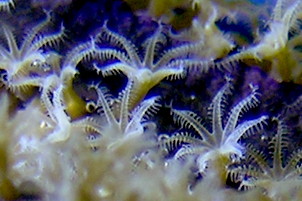
''Alcyonium glomeratum'' or red sea fingers is a species of Alcyonacea, soft coral in the family Alcyoniidae. It is found around the southern and western coasts of Great Britain, Britain and Ireland. Description Red sea fingers is similar in shape to ''Alcyonium digitatum'' but is usually blood red or rust coloured. The finger-shaped lobes are slender and can be up to thirty centimetres long. The polyps are white and each one has eight pinnate tentacles which give the colony a feathery appearance when they are extended. Distribution This coral is found on the west coast of Britain and Ireland, north to western Scotland and south to the Bay of Biscay. It is quite localised but may be abundant in places. It is also found on the East Coast of United Arab Emirates (Gulf of Oman - Indian Ocean) on wreck: Inshcape-2 opposite to Khor Fakkan, Khurr-Fakkan City. Below Photo was taken on Inshcape-2 Wreck by Yahia Mokhtar, December 2014 (seabed 22m) and shows the coral. Gallery File:Red ... [...More Info...] [...Related Items...] OR: [Wikipedia] [Google] [Baidu] |
Arthur Hill Hassall
Arthur Hill Hassall (13 December 1817, Teddington – 9 April 1894, San Remo) was a British physician, chemist and microscopist who is primarily known for his work in public health and food safety. Biography Hassall was born in Middlesex as the youngest son of five children in a house of a surgeon. His father was Thomas Hassall (1771–1844) and his mother, née Ann Sherrock ( 1778–1817). He spent his school years in Richmond. He entered medicine through apprenticeship in 1834 to his uncle Sir James Murray (1788–1871), spending his early career in Dublin, where he also studied botany and the seashore. In 1846 he published a two-volume study, ''The Microscopic Anatomy of the Human Body in Health and Disease'', the first English textbook on the subject. After further studying botany at Kew and publishing on botanical topics, particularly freshwater algae, he came to public attention with his 1850 book ''A microscopical examination of the water supplied to the inhabitants of ... [...More Info...] [...Related Items...] OR: [Wikipedia] [Google] [Baidu] |
Bay Of Biscay
The Bay of Biscay (), known in Spain as the Gulf of Biscay ( es, Golfo de Vizcaya, eu, Bizkaiko Golkoa), and in France and some border regions as the Gulf of Gascony (french: Golfe de Gascogne, oc, Golf de Gasconha, br, Pleg-mor Gwaskogn), is a gulf of the northeast Atlantic Ocean located south of the Celtic Sea. It lies along the western coast of France from Point Penmarc'h to the Spanish border, and the northern coast of Spain west to Cape Ortegal. The south area of the Bay of Biscay that washes over the northern coast of Spain is known locally as the Cantabrian Sea. The average depth is and the greatest depth is . Name The Bay of Biscay is named (for English speakers) after Biscay on the northern Spanish coast, probably standing for the western Basque districts (''Biscay'' up to the early 19th century). Its name in other languages is: * ast, Mar Cantábricu * eu, Bizkaiko golkoa * br, pleg-mor Gwaskogn * french: golfe de Gascogne (named after Gascony, France) * ... [...More Info...] [...Related Items...] OR: [Wikipedia] [Google] [Baidu] |
Neritic Zone
The neritic zone (or sublittoral zone) is the relatively shallow part of the ocean above the drop-off of the continental shelf, approximately in depth. From the point of view of marine biology it forms a relatively stable and well-illuminated environment for marine life, from plankton up to large fish and corals, while physical oceanography sees it as where the oceanic system interacts with the coast. Definition (marine biology), context, extra terminology In marine biology, the neritic zone, also called coastal waters, the coastal ocean or the sublittoral zone, refers to that zone of the ocean where sunlight reaches the ocean floor, that is, where the water is never so deep as to take it out of the photic zone. It extends from the low tide mark to the edge of the continental shelf, with a relatively shallow depth extending to about 200 meters (660 feet). Above the neritic zone lie the intertidal (or eulittoral) and supralittoral zones; below it the continental slope beg ... [...More Info...] [...Related Items...] OR: [Wikipedia] [Google] [Baidu] |
Bedrock
In geology, bedrock is solid rock that lies under loose material ( regolith) within the crust of Earth or another terrestrial planet. Definition Bedrock is the solid rock that underlies looser surface material. An exposed portion of bedrock is often called an outcrop. The various kinds of broken and weathered rock material, such as soil and subsoil, that may overlie the bedrock are known as regolith. Engineering geology The surface of the bedrock beneath the soil cover (regolith) is also known as ''rockhead'' in engineering geology, and its identification by digging, drilling or geophysical methods is an important task in most civil engineering projects. Superficial deposits can be very thick, such that the bedrock lies hundreds of meters below the surface. Weathering of bedrock Exposed bedrock experiences weathering, which may be physical or chemical, and which alters the structure of the rock to leave it susceptible to erosion. Bedrock may also experience sub ... [...More Info...] [...Related Items...] OR: [Wikipedia] [Google] [Baidu] |
Khor Fakkan
Khor Fakkan ( ar, خَوْر فَكَّان, Khawr Fakkān) is a city and exclave of the Emirate of Sharjah, located on the east coast of the United Arab Emirates (UAE), facing the Gulf of Oman, and geographically surrounded by the Emirate of Fujairah. The city, the second largest on the east coast after Fujairah City, is set on the bay of Khor Fakkan, which means "Creek of Two Jaws". It is the site of Khor Fakkan Container Terminal, the only natural deep-sea port in the region and one of the major container ports in the UAE. The Port of Khor Fakkan faces the Emirate of Sharjah’s eastern seaboard, extending connections with Asia and the Far East. This port is one of the Emirate’s three ports. It is also a popular spot among domestic tourists due to its white sand beaches and coral reefs that attract many marine life enthusiasts. Khor Fakkan beach lies to the north of the center of the town. Khor Fakkan is located on the east coast of the UAE, between the Shumayliyah Mounta ... [...More Info...] [...Related Items...] OR: [Wikipedia] [Google] [Baidu] |
Indian Ocean
The Indian Ocean is the third-largest of the world's five oceanic divisions, covering or ~19.8% of the water on Earth's surface. It is bounded by Asia to the north, Africa to the west and Australia to the east. To the south it is bounded by the Southern Ocean or Antarctica, depending on the definition in use. Along its core, the Indian Ocean has some large marginal or regional seas such as the Arabian Sea, Laccadive Sea, Bay of Bengal, and Andaman Sea. Etymology The Indian Ocean has been known by its present name since at least 1515 when the Latin form ''Oceanus Orientalis Indicus'' ("Indian Eastern Ocean") is attested, named after India, which projects into it. It was earlier known as the ''Eastern Ocean'', a term that was still in use during the mid-18th century (see map), as opposed to the ''Western Ocean'' ( Atlantic) before the Pacific was surmised. Conversely, Chinese explorers in the Indian Ocean during the 15th century called it the Western Oceans. In Ancie ... [...More Info...] [...Related Items...] OR: [Wikipedia] [Google] [Baidu] |
Gulf Of Oman
The Gulf of Oman or Sea of Oman ( ar, خليج عمان ''khalīj ʿumān''; fa, دریای عمان ''daryâ-ye omân''), also known as Gulf of Makran or Sea of Makran ( ar, خلیج مکران ''khalīj makrān''; fa, دریای مکران ''daryâ-ye makrān''), is a gulf that connects the Arabian Sea with the Strait of Hormuz, which then runs to the Persian Gulf. It borders Iran and Pakistan on the north, Oman on the south, and the United Arab Emirates on the west. Extent The International Hydrographic Organization defines the limits of the Gulf of Oman as follows: Exclusive economic zone Exclusive economic zones in Persian Gulf: Bordering countries Coastline length of bordering countries: # - 850 km coastline # - 750 km coastline # - 50 km coastline # - 50 km coastline Alternative names The Gulf of Oman historically and geographically has been referred to with different names by Arabian, Iranian, Indian, Pakistani and European geogr ... [...More Info...] [...Related Items...] OR: [Wikipedia] [Google] [Baidu] |
United Arab Emirates
The United Arab Emirates (UAE; ar, اَلْإِمَارَات الْعَرَبِيَة الْمُتَحِدَة ), or simply the Emirates ( ar, الِْإمَارَات ), is a country in Western Asia ( The Middle East). It is located at the eastern end of the Arabian Peninsula and shares borders with Oman and Saudi Arabia, while having maritime borders in the Persian Gulf with Qatar and Iran. Abu Dhabi is the nation's capital, while Dubai, the most populous city, is an international hub. The United Arab Emirates is an elective monarchy formed from a federation of seven emirates, consisting of Abu Dhabi (the capital), Ajman, Dubai, Fujairah, Ras Al Khaimah, Sharjah and Umm Al Quwain. Each emirate is governed by an emir and together the emirs form the Federal Supreme Council. The members of the Federal Supreme Council elect a president and vice president from among their members. In practice, the emir of Abu Dhabi serves as president while the ruler of Dubai is vice pre ... [...More Info...] [...Related Items...] OR: [Wikipedia] [Google] [Baidu] |
Scotland
Scotland (, ) is a Countries of the United Kingdom, country that is part of the United Kingdom. Covering the northern third of the island of Great Britain, mainland Scotland has a Anglo-Scottish border, border with England to the southeast and is otherwise surrounded by the Atlantic Ocean to the north and west, the North Sea to the northeast and east, and the Irish Sea to the south. It also contains more than 790 Islands of Scotland, islands, principally in the archipelagos of the Hebrides and the Northern Isles. Most of the population, including the capital Edinburgh, is concentrated in the Central Belt—the plain between the Scottish Highlands and the Southern Uplands—in the Scottish Lowlands. Scotland is divided into 32 Subdivisions of Scotland, administrative subdivisions or local authorities, known as council areas. Glasgow, Glasgow City is the largest council area in terms of population, with Highland (council area), Highland being the largest in terms of area. Limi ... [...More Info...] [...Related Items...] OR: [Wikipedia] [Google] [Baidu] |
Species
In biology, a species is the basic unit of classification and a taxonomic rank of an organism, as well as a unit of biodiversity. A species is often defined as the largest group of organisms in which any two individuals of the appropriate sexes or mating types can produce fertile offspring, typically by sexual reproduction. Other ways of defining species include their karyotype, DNA sequence, morphology, behaviour or ecological niche. In addition, paleontologists use the concept of the chronospecies since fossil reproduction cannot be examined. The most recent rigorous estimate for the total number of species of eukaryotes is between 8 and 8.7 million. However, only about 14% of these had been described by 2011. All species (except viruses) are given a two-part name, a "binomial". The first part of a binomial is the genus to which the species belongs. The second part is called the specific name or the specific epithet (in botanical nomenclature, also sometimes i ... [...More Info...] [...Related Items...] OR: [Wikipedia] [Google] [Baidu] |
Pinnate
Pinnation (also called pennation) is the arrangement of feather-like or multi-divided features arising from both sides of a common axis. Pinnation occurs in biological morphology, in crystals, such as some forms of ice or metal crystals, and in patterns of erosion or stream beds. The term derives from the Latin word ''pinna'' meaning "feather", "wing", or "fin". A similar concept is "pectination," which is a comb-like arrangement of parts (arising from one side of an axis only). Pinnation is commonly referred to in contrast to "palmation," in which the parts or structures radiate out from a common point. The terms "pinnation" and "pennation" are cognate, and although they are sometimes used distinctly, there is no consistent difference in the meaning or usage of the two words.Jackson, Benjamin, Daydon; A Glossary of Botanic Terms with their Derivation and Accent; Published by Gerald Duckworth & Co. London, 4th ed 1928 Plants Botanically, pinnation is an arrangement of di ... [...More Info...] [...Related Items...] OR: [Wikipedia] [Google] [Baidu] |
Polyps
A polyp in zoology is one of two forms found in the phylum Cnidaria, the other being the medusa. Polyps are roughly cylindrical in shape and elongated at the axis of the vase-shaped body. In solitary polyps, the aboral (opposite to oral) end is attached to the substrate by means of a disc-like holdfast called a pedal disc, while in colonies of polyps it is connected to other polyps, either directly or indirectly. The oral end contains the mouth, and is surrounded by a circlet of tentacles. Classes In the class Anthozoa, comprising the sea anemones and corals, the individual is always a polyp; in the class Hydrozoa, however, the individual may be either a polyp or a medusa, with most species undergoing a life cycle with both a polyp stage and a medusa stage. In class Scyphozoa, the medusa stage is dominant, and the polyp stage may or may not be present, depending on the family. In those scyphozoans that have the larval planula metamorphose into a polyp, the polyp, also ... [...More Info...] [...Related Items...] OR: [Wikipedia] [Google] [Baidu] |


.jpg)


