|
Albury, Hertfordshire
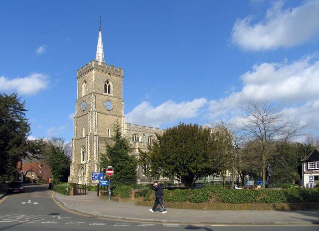
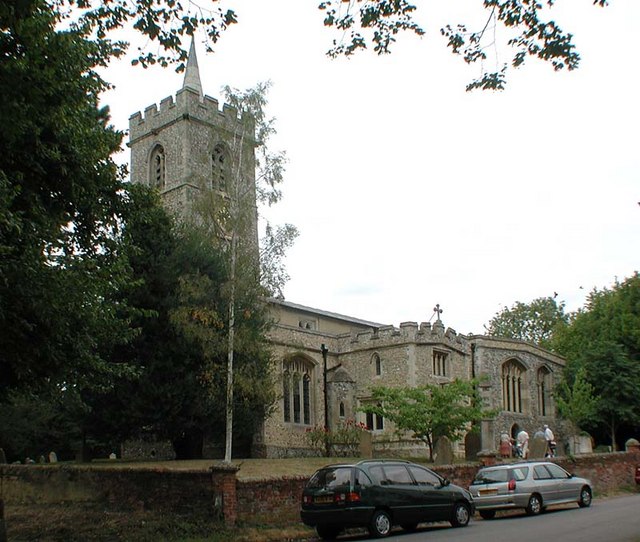
Albury is a village and civil parish in the East Hertfordshire district of Hertfordshire, England, about five miles west of Bishop's Stortford. According to the 2001 census it had a population of 537, increasing in the 2011 Census to 595. Albury lies between Little Hadham to the south and Furneux Pelham to the north and includes the hamlets Albury End, Clapgate, Patmore Heath and Upwick Green. The 1894–1895 edition of ''The Comprehensive Gazetteer of England and Wales'' listed the hamlets: Albury End, Church End, Clapgate, Gravesend, Patmore Heath, and Upwich. An earlier gazetteer, the ''Imperial Gazetteer of England and Wales'' dated 1870–1872 stated that the north-lying Patient-End is an Albury hamlet. Gravesend and Patmore Heath are 400 metres apart. The name "Albury" derives from the Old English ''ald'' (old) and ''burh'' (fortification). To the northwest of the village stood Albury Hall, a three-storey manor house believed to have been re-built by MP John Calvert ... [...More Info...] [...Related Items...] OR: [Wikipedia] [Google] [Baidu] |
Hertfordshire
Hertfordshire ( or ; often abbreviated Herts) is one of the home counties in southern England. It borders Bedfordshire and Cambridgeshire to the north, Essex to the east, Greater London to the south, and Buckinghamshire to the west. For government statistical purposes, it forms part of the East of England region. Hertfordshire covers . It derives its name – via the name of the county town of Hertford – from a Hart (deer), hart (stag) and a Ford (crossing), ford, as represented on the county's coat of arms and on the Flag of Hertfordshire, flag. Hertfordshire County Council is based in Hertford, once the main market town and the current county town. The largest settlement is Watford. Since 1903 Letchworth has served as the prototype Garden city movement, garden city; Stevenage became the first town to expand under post-war Britain's New Towns Act 1946, New Towns Act of 1946. In 2013 Hertfordshire had a population of about 1,140,700, with Hemel Hempstead, Stevenage, Watford ... [...More Info...] [...Related Items...] OR: [Wikipedia] [Google] [Baidu] |
Ware, Hertfordshire
Ware is a town in Hertfordshire, England close to the county town of Hertford. It is also a civil parish in East Hertfordshire district. Location The town lies on the north–south A10 road which is partly shared with the east–west A414 (for Hertford to the west and Harlow to the east). There is a large viaduct over the River Lea at Kings Meads. The £3.6m two-mile bypass opened on 17 January 1979. At the north end of the bypass is the Wodson Park Sports and Leisure Centre and Hanbury Manor, a hotel and country club. The former route of the A10 through the town is now the A1170. The railway station is on the Hertford East Branch Line and operated by Greater Anglia and is on a short single track section of the otherwise double track line. History Archaeology has shown that Ware has been occupied since at least the Mesolithic period (which ended about 4000 BC). The Romans had a sizeable settlement here and foundations of several buildings, including a temple, and two cemeter ... [...More Info...] [...Related Items...] OR: [Wikipedia] [Google] [Baidu] |
Civil Parish
In England, a civil parish is a type of Parish (administrative division), administrative parish used for Local government in England, local government. It is a territorial designation which is the lowest tier of local government below districts of England, districts and metropolitan and non-metropolitan counties of England, counties, or their combined form, the Unitary authorities of England, unitary authority. Civil parishes can trace their origin to the ancient system of Parish (Church of England), ecclesiastical parishes, which historically played a role in both secular and religious administration. Civil and religious parishes were formally differentiated in the 19th century and are now entirely separate. Civil parishes in their modern form came into being through the Local Government Act 1894, which established elected Parish councils in England, parish councils to take on the secular functions of the vestry, parish vestry. A civil parish can range in size from a sparsely ... [...More Info...] [...Related Items...] OR: [Wikipedia] [Google] [Baidu] |
East Hertfordshire
East Hertfordshire is a local government district in Hertfordshire, England. Its council is based in Hertford, the county town of Hertfordshire. The largest town in the district is Bishop's Stortford, and the other main towns are Ware, Buntingford and Sawbridgeworth. At the 2011 Census, the population of the district was 137,687. The district was formed on 1 April 1974, under the Local Government Act 1972, by the merger of the municipal borough of Hertford with Bishop's Stortford, Sawbridgeworth and Ware urban districts, and Braughing Rural District, Ware Rural District and part of Hertford Rural District. By area it is the largest of the ten local government districts in Hertfordshire. It borders the North Hertfordshire district and the boroughs of Stevenage, Welwyn Hatfield and Broxbourne in Hertfordshire, and the districts of Epping Forest, Harlow and Uttlesford in Essex. In the 2006 edition of Channel 4's "Best and Worst Places to Live in the UK", East Hertford ... [...More Info...] [...Related Items...] OR: [Wikipedia] [Google] [Baidu] |
Bishop's Stortford
Bishop's Stortford is a historic market town in Hertfordshire, England, just west of the M11 motorway on the county boundary with Essex, north-east of central London, and by rail from Liverpool Street station. Stortford had an estimated population of 41,088 in 2020. The district of East Hertfordshire, where the town is located, has been ranked as the best place to live in the United Kingdom, UK by the Halifax Quality of Life annual survey in 2020. The town is commonly known as “Stortford” by locals. History Etymology The origins of the town's name are uncertain. One possibility is that the Saxons, Saxon settlement derives its name from 'Steorta's ford' or 'tail ford', in the sense of a 'tail', or tongue, of land. The town became known as Bishop's Stortford due to the acquisition in 1060 by the Bishop of London. The River Stort is named after the town, and not the town after the river. When cartographers visited the town in the 16th century, they reasoned that the tow ... [...More Info...] [...Related Items...] OR: [Wikipedia] [Google] [Baidu] |
Little Hadham
Little Hadham is a village and civil parish in the district of East Hertfordshire, Hertfordshire, England. At the census of 2001 it had a population of 1,081, increasing to 1,153 at the 2011 Census. It is bypassed by the A120 road, which connects it to the nearby town of Bishop's Stortford. The civil parish includes the hamlets of Bury Green, Church End, Cradle End, Green Street and Hadham Ford. Little Hadham, together with the neighbouring village of Much Hadham, are collectively known as ''The Hadhams''. The rural village is situated on the banks of the River Ash and is characterised by half-timbered houses. The medieval parish church, dedicated to Saint Cecilia, was reconstructed in the late 14th or 15th century. The Bishop of London is the patron of the church. Hadham Hall Hadham Hall, an ancient manor house situated south-east of the village on the Stortford Road, was the family seat of the Capell (or Capel) family, also Rayne Hall in Rayne, Essex. It was bought by S ... [...More Info...] [...Related Items...] OR: [Wikipedia] [Google] [Baidu] |
Furneux Pelham
Furneux Pelham or Furneaux Pelham is a village and civil parish in Hertfordshire, England. The village is one of the Pelhams, part of an early medieval larger swathe of land known as Pelham including Brent Pelham to the north and Stocking Pelham to the east and north-east. The village is largely linear covering much of the width of the parish from east to west and is buffered by gently sloped fields with some woodland to all sides. It is known for its ford (Violet's Lane) to the north along the upper Ash which is over long traversable by 4x4 enthusiasts most of the year and in the periods of least flow by experienced off-road motorcyclists. Landmarks The village has a church, St Mary the Virgin, with a medieval carved wooden roof which was restored and elaborately painted in the 1960s by the artist John Norbury. The spire has the motto "Time Flies, Mind your Business'" on the clock. Furneux Pelham has a large pub the ''Brewery Tap'' opposite the site of the former Rayme ... [...More Info...] [...Related Items...] OR: [Wikipedia] [Google] [Baidu] |
Albury End
Albury End is a hamlet in Hertfordshire, England. It is in the civil parish of Albury Albury () is a major regional city in New South Wales, Australia. It is located on the Hume Highway and the northern side of the Murray River. Albury is the seat of local government for the council area which also bears the city's name – the .... External links Hamlets in Hertfordshire East Hertfordshire District {{Hertfordshire-geo-stub ... [...More Info...] [...Related Items...] OR: [Wikipedia] [Google] [Baidu] |
Old English
Old English (, ), or Anglo-Saxon, is the earliest recorded form of the English language, spoken in England and southern and eastern Scotland in the early Middle Ages In the history of Europe, the Middle Ages or medieval period lasted approximately from the late 5th to the late 15th centuries, similar to the post-classical period of global history. It began with the fall of the Western Roman Empire .... It was brought to Great Britain by Anglo-Saxon settlement of Britain, Anglo-Saxon settlers in the mid-5th century, and the first Old English literature, Old English literary works date from the mid-7th century. After the Norman conquest of 1066, English was replaced, for a time, by Anglo-Norman language, Anglo-Norman (a langues d'oïl, relative of French) as the language of the upper classes. This is regarded as marking the end of the Old English era, since during this period the English language was heavily influenced by Anglo-Norman, developing into a phase know ... [...More Info...] [...Related Items...] OR: [Wikipedia] [Google] [Baidu] |
Burh
A burh () or burg was an Old English fortification or fortified settlement. In the 9th century, raids and invasions by Vikings prompted Alfred the Great to develop a network of burhs and roads to use against such attackers. Some were new constructions; others were situated at the site of Iron Age hillforts or Roman forts and employed materials from the original fortifications. As at Lundenburh (medieval London), many were also situated on rivers: this facilitated internal lines of supply while aiming to restrict access to the interior of the kingdom for attackers in shallow- draught vessels such as longships. Burhs also had a secondary role as commercial and sometimes administrative centres. Their fortifications were used to protect England's various royal mints. Name and were Old English developments of the Proto-Germanic word reconstructed as , cognate with the verb ''Oxford English Dictionary'', 1st ed. "borough, ''n.'' Oxford University Press (Oxford), 188 ... [...More Info...] [...Related Items...] OR: [Wikipedia] [Google] [Baidu] |
Albury Hall
Albury () is a major regional city in New South Wales, Australia. It is located on the Hume Highway and the northern side of the Murray River. Albury is the seat of local government for the council area which also bears the city's name – the City of Albury. It is on the Victoria-New South Wales border. Albury has an urban population of 49,172 and is separated from its twin city in Victoria, Wodonga, by the Murray River. Together, the two cities form an urban area with a population of 93,603 at June 2018. Estimated resident population, 30 June 2018. It is from the state capital Sydney and from the Victorian capital Melbourne. Said to be named after a village in England, Albury developed as a major transport link between New South Wales and Victoria and was proclaimed a city in 1946. History The Wiradjuri people were the first known humans to occupy the area, (Wiradjuri northern dialect pronunciation iraːjd̪uːraj or Wirraayjuurray people (Wiradjuri southern dialect pron ... [...More Info...] [...Related Items...] OR: [Wikipedia] [Google] [Baidu] |
John Calvert (1726–1804)
John Calvert (1726–1804), was an English brewer and politician who sat in the House of Commons for 48 years between 1754 and 1802. Calvert was born on 6 May 1726 the son of Felix Calvert of Albury Hall and his wife Mary Calvert daughter of Felix Calvert of Nine Ashes, Hertfordshire who was his second cousin. The Calvert family were London brewers who owned the Peacock Brewhouse in Whitecross Street and the Hour Glass brewhouse in Thames Street. Calvert was returned as Member of Parliament for Wendover by Lord Verney in a by-election on 25 February 1754 and was re-elected in the 1754 general election. His father died on 29 April 1755 and he inherited a partnership in the family business at the Peacock Brewery, Whitecross Street which he ran successfully for many years. In 1761 Calvert was returned unopposed as MP for Hertford and again in 1774. He then lost his seat at Hertford in the 1780 general election but was returned by Lord Weymouth as MP for Tamworth in a by-electi ... [...More Info...] [...Related Items...] OR: [Wikipedia] [Google] [Baidu] |


