|
Ahar, Rajasthan
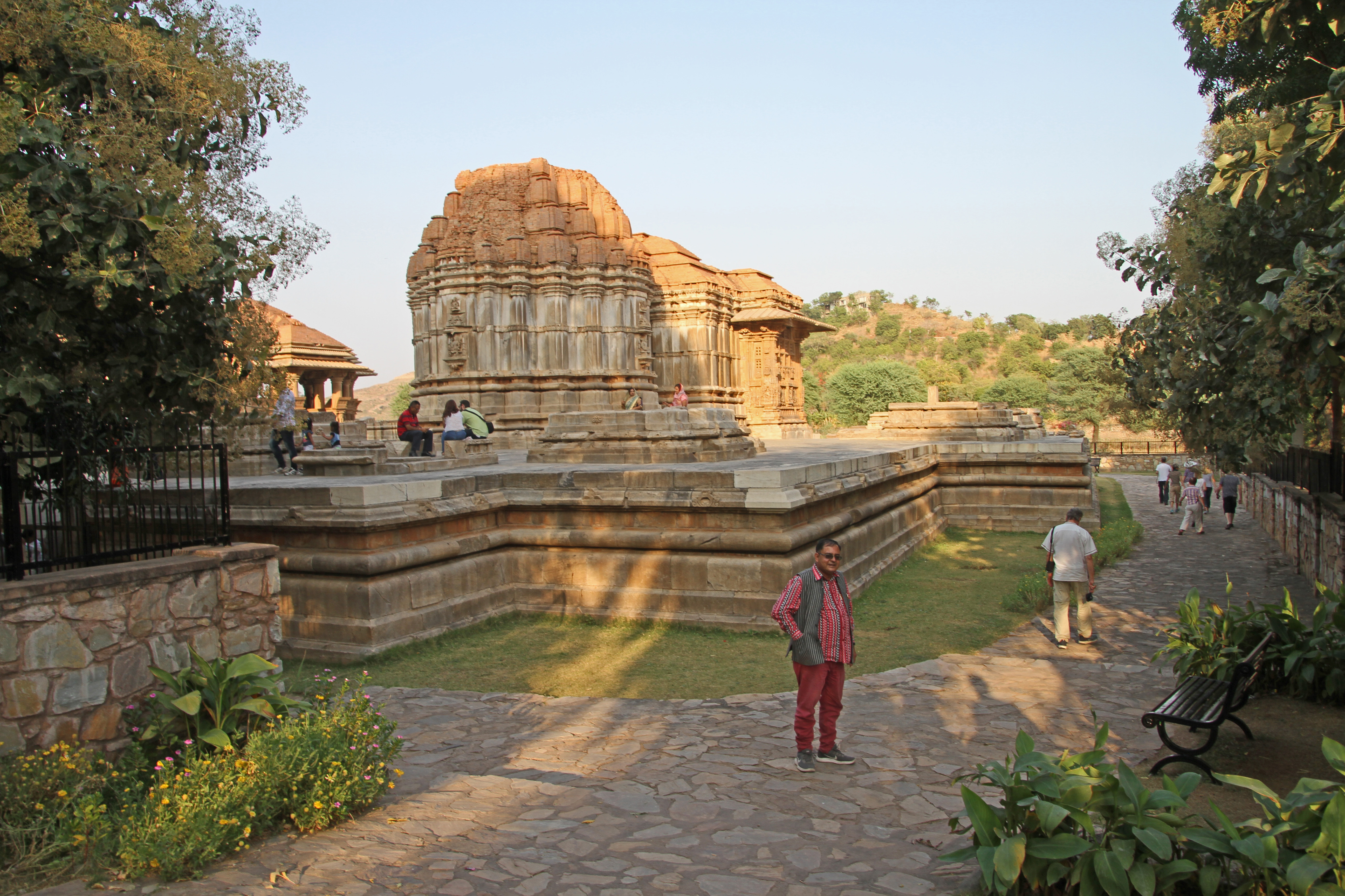
Ahar is a former town of historical significance, located on the north bank of the Ahar River in the present-day city of Udaipur, Rajasthan, in India. History Archeological excavations in the late 1950s and early 1960s revealed that Ahar was the site of the Chalcolithic Ahar culture. Two distinct cultures have been identified at the Ahar archeological site - Ahar Period I (2580 BC to 1500 BC) and Ahar Period II (1000 BC onwards). In the pre-modern era, Ahar was a politically significant town after it became the capital of the Guhil rulers of Mewar in c.948 and stayed so until c.1116 when the capital moved to Nagda. Its other historical names are Aghatapura and Atpura. See also * Ahar Cenotaphs The Ahar Cenotaphs are a group of cenotaphs located in Ahar, Udaipur, Rajasthan, India. The site contains more than 250 cenotaphs of the Maharanas of Mewar that were built over approximately 350 years. There are 19 chhatri ''Chhatri'' a ... References Udaipur district ... [...More Info...] [...Related Items...] OR: [Wikipedia] [Google] [Baidu] |
Ahar Cenotaphs
The Ahar Cenotaphs are a group of cenotaphs located in Ahar, Udaipur, Rajasthan, India. The site contains more than 250 cenotaphs of the Maharanas of Mewar that were built over approximately 350 years. There are 19 chhatri ''Chhatri'' are elevated, dome-shaped pavilions used as an element in Indo-Islamic architecture and Indian architecture. Originating as a canopy above tombs, they serve as decorative elements. The earliest example of chhatri being used in the ...s that commemorate the 19 maharajas who were cremated here. The group of cenotaphs is also known as the Mahasati. References External links * http://www.udaipur.org.uk/excursions/ahar.html * https://web.archive.org/web/20100824042737/http://www.indiasite.com/rajasthan/udaipur/ahar.html Monuments and memorials in Rajasthan Buildings and structures in Udaipur Tourist attractions in Udaipur Rajasthani architecture Cenotaphs in India {{udaipur-stub ... [...More Info...] [...Related Items...] OR: [Wikipedia] [Google] [Baidu] |
Rajasthan
Rajasthan (; lit. 'Land of Kings') is a state in northern India. It covers or 10.4 per cent of India's total geographical area. It is the largest Indian state by area and the seventh largest by population. It is on India's northwestern side, where it comprises most of the wide and inhospitable Thar Desert (also known as the Great Indian Desert) and shares a border with the Pakistani provinces of Punjab to the northwest and Sindh to the west, along the Sutlej- Indus River valley. It is bordered by five other Indian states: Punjab to the north; Haryana and Uttar Pradesh to the northeast; Madhya Pradesh to the southeast; and Gujarat to the southwest. Its geographical location is 23.3 to 30.12 North latitude and 69.30 to 78.17 East longitude, with the Tropic of Cancer passing through its southernmost tip. Its major features include the ruins of the Indus Valley civilisation at Kalibangan and Balathal, the Dilwara Temples, a Jain pilgrimage site at Rajasthan's only hill stat ... [...More Info...] [...Related Items...] OR: [Wikipedia] [Google] [Baidu] |
Udaipur District
Udaipur district is one of the 33 districts of Rajasthan state in western India. The historic city of Udaipur is the administrative headquarters of the district. The district is part of the Mewar region of Rajasthan. History Before Udaipur district was established in independent India, it was a part of former Mewar or Udaipur State, comprising little less than half the portion of the former state. With the formation of the United State of Rajasthan in 1948, parts of the erstwhile district of Girwa, Khamnor, Rajnagar, Bhim, Magra, Kherwara and Kumbhalgarh, together with the thikanas of Nathdwara, Kankroli, Salumbar (excluding Sayra tehsil), Bhinder, Kanor, Bansi, Bari Sadri, Amet, Sardargarh, Deogarh and Gogunda were combined to constitute the district of Udaipur. During the decadal period 1951–61, two new tehsils – Nathdwara and Gogunda – were created in the district. In 1991, seven tehsils of Udaipur district (Bhim, Deogarh, Amet, Kumbhalgarh, Rajsamand, Nathdwara a ... [...More Info...] [...Related Items...] OR: [Wikipedia] [Google] [Baidu] |
Ahar River
The Ahar River is a tributary of the Berach River (itself a tributary of Banas River, which in turn is a tributary of Chambal river, itself a tributary of Yamuna River, which in turn is the most important tributary of Ganges River). The river flows through the Udaipur city and is its larger drainage body. The spill water of the famous Lake Pichola and Fateh Sagar Lake of Udaipur district gets into the Ahar river. The river further downstream feed the Udaisagar Lake located just outside Udaipur city. This historically important river is at present functioning as the drainage body of the Udaipur city filled with sewage and garbage. Ahar River is also the site of 3000 BC to 1500BC Chalcolithic archaeological culture Ahar-Banas culture. On its river bank in Udaipur there are Royal Cenotaphs of Maharanas of Mewar called "Ahar ki Chhatriya" literally Ahar Cenotaphs The Ahar Cenotaphs are a group of cenotaphs located in Ahar, Udaipur, Rajasthan, India. The site contains mor ... [...More Info...] [...Related Items...] OR: [Wikipedia] [Google] [Baidu] |
Udaipur
Udaipur () (ISO 15919: ''Udayapura''), historically named as Udayapura, is a city and municipal corporation in Udaipur district of the state of Rajasthan, India. It is the administrative headquarter of Udaipur district. It is the historic capital of the kingdom of Mewar in the former Rajputana Agency. It was founded in 1559 by Udai Singh II of the Sisodia clan of Rajput, when he shifted his capital from the city of Chittorgarh to Udaipur after Chittorgarh was besieged by Akbar. It remained as the capital city till 1818 when it became a British princely state, and thereafter the Mewar province became a part of Rajasthan when India gained independence in 1947. The city is located in the southernmost part of Rajasthan, near the Gujarat border. It is surrounded by the Aravali Range, which separates it from the Thar Desert. It is placed almost in the middle of two major Indian metro cities, around 660 km from Delhi and 800 km from Mumbai. Besides, connectivity with Gujar ... [...More Info...] [...Related Items...] OR: [Wikipedia] [Google] [Baidu] |
Chalcolithic
The Copper Age, also called the Chalcolithic (; from grc-gre, χαλκός ''khalkós'', "copper" and ''líthos'', "stone") or (A)eneolithic (from Latin '' aeneus'' "of copper"), is an archaeological period characterized by regular human manipulation of copper, but prior to the discovery of bronze alloys. Modern researchers consider the period as a subset of the broader Neolithic, but earlier scholars defined it as a transitional period between the Neolithic and the Bronze Age. The archaeological site of Belovode, on Rudnik mountain in Serbia, has the world's oldest securely dated evidence of copper smelting at high temperature, from (7000 BP). The transition from Copper Age to Bronze Age in Europe occurred between the late 5th and the late In the Ancient Near East the Copper Age covered about the same period, beginning in the late and lasting for about a millennium before it gave rise to the Early Bronze Age. Terminology The multiple names result from m ... [...More Info...] [...Related Items...] OR: [Wikipedia] [Google] [Baidu] |
Ahar–Banas Culture
The Ahar culture, also known as the Banas culture is a Chalcolithic archaeological culture on the banks of Ahar River of southeastern Rajasthan state in India, lasting from 3000 to 1500 BCE, contemporary and adjacent to the Indus Valley civilization. Situated along the Banas and Berach Rivers, as well as the Ahar River, the Ahar–Banas people were exploiting the copper ores of the Aravalli Range to make axes and other artefacts. They were sustained on a number of crops, including wheat and barley. Geographical extent More than 90 sites of the Ahar culture have been identified to date. The main distribution seems to be concentrated in the river valleys of Banas and its tributaries. A number of sites with Ahar culture level are also found from Jawad, Mandsaur, Kayatha and Dangwada in Madhya Pradesh state. In Rajasthan, most of the sites are located in Udaipur, Chittorgarh, Dungarpur, Banswara, Ajmer, Tonk and Bhilwara districts, which include, Ahar, Gilund, Bansen, Keli, Bal ... [...More Info...] [...Related Items...] OR: [Wikipedia] [Google] [Baidu] |
Post-classical History
In world history, post-classical history refers to the period from about 500 AD to 1500, roughly corresponding to the European Middle Ages. The period is characterized by the expansion of civilizations geographically and development of trade networks between civilizations. This period is also called the medieval era, post-antiquity era, post-ancient era, pre-modernity era or pre-modern era. In Asia, the spread of Islam created a series of caliphates and inaugurated the Islamic Golden Age, leading to advances in science in the medieval Islamic world and trade among the Asian, African and European continents. East Asia experienced the full establishment of power of Imperial China, which established several prosperous dynasties influencing Korea, Vietnam, and Japan. Religions such as Buddhism and Neo-Confucianism spread in the region. Gunpowder was developed in China during the post-classical era. The Mongol Empire connected Europe and Asia, creating safe trade and stability betwe ... [...More Info...] [...Related Items...] OR: [Wikipedia] [Google] [Baidu] |
Udaipur State
Kingdom of Mewar, sometimes known as Udaipur State, was ruled by the Sisodia dynasty. It was an independent kingdom in Rajputana region of India. It was established around the 7th century as minor rulers of the Nagada-Ahar region of Udaipur and later in the 10th century, it transformed into an independent state under Rawal Bharttripatta II. In 1303, the kingdom was invaded, its capital fort Chittorgarh was besieged and taken by Alauddin Khalji killing the entire main branch of the family known as the '' Rawal Branch''.: "Amir Khusrau's works have omitted mention of several episodes unpalatable to the Sultan among them the murder of Jalaluddin Khilji by his nephew, Alauddin; Alauddin's defeat at the hands of the Mongols; and the Mongol siege of Delhi. Srivastava also asserts that it would be wrong to say that Jayasi had concocted the entire story of Padmini. He holds that ‘Jayasi wrote out a romance, the plot of which he derived from Amir Khusrau's Khazain-ul-Futuh’, and whi ... [...More Info...] [...Related Items...] OR: [Wikipedia] [Google] [Baidu] |
Nagda, Rajasthan
Nagda is a village in Udaipur district of Rajasthan state in India. It was once a prominent city in the early Mewar state. Today it is known primarily for the remains of the Sahastra Bahu Temples. Location Nagda is situated approximately 20 kilometers north of Udaipur or 2.5km away from Eklingji, another sacred area. History Nagda was probably established by King Nagaditya of the Guhil dynasty in the 7th century AD and it was known as Nagahrada then. Nagda was the first capital of Mewar and continued to be so until c. 948 when the capital was shifted to Ahar Ahar ( fa, italic=yes, اهر, az, اهر) is a city and capital of Ahar County, East Azerbaijan Province, Iran. According to the 2016 census, Ahar was the fourth most populated city of the province with a population of 100,641 in 20,844 fam .... In c.1116, Nagda again became the capital of Mewar and stayed so until the early part of the 13th century when it was sacked by Sultan Iltutmish's forces. Population The pop ... [...More Info...] [...Related Items...] OR: [Wikipedia] [Google] [Baidu] |


