|
Ae Bridgend
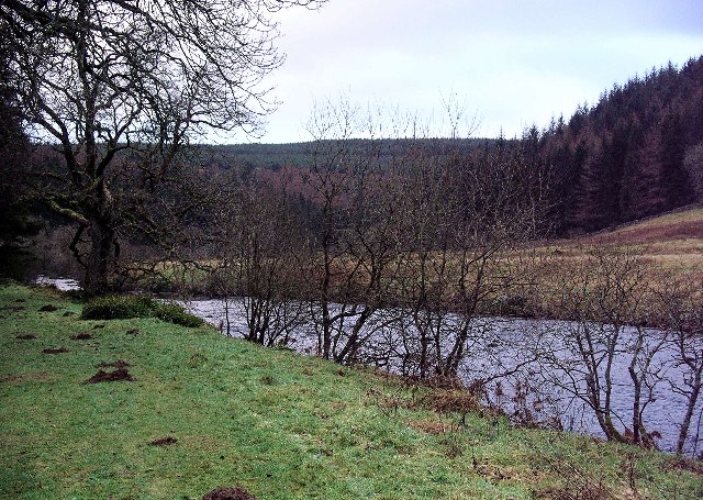
Ae Bridgend is a hamlet in the Scotland, Scottish council area of Dumfries and Galloway next to the Water of Ae, River Ae. It is located at an altitude of 96.9 meters above sea level. It is the place where the trunk A701 road between Dumfries and Moffat crosses the Water of Ae. See also *Ae, Scotland References [...More Info...] [...Related Items...] OR: [Wikipedia] [Google] [Baidu] |
Scotland
Scotland (, ) is a country that is part of the United Kingdom. Covering the northern third of the island of Great Britain, mainland Scotland has a border with England to the southeast and is otherwise surrounded by the Atlantic Ocean to the north and west, the North Sea to the northeast and east, and the Irish Sea to the south. It also contains more than 790 islands, principally in the archipelagos of the Hebrides and the Northern Isles. Most of the population, including the capital Edinburgh, is concentrated in the Central Belt—the plain between the Scottish Highlands and the Southern Uplands—in the Scottish Lowlands. Scotland is divided into 32 administrative subdivisions or local authorities, known as council areas. Glasgow City is the largest council area in terms of population, with Highland being the largest in terms of area. Limited self-governing power, covering matters such as education, social services and roads and transportation, is devolved from the Scott ... [...More Info...] [...Related Items...] OR: [Wikipedia] [Google] [Baidu] |
Dumfries And Galloway
Dumfries and Galloway ( sco, Dumfries an Gallowa; gd, Dùn Phrìs is Gall-Ghaidhealaibh) is one of 32 unitary council areas of Scotland and is located in the western Southern Uplands. It covers the counties of Scotland, historic counties of Dumfriesshire, Kirkcudbrightshire, and Wigtownshire, the latter two of which are collectively known as Galloway. The administrative centre and largest settlement is the town of Dumfries. The second largest town is Stranraer, on the North Channel (Great Britain and Ireland), North Channel coast, some to the west of Dumfries. Following the 1975 reorganisation of local government in Scotland, the three counties were joined to form a single regions and districts of Scotland, region of Dumfries and Galloway, with four districts within it. The districts were abolished in 1996, since when Dumfries and Galloway has been a unitary local authority. For lieutenancy areas of Scotland, lieutenancy purposes, the area is divided into three lieutenancy a ... [...More Info...] [...Related Items...] OR: [Wikipedia] [Google] [Baidu] |
Water Of Ae
The Water of Ae is a tributary of the River Annan into which it flows west of Lockerbie in Dumfries and Galloway administrative county of South West Scotland in the United Kingdom The United Kingdom of Great Britain and Northern Ireland, commonly known as the United Kingdom (UK) or Britain, is a country in Europe, off the north-western coast of the European mainland, continental mainland. It comprises England, Scotlan .... It rises on the eastern slopes of Queensberry. References External linksThe Water of Ae at Bridge of Ae and the village Ae {{Scotland-river-stub ... [...More Info...] [...Related Items...] OR: [Wikipedia] [Google] [Baidu] |
A701 Road
The A701 is a major road in Scotland that runs from Dumfries to Edinburgh. Route The A701 leaves Dumfries and travels north to meet the A74(M) east of Beattock. It then passes beneath the A74(M) before continuing to the north-east towards Moffat and ultimately Edinburgh. The road can be an alternative to the A7 or A702 routes to Edinburgh from the A74(M) and M6. It is signposted as a scenic route to Edinburgh from the motorway. The A701 is popular with motorcyclists and passes close to the edge of the Devil's Beef Tub. It runs also parallel with the former Talla Railway for several miles. A stretch of the A701, between Penicuik and Edinburgh has a proposed bypass to run alongside it. This has been contested for many years, as the bypass will form a bottle neck back into the current road, and also will cut through an important wildlife corridor A wildlife corridor, habitat corridor, or green corridor is an area of habitat connecting wildlife populations separat ... [...More Info...] [...Related Items...] OR: [Wikipedia] [Google] [Baidu] |
Dumfries
Dumfries ( ; sco, Dumfries; from gd, Dùn Phris ) is a market town and former royal burgh within the Dumfries and Galloway council area of Scotland. It is located near the mouth of the River Nith into the Solway Firth about by road from the Anglo-Scottish border and just away from Cumbria by air. Dumfries is the county town of the historic county of Dumfriesshire. Before becoming King of Scots, Robert the Bruce killed his rival the Red Comyn at Greyfriars Kirk in the town on 10 February 1306. The Young Pretender had his headquarters here during a 3-day sojourn in Dumfries towards the end of 1745. During the Second World War, the bulk of the Norwegian Army during their years in exile in Britain consisted of a brigade in Dumfries. Dumfries is nicknamed ''Queen of the South''. This is also the name of the town's professional football club. People from Dumfries are known colloquially in Scots language as ''Doonhamers''. Toponymy There are a number of theories on the etymo ... [...More Info...] [...Related Items...] OR: [Wikipedia] [Google] [Baidu] |
Moffat
Moffat ( gd, Mofad) is a burgh and parish in Dumfriesshire, now part of the Dumfries and Galloway local authority area in Scotland. It lies on the River Annan, with a population of around 2,500. It was a centre of the wool trade and a spa town. Moffat is around to the southeast of Glasgow, southwest of Edinburgh, northeast of Dumfries and northwest of Carlisle. The Moffat House Hotel, located at the northern end of the High Street, was designed by John Adam. The nearby Star Hotel, a mere 20 ft (6 m) wide, was listed in the Guinness Book of Records as the narrowest hotel in the world. Moffat won the Britain in Bloom contest in 1996. Moffat is home to Moffat toffee. The town is held to be the ancestral seat of Clan Moffat. The Devil's Beef Tub near Moffat was used by the members of Clan Moffat and later the members of Clan Johnstone to hoard cattle stolen in predatory raids. Early tourism as a spa town From 1633 Moffat began to grow from a small village into a ... [...More Info...] [...Related Items...] OR: [Wikipedia] [Google] [Baidu] |
Ae, Scotland
Ae (pronounced ) is a village in Dumfries and Galloway, south west Scotland. The village is located on the edge of a man-made conifer forest, and is approximately north of Dumfries. History Robert Chambers (publisher born 1802), Robert Chambers wrote of the Ae area in 1826, describing it as a Moorland, moor with a glen (known as Glenae), whose inhabitants were "long famed for broils, battles, and feats of activity". Chambers wrote that most men in the area were employed in farming and transporting goods on horseback between the village and Glasgow, as well as the cities of Carlisle, Cumbria, Carlisle and Manchester. These "lads of Ae" had a reputation that preceded them, being famous for "cudgel-playing [and] boxing" at every fair and wedding the area held. The village of Ae is one of the youngest villages in Britain, having been founded in 1947 by the Forestry Commission. Geography The village is situated between the Water of Ae and the Goukstane Burn after they have f ... [...More Info...] [...Related Items...] OR: [Wikipedia] [Google] [Baidu] |


