A580 Road
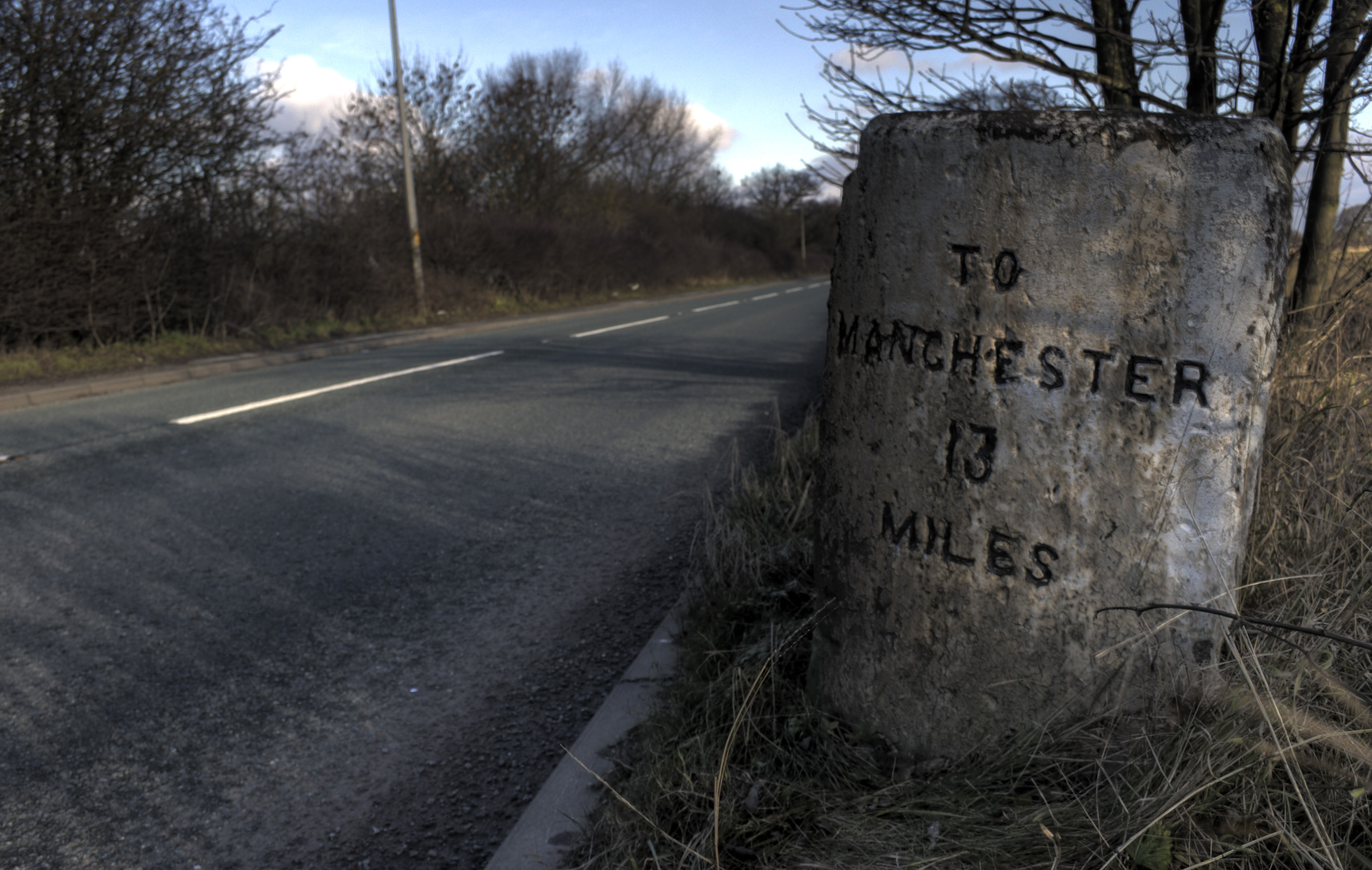
The A580 (officially the Liverpool–East Lancashire Road, colloquially the East Lancs Road) is the United Kingdom's first purpose-built inter-city highway. The road, which remains a primary A road, was officially opened by King George V on 18 July 1934. It links Liverpool to Salford, 3 miles west of Manchester city centre. Purpose The road was built to provide better access between the Port of Liverpool and the industrial areas of East Lancashire around Manchester. The new high-quality trunk road would supersede the indirect and heavily built-up A57 through Prescot, Warrington and Eccles. Journey times for road haulage would be reduced to under an hour. This road was built with a 1930s Dutch-style cycle path running its entire length. Many roads at this time were built with cycle paths but most have been lost due to road widening schemes. History First phase (completed) The first part, which was completed within three years, was from Walton, Liverpool, to the junction ... [...More Info...]       [...Related Items...]     OR:     [Wikipedia]   [Google]   [Baidu]   |
|
Kirkdale, Liverpool
Kirkdale is a district of Liverpool, Merseyside, England, and a Liverpool City Council ward that covers both Kirkdale and Vauxhall. At the 2011 Census, the population was 16,115. History Kirkdale is a working class area with mainly Victorian terraced houses. From 1885 to 1983, it was part of the Liverpool Kirkdale constituency. Kirkdale is bordered by Bootle to the north, Walton and Everton to the east and Vauxhall to the south. Boundary Street was an ancient division between the township of Kirkdale and Liverpool before Liverpool's expansion took in Kirkdale in the 1860s. It thus separates Kirkdale and Vauxhall. Kirkdale is now undergoing a large amount of regeneration. The old Easby estate has been demolished to make way for new two-, three- and four-bedroom properties. They have been built for both local residents and incomers. Transport There are three railway stations in the district, owing to its size and location near where the Merseyrail Northern Line branches dive ... [...More Info...]       [...Related Items...]     OR:     [Wikipedia]   [Google]   [Baidu]   |
|
A57 Road
The A57 is a major road in England. It runs east from Liverpool to Lincoln, England, Lincoln via Warrington, Cadishead, Irlam, Patricroft, Eccles, Greater Manchester, Eccles, Salford, Greater Manchester, Salford and Manchester, then through the Pennines over the Snake Pass (between the high moorlands of Bleaklow and Kinder Scout), around the Ladybower Reservoir, through Sheffield and past Worksop. Between Liverpool and Glossop, the road has largely been superseded by the M62 motorway, M62, M602 motorway, M602 and M67 motorways. Within Manchester a short stretch becomes the Mancunian Way, designated A57(M). Route Liverpool–Warrington The A57 begins at The Strand (A5036) near the River Mersey, as part of Water Street. It forms an east–west route through the north of the city centre with another one-way road system as Tithebarn Street (passing part of Liverpool John Moores University), Great Crosshall Street and Churchill Way in the east direction and Churchill Way and Dale ... [...More Info...]       [...Related Items...]     OR:     [Wikipedia]   [Google]   [Baidu]   |
|
Pennines
The Pennines (), also known as the Pennine Chain or Pennine Hills, are a range of uplands running between three regions of Northern England: North West England on the west, North East England and Yorkshire and the Humber on the east. Commonly described as the "backbone of England", the range stretches northwards from the Peak District at the southern end, through the South Pennines, Yorkshire Dales and North Pennines to the Tyne Gap, which separates the range from the Border Moors and Cheviot Hills across the Anglo-Scottish border, although some definitions include them. South of the Aire Gap is a western spur into east Lancashire, comprising the Rossendale Fells, West Pennine Moors and the Bowland Fells in North Lancashire. The Howgill Fells and Orton Fells in Cumbria are sometimes considered to be Pennine spurs to the west of the range. The Pennines are an important water catchment area with numerous reservoirs in the head streams of the river valleys. The North Pennin ... [...More Info...]       [...Related Items...]     OR:     [Wikipedia]   [Google]   [Baidu]   |
|
United Kingdom
The United Kingdom of Great Britain and Northern Ireland, commonly known as the United Kingdom (UK) or Britain,Usage is mixed. The Guardian' and Telegraph' use Britain as a synonym for the United Kingdom. Some prefer to use Britain as shorthand for Great Britain. The British Cabinet Office's Government Digital Servicebr>style guidefor use on gov.uk recommends: "Use UK and United Kingdom in preference to Britain and British (UK business, UK foreign policy, ambassador and high commissioner). But British embassy, not UK embassy." is a sovereign country in north-western Europe, off the north-western coast of the European mainland. The United Kingdom includes the island of Great Britain, the north-eastern part of the island of Ireland, and many smaller islands within the British Isles. Northern Ireland shares a land border with the Republic of Ireland. Otherwise, the United Kingdom is surrounded by the Atlantic Ocean, with the North Sea to the east, the English Channel to ... [...More Info...]       [...Related Items...]     OR:     [Wikipedia]   [Google]   [Baidu]   |
|
Highways Agency
National Highways, formerly the Highways Agency and later Highways England, is a government-owned company charged with operating, maintaining and improving motorways and major A roads in England. It also sets highways standards used by all four UK administrations, through the Design Manual for Roads and Bridges. Within England, it operates information services through the provision of on-road signage and its Traffic England website, provides traffic officers to deal with incidents on its network, and manages the delivery of improvement schemes to the network. Founded as an executive agency, it was converted into a government-owned company, Highways England, on 1 April 2015. As part of this transition, the UK government set out its vision for the future of the English strategic road network in its Road Investment Strategy. A second Road Investment Strategy was published in March 2020, with the company set to invest £27 billion between 2020 and 2025 to improve the network as d ... [...More Info...]       [...Related Items...]     OR:     [Wikipedia]   [Google]   [Baidu]   |
|
Central Reservation
The median strip, central reservation, roadway median, or traffic median is the reserved area that separates opposing lanes of traffic on divided roadways such as divided highways, dual carriageways, freeways, and motorways. The term also applies to divided roadways other than highways, including some major streets in urban or suburban areas. The reserved area may simply be paved, but commonly it is adapted to other functions; for example, it may accommodate decorative landscaping, trees, a median barrier, or railway, rapid transit, light rail, or streetcar lines. Regional terminology There is no international English standard for the term. Median, median strip, and median divider island are common in North American and Antipodean English. Variants in North American English include regional terms such as neutral ground in New Orleans usage. In British English the central reservation or central median the preferred usage; it also occurs widely in formal documents in som ... [...More Info...]       [...Related Items...]     OR:     [Wikipedia]   [Google]   [Baidu]   |
|
Dual Carriageway
A dual carriageway ( BE) or divided highway ( AE) is a class of highway with carriageways for traffic travelling in opposite directions separated by a central reservation (BrE) or median (AmE). Roads with two or more carriageways which are designed to higher standards with controlled access are generally classed as motorways, freeways, etc., rather than dual carriageways. A road without a central reservation is a single carriageway regardless of the number of lanes. Dual carriageways have improved road traffic safety over single carriageways and typically have higher speed limits as a result. In some places, express lanes and local/collector lanes are used within a local-express-lane system to provide more capacity and to smooth traffic flows for longer-distance travel. History A very early (perhaps the first) example of a dual carriageway was the ''Via Portuensis'', built in the first century by the Roman emperor Claudius between Rome and its port Ostia at the mouth of t ... [...More Info...]       [...Related Items...]     OR:     [Wikipedia]   [Google]   [Baidu]   |
|
County Borough Of Salford
Salford was, from 1844 to 1974, a local government district in the county of Lancashire in the northwest of England, covering the city of Salford. It was granted city status in 1926. History Free Borough and Police Commissioners In about 1230, the vill of Salford, Lancashire, was created a free borough by charter granted by Ranulph de Blondeville, 4th Earl of Chester. The borough's government was in the hands of a borough-reeve and portmote court. The reeve was elected by the burgesses at large, while the head of the Molyneux family of Sefton presided over the court as hereditary steward of the Hundred of Salford. In 1791 the first modern local government was established in the area, when the Manchester and Salford Police Act created commissioners to administer the two towns. In 1843 the inhabitant householders petitioned the Privy Council for a royal charter, charter of incorporation under the Municipal Corporations Act 1835 The charter was granted on 16 April 1844, and the ... [...More Info...]       [...Related Items...]     OR:     [Wikipedia]   [Google]   [Baidu]   |
|
A6 Road (England)
The A6 is one of the main north–south roads in England. It runs from Luton in Bedfordshire to Carlisle in Cumbria, although it formerly started at a junction with the A1 at Barnet. It is the fourth longest numbered road in Britain; only the A1, A38 and A30 are longer. Running north-west from Luton, the road passes through Bedford, bypasses Rushden, Kettering and Market Harborough, continues through Leicester, Loughborough, Derby and Matlock before passing through the Peak District to Bakewell, Buxton, Stockport, Manchester, Salford, Pendleton, Irlams o' th' Height, Pendlebury, Swinton, Wardley, Linnyshaw, Walkden, Little Hulton, Westhoughton, Chorley, Preston, Lancaster, Kendal and Penrith before reaching Carlisle. South of Derby, the road is paralleled by the M1 motorway; between Manchester and Preston, the M6 and M61 motorways approximate its course; and from Preston to its northern terminus in Carlisle, it is paralleled by the M6 only. Between Derby and Ma ... [...More Info...]       [...Related Items...]     OR:     [Wikipedia]   [Google]   [Baidu]   |
|
Walton, Liverpool
Walton is an area of Liverpool, England, north of Anfield and east of Bootle and Orrell Park. Historically in Lancashire, it is largely residential, with a diverse population. History The name may derive from the same origin as Wales. The incoming Saxons called the earlier native inhabitants (the Celtic Britons) ''Walas'' or ''Wealas'', meaning "foreigner". Another possible etymology is ''Wald tun'', Old English for "Forest Town". Walton's recorded history starts with the death of Edward the Confessor, when Winestan held the manor of Walton. After the Norman conquest of 1066, Roger of Poitou included Walton in the lands he gave to his sheriff, Godfrey. In 1200, King John gave Walton to Richard de Meath, who left it to his brother, Henry de Walton. Henry's son William inherited the land, but died before his son Richard was of age, so Richard was made a ward of Nicholas de la Hose by the Earl of Derby and the estate was managed by nobles outside the family for a time. Walton ... [...More Info...]       [...Related Items...]     OR:     [Wikipedia]   [Google]   [Baidu]   |
|
East Lancashire Road - Geograph
East or Orient is one of the four cardinal directions or points of the compass. It is the opposite direction from west and is the direction from which the Sun rises on the Earth. Etymology As in other languages, the word is formed from the fact that east is the direction where the Sun rises: ''east'' comes from Middle English ''est'', from Old English ''ēast'', which itself comes from the Proto-Germanic *''aus-to-'' or *''austra-'' "east, toward the sunrise", from Proto-Indo-European *aus- "to shine," or "dawn", cognate with Old High German ''*ōstar'' "to the east", Latin ''aurora'' 'dawn', and Greek ''ēōs'' 'dawn, east'. Examples of the same formation in other languages include Latin oriens 'east, sunrise' from orior 'to rise, to originate', Greek ανατολή anatolé 'east' from ἀνατέλλω 'to rise' and Hebrew מִזְרָח mizraḥ 'east' from זָרַח zaraḥ 'to rise, to shine'. ''Ēostre'', a Germanic goddess of dawn, might have been a personificatio ... [...More Info...]       [...Related Items...]     OR:     [Wikipedia]   [Google]   [Baidu]   |
|
Haulage
Haulage is the business of transporting goods by road or rail between suppliers and large consumer outlets, factories, warehouses, or depots. This includes everything humans might wish to move in bulk - from vegetables and other foodstuffs, to clothes, ore, coal, and other supply (economics), supplies. Haulage also involves the transportation of chemicals in large sealed containers, and the removal of waste. As the word implies, goods are loaded into large trailers or carriages and hauled between different locations. Traditionally, this was by large animals such as horses or oxen - where the practice may also be called cartage or drayage. However, in the modern age, this act is mostly performed by trains or trucks - with large shipping vessels acting as intermediaries for crossing oceans. Truck driver, Truck drivers on haulage shifts are typically male, and often work long and difficult hours with few breaks - regularly sleeping in their vehicles overnight and eating/showering at rest ... [...More Info...]       [...Related Items...]     OR:     [Wikipedia]   [Google]   [Baidu]   |