|
1908 Convention Line
Ciid or 'Iid ( so, Arlo Ciideed) is an archaic native geographic name for the land between the region of Mudug and the Nugaal Valley, roughly congruous with the northern Bookh district in Ethiopia. As such, Ciid constitutes the tripoint of the former three colonial powers Abyssinia, Britain and Italy, thus situating Mudug immediately southeast of Ciid, the Nugaal Valley immediately north of Ciid, and Haud to the west of Ciid. One historian referred to it as the syrup-colored land and it is today embodied by Ciid towns such as Xamxam, Magacley, Qoriley, Biriqodey, Beerdhiga and Gumburka Cagaare. Ciid constitutes the northernmost parts of the disputed Somali-Ethiopian territory outlined in the 16 May 1908 Italo-Ethiopian border agreement also called the 1908 Convention. A 2001 Journal from Indiana University describes Ciid as partially overlapping with Boocame District by referring to Ciid as ''north of the Mudug region and the west of the Garowe region''. Anthropology Someone wh ... [...More Info...] [...Related Items...] OR: [Wikipedia] [Google] [Baidu] |
Bookh
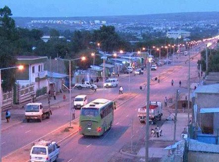
Boh ( Somali: ''Bookh''), popularly known as '''Iid'', is one of the woredas in the Somali Region of Ethiopia. Part of the Werder Zone, Boh is located in the easternmost part of the country, at the point of the angle jutting into Somalia; on its other sides, this woreda is bordered on the southwest by Geladin, and on the northwest by Danot. The easternmost point of this woreda is the easternmost point of Ethiopia. Towns in Boh include Boh, Dameercad, Galhamur, Dogob, Wanaagsan, Saaxdheer, Domco and Marqaan weyne, Qoriley, Gumburka Cagaare, Turgasangas, Toga Erigoo. History The historic name of the Boh or Bookh region was Ciid. Before 1960, there was little water available during the dry season in Boh; although the Geladi wells and other shallow wells in their vicinity were used, they did not always yield sufficient water in the dry season to serve as a reliable permanent water source. So the pastures in the woreda were traditionally abandoned by the local nomadic pastora ... [...More Info...] [...Related Items...] OR: [Wikipedia] [Google] [Baidu] |
Somali Region
The Somali Region ( so, Deegaanka Soomaalida, am, ሱማሌ ክልል, Sumalē Kilil, ar, المنطقة الصومالية), also known as Soomaali Galbeed (''Western Somalia'') and officially the Somali Regional State, is a regional state in eastern Ethiopia. Its territory is the largest after Oromia Region. The regional state borders the Ethiopian regions of Afar and Oromia and the chartered city Dire Dawa (Dire Dhawa) to the west, as well as Djibouti to the north, Somaliland to the northeast, Somalia to the south; and Kenya to the southwest. Jijiga is the capital of the Somali Region. The capital was formerly Gode, until Jijiga became the capital in 1995 on account of political considerations. The Somali regional government is composed of the executive branch, led by the President; the legislative branch, which comprises the State Council; and the judicial branch, which is led by the State Supreme Court. Overview The Somali Region formed a large part of the pre-19 ... [...More Info...] [...Related Items...] OR: [Wikipedia] [Google] [Baidu] |
South West State Of Somalia
The South-West State of Somalia ( so, Goboleedka Koonfur Galbeed ee Soomaaliya, Maay Maay: ''Koofur Orsi''), is a Federal Member State in southwestern Somalia. It was founded by Hasan Muhammad Nur Shatigadud, leader of the Somalia RRA on 1 April 2002. It was the third autonomous region to be established. After its dissolution in 2005, the territory was re-established in November 2009 as an official federal member state of Somalia. Abdiaziz Laftagareen was selected the president of this state. The official capital of South-West state is Barawa, located on the coast of the Somali Sea, though the state administration is currently based in Baidoa. Location and name The South West state is bordered to the north by Ethiopia, to the west by Jubbaland, to the east by Hirshabelle, and to the south by the Somali Sea. To the southeast, it is also bordered by Banaadir, whose administrative status was unclear during the 2010s. During its development phase, the regional state of was cal ... [...More Info...] [...Related Items...] OR: [Wikipedia] [Google] [Baidu] |
Mohamed Bullaleh
Haji Mohamed Bullaleh ( so, Xaaji Maxamed Bullaale) commonly known as Haji Warabe was an early 20th century Akil (chief) of the Habr Yunis Rer Ainanshe. Korahe raid (Hagoogane) In the early 20th century during the Dervish wars, the British and Abyssinians came to an agreement that cross border camel raiding between the Somali tribes was to be banned and that the offending tribes would be punished by their respective governments. The Abyssinians only nominally having control over the Haud failed to meet their end of the agreement and this resulted in the Dervish and Ogaden alliance raiding with impunity while the Isaaq and Dhulbahante were unable to avenge the raids due to the British Camel corps restraining them and returning looted Ogaden livestock. The secretary administrator of British Somaliland, Douglas James Jardine noted that the Isaaq sub clans inhabiting the Haud were in fact militarily superior and stronger than their Ogaden counterparts. After a series of Dervish-Ogad ... [...More Info...] [...Related Items...] OR: [Wikipedia] [Google] [Baidu] |
Somaliland Camel Corps
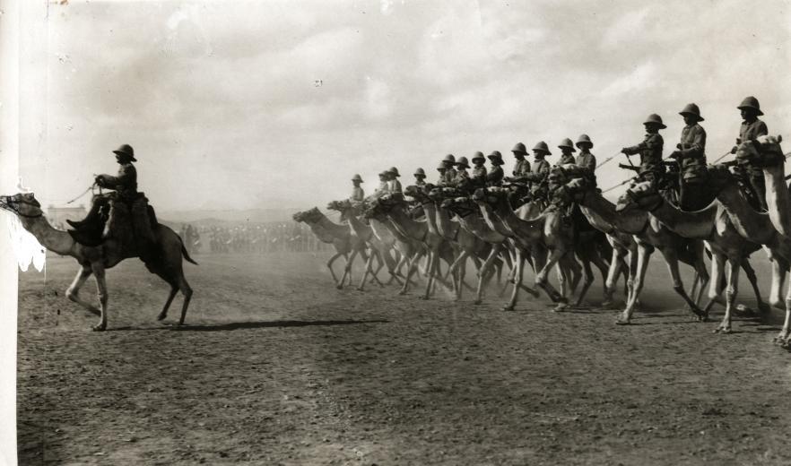
The Somaliland Camel Corps (SCC) was a Rayid unit of the British Army based in British Somaliland. It lasted from the early 20th century until 1944. Beginnings and the Dervish rebellion In 1888, after signing successive treaties with the then ruling Somali Sultans, the British established a protectorate in northern present-day Somaliland referred to as British Somaliland. The British immediately recognized the affinity between the Somali people and their camel charges. The "Somali Camel Constabulary" was an early attempt to harness this natural affinity militarily. In 1895, the haroun established the Dervish courts and Warfare commenced with colonial powers from 1900 until 1920. Somaliland Campaign On 9 August 1913, the "Somaliland Camel Constabulary" suffered a serious defeat at the Battle of Dul Madoba at the hands of the Ibraahin Xoorane and Axmed Aarey. Hassan, the emir of Diiriye Guure roamed British Somaliland, having already evaded several attempts at capture. At ... [...More Info...] [...Related Items...] OR: [Wikipedia] [Google] [Baidu] |
Somaliland Scouts
The Somaliland Scouts was a Rayid military unit, a regiment, of the British Army. It was established after the liberation of British Somaliland from Italy in December 1941 and the dissolution of the Somaliland Camel Corps in 1942, which was formerly tasked with the defense of the protectorate. History Originally formed as the ''Somali Guard Battalion'', and tasked with defending the border between British and French Somaliland, the brigade quickly rose in size and importance. It later became the Somali Companies in June 1942, before finally being renamed to the Somaliland Scouts in August 1943. A transcript of a Reuters report of 26 June 1960 says that, during the independence ceremony for Somaliland "..Nearly 1,000 British-trained Somaliland Scouts were then handed over to the Prime Minister by Brigadier O. G. Brooks, the Colonel Commandant." On 1 July 1960, upon the merger of British Somaliland and Italian Somaliland to form the Somali Republic, the Somaliland Scouts was me ... [...More Info...] [...Related Items...] OR: [Wikipedia] [Google] [Baidu] |
Illaloes
Illaloes, nicknamed the Tally-hoes during its inception, were a Rayid military arm of the King's African Rifles and Somaliland Camel Corps during the Scramble for Africa period of colonial history. However, subsequent to this period, they were employed as wardens and security custodians in British Military Administration in Ogaden and Haud, in the British Somali Coast Protectorate, and in British Jubaland. During the anti-Darawiish war, Illaloes or Tally-hoes were often places alongside various ethnic groups such as the Yaos of the Lake Malawi region, and Sikhs, and the recently conquered Boers Boers ( ; af, Boere ()) are the descendants of the Dutch-speaking Free Burghers of the eastern Cape frontier in Southern Africa during the 17th, 18th, and 19th centuries. From 1652 to 1795, the Dutch East India Company controlled this area ..., and Bikaners from Rajasthan in India, as well as Punjabs. The main utility of Illaloes was their endurance. A former sergeant in charge o ... [...More Info...] [...Related Items...] OR: [Wikipedia] [Google] [Baidu] |
Huwan
Ciid or 'Iid ( so, Arlo Ciideed) is an archaic native geographic name for the land between the region of Mudug and the Nugaal Valley, roughly congruous with the northern Bookh district in Ethiopia. As such, Ciid constitutes the tripoint of the former three colonial powers Abyssinia, Britain and Italy, thus situating Mudug immediately southeast of Ciid, the Nugaal Valley immediately north of Ciid, and Haud to the west of Ciid. One historian referred to it as the syrup-colored land and it is today embodied by Ciid towns such as Xamxam, Magacley, Qoriley, Biriqodey, Beerdhiga and Gumburka Cagaare. Ciid constitutes the northernmost parts of the disputed Somali-Ethiopian territory outlined in the 16 May 1908 Italo-Ethiopian border agreement also called the 1908 Convention. A 2001 Journal from Indiana University describes Ciid as partially overlapping with Boocame District by referring to Ciid as ''north of the Mudug region and the west of the Garowe region''. Anthropology Someone w ... [...More Info...] [...Related Items...] OR: [Wikipedia] [Google] [Baidu] |
Mogadishu
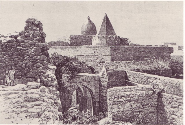
Mogadishu (, also ; so, Muqdisho or ; ar, مقديشو ; it, Mogadiscio ), locally known as Xamar or Hamar, is the capital and List of cities in Somalia by population, most populous city of Somalia. The city has served as an important port connecting traders across the Indian Ocean for millennia, and has an estimated population of 2,388,000 (2021). Mogadishu is located in the coastal Banadir region on the Indian Ocean, which unlike other Somali regions, is considered a municipality rather than a (federal state). Mogadishu has a long history, which ranges from the Ancient history, ancient period up until the present, serving as the capital of the Sultanate of Mogadishu in the 9th-13th century, which for many centuries controlled the Indian Ocean gold trade, and eventually came under the Ajuran Empire in the 13th century which was an important player in the medieval Silk Road maritime trade. Mogadishu enjoyed the height of its prosperity during the 14th and 15th centuries a ... [...More Info...] [...Related Items...] OR: [Wikipedia] [Google] [Baidu] |
Italian Somaliland
Italian Somalia ( it, Somalia Italiana; ar, الصومال الإيطالي, Al-Sumal Al-Italiy; so, Dhulka Talyaaniga ee Soomaalida), was a protectorate and later colony of the Kingdom of Italy in present-day Somalia. Ruled in the 19th century by the Somali Sultanates of Hobyo and Majeerteen in the north, and the Hiraab Imamate and Geledi Sultanate and the Biimaal Sultanate leading a resistance against the colonials in southern Somalia for decades. The territory was acquired in the 1880s by Italy through various treaties.Mariam Arif Gassem, ''Somalia: clan vs. nation'' (s.n.: 2002), p.4 In 1936, the region was integrated into Italian East Africa as the Somalia Governorate. This would last until Italy's loss of the region in 1941, during the East African campaign of World War II. Italian Somalia then came under British military administration until 1950, when it became a United Nations trusteeship, the Trust Territory of Somalia under Italian administration. On 1 July 196 ... [...More Info...] [...Related Items...] OR: [Wikipedia] [Google] [Baidu] |
Endonym And Exonym
An endonym (from Greek: , 'inner' + , 'name'; also known as autonym) is a common, ''native'' name for a geographical place, group of people, individual person, language or dialect, meaning that it is used inside that particular place, group, or linguistic community in question; it is their self-designated name for themselves, their homeland, or their language. An exonym (from Greek: , 'outer' + , 'name'; also known as xenonym) is an established, ''non-native'' name for a geographical place, group of people, individual person, language or dialect, meaning that it is used only outside that particular place, group, or linguistic community. Exonyms exist not only for historico-geographical reasons but also in consideration of difficulties when pronouncing foreign words. For instance, is the endonym for the country that is also known by the exonym ''Germany'' in English, in Spanish and in French. Naming and etymology The terms ''autonym'', ''endonym'', ''exonym'' and ''xe ... [...More Info...] [...Related Items...] OR: [Wikipedia] [Google] [Baidu] |


