|
Yaxhá
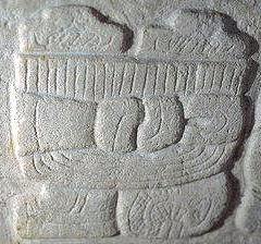
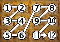
Yaxha (or Yaxhá in Spanish orthography) is a Mesoamerican archaeological site in the northeast of the Petén Basin in modern-day Guatemala. As a ceremonial centre of the pre-Columbian Maya civilization, Yaxha was the third largest city in the region and experienced its maximum power during the Early Classic period (c. AD 250–600). The city was located on a ridge overlooking Lake Yaxha. The name of the city derives from the Mayan for "blue-green water"; it is a notable survival of a Classic period place-name into the modern day. The Yaxha kingdom is estimated to have covered an area of and to have had a peak population of 42,000 in the Late Classic period of Mesoamerican chronology. Yaxha had a long history of occupation with the first settlement being founded sometime in the Middle Preclassic period (c. 1000–350 BC). It developed into the largest city in the eastern Petén lakes region during the Late Preclassic (c. 350 BC – AD 250) and expanded into an enormous city durin ... [...More Info...] [...Related Items...] OR: [Wikipedia] [Google] [Baidu] |
Cultural Triangle Yaxha-Nakum-Naranjo National Park
The Cultural Triangle Yaxha-Nakum-Naranjo National Park (Triángulo Cultural in Spanish) is a multidisciplinary project involving archaeologists, architects, restaurateurs, and biologists. It is situated in Petén, Guatemala. The project does not only work in one archaeological site, but in a region of including three gigantic sites and 14 sub-centers – the most populated area of the Classic period of the Maya civilization. History The project, founded in 1994, started with over 300 Guatemalan workers and 12 scientists. The first work carried out was at Topoxte, an island within the lake of Yaxha. Here you find the only exposed architecture of the Maya Postclassic period in the whole Petén Basin. One of the temples, so called Temple C, was near to its collapse. That’s why the team restored it during the first two years. Today the island is one of the principal points of interest in the Petén and the cooperative of the project brings many tourists by boat to the island. Y ... [...More Info...] [...Related Items...] OR: [Wikipedia] [Google] [Baidu] |
Petén Department
Petén (from the Itza' language, Itz'a, , 'Great Island') is a Departments of Guatemala, department of Guatemala. It is geographically the northernmost department of Guatemala, as well as the largest by area at it accounts for about one third of Guatemala's area. The capital is Flores, Guatemala, Flores. The population at the mid-2018 official estimate was 595,548.Instituto Nacional de Estadistica Guatemala (web). Geography The Petén department is bordered on the east by Belize and by Mexico (with the Mexican states of Chiapas to the west, Tabasco to the northwest and Campeche to the north). Its northwest border includes the border town of El Ceibo, Guatemala, adjacent to El Ceibo, Tabasco, Mexico. To the south it borders the Guatemalan departments of Alta Verapaz and Izabal Department, Izabal.ITMB Publishing Ltd. 2005. Much of the western border with Mexico is formed by the Usumacinta River and its tributary the Salinas River (Guatemala), Salinas River. Portions of the souther ... [...More Info...] [...Related Items...] OR: [Wikipedia] [Google] [Baidu] |
Topoxte
Topoxte () (or Topoxté in Spanish orthography) is a pre-Columbian Maya civilization, Maya archaeological site in the Petén Basin in northern Guatemala with a long occupational history dating as far back as the Mesoamerican chronology, Middle Preclassic.Pinto & Noriega 1995, pp.576–7. As the capital of the Kowoj, Kowoj Maya, it was the largest of the few Mesoamerican chronology, Postclassic Mesoamerican sites in the area. Topoxte is located on an island on Laguna Yaxhá, Yaxha Lake across from the important Classic period center of Yaxha.Sharer & Traxler 2006, p.617. Topoxte was named by Teobert Maler in 1904;Chase 1976, p.155. the name means "seed of the Ramón tree." There is no record of the name Topoxte prior to this. The Ramón tree, commonly known as breadnut, was an important component of the ancient Maya diet and subsistence, Maya diet. Prior to this the site was known as ''Islapag'', as noted in 1831 by Juan Galindo in his report to the Society of Antiquaries of London ... [...More Info...] [...Related Items...] OR: [Wikipedia] [Google] [Baidu] |
Nakum
Nakum ("House of the pot") is a Mesoamerican archaeological site, and a former ceremonial center and city of the pre-Columbian Maya civilization. It is located in the northeastern portion of the Petén Basin region, in the modern-day Guatemalan department of Petén. The northeastern Petén region contains a good number of other significant Maya sites, and Nakum is one of the three sites forming the Cultural Triangle of " Yaxha-Nakum- Naranjo". Nakum is approximately to the north of Yaxha and some to the east of Tikal, on the banks of the Holmul River. Its main features include an abundance of visibly restored architecture, and the roof comb of the site's main temple structure is one of the best-preserved outside Tikal. History This city has evidence of occupation dating from the Middle Preclassic period of Mesoamerican chronology. For the most part of the Classic period, Nakum appeared to be subordinate to Tikal. Nakum particularly flourished during the Late Classic (c. ... [...More Info...] [...Related Items...] OR: [Wikipedia] [Google] [Baidu] |
Petén Basin
The Petén Basin is a geographical subregion of the Maya Lowlands, primarily located in northern Guatemala within the Department of El Petén, and into the state of Campeche in southeastern Mexico. During the Late Preclassic and Classic periods of pre-Columbian Mesoamerican chronology many major centers of the Maya civilization flourished, such as Tikal and Calakmul. A distinctive Petén-style of Maya architecture and inscriptions arose. The archaeological sites La Sufricaya and Holmul are also located in this region. History By the first half of the 1st millennium BCE, the Petén and Mirador Basin of this region were already well-established with a number of monumental sites and cities of the Maya civilization. Significant Maya sites of this Preclassic era of Mesoamerican chronology include Nakbé, El Mirador, Naachtun, San Bartolo and Cival in the Mirador Basin. Classic Period Later, Petén became the heartland of the Maya Classic Period (c. 200 – 900 CE). ... [...More Info...] [...Related Items...] OR: [Wikipedia] [Google] [Baidu] |
Maya Civilization
The Maya civilization () was a Mesoamerican civilization that existed from antiquity to the early modern period. It is known by its ancient temples and glyphs (script). The Maya script is the most sophisticated and highly developed writing system in the pre-Columbian Americas. The civilization is also noted for its art, architecture, mathematics, calendar, and astronomical system. The Maya civilization developed in the Maya Region, an area that today comprises southeastern Mexico, all of Guatemala and Belize, and the western portions of Honduras and El Salvador. It includes the northern lowlands of the Yucatán Peninsula and the Guatemalan Highlands of the Sierra Madre, the Mexican state of Chiapas, southern Guatemala, El Salvador, and the southern lowlands of the Pacific littoral plain. Today, their descendants, known collectively as the Maya, number well over 6 million individuals, speak more than twenty-eight surviving Mayan languages, and reside in nearly the s ... [...More Info...] [...Related Items...] OR: [Wikipedia] [Google] [Baidu] |
Petén (department)
Petén or Peten may refer to: *Petén Department, a department of Guatemala *Petén Basin The Petén Basin is a geographical subregion of the Maya Lowlands, primarily located in northern Guatemala within the Department of El Petén, and into the state of Campeche in southeastern Mexico. During the Late Preclassic and Classic periods ..., the geographical/archaeological region of Mesoamerica and a center of the Maya civilization * Lake Petén Itzá, a lake in the Petén Basin region * Peten Itza kingdom, a Maya kingdom in Central America centered on the city of Nojpetén *The Hebrew name () for the Boeing AH-64A Apache in Israeli service, meaning "Cobra" in English * Petén molly, a fish {{disambiguation, geo ... [...More Info...] [...Related Items...] OR: [Wikipedia] [Google] [Baidu] |
Tikal
Tikal (; ''Tik'al'' in modern Mayan orthography) is the ruin of an ancient city, which was likely to have been called Yax Mutal, found in a rainforest in Guatemala. It is one of the largest archaeological sites and urban centers of the Pre-Columbian era, pre-Columbian Maya civilization. It is located in the archaeological region of the Petén Basin in what is now northern Guatemala. Situated in Petén Department, the site is part of Guatemala's Tikal National Park and in 1979 it was declared a UNESCO World Heritage Site. Tikal was the capital of a state that became one of the most powerful kingdoms of the ancient Maya. Though monumental architecture at the site dates back as far as the 4th century BC, Tikal reached its apogee during the Mesoamerican chronology, Classic Period, c. 200 to 900. During this time, the Maya city, city dominated much of the Maya region politically, economically, and militarily, while interacting with areas throughout Mesoamerica such as the great metr ... [...More Info...] [...Related Items...] OR: [Wikipedia] [Google] [Baidu] |
Laguna Yaxhá
Laguna (Italian and Spanish word for lagoon), is a Spanish, Italian, and Polish surname. It may also refer to: People * Andrés Laguna (1499–1559), Spanish physician, pharmacologist, and botanist * Benjamín Máximo Laguna y Villanueva (1822–1902), Spanish forester, entomologist and botanist of Spanish and Philippine flora * Theodore de Laguna (1876–1930), American philosopher, taught at Bryn Mawr College and in the Philippines, early feminist. * Aleksander Łaguna (7/10/1894 – 9/10/1934) – Major pilot of the Polish Army, knight of the Virtuti Militari * Mikołaj Łaguna (14/06/1890–1940) – Polish lieutenant, murdered in Katyn * Piotr Łaguna (1905–1941), major of the Polish Army, pilot * Stosław (Klemens Stanisław) Łaguna, (23/02/1833-28/04/1900), professor of Polish Law at the University of Saint Petersburg, January Uprising participant * Stanisław Ignacy Łaguna (18 January 1878-1 August 1943) – Polish engineer, councilor of the Lviv City Council ... [...More Info...] [...Related Items...] OR: [Wikipedia] [Google] [Baidu] |
Emblem Glyph
Maya script, also known as Maya glyphs, is historically the native writing system of the Maya civilization of Mesoamerica and is the only Mesoamerican writing system that has been substantially deciphered. The earliest inscriptions found which are identifiably Maya date to the 3rd century BCE in San Bartolo (Maya site), San Bartolo, Guatemala. Maya writing was in continuous use throughout Mesoamerica until the Spanish conquest of the Maya in the 16th and 17th centuries. Though modern Mayan languages are almost entirely written using the Latin alphabet rather than Maya script, there have been recent developments encouraging a revival of the Maya glyph system. Maya writing used logograms complemented with a set of syllabary, syllabic glyphs, somewhat similar in function to modern Japanese writing. Maya writing was called "hieroglyphics" or hieroglyphs by early European explorers of the 18th and 19th centuries who found its general appearance reminiscent of Egyptian hieroglyphs, al ... [...More Info...] [...Related Items...] OR: [Wikipedia] [Google] [Baidu] |


