|
Petén Basin
The Petén Basin is a geographical subregion of the Maya Lowlands, primarily located in northern Guatemala within the Department of El Petén, and into the state of Campeche in southeastern Mexico. During the Late Preclassic and Classic periods of pre-Columbian Mesoamerican chronology many major centers of the Maya civilization flourished, such as Tikal and Calakmul. A distinctive Petén-style of Maya architecture and inscriptions arose. The archaeological sites La Sufricaya and Holmul are also located in this region. History By the first half of the 1st millennium BCE, the Petén and Mirador Basin of this region were already well-established with a number of monumental sites and cities of the Maya civilization. Significant Maya sites of this Preclassic era of Mesoamerican chronology include Nakbé, El Mirador, Naachtun, San Bartolo and Cival in the Mirador Basin. Classic Period Later, Petén became the heartland of the Maya Classic Period (c. 200 – 900 CE). ... [...More Info...] [...Related Items...] OR: [Wikipedia] [Google] [Baidu] |
Maya Lowlands
The Maya Lowlands are the largest cultural and geographic, first order subdivision of the Maya Region, located in eastern Mesoamerica. Extent The Maya Lowlands are restricted by the Gulf of Mexico to the north, the Caribbean Sea to the east, and the Maya Highlands to the south and west. The precise northern and eastern limits of the Lowlands are widely agreed upon, being formed by conspicuous bodies of water. Their southern and western limits, however, are not precisely fixed, as these are restricted by 'subtle environmental changes or transitions from one zone he Highlandsto another he Lowlands' rather than conspicuous geographic features. The Lowlands fully encompass Belize, the Guatemalan department of Peten, and the Mexican states of Campeche, Yucatán, and Quintana Roo. They may further partially encompass a number of northerly Guatemalan departments, northwesterly Honduran departments, and southeasterly Mexican states. Divisions The Lowlands are usually subd ... [...More Info...] [...Related Items...] OR: [Wikipedia] [Google] [Baidu] |
Nakbé
Nakbe is one of the largest early Maya archaeological sites. Nakbe is located in the Mirador Basin, in the Petén region of Guatemala, approximately 13 kilometers south of the largest Maya city of El Mirador. Excavations at Nakbe suggest that habitation began at the site during the Early Formative period (c. 1400 BC) and continued to be a large site until its collapse during the Terminal Formative period (100–200 CE). The fall of Nakbe and El Mirador took place at roughly the same time. Discovery and excavation The site was first discovered in 1930 by aerial photos taken of the region, but excavations of the site did not take place until 1962. Archaeologist Ian Graham was the first person to start excavations, but it wasn’t until the 1980s and 1990s that real excavation began by UCLA's Institute of Geophysics and Planetary Sciences, and the Institute of Anthropology and History of Guatemala. The combined efforts of these two groups resulted in the RAINPEG Project, which ... [...More Info...] [...Related Items...] OR: [Wikipedia] [Google] [Baidu] |
Machaquilá
Machaquila (or Machaquilá, using Spanish orthography) is a major ruined city of the Maya civilization in what is now the El Peten department of Guatemala. Location The ruins of Machaquila fall within the municipality of Poptún, in the Petén department of Guatemala. It is approximately west of the town of Poptún, and southeast of Sayaxché. Machaquila is situated on the banks of the lower Machaquila River, which is a major tributary of the Pasión River. The site is in a relatively isolated region. During the Classic period, the city's location would have placed it upon a trade route running from the Maya Mountains in the east to the Pasión River in the west, and ultimately to the Usumacinta River.Chocón and Laporte 2002, p. 1. Machaquila is southeast of the contemporary Maya site of Seibal.Laporte, Mejía and Chocón 2005, p. 400. The site core containing the city's monumental architecture is protected, but under threat from occupation by landless peasants. The surrou ... [...More Info...] [...Related Items...] OR: [Wikipedia] [Google] [Baidu] |
Uaxactún
Uaxactun (pronounced ) is an ancient sacred place of the Maya civilization, located in the Petén Basin region of the Maya lowlands, in the present-day department of Petén, Guatemala. The site lies some north of the major center of Tikal. The name is sometimes spelled as Waxaktun. History of discovery With recent achievements in the decipherment of the ancient Maya hieroglyphic writing system, it has been determined that the ancient name for this site translates roughly as ''Siaan K'aan'' or "Born in Heaven". The name ''Uaxactun'' was given to the site by its rediscoverer, archaeologist Sylvanus Morley, in May 1916. He coined the name from Maya words ''Waxac'' and ''Tun'', to mean "Eight Stones". The name has two meanings; Morley's stated reason for the name was to commemorate it as the first site where an inscription dating from the 8th Baktún of the Maya calendar was discovered (making it then the earliest known Maya date). The other meaning is a pun, since "Uaxactun" sou ... [...More Info...] [...Related Items...] OR: [Wikipedia] [Google] [Baidu] |
Usumacinta
The Usumacinta River (; named after the howler monkey) is a river in southeastern Mexico and northwestern Guatemala. It is formed by the junction of the Pasión River, which arises in the Sierra de Santa Cruz (in Guatemala) and the Salinas River, also known as the Rio Chixoy, or the Rio Negro, which descends from the Sierra Madre de Guatemala. It defines part of the border between Guatemala and the Mexican state of Chiapas, then continues its northwesterly course, meandering through the Mexican state of Tabasco to the Gulf of Mexico. The Usumacinta River enters Mexican territory in the state of Tabasco and across the Cañón del Usumacinta (Usumacinta Canyon) ecological reserve, forming impressive canyons along its route. Passing the canyon called ''"Boca del Cerro",'' Tenosique, the Usumacinta goes into the plain of Tabasco. Two distributaries, the Palizada River and San Pedro y San Pablo River, branch from the main stem of the Usumacinta and empty north and east int ... [...More Info...] [...Related Items...] OR: [Wikipedia] [Google] [Baidu] |
Classic Maya
Classic Maya (or properly Classical Chʼoltiʼ) is the oldest historically attested member of the Mayan language family. It is the main language documented in the pre-Columbian inscriptions of the classical period of the Maya civilization. It is also the common ancestor of the Cholan branch of the Mayan language family. Contemporary descendants of classical Maya include Chʼol and Chʼortiʼ. Speakers of these languages can understand many Classic Mayan words. Classic Maya is quite a morphologically binding language, and most words in the language consist of multiple morphemes with relatively little irregularity. It shows some regional and temporal variations, which is completely normal considering the long period of use of the language. Even so, the texts make it clear that it is a single, uniform language. Classical Maya shows ergative alignment in its morphology, as well as syntactically in focus constructs. Although the descendant Cholan languages limit this pattern of e ... [...More Info...] [...Related Items...] OR: [Wikipedia] [Google] [Baidu] |
Famine
A famine is a widespread scarcity of food caused by several possible factors, including, but not limited to war, natural disasters, crop failure, widespread poverty, an Financial crisis, economic catastrophe or government policies. This phenomenon is usually accompanied or followed by regional malnutrition, starvation, epidemic, and increased death, mortality. Every inhabited continent in the world has experienced a period of famine throughout history. During the 19th and 20th centuries, Southeast Asia, Southeast and South Asia, as well as Eastern Europe, Eastern and Central Europe, suffered the greatest number of fatalities due to famine. Deaths caused by famine declined sharply beginning in the 1970s, with numbers falling further since 2000. Since 2010, Africa has been the most affected continent in the world by famine. As of 2025, Haiti and Afghanistan are the two states with the most catastrophic and widespread states of famine, followed by Palestine (confined to Gaza Strip ... [...More Info...] [...Related Items...] OR: [Wikipedia] [Google] [Baidu] |
Overfarming
Overexploitation, also called overharvesting or ecological overshoot, refers to harvesting a renewable resource to the point of diminishing returns. Continued overexploitation can lead to the destruction of the resource, as it will be unable to replenish. The term applies to natural resources such as water aquifers, grazing pastures and forests, wild medicinal plants, fish stocks and other wildlife. In ecology, overexploitation describes one of the five main activities threatening global biodiversity. Ecologists use the term to describe populations that are harvested at an unsustainable rate, given their natural rates of mortality and capacities for reproduction. This can result in extinction at the population level and even extinction of whole species. In conservation biology, the term is usually used in the context of human economic activity that involves the taking of biological resources, or organisms, in larger numbers than their populations can withstand. The term is als ... [...More Info...] [...Related Items...] OR: [Wikipedia] [Google] [Baidu] |
Agriculture In Mesoamerica
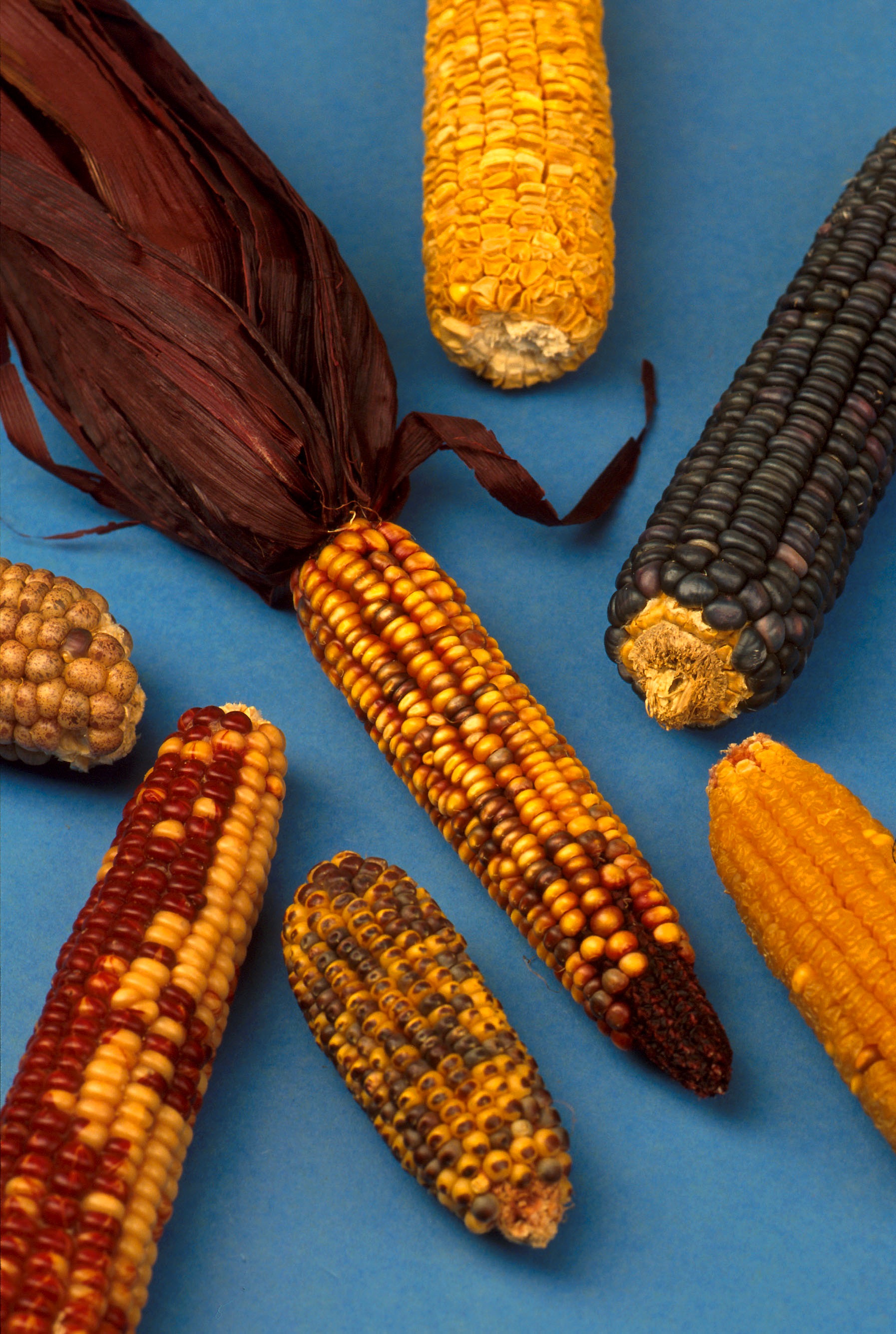
Agriculture in Mesoamerica dates to the Archaic period of Mesoamerican chronology (8000–2000 BC). At the beginning of the Archaic period, the Early Hunters of the late Pleistocene era (50,000–10,000 BC) led nomadic lifestyles, relying on hunting and gathering for sustenance. However, the nomadic lifestyle that dominated the late Pleistocene and the early Archaic slowly transitioned into a more sedentary lifestyle as the hunter gatherer micro-bands in the region began to cultivate wild plants. The cultivation of these plants provided security to the Mesoamericans, allowing them to increase surplus of " starvation foods" near seasonal camps; this surplus could be utilized when hunting was bad, during times of drought, and when resources were low. The cultivation of plants could have been started purposefully, or by accident. The former could have been done by bringing a wild plant closer to a camp site, or to a frequented area, so it was easier to access and collect. The latt ... [...More Info...] [...Related Items...] OR: [Wikipedia] [Google] [Baidu] |
Population Density
Population density (in agriculture: Standing stock (other), standing stock or plant density) is a measurement of population per unit land area. It is mostly applied to humans, but sometimes to other living organisms too. It is a key geographical term.Matt RosenberPopulation Density Geography.about.com. March 2, 2011. Retrieved on December 10, 2011. Biological population densities Population density is population divided by total land area, sometimes including seas and oceans, as appropriate. Low densities may cause an extinction vortex and further reduce fertility. This is called the Allee effect after the scientist who identified it. Examples of the causes of reduced fertility in low population densities are: * Increased problems with locating sexual mates * Increased inbreeding Human densities Population density is the number of people per unit of area, usually transcribed as "per square kilometre" or square mile, and which may include or exclude, for example, ar ... [...More Info...] [...Related Items...] OR: [Wikipedia] [Google] [Baidu] |
Cival
Cival is an archaeological site in the Petén Basin region of the southern Maya lowlands, which was formerly a major city of the Pre-Columbian Maya civilization. It is located in the present-day Department of Petén, Guatemala. The site flourished from about the 6th century B.C. through the 1st century C.E., during the Preclassic Period (see: Mesoamerican chronology). It may have had a peak population of some 10,000 people. The site is about 25 miles (40 km) east of Tikal, on a ridge over the left bank of the Holmul river. The site has temples on step pyramids and plazas arranged to point to astronomical events such as the equinox sunrise, and is surrounded by a defensive wall. The site's largest step pyramid is 27 metres high and 70 x 40 metres wide. Some buildings were decorated with stucco sculptures depicting Mesoamerican deities. The site was long lost in the jungle, and was discovered and partly plundered by looters around 1980. It was first mapped by explorer Ia ... [...More Info...] [...Related Items...] OR: [Wikipedia] [Google] [Baidu] |


