|
Wolfsklippe
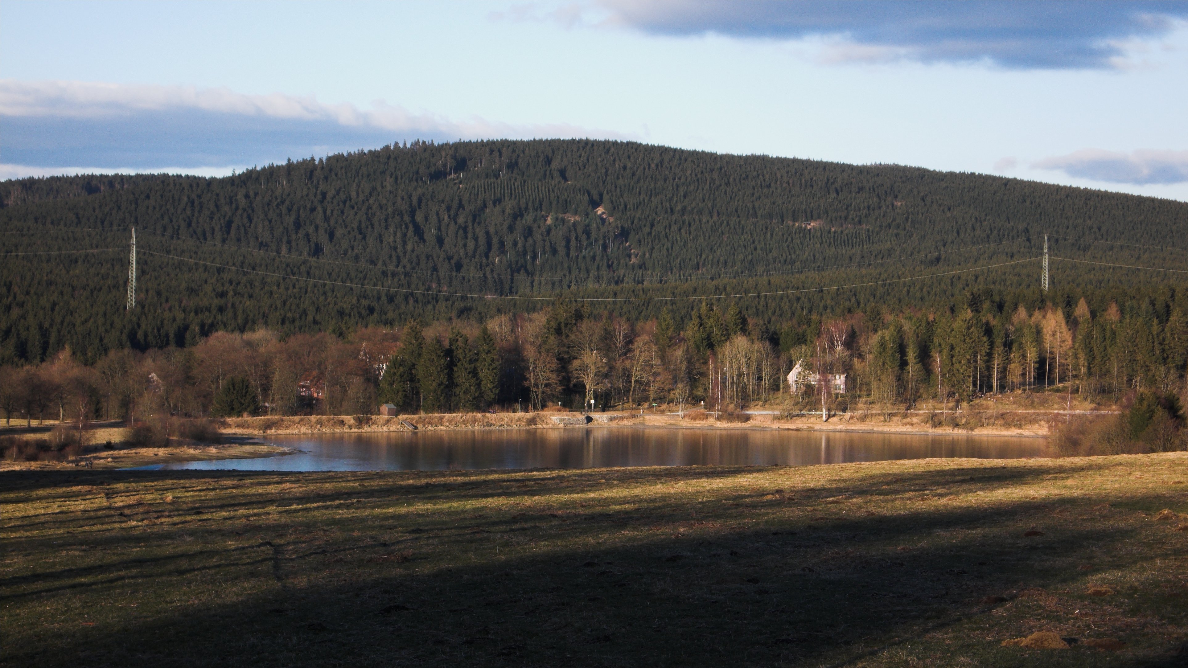
The Wolfsklippen, also called the Wolfsklippe, is a granite mountain in the Harz mountains in Central Germany with an observation platform on the summit. Its height is frequently given as about , but occasionally also as only around . Location The mountain lies northeast of the Brocken, the highest elevation in the Harz, about 200 m east of the road way from Drei Annen Hohne to Plessenburg. History Over 100 years ago the Harz Club erected on the summit of the Wolfsklippen one of four iron observation platforms in the Harz that still exist. At that time it had a good view of the Brocken and towards Ilsenburg and Wernigerode. Today this outlook is no longer visible due to the tall spruce trees that block the view. Name and legend AT the Wolfsklippen the last wolf in the area is supposed to have been killed, which is where the name of the mountain comes from. According to another legend, the name of the crags comes from the witch hunting period, when a girl accused of wit ... [...More Info...] [...Related Items...] OR: [Wikipedia] [Google] [Baidu] |
Schalke (Harz)
The Schalke is a mountain, , in the Upper Harz in the German state of Lower Saxony. It lies in Goslar district north of Clausthal-Zellerfeld and west of Schulenberg. From 1959 there was a French listening post on the summit, which was supplemented in 1968 by a 64 m high concrete tower. This tower stood empty from 1993 and was demolished on 11 October 2002; the entire facility being removed in September 2003. Other listening posts in the Harz were located on the Wurmberg and the Stöberhai. Towers that still exist include those on the Ravensberg and the Bocksberg, the latter not far from the Schalke. The observation tower, which was about 10.5 m high, stood about 50 metres southeast of the listening post until 2002 and, following the demolition of the latter, was moved back to its original site on the summit. However it only has good views towards the east and south. The view extends from the Brocken past the Wurmberg and Hanskühnenburg to Clausthal-Zellerfeld ... [...More Info...] [...Related Items...] OR: [Wikipedia] [Google] [Baidu] |
Harzer Wandernadel
The Harzer Wandernadel is a system of hiking awards in the Harz mountains in central Germany. The hiker (or mountain biker) can earn awards at different levels of challenge by walking to the various checkpoints in the network and stamping his or her passbook to record the visit. With 222 checkpoints in three federal states and across five districts in the Harz and with membership in five figures, the system has gained a following Germany-wide. Purpose The idea of the ''Wandernadel'' (literally "hiking needle/pin" --> "hiking badge") is to give those holidaying in the Harz a worthwhile goal to achieve and encourage them to stay for longer or return. It also aims to encourage those who live in the local area to go hiking and improve their fitness. In addition the system helps tourists and locals to get to know the many different sights and hiking trails in the Harz. To that end, checkpoints have been located at scenic viewing points, places of geological or botanical, culturalbo ... [...More Info...] [...Related Items...] OR: [Wikipedia] [Google] [Baidu] |
Plessenburg
Plessenburg is a village in the town of Ilsenburg in the Harz National Park, in the district of Harz in the German state of Saxony-Anhalt. Location and establishment In the years 1775-76 Count Henry Ernest of Stolberg-Wernigerode had a grand hunting lodge built on the Königskoll in the Huysburger Häu south of Ilsenburg. He named it Plessenburg after his son-in-law, Prince Frederick Erdmann of Anhalt-Köthen-Pleß. In the 19th century, there was a forester's house some distance away from the hunting lodge, which soon become a popular day tripper's cafe. In 1880 a timber-framed building was built for the kitchen staff immediately next to the hunting lodge. The kitchen staff building became a restaurant when the Princes of Stolberg-Wernigerode were dispossessed after the Second World War, and it was later joined structurally to the old hunting lodge. Today it is a popular inn for day visitors, the ''Gasthaus Plessenburg''. Tourism Numerous footpaths converge on Plessenburg ... [...More Info...] [...Related Items...] OR: [Wikipedia] [Google] [Baidu] |
Harz Mountains
The Harz () is a highland area in northern Germany. It has the highest elevations for that region, and its rugged terrain extends across parts of Lower Saxony, Saxony-Anhalt, and Thuringia. The name ''Harz'' derives from the Middle High German word ''Hardt'' or ''Hart'' (hill forest). The name ''Hercynia'' derives from a Celtic name and could refer to other mountain forests, but has also been applied to the geology of the Harz. The Brocken is the highest summit in the Harz with an elevation of above sea level. The Wurmberg () is the highest peak located entirely within the state of Lower Saxony. Geography Location and extent The Harz has a length of , stretching from the town of Seesen in the northwest to Eisleben in the east, and a width of . It occupies an area of , and is divided into the Upper Harz (''Oberharz'') in the northwest, which is up to 800 m high, apart from the 1,100 m high Brocken massif, and the Lower Harz (''Unterharz'') in the east which is up to aroun ... [...More Info...] [...Related Items...] OR: [Wikipedia] [Google] [Baidu] |
Wernigerode
Wernigerode () is a town in the district of Harz, Saxony-Anhalt, Germany. Until 2007, it was the capital of the district of Wernigerode. Its population was 35,041 in 2012. Wernigerode is located southwest of Halberstadt, and is picturesquely situated on the Holtemme river, on the northern slopes of the Harz Mountains. Wernigerode is located on the German Timber-Frame Road. Geography Location The town lies at about 250 metres above sea level (NN) on the northeastern flank of the Harz Mountains in central Germany, at the foot of their highest peak, the Brocken, on the B 6 and B 244 federal highways and on the railway line from Halberstadt to Vienenburg that links the cities of Halle (Saale) and Hanover. The River Holtemme flows through the town and, not far from its western gate, it is joined by the Zillierbach stream, which is also known as the Flutrenne near its mouth. North of the town the Barrenbach flows through several ponds and empties into the Holtemme in the ... [...More Info...] [...Related Items...] OR: [Wikipedia] [Google] [Baidu] |
Mountains Of The Harz
A mountain is an elevated portion of the Earth's crust, generally with steep sides that show significant exposed bedrock. Although definitions vary, a mountain may differ from a plateau in having a limited summit area, and is usually higher than a hill, typically rising at least 300 metres (1,000 feet) above the surrounding land. A few mountains are isolated summits, but most occur in mountain ranges. Mountains are formed through tectonic forces, erosion, or volcanism, which act on time scales of up to tens of millions of years. Once mountain building ceases, mountains are slowly leveled through the action of weathering, through slumping and other forms of mass wasting, as well as through erosion by rivers and glaciers. High elevations on mountains produce colder climates than at sea level at similar latitude. These colder climates strongly affect the ecosystems of mountains: different elevations have different plants and animals. Because of the less hospitable terrain and ... [...More Info...] [...Related Items...] OR: [Wikipedia] [Google] [Baidu] |
Mountains And Hills Of Saxony-Anhalt
A mountain is an elevated portion of the Earth's crust, generally with steep sides that show significant exposed bedrock. Although definitions vary, a mountain may differ from a plateau in having a limited summit area, and is usually higher than a hill, typically rising at least 300 metres (1,000 feet) above the surrounding land. A few mountains are isolated summits, but most occur in mountain ranges. Mountains are formed through tectonic forces, erosion, or volcanism, which act on time scales of up to tens of millions of years. Once mountain building ceases, mountains are slowly leveled through the action of weathering, through slumping and other forms of mass wasting, as well as through erosion by rivers and glaciers. High elevations on mountains produce colder climates than at sea level at similar latitude. These colder climates strongly affect the ecosystems of mountains: different elevations have different plants and animals. Because of the less hospitable terrain and ... [...More Info...] [...Related Items...] OR: [Wikipedia] [Google] [Baidu] |
Poppenberg (Harz)
The Poppenberg is a tree-covered hill east of Ilfeld in the Harz mountains of Germany, at an elevation of 601 metres. Since 1897, there has been a steel lattice observation tower on the summit. The tower was built by the Nordhausen branch of the Harz Club and was named after Otto, Prince of Stolberg-Wernigerode. In good weather, it has an extensive view over the South Harz, the Goldene Aue and the Kyffhäuser. The Poppenberg is no. 92 in the system of check points in the Harzer Wandernadel network of walking trails. History Until 1932, the hill belonged to the Prussian Province of Hanover, but was then transferred to the Province of Saxony. Today, it lies in the free state of Thuringia and is the highest elevation in the Thuringian part of the Harz. In 1994, the Poppenberg Observation Tower, the hill's lattice observation tower, was refurbished. Geography The Poppenberg is situated east of Ilfeld, in the Harz mountains, in the state of Thuringia. See also * Poppenberg Observa ... [...More Info...] [...Related Items...] OR: [Wikipedia] [Google] [Baidu] |
Joseph's Cross
The Joseph Cross (German: ''Josephskreuz'') is an observation tower in form of a double cross on the 580-metre-high Großer Auerberg near Stolberg (Harz), Germany. The Joseph Cross is a steel framework construction with a height of 38 metres and a weight of 125 tons, which was built between 20 April 1896 and 9 August 1896. The Joseph Cross was closed for visitors from 1987 to 1990, before being refurbished and reopened. History In the 17th century there was a timber-framed observation tower on the Auerberg that was demolished in 1768 due to disrepair and weather damage. In 1832, Count Joseph of Stolberg-Stolberg commissioned the Berlin architect, Karl Friedrich Schinkel, to design a new tower, which a carpenter from Stolberg carried out. The topping out ceremony of Schinkel's wooden tower, built in the form of a double cross, was celebrated on 24 September 1833. On 21 June 1834, the tower was officially opened and named the "Joseph Cross" after its client.The "s" in the German n ... [...More Info...] [...Related Items...] OR: [Wikipedia] [Google] [Baidu] |
Witch Hunting
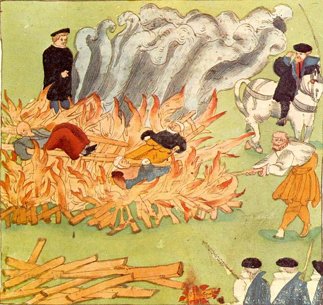
A witch-hunt, or a witch purge, is a search for people who have been labeled witches or a search for evidence of witchcraft. The classical period of witch-hunts in Early Modern Europe and Colonial America took place in the Early Modern period or about 1450 to 1750, spanning the upheavals of the Reformation and the Thirty Years' War, resulting in an estimated 35,000 to 50,000 executions. The last executions of people convicted as witches in Europe took place in the 18th century. In other regions, like Africa and Asia, contemporary witch-hunts have been reported from sub-Saharan Africa and Papua New Guinea, and official legislation against witchcraft is still found in Saudi Arabia and Cameroon today. In current language, "witch-hunt" metaphorically means an investigation that is usually conducted with much publicity, supposedly to uncover subversive activity, disloyalty, and so on, but with the real purpose of intimidating political opponents. It can also involve elemen ... [...More Info...] [...Related Items...] OR: [Wikipedia] [Google] [Baidu] |


