|
Schalke (Harz)
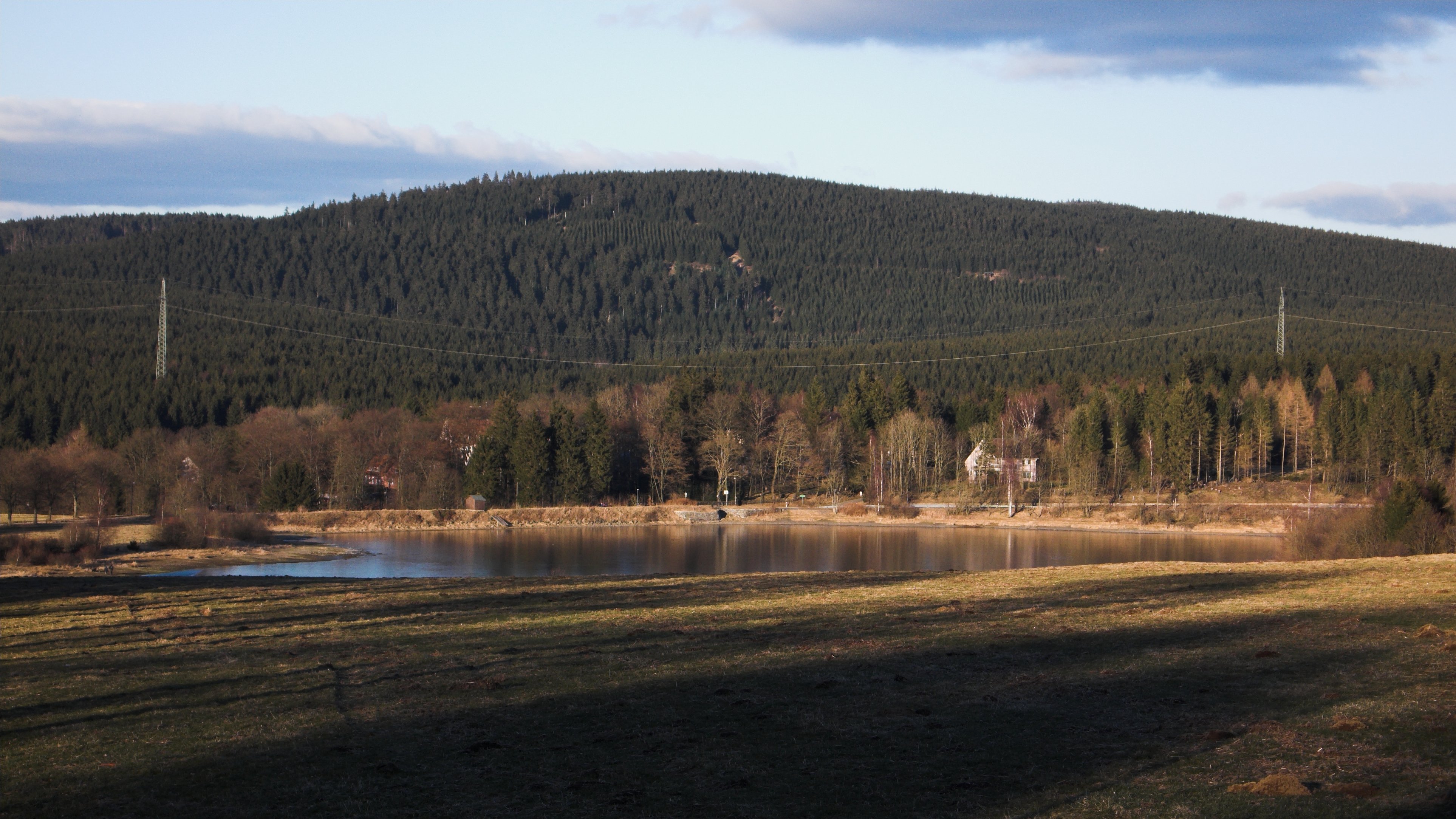
The Schalke is a mountain, , in the Upper Harz in the German state of Lower Saxony. It lies in Goslar district north of Clausthal-Zellerfeld and west of Schulenberg. From 1959 there was a French listening post on the summit, which was supplemented in 1968 by a 64 m high concrete tower. This tower stood empty from 1993 and was demolished on 11 October 2002; the entire facility being removed in September 2003. Other listening posts in the Harz were located on the Wurmberg and the Stöberhai. Towers that still exist include those on the Ravensberg and the Bocksberg, the latter not far from the Schalke. The observation tower, which was about 10.5 m high, stood about 50 metres southeast of the listening post until 2002 and, following the demolition of the latter, was moved back to its original site on the summit. However it only has good views towards the east and south. The view extends from the Brocken past the Wurmberg and Hanskühnenburg to Clausthal-Zellerfeld ... [...More Info...] [...Related Items...] OR: [Wikipedia] [Google] [Baidu] |
Harz Club
The Harz Club (german: Harzklub) is club dedicated to maintaining the traditions of the Harz mountains in Germany and looking after the walking trails in the Harz. It was founded in 1886 in Seesen and, today, has about 16,000 members in some 90 branches. History The Harz Club was founded on 8 August 1886 in Seesen. The railway director, Albert Schneider, was its first chairman. One of the co-founders was Carl Reuß. Its first task was to open up the Harz to walkers and tourists. Later, numerous local history groups were started and it took on the maintenance of Harz traditions. Nature conservation was added to its articles as an important aim in 1907. Before the outbreak of the Second World War membership stood at almost 20,000 in 120 branches. Following the division of the Harz, the development of the Harz Nature Park became the priority within the western zone. In East Germany the Harz Club was banned as an organisation, similar functions were entrusted to the subordina ... [...More Info...] [...Related Items...] OR: [Wikipedia] [Google] [Baidu] |
Mountains Of Lower Saxony
This List of mountains and hills in Lower Saxony shows a selection of high or well-known mountains and hills in the German state of Lower Saxony (''in order of height''). Although there is no universally agreed definition of a 'mountain', summits at 2.000 feet (610 metres) or higher may generally be referred to as mountains; those below 2.000 feet as 'hills',Whittow, John (1984). ''Dictionary of Physical Geography''. London: Penguin, 1984. . hence the division of this list. By this definition, it can be seen that all the mountains in Lower Saxony occur in the Harz. Highest points in Lower Saxony's regions The following table lists the highest points in the various landscapes (hill ranges or regions) of Lower Saxony. In the "Landscape" column, major hill ranges are shown in bold. Clicking "List" in the rows of the "List" column links to other hills or mountains in that landscape – some of which are outside Lower Saxony. The table is arranged by height, but may be sorted by oth ... [...More Info...] [...Related Items...] OR: [Wikipedia] [Google] [Baidu] |
Wolfsklippen
The Wolfsklippen, also called the Wolfsklippe, is a granite mountain in the Harz mountains in Central Germany with an observation platform on the summit. Its height is frequently given as about , but occasionally also as only around . Location The mountain lies northeast of the Brocken, the highest elevation in the Harz, about 200 m east of the road way from Drei Annen Hohne to Plessenburg. History Over 100 years ago the Harz Club erected on the summit of the Wolfsklippen one of four iron observation platforms in the Harz that still exist. At that time it had a good view of the Brocken and towards Ilsenburg and Wernigerode. Today this outlook is no longer visible due to the tall spruce trees that block the view. Name and legend AT the Wolfsklippen the last wolf in the area is supposed to have been killed, which is where the name of the mountain comes from. According to another legend, the name of the crags comes from the witch hunting period, when a girl accused of wit ... [...More Info...] [...Related Items...] OR: [Wikipedia] [Google] [Baidu] |
Poppenberg (Harz)
The Poppenberg is a tree-covered hill east of Ilfeld in the Harz mountains of Germany, at an elevation of 601 metres. Since 1897, there has been a steel lattice observation tower on the summit. The tower was built by the Nordhausen branch of the Harz Club and was named after Otto, Prince of Stolberg-Wernigerode. In good weather, it has an extensive view over the South Harz, the Goldene Aue and the Kyffhäuser. The Poppenberg is no. 92 in the system of check points in the Harzer Wandernadel network of walking trails. History Until 1932, the hill belonged to the Prussian Province of Hanover, but was then transferred to the Province of Saxony. Today, it lies in the free state of Thuringia and is the highest elevation in the Thuringian part of the Harz. In 1994, the Poppenberg Observation Tower, the hill's lattice observation tower, was refurbished. Geography The Poppenberg is situated east of Ilfeld, in the Harz mountains, in the state of Thuringia. See also * Poppenberg Observa ... [...More Info...] [...Related Items...] OR: [Wikipedia] [Google] [Baidu] |
List Of Mountains And Hills In Lower Saxony
This List of mountains and hills in Lower Saxony shows a selection of high or well-known mountains and hills in the German state of Lower Saxony (''in order of height''). Although there is no universally agreed definition of a 'mountain', summits at 2.000 feet (610 metres) or higher may generally be referred to as mountains; those below 2.000 feet as 'hills',Whittow, John (1984). ''Dictionary of Physical Geography''. London: Penguin, 1984. . hence the division of this list. By this definition, it can be seen that all the mountains in Lower Saxony occur in the Harz. Highest points in Lower Saxony's regions The following table lists the highest points in the various landscapes (hill ranges or regions) of Lower Saxony. In the "Landscape" column, major hill ranges are shown in bold. Clicking "List" in the rows of the "List" column links to other hills or mountains in that landscape – some of which are outside Lower Saxony. The table is arranged by height, but may be sorted by oth ... [...More Info...] [...Related Items...] OR: [Wikipedia] [Google] [Baidu] |
Lower Schalke Pond
Lower may refer to: *Lower (surname) *Lower Township, New Jersey *Lower Receiver (firearms) *Lower Wick Lower Wick is a small hamlet located in the county of Gloucestershire, England. It is situated about five miles south west of Dursley, eighteen miles southwest of Gloucester and fifteen miles northeast of Bristol. Lower Wick is within the civil ... Gloucestershire, England See also * Nizhny {{Disambiguation ... [...More Info...] [...Related Items...] OR: [Wikipedia] [Google] [Baidu] |
Goslar
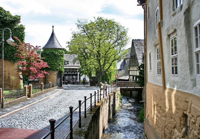
Goslar (; Eastphalian: ''Goslär'') is a historic town in Lower Saxony, Germany. It is the administrative centre of the district of Goslar and located on the northwestern slopes of the Harz mountain range. The Old Town of Goslar and the Mines of Rammelsberg are UNESCO World Heritage Sites for their millenium-long testimony to the history of ore mining and their political importance for the Holy Roman Empire and Hanseatic League. Each year Goslar awards the Kaiserring to an international artist, called the "Nobel Prize" of the art world. Geography Goslar is situated in the middle of the upper half of Germany, about south of Brunswick and about southeast of the state capital, Hanover. The Schalke mountain is the highest elevation within the municipal boundaries at . The lowest point of is near the Oker river. Geographically, Goslar forms the boundary between the Hildesheim Börde which is part of the Northern German Plain, and the Harz range, which is the highest, norther ... [...More Info...] [...Related Items...] OR: [Wikipedia] [Google] [Baidu] |
Bundesstraße 241
The B 241 is a federal road (''Bundesstraße'') in Germany. It runs from Hohenwepel (near Warburg) to Vienenburg. Course States and districts * North Rhine-Westphalia ** Höxter district *** Hohenwepel, Borgentreich, Dalhausen, Beverungen * Lower Saxony ** Holzminden district *** Lauenförde ** Northeim district *** Amelith, Schönhagen, Kammerborn, Sohlingen, Uslar, Bollensen, Gierswalde, Volpriehausen, Goseplack, Hardegsen, Lutterhausen, Moringen, Höckelheim, Northeim, Hammenstedt, Katlenburg ** Göttingen district *** Dorste *** Osterode ** Goslar district *** Clausthal-Zellerfeld, Goslar, Vienenburg, Wiedelah River crossings * Weser, between Beverungen and Lauenförde * Ahle, in Uslar * Leine, between Höckelheim und Northeim * Gose near Goslar * Rhume, in Northeim and in Katlenburg * Söse, in Osterode * Oker, in Oker and Vienenburg Tourism * On the section between Lauenförde and Amelith there are two ''Grabungsstellen'' as well as the Hu ... [...More Info...] [...Related Items...] OR: [Wikipedia] [Google] [Baidu] |
Harzer Wandernadel
The Harzer Wandernadel is a system of hiking awards in the Harz mountains in central Germany. The hiker (or mountain biker) can earn awards at different levels of challenge by walking to the various checkpoints in the network and stamping his or her passbook to record the visit. With 222 checkpoints in three federal states and across five districts in the Harz and with membership in five figures, the system has gained a following Germany-wide. Purpose The idea of the ''Wandernadel'' (literally "hiking needle/pin" --> "hiking badge") is to give those holidaying in the Harz a worthwhile goal to achieve and encourage them to stay for longer or return. It also aims to encourage those who live in the local area to go hiking and improve their fitness. In addition the system helps tourists and locals to get to know the many different sights and hiking trails in the Harz. To that end, checkpoints have been located at scenic viewing points, places of geological or botanical, culturalbo ... [...More Info...] [...Related Items...] OR: [Wikipedia] [Google] [Baidu] |


