|
Vostok Station
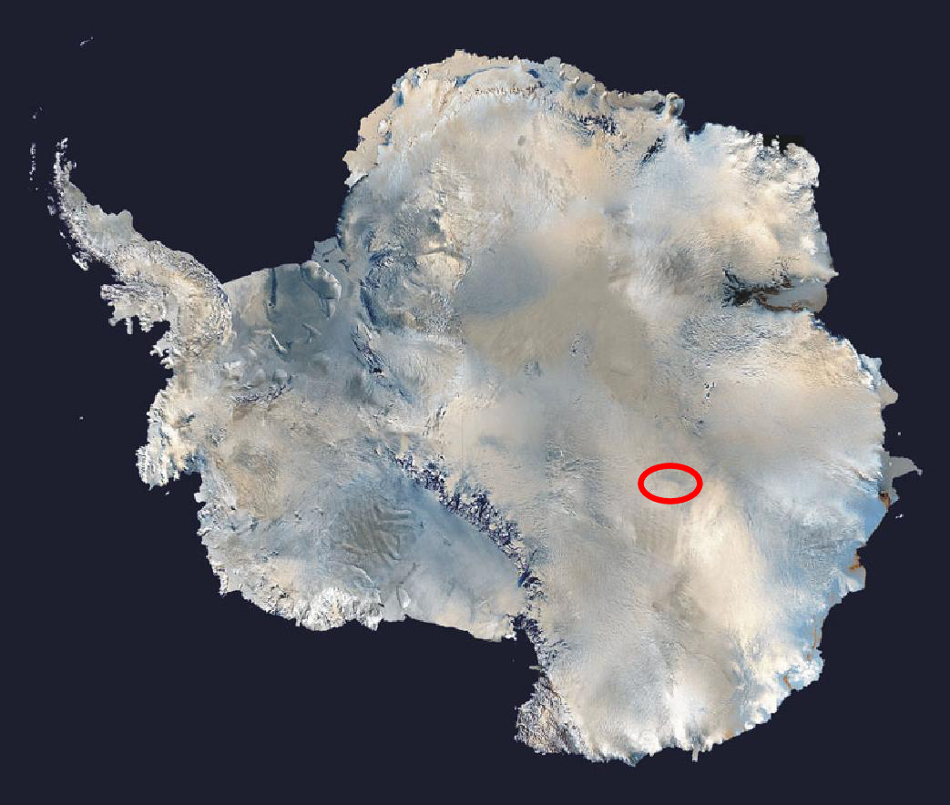
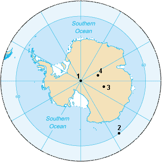
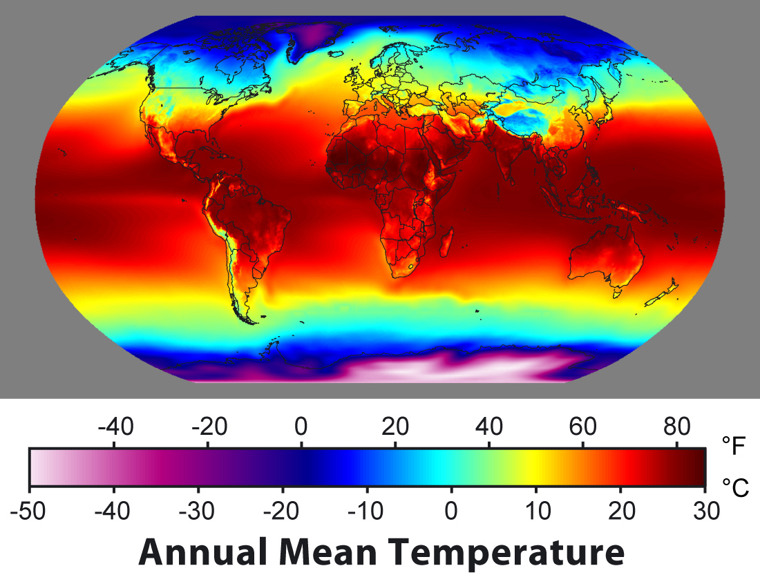
Vostok Station (, , ) is a Russian research station in inland Princess Elizabeth Land, Antarctica. Founded by the Soviet Union in 1957, the station lies at the southern Pole of Cold, with the lowest reliably measured natural temperature on Earth of .Global Measured Extremes of Temperature and Precipitation. . Retrieved on 21 June 2007. Research includes ice core drilling and magnetometry. Vostok was named after '' [...More Info...] [...Related Items...] OR: [Wikipedia] [Google] [Baidu] |
Research Stations In Antarctica
Multiple governments have set up permanent research stations in Antarctica and these bases are widely distributed. Unlike the drifting ice stations set up in the Arctic, the current research stations of the Antarctic are constructed either on rocks or on ice that are (for practical purposes) fixed in place. Many of these stations are demographics of Antarctica, staffed throughout the year. Of the 56 signatories to the Antarctic Treaty System, Antarctic Treaty, a total of 55 countries (as of 2023) operate seasonal (summer) and year-round research stations on the continent. The number of people performing and supporting scientific research on the continent and nearby islands varies from approximately 4,800 during the summer to around 1,200 during the winter (June). In addition to these permanent stations, approximately Antarctic field camps, 30 field camps are established each summer to support specific projects. History First bases During the Heroic Age of Antarctic Explo ... [...More Info...] [...Related Items...] OR: [Wikipedia] [Google] [Baidu] |
Mikhail Lazarev
Admiral Mikhail Petrovich Lazarev (; ) was a Russian fleet commander and explorer. Education and early career Lazarev was born in Vladimir city, a scion of the old Russian nobility from the Vladimir province. In 1800, he enrolled in Russia's Naval College. Three years later he was sent to the British Royal Navy, where he would stay for a continuous five-year navigation. From 1808 to 1813, Lazarev served in the Baltic Fleet. He took part in the Russo-Swedish War of 1808–1809 and Patriotic War of 1812. Career as an explorer Lazarev first circumnavigated the globe in 1813–1816, aboard the vessel ''Suvorov''; the expedition began at Kronstadt and reached Alaska. During this voyage, Lazarev discovered the Suvorov Atoll. As a commander of the ship and Fabian Gottlieb von Bellingshausen's deputy on his world cruise in 1819–1821 (Bellingshausen commanded ), Lazarev took part in the discovery of Antarctica and numerous islands. On 28 January 1820 the expedition dis ... [...More Info...] [...Related Items...] OR: [Wikipedia] [Google] [Baidu] |
Kunlun Station
Kunlun Station () is the southernmost of five Chinese research stations in Antarctica. When it is occupied during the summer, it is the second-southernmost research base in Antarctica, behind only the American Amundsen–Scott South Pole Station at the geographical South Pole. When Kunlun is not in operation, the year-round Russian Vostok Station is the second-southernmost base in Antarctica. It is located at 4087 m above sea level on the East Antarctic Ice Sheet, making it the highest base in Antarctica. It is only 7.3 km southwest of Dome A, the highest point on the Antarctic Plateau. The station was officially opened on January 27, 2009. Fully constructed the station is planned to cover an area of 558 m2. The main building, covering 236 m2, is planned erected in April 2009. The site is one of the coldest in the world, with temperatures occasionally reaching in the winter. It is indicated from satellite measurements that places nearby could reach a world record temper ... [...More Info...] [...Related Items...] OR: [Wikipedia] [Google] [Baidu] |
South Pole
The South Pole, also known as the Geographic South Pole or Terrestrial South Pole, is the point in the Southern Hemisphere where the Earth's rotation, Earth's axis of rotation meets its surface. It is called the True South Pole to distinguish from the south magnetic pole. The South Pole is by definition the southernmost point on the Earth, lying antipode (geography), antipodally to the North Pole. It defines geodetic latitude 90° South, as well as the direction of true south. At the South Pole all directions point North; all lines of longitude converge there, so its longitude can be defined as any degree value. No time zone has been assigned to the South Pole, so any time can be used as the local time. Along tight latitude circles, clockwise is east and counterclockwise is west. The South Pole is at the center of the Southern Hemisphere. Situated on the continent of Antarctica, it is the site of the United States Amundsen–Scott South Pole Station, which was established in 19 ... [...More Info...] [...Related Items...] OR: [Wikipedia] [Google] [Baidu] |
Amundsen–Scott South Pole Station
The Amundsen–Scott South Pole Station is a science and technology in the United States, United States scientific research station at the South Pole of the Earth. It is the List of extreme points of the United States, southernmost point under the jurisdiction (not sovereignty) of the United States. The station is located on the high Antarctic Plateau, plateau of Antarctica at above sea level. It is administered by the Office of Polar Programs of the National Science Foundation, specifically the United States Antarctic Program (USAP). It is named in honor of Norwegian Roald Amundsen and Briton Robert Falcon Scott, Robert F. Scott, leaders of the competing first and second expeditions to reach the pole, in the summer of 1911–1912. The original Amundsen–Scott Station was built by Seabee, Navy Seabees for the federal government of the United States during November 1956, as part of its commitment to the Science, scientific goals of the International Geophysical Year, an ef ... [...More Info...] [...Related Items...] OR: [Wikipedia] [Google] [Baidu] |
Sea Level
Mean sea level (MSL, often shortened to sea level) is an mean, average surface level of one or more among Earth's coastal Body of water, bodies of water from which heights such as elevation may be measured. The global MSL is a type of vertical datuma standardised geodetic datumthat is used, for example, as a chart datum in cartography and Navigation, marine navigation, or, in aviation, as the standard sea level at which atmospheric pressure is measured to Calibration, calibrate altitude and, consequently, aircraft flight levels. A common and relatively straightforward mean sea-level standard is instead a long-term average of tide gauge readings at a particular reference location. The term ''above sea level'' generally refers to the height above mean sea level (AMSL). The term APSL means above present sea level, comparing sea levels in the past with the level today. Earth's radius at sea level is 6,378.137 km (3,963.191 mi) at the equator. It is 6,356.752 km (3,94 ... [...More Info...] [...Related Items...] OR: [Wikipedia] [Google] [Baidu] |
Climatology
Climatology (from Greek , ''klima'', "slope"; and , '' -logia'') or climate science is the scientific study of Earth's climate, typically defined as weather conditions averaged over a period of at least 30 years. Climate concerns the atmospheric condition during an extended to indefinite period of time; weather is the condition of the atmosphere during a relative brief period of time. The main topics of research are the study of climate variability, mechanisms of climate changes and modern climate change. This topic of study is regarded as part of the atmospheric sciences and a subdivision of physical geography, which is one of the Earth sciences. Climatology includes some aspects of oceanography and biogeochemistry. The main methods employed by climatologists are the analysis of observations and modelling of the physical processes that determine climate. Short term weather forecasting can be interpreted in terms of knowledge of longer-term phenomena of climate, for insta ... [...More Info...] [...Related Items...] OR: [Wikipedia] [Google] [Baidu] |
Geophysics
Geophysics () is a subject of natural science concerned with the physical processes and Physical property, properties of Earth and its surrounding space environment, and the use of quantitative methods for their analysis. Geophysicists conduct investigations across a wide range of scientific disciplines. The term ''geophysics'' classically refers to solid earth applications: Earth's figure of the Earth, shape; its gravitational, Earth's magnetic field, magnetic fields, and electromagnetic fields; its structure of the Earth, internal structure and Earth#Chemical composition, composition; its geodynamics, dynamics and their surface expression in plate tectonics, the generation of magmas, volcanism and rock formation. However, modern geophysics organizations and pure scientists use a broader definition that includes the water cycle including snow and ice; geophysical fluid dynamics, fluid dynamics of the oceans and the atmosphere; atmospheric electricity, electricity and magnetism in ... [...More Info...] [...Related Items...] OR: [Wikipedia] [Google] [Baidu] |
Actinometer
An actinometer is an instrument that can measure the heating power of radiation. Actinometers are used in meteorology to measure solar radiation as pyranometers, pyrheliometers and net radiometers. An actinometer is a chemical system or physical device which determines the number of photons in a beam integrally or per unit time. This name is commonly applied to devices used in the ultraviolet and visible wavelength ranges. For example, solutions of iron(III) oxalate can be used as a chemical actinometer, while bolometers, thermopiles, and photodiodes are physical devices giving a reading that can be correlated to the number of photons detected. History Swiss physicist Horace-Bénédict de Saussure invented an early version in the late 18th century. His design used a blackened thermometer enclosed in a glass sphere to measure solar radiation, which he referred to as a "heliothermometer." This instrument is considered one of the first tools to systematically measure solar intens ... [...More Info...] [...Related Items...] OR: [Wikipedia] [Google] [Baidu] |
Magnetosphere
In astronomy and planetary science, a magnetosphere is a region of space surrounding an astronomical object in which charged particles are affected by that object's magnetic field. It is created by a celestial body with an active interior Dynamo theory, dynamo. In the space environment close to a planetary body with a dipole magnetic field such as Earth, the field lines resemble a simple magnetic dipole. Farther out, field lines can be significantly distorted by the flow of electrically conducting plasma (physics), plasma, as emitted from the Sun (i.e., the solar wind) or a nearby star. Planets having active magnetospheres, like the Earth, are capable of mitigating or blocking the effects of solar radiation or cosmic radiation. Interactions of particles and atmospheres with magnetospheres are studied under the specialized scientific subjects of plasma physics, space physics, and aeronomy. History Study of Earth's magnetosphere began in 1600, when William Gilbert (astronomer), W ... [...More Info...] [...Related Items...] OR: [Wikipedia] [Google] [Baidu] |
South Geomagnetic Pole
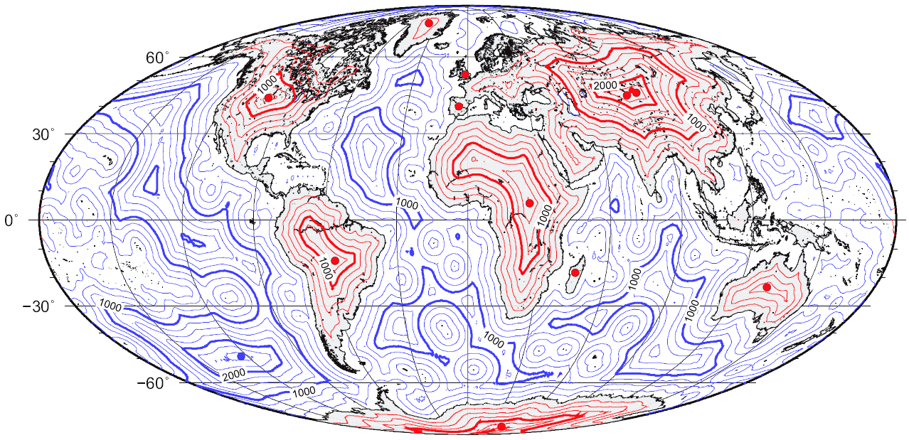
The geomagnetic poles are antipodal points where the axis of a best-fitting dipole intersects the surface of Earth. This ''theoretical'' dipole is equivalent to a powerful bar magnet at the center of Earth, and comes closer than any other point dipole model to describing the magnetic field observed at Earth's surface. In contrast, the magnetic poles of the actual Earth are not antipodal; that is, the line on which they lie does not pass through Earth's center. Owing to the motion of fluid in the Earth's outer core, the actual magnetic poles are constantly moving (secular variation). However, over thousands of years, their direction averages to the Earth's rotation axis. On the order of once every half a million years, the poles reverse (i.e., north switches place with south) although the time frame of this switching can be anywhere from every 10 thousand years to every 50 million years. The poles also swing in an oval of around in diameter daily due to solar wind deflec ... [...More Info...] [...Related Items...] OR: [Wikipedia] [Google] [Baidu] |
Pole Of Inaccessibility
In geography, a pole of inaccessibility is the farthest (or most difficult to reach) location in a given landmass, sea, or other topographical feature, starting from a given boundary, relative to a given criterion. A geographical criterion of inaccessibility marks a location that is the most challenging to reach according to that criterion. Often it refers to the most distant point from the coastline, implying the farthest point into a landmass from the shore, or the farthest point into a body of water from the shore. In these cases, a pole of inaccessibility is the center of a maximally large circle that can be drawn within an area of interest only touching but not crossing a coastline. Where a coast is imprecisely defined, the pole will be similarly imprecise. Northern pole of inaccessibility The northern pole of inaccessibility, sometimes known as the Arctic pole, is located on the Arctic Ocean pack ice at a distance farthest from any landmass. The original position was wro ... [...More Info...] [...Related Items...] OR: [Wikipedia] [Google] [Baidu] |


