|
Uman
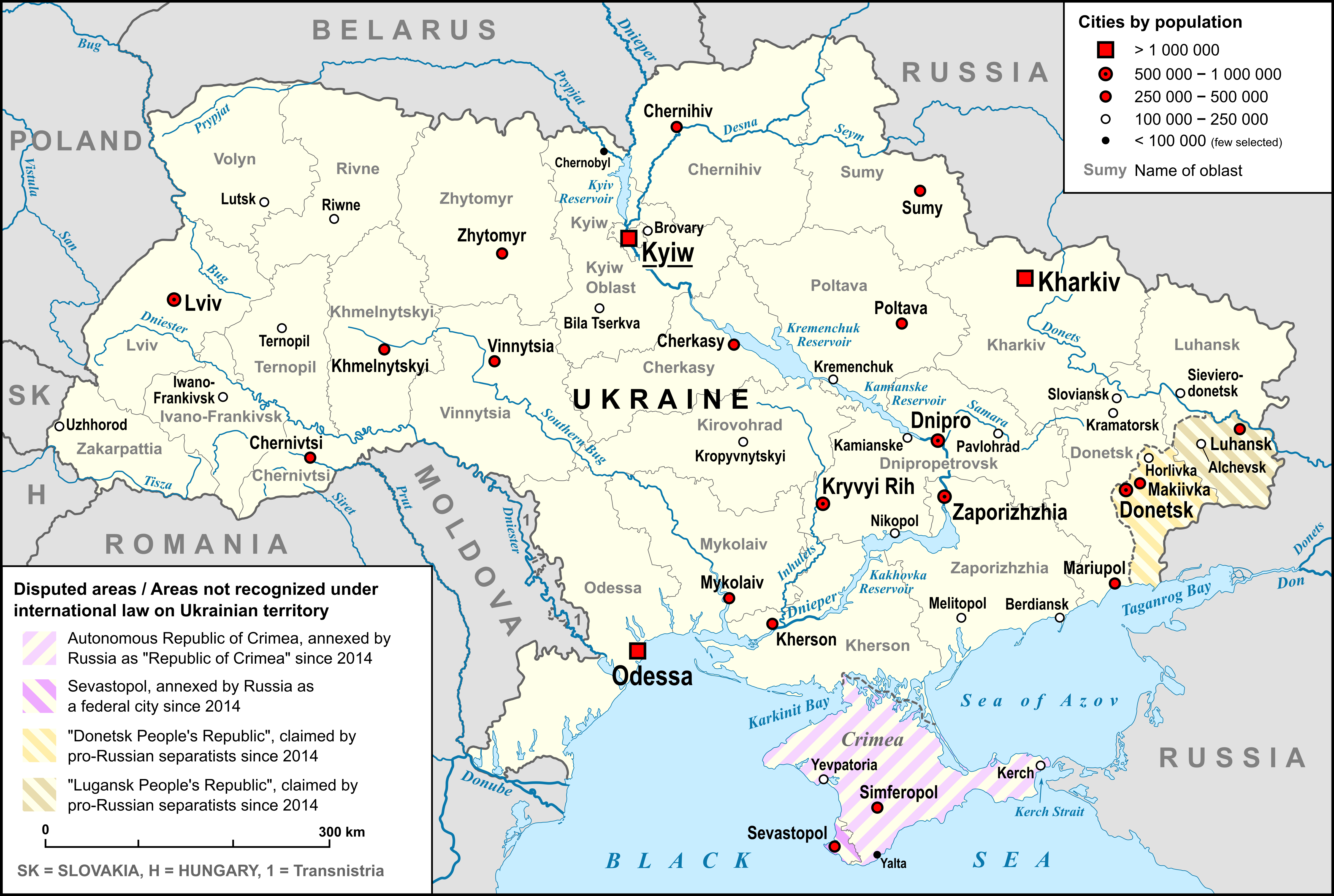
Uman (, , ) is a city in Cherkasy Oblast, central Ukraine. It is located to the east of Vinnytsia. Located in the east of the historical region of Podolia, the city rests on the banks of the Umanka River. Uman serves as the administrative center of Uman Raion (district). It hosts the administration of Uman urban hromada, one of the hromadas of Ukraine. Population: Among Ukrainians, Uman is known for its depiction of the Haydamak rebellions in Taras Shevchenko's longest of poems, ''Haidamaky'' ("The Haidamaks", 1843). The city is also a pilgrimage site for Breslov Hasidic Jews and a major center of gardening research containing the dendrological park Sofiyivka and the University of Gardening. Uman (Humań) was a privately owned city of Poland and the Polish–Lithuanian Commonwealth. Name In addition to the , in other languages the name of the city is and (local Yiddish pronunciation 'Imen'). History Polish rule Uman was first mentioned in historical documents in ... [...More Info...] [...Related Items...] OR: [Wikipedia] [Google] [Baidu] |
Uman Raion
Uman Raion () is a raion (district) in the west of Cherkasy Oblast (Oblast, province) of central Ukraine. Its Capital (political), administrative center is the city of Uman. Population: On 18 July 2020, as part of the administrative reform of Ukraine, the number of raions of Cherkasy Oblast was reduced to four, and the area of Uman Raion was significantly expanded. Four abolished raions, Khrystynivka Raion, Khrystynivka, Mankivka Raion, Mankivka, Monastyryshche Raion, Monastyryshche, and Zhashkiv Raions, as well as the city of Uman, which was previously incorporated as a City of regional significance (Ukraine), city of oblast significance and did not belong to the raion, were merged into Uman Raion. The January 2020 estimate of the raion population was Subdivisions Current After the reform in July 2020, the raion consisted of 13 hromadas: * Babanka settlement hromada with the administration in the Populated places in Ukraine#Rural settlements, rural settlement of Babanka, retain ... [...More Info...] [...Related Items...] OR: [Wikipedia] [Google] [Baidu] |
Cherkasy Oblast
Cherkasy Oblast (, ), also referred to as Cherkashchyna (, ) is an administrative divisions of Ukraine, oblast (province) in central Ukraine located along the Dnieper, Dnieper River. The Capital city, administrative center of the oblast is the city of Cherkasy. The current population of the oblast is Geography Spanning , Cherkasy Oblast is the 18th largest oblast of Ukraine, comprising about 3.5% of the area of the country. The south flowing Dnieper River with the hilly western bank and the plain eastern bank divides the oblast into two unequal parts. The larger western part belongs to the Dnieper Upland. The low-lying eastern part of the oblast used to be subject to the frequent Dnieper flooding before the flow of the river became controlled by multiple dams of hydroelectricity, Hydroelectric Power Plants constructed along the river in the 20th century. The oblast extends for 245 km from south-west to north-east, and for 150 km from north to south. The northernmost p ... [...More Info...] [...Related Items...] OR: [Wikipedia] [Google] [Baidu] |
Uman Urban Hromada
Uman urban territorial hromada () is one of Ukraine's hromadas, located in Uman Raion within Cherkasy Oblast. Its capital is the city of Uman Uman (, , ) is a city in Cherkasy Oblast, central Ukraine. It is located to the east of Vinnytsia. Located in the east of the historical region of Podolia, the city rests on the banks of the Umanka River. Uman serves as the administrative c .... The hromada has an area of , as well as a population of 87,905 (). Composition In addition to one city (Uman), the hromada contains the village of . References {{Cherkasy Oblast Hromadas of Cherkasy Oblast Ukrainian hromadas established during the 2020 administrative reform ... [...More Info...] [...Related Items...] OR: [Wikipedia] [Google] [Baidu] |
Sofiyivka Park
Sofiyivsky Park () or Sofiyivka Park (; ) is an arboretum (type of botanical garden) and a scientific-research institute of the National Academy of Sciences of Ukraine (NASU Department of Biology). The park is located in the northern part of the City of Uman, Cherkasy Oblast (Central Ukraine), near the Kamianka River. Some areas of the park are reminiscent of an English garden. Today, the park is a popular recreational spot, annually visited by 300,000 visitors. Since 2000, it is listed on the Tentative List of World Heritage Sites in Ukraine. Sofiyivka is a scenic landmark of world gardening design at the beginning of the 19th century. The park accounts for over 2,000 types of trees and brush (local and exotic) among which are taxodium (marsh cypress), Weymouth Pine, tulip tree, platanus, ginkgo, and many others. Since 1980, the director of the park is the member-correspondent of the Academy of Sciences, doctor of biological sciences Ivan Kosenko. In 1985, small planet #2259 ... [...More Info...] [...Related Items...] OR: [Wikipedia] [Google] [Baidu] |
Uman Regiment
The Uman Regiment () was one of the seventeen territorial-administrative subdivisions of the Hetman State. But after the division of the Hetman State the regiment became part of the Right-bank Ukraine. The Regiment consisted of 10 sotnias. The regiment's capital was the city of Uman, now in Cherkasy Oblast of central Ukraine. The regiment was established in 1648 at the outbreak of the Khmelnytsky Uprising. When the Ruin occurred the regiment was placed under the control of Right-bank Ukraine hetmans. The regiment was split during the 1670s as a result of factional fighting between its colonel, Mykhailo Khanenko, and Hetman Petro Doroshenko. Which caused half of the troops to join forces with invading Left-bank Ukraine Cossacks. The regiment was eventually disbanded in 1686. The regiment was recreated in 1704 under Ivan Mazepa who reunited both banks under his rule during the Great Northern War, but was dissolved in 1712 when the territory was returned to the Polish–Lithuani ... [...More Info...] [...Related Items...] OR: [Wikipedia] [Google] [Baidu] |
Breslov (Hasidic Group)
Breslov (also Bratslav and Breslev) is a branch of Hasidic Judaism founded by Nachman of Breslov (1772–1810), a great-grandson of the Baal Shem Tov, founder of Hasidism. Its adherents strive to develop an intense, joyous relationship with God and receive guidance toward this goal from the teachings of Nachman. The movement has had no central, living leader for the past 200 years, as Nachman did not designate a successor. As such, Breslov adherents are sometimes referred to as the "dead Hasidim" () since they have never had a formal Rebbe since Nachman's death. However, certain groups and communities under the Breslov banner refer to their leaders as "Rebbe". The movement weathered strong opposition from virtually all other Hasidic movements in Ukraine throughout the 19th century, yet, at the same time, experienced growth in numbers of followers from Ukraine, Belarus, Lithuania, and Poland. By World War I, thousands of Breslov Hasidim lived in the region. After the Bolshevi ... [...More Info...] [...Related Items...] OR: [Wikipedia] [Google] [Baidu] |
Podolia
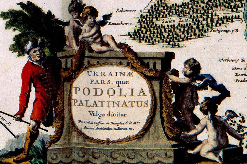
Podolia or Podillia is a historic region in Eastern Europe located in the west-central and southwestern parts of Ukraine and northeastern Moldova (i.e. northern Transnistria). Podolia is bordered by the Dniester River and Boh River. It features an elongated plateau and fertile agricultural land covering an area of . The two main rivers serve as important trade channels. Podolia is known for its cherries, mulberries, melons, gourds, and cucumbers. The region has a rich history, dating back to the Neolithic, with various tribes and civilizations occupying it over time. It became part of the Kingdom of Galicia–Volhynia, the Golden Horde, the Kingdom of Poland, the Grand Duchy of Lithuania, the Ottoman Empire, the Habsburg monarchy of Austria, and the Russian Empire. In the 20th century, Podolia underwent various political changes, with both the Second Polish Republic and the Soviet Union controlling parts of it at different times. Podolian culture is renowned for its folk icon-p ... [...More Info...] [...Related Items...] OR: [Wikipedia] [Google] [Baidu] |
List Of Cities In Ukraine
There are 463 populated places in Ukraine, populated places in Ukraine that have been officially granted city status () by the Verkhovna Rada, the country's parliament, as of 23 April 2025. Settlements with more than 10,000 people are eligible for city status although the status is typically also granted to settlements of historical or regional importance. Smaller settlements are Populated places in Ukraine#Rural settlements, rural settlements () and villages (). Historically, there were systems of city rights, granted by the territorial lords, which defined the status of a place as a ''misto'' or ''selo''. In the past, cities were self-governing and had several privileges. The list of cities is roughly ordered by population and the 2022 estimates are compared to the 2001 Ukrainian census, except for Chernobyl for which the population is an unofficial estimate. The City with special status, cities with special status are shown in ''italic''. The average population size is 62,000. ... [...More Info...] [...Related Items...] OR: [Wikipedia] [Google] [Baidu] |
Umanka (river)
The Umanka (Ukrainian: Уманка) is a river in Cherkasy Oblast, Ukraine. It is a tributary of the Yatran River, which it enters southeast of Uman Uman (, , ) is a city in Cherkasy Oblast, central Ukraine. It is located to the east of Vinnytsia. Located in the east of the historical region of Podolia, the city rests on the banks of the Umanka River. Uman serves as the administrative c .... References {{Ukraine-river-stub Rivers of Ukraine ... [...More Info...] [...Related Items...] OR: [Wikipedia] [Google] [Baidu] |
Raions Of Ukraine
A raion (; ), often translated as district, is the second-level Administrative divisions of Ukraine, administrative division in Ukraine. Raions were created in a 1922 administrative reform of the Soviet Union, to which Ukraine, as the Ukrainian Soviet Socialist Republic, belonged. On 17 July 2020, the Verkhovna Rada (Ukraine's parliament) approved an administrative reform to merge most of the 490 raions, along with the "City of regional significance (Ukraine), cities of regional significance", which were previously outside the raions, into just 136 reformed raions. Most tasks of the raions (education, healthcare, sport facilities, culture, and social welfare) were taken over by new hromadas, the subdivisions of raions.Where did 354 ... [...More Info...] [...Related Items...] OR: [Wikipedia] [Google] [Baidu] |
Bracław Voivodeship
The Bracław Voivodeship (; ; , ''Braclavśke vojevodstvo'') was a unit of administrative division of the Polish–Lithuanian Commonwealth. Created in 1566 as part of the Grand Duchy of Lithuania, it was passed to the Crown of the Kingdom of Poland, Kingdom of Poland in 1569 following the Union of Lublin. After Second Partition of Poland in 1793 the voivodeship was taken by the Russian Empire and replaced with the Bratslav Viceroyalty. In 1648-57 the territory of voivodeship was a part of Cossack Hetmanate following the Khmelnytsky Uprising and Truce of Andrusovo, while in 1672-99 it became part of Ottoman Ukraine which was a vassal Ottoman Empire (see: Treaty of Buchach and Treaty of Karlowitz). Overview Together with the Podolian Voivodeship it formed the historical region of Podolia and part of a bigger Lesser Poland Province, Crown of the Kingdom of Poland, Lesser Poland Province of the Kingdom of Poland. Officially, the capital of the voivodeship was in Braclaw (today Bra ... [...More Info...] [...Related Items...] OR: [Wikipedia] [Google] [Baidu] |
Private Town
Private towns in the Polish–Lithuanian Commonwealth were privately owned towns within the lands owned by magnates, bishops, knights and princes, among others. Amongst the most well-known former private magnate towns are Białystok, Zamość, Rzeszów, Puławy, Tarnów, Siedlce, Biała Podlaska, Ivano-Frankivsk, Ternopil and Uman. Magnate palaces and castles can be often found in former private magnate towns. Examples include the Branicki Palace in Białystok; the Czartoryski Palace in Puławy; the Zamoyski Palace in Zamość; the Lubomirski Castle in Rzeszów; the Radziwiłł Palace in Biała Podlaska; the Ogiński Palace in Siedlce; the Potocki Palaces in Międzyrzec Podlaski, Tulchyn and Vysokaye; the Wiśniowiecki Palace in Vyshnivets; and the Zbaraski Castle in Zbarazh. Also various other landmarks were often founded by the owners, including town halls, churches, monasteries, schools and theatres, some rather unique, like the Mannerist Kalwaria Zebrzydowska Park an ... [...More Info...] [...Related Items...] OR: [Wikipedia] [Google] [Baidu] |


