|
Podolia
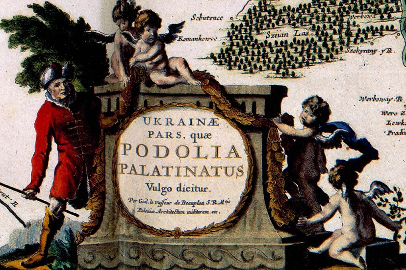
Podolia or Podillia is a historic region in Eastern Europe located in the west-central and southwestern parts of Ukraine and northeastern Moldova (i.e. northern Transnistria). Podolia is bordered by the Dniester River and Boh River. It features an elongated plateau and fertile agricultural land covering an area of . The two main rivers serve as important trade channels. Podolia is known for its cherries, mulberries, melons, gourds, and cucumbers. The region has a rich history, dating back to the Neolithic, with various tribes and civilizations occupying it over time. It became part of the Kingdom of Galicia–Volhynia, the Golden Horde, the Kingdom of Poland, the Grand Duchy of Lithuania, the Ottoman Empire, the Habsburg monarchy of Austria, and the Russian Empire. In the 20th century, Podolia underwent various political changes, with both the Second Polish Republic and the Soviet Union controlling parts of it at different times. Podolian culture is renowned for its folk icon-p ... [...More Info...] [...Related Items...] OR: [Wikipedia] [Google] [Baidu] |
Kamianets-Podilskyi
Kamianets-Podilskyi (, ; ) is a city on the Smotrych River in western Ukraine, western Ukraine, to the north-east of Chernivtsi. Formerly the administrative center of Khmelnytskyi Oblast, the city is now the administrative center of Kamianets-Podilskyi Raion within the oblast. It hosts the administration of Kamianets-Podilskyi urban hromada. Population: Kamianets-Podilskyi is a historical center of Podolia region, serving as a capital of the Duchy of Podolia, Podolian Voivodeship, Podolia Eyalet, Podolia Governorate, and Podolian District. During the Ukrainian–Soviet War, the city officially served as the temporary capital of the Ukrainian People's Republic from 1919 to 1920. Name Originally known as Kamianec, its name was changed to the current following the partitions of Poland and occupation by the Russian Empire in 1795. The first part of the city's dual name originates from ' () or ', meaning 'stone' in Old East Slavic, Old Slavic. The second part of its name relate ... [...More Info...] [...Related Items...] OR: [Wikipedia] [Google] [Baidu] |
Golden Horde
The Golden Horde, self-designated as ''Ulug Ulus'' ( in Turkic) was originally a Mongols, Mongol and later Turkicized khanate established in the 13th century and originating as the northwestern sector of the Mongol Empire. With the division of the Mongol Empire after 1259, it became a functionally separate khanate. It is also known as the Kipchak Khanate or the Ulus of Jochi, and replaced the earlier, less organized Cuman–Kipchak confederation. After the death of Batu Khan (the founder of the Blue Horde) in 1255, his dynasty flourished for a full century, until 1359, though the intrigues of Nogai Khan, Nogai instigated a partial civil war in the late 1290s. The Horde's military power peaked during the reign of Özbeg Khan (1312–1341), who adopted Islam. The territory of the Golden Horde at its peak extended from Siberia and Central Asia to parts of Eastern Europe from the Ural Mountains, Urals to the Danube in the west, and from the Black Sea to the Caspian Sea in the south ... [...More Info...] [...Related Items...] OR: [Wikipedia] [Google] [Baidu] |
Ukrainian Historical Regions
This is a list of historical regions in present-day Ukraine. Main historical regions Traditional regions The traditional names of the regions of Ukraine are important geographic, historical, and ethnographic identifiers. * Dnieper Ukraine, Over-Dnieper Ukraine, or Great Ukraine ** Land of Kyiv *** Right-bank Ukraine (east of Zhytomyr Oblast, Kyiv Oblast, Cherkasy Oblast), Central Ukraine *** Polesia, Land of Turov (north of Kyiv Oblast, east of Brest Oblast, west of Gomel Oblast), Northern Ukraine ** Land of Pereyaslav (predominantly Poltava Oblast and east of Kyiv Oblast), southern part of Left-bank Ukraine, Little Russia, Central Ukraine ** Land of Chernihiv (predominantly Chernihiv Oblast, west of Bryansk Oblast, east of Gomel Oblast), northern part of Left-bank Ukraine, Little Russia, Northern Ukraine ** Severia (Sumy Oblast, Kharkiv Oblast, Kursk Oblast, Belgorod Oblast) ** Sloboda Ukraine (mostly Kharkiv Oblast) * Ruthenia, Kingdom of Rus, Western Ukraine, Western ... [...More Info...] [...Related Items...] OR: [Wikipedia] [Google] [Baidu] |
Khmelnytskyi Oblast
Khmelnytskyi Oblast (), also known as Khmelnychchyna (), is an administrative divisions of Ukraine, oblast (province) in western Ukraine covering portions of the historical regions of western Podolia and southern Volhynia. The Capital (political), administrative center of the oblast is the city of Khmelnytskyi, Ukraine, Khmelnytskyi. The current estimated population is around Created in 1937 out of border okrugs of Vinnytsia Oblast, in 1941–44 it was under Nazi Germany occupation and part of the Reichskommissariat Ukraine (Wolhynien und Podolien general district). Following the Kamenets-Podolsky pocket in spring of 1944 as part of the Proskurov-Chernovtsy operation, Soviet troops removed the German occupation in the region. Until 4 February 1954 it was called Kamianets-Podilskyi Oblast () and was centered in Kamianets-Podilsky until 1941. The region rebranding took place after the official renaming of the region's administrative center to Khmelnytskyi, Ukraine, Khmelnytskyi. G ... [...More Info...] [...Related Items...] OR: [Wikipedia] [Google] [Baidu] |
Kamianets-Podilskyi Castle
The Kamianets-Podilskyi Castle (; ; ) is a former Ruthenian-Lithuanian castle and a later three-part Polish fortress located in the historic city of Kamianets-Podilskyi, Ukraine, in the historic region of Podilia in the western part of the country. Its name is attributed to the root (linguistics), root word '''kamin''', from the Slavic languages, Slavic word for 'stone'. Historical accounts date Kamianets-Podilskyi Castle to the early 14th century, although recent archaeological evidence has proved human existence in the area back to the 12th or 13th century. Initially built to protect the bridge connecting the city with the mainland, the castle sits on top of a peninsula carved out by the winding Smotrych River, forming a natural defense system for Kamianets-Podilskyi's historic Old Town neighborhood. Its location on a strategic transport crossroad in Podilia made the castle a prime target for foreign invaders, who rebuilt the castle to suit their own needs, adding to its multi ... [...More Info...] [...Related Items...] OR: [Wikipedia] [Google] [Baidu] |
West Ukraine
Western Ukraine or West Ukraine (, ) refers to the western territories of Ukraine. There is no universally accepted definition of the territory's boundaries, but the contemporary Ukrainian administrative regions ( oblasts) of Chernivtsi, Ivano-Frankivsk, Lviv, Ternopil and Zakarpattia (which were part of the former Austro-Hungarian Empire) are typically included. In addition, Volyn and Rivne oblasts (parts of the territory annexed from the Polish–Lithuanian Commonwealth during its Third Partition) are also usually included. In modern sources, Khmelnytskyi Oblast is often included because of its geographical, linguistic and cultural association with Western Ukraine, although this can not be confirmed from a historical and political point of view. It includes several historical regions such as Carpathian Ruthenia, Halychyna including Pokuttia (the eastern portion of Eastern Galicia), most of Volhynia, northern Bukovina and the Hertsa region, and Podolia. Western Ukraine ... [...More Info...] [...Related Items...] OR: [Wikipedia] [Google] [Baidu] |
Vinnytsia
Vinnytsia ( ; , ) is a city in west-central Ukraine, located on the banks of the Southern Bug. It serves as the administrative centre, administrative center of Vinnytsia Oblast. It is the largest city in the historic region of Podillia. It also serves as the administrative center of Vinnytsia Raion, one of the six raions of Vinnytsia Oblast. It has a population of The city's roots date back to the Middle Ages. It was under Grand Duchy of Lithuania, Lithuanian and Crown of the Kingdom of Poland, Polish control for centuries. From 1653 to 1667, Vinnytsia was a regimental city of the Cossack Hetmanate, Hetman state, and in 1793, it was ceded to the Russian Empire. During the 1930s and early 1940s, the city was the site of massacres, first during Joseph Stalin, Stalin's purges and then during the Holocaust in Ukraine and the Nazi occupation. A Cold War–era Havryshivka Vinnytsia International Airport, airbase was located near the city. Currently, Vinnytsia is developing as one of th ... [...More Info...] [...Related Items...] OR: [Wikipedia] [Google] [Baidu] |
Odesa Oblast
Odesa Oblast (), also referred to as Odeshchyna (Одещина), is an administrative divisions of Ukraine, oblast (province) of southwestern Ukraine, located along the northern coast of the Black Sea. Its administrative centre is the city of Odesa. Population: The length of coastline (sea-coast and estuaries) reaches , while the state border stretches for .Tell about Ukraine. Odesa Oblast 24 Kanal (youtube). The region has eight seaports and five of the biggest lakes, including Yalpuh Lake, in Ukraine. With over of vineyards, it is also the Wine production in Odesa Oblast, largest wine-growing region in Ukraine. History Evidence of the earliest inhabitants in this area comes from the settlements and burial grounds of the Neolithic Karanovo cu ...[...More Info...] [...Related Items...] OR: [Wikipedia] [Google] [Baidu] |
Vinnytsia Oblast
Vinnytsia Oblast (, ), also referred to as Vinnychchyna (), is an oblasts of Ukraine, oblast in central Ukraine. Its capital city, administrative center is Vinnytsia. The oblast has a population of History Vinnytsia Oblast, first established on February 27, 1932, originally comprised Raions of Ukraine, raions (regions) of the following former okruhas of Ukraine (districts of Soviet Ukraine): * Uman Okruha * Berdychiv Okruha * Vinnytsia Okruha * Mohyliv Okruha * Tulchyn Okruha * Shepetivka Okruha * Proskuriv Okruha * Kamianets Okruha In 1935 bordering territories of the oblast were transformed into Soviet border districts: Shepetivka Okrug, Proskuriv Okrug, and Kamianets Okrug. In 1937 the Kamianets Oblast, based on the border districts, was formed (it later became Khmelnytsky Oblast). During World War II the occupying Axis powers split the territory of Vinnytsia Oblast between the General District Shitomir (Zhytomyr in Reichskommissariat Ukraine) and the Transnistria Governorate ... [...More Info...] [...Related Items...] OR: [Wikipedia] [Google] [Baidu] |
Russian Empire
The Russian Empire was an empire that spanned most of northern Eurasia from its establishment in November 1721 until the proclamation of the Russian Republic in September 1917. At its height in the late 19th century, it covered about , roughly one-sixth of the world's landmass, making it the list of largest empires, third-largest empire in history, behind only the British Empire, British and Mongol Empire, Mongol empires. It also Russian colonization of North America, colonized Alaska between 1799 and 1867. The empire's 1897 census, the only one it conducted, found a population of 125.6 million with considerable ethnic, linguistic, religious, and socioeconomic diversity. From the 10th to 17th centuries, the Russians had been ruled by a noble class known as the boyars, above whom was the tsar, an absolute monarch. The groundwork of the Russian Empire was laid by Ivan III (), who greatly expanded his domain, established a centralized Russian national state, and secured inde ... [...More Info...] [...Related Items...] OR: [Wikipedia] [Google] [Baidu] |
Ternopil Oblast
Ternopil Oblast (), also referred to as Ternopilshchyna () or Ternopillia (), is an Oblasts of Ukraine, oblast (province) of Ukraine. Its Capital (political), administrative center is Ternopil, through which flows the Seret (river), Seret, a tributary of the Dniester. Population: One of the natural wonders of the region are its cave complexes.Tell about Ukraine. Ternopil Oblast . 24 Kanal (youtube). Although Ternopil Oblast is among the smallest regions in Ukraine, over 100 caves have been discovered there. Scientists believe these are only 20% of all possible caves in the region. The biggest cave is Optymistychna Cave. Measuring in total length, it is the longest cave in Eurasia and the list of longest caves, fifth-longest in the world. [...More Info...] [...Related Items...] OR: [Wikipedia] [Google] [Baidu] |
Ukraine
Ukraine is a country in Eastern Europe. It is the List of European countries by area, second-largest country in Europe after Russia, which Russia–Ukraine border, borders it to the east and northeast. Ukraine also borders Belarus to the north; Poland and Slovakia to the west; Hungary, Romania and Moldova to the southwest; and the Black Sea and the Sea of Azov to the south and southeast. Kyiv is the nation's capital and List of cities in Ukraine, largest city, followed by Kharkiv, Odesa, and Dnipro. Ukraine's official language is Ukrainian language, Ukrainian. Humans have inhabited Ukraine since 32,000 BC. During the Middle Ages, it was the site of early Slavs, early Slavic expansion and later became a key centre of East Slavs, East Slavic culture under the state of Kievan Rus', which emerged in the 9th century. Kievan Rus' became the largest and most powerful realm in Europe in the 10th and 11th centuries, but gradually disintegrated into rival regional powers before being d ... [...More Info...] [...Related Items...] OR: [Wikipedia] [Google] [Baidu] |


