|
Kamianets-Podilskyi
Kamianets-Podilskyi (, ; ) is a city on the Smotrych River in western Ukraine, western Ukraine, to the north-east of Chernivtsi. Formerly the administrative center of Khmelnytskyi Oblast, the city is now the administrative center of Kamianets-Podilskyi Raion within the oblast. It hosts the administration of Kamianets-Podilskyi urban hromada. Population: Kamianets-Podilskyi is a historical center of Podolia region, serving as a capital of the Duchy of Podolia, Podolian Voivodeship, Podolia Eyalet, Podolia Governorate, and Podolian District. During the Ukrainian–Soviet War, the city officially served as the temporary capital of the Ukrainian People's Republic from 1919 to 1920. Name Originally known as Kamianec, its name was changed to the current following the partitions of Poland and occupation by the Russian Empire in 1795. The first part of the city's dual name originates from ' () or ', meaning 'stone' in Old East Slavic, Old Slavic. The second part of its name relate ... [...More Info...] [...Related Items...] OR: [Wikipedia] [Google] [Baidu] [Amazon] |
Kamianets-Podilskyi Raion
Kamianets-Podilskyi Raion () is one of the three administrative Raions of Ukraine, raions (district) of Khmelnytskyi Oblast in western Ukraine. Its administrative center is located in the city of Kamianets-Podilskyi. Population: On 18 July 2020, as part of the administrative reform of Ukraine, the number of raions of Khmelnytskyi Oblast was reduced to three, and the area of Kamianets-Podilskyi Raion was significantly expanded. Three abolished raions, Chemerivtsi Raion, Chemerivtsi, Dunaivtsi Raion, Dunaivtsi, and Nova Ushytsia Raions, as well as the city of Kamianets-Podilskyi, which was previously incorporated as a City of regional significance (Ukraine), city of oblast significance and did not belong to the raion, were merged into Kamianets-Podilskyi Raion. The January 2020 estimate of the raion population was Its population was 75,506 in the Ukrainian Census (2001), 2001 Ukrainian Census. Geography Kamianets-Podilskyi Raion is located in the southernmost part of the Khmeln ... [...More Info...] [...Related Items...] OR: [Wikipedia] [Google] [Baidu] [Amazon] |
Kamianets-Podilskyi Castle
The Kamianets-Podilskyi Castle (; ; ) is a former Ruthenian-Lithuanian castle and a later three-part Polish fortress located in the historic city of Kamianets-Podilskyi, Ukraine, in the historic region of Podilia in the western part of the country. Its name is attributed to the root (linguistics), root word '''kamin''', from the Slavic languages, Slavic word for 'stone'. Historical accounts date Kamianets-Podilskyi Castle to the early 14th century, although recent archaeological evidence has proved human existence in the area back to the 12th or 13th century. Initially built to protect the bridge connecting the city with the mainland, the castle sits on top of a peninsula carved out by the winding Smotrych River, forming a natural defense system for Kamianets-Podilskyi's historic Old Town neighborhood. Its location on a strategic transport crossroad in Podilia made the castle a prime target for foreign invaders, who rebuilt the castle to suit their own needs, adding to its multi ... [...More Info...] [...Related Items...] OR: [Wikipedia] [Google] [Baidu] [Amazon] |
Podillia
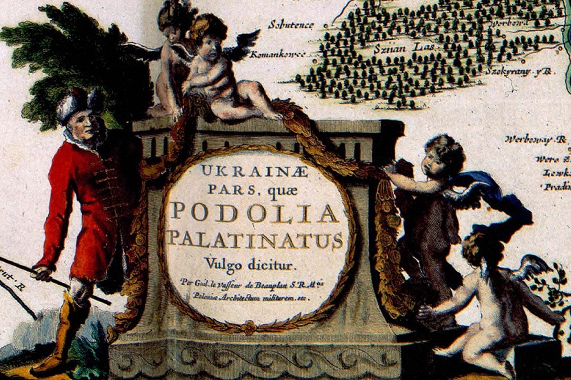
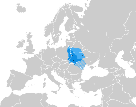
Podolia or Podillia is a historic region in Eastern Europe located in the west-central and southwestern parts of Ukraine and northeastern Moldova (i.e. northern Transnistria). Podolia is bordered by the Dniester River and Boh River. It features an elongated plateau and fertile agricultural land covering an area of . The two main rivers serve as important trade channels. Podolia is known for its cherries, mulberries, melons, gourds, and cucumbers. The region has a rich history, dating back to the Neolithic, with various tribes and civilizations occupying it over time. It became part of the Kingdom of Galicia–Volhynia, the Golden Horde, the Kingdom of Poland, the Grand Duchy of Lithuania, the Ottoman Empire, the Habsburg monarchy of Austria, and the Russian Empire. In the 20th century, Podolia underwent various political changes, with both the Second Polish Republic and the Soviet Union controlling parts of it at different times. Podolian culture is renowned for its folk icon-p ... [...More Info...] [...Related Items...] OR: [Wikipedia] [Google] [Baidu] [Amazon] |
Khmelnytskyi Oblast
Khmelnytskyi Oblast (), also known as Khmelnychchyna (), is an administrative divisions of Ukraine, oblast (province) in western Ukraine covering portions of the historical regions of western Podolia and southern Volhynia. The Capital (political), administrative center of the oblast is the city of Khmelnytskyi, Ukraine, Khmelnytskyi. The current estimated population is around Created in 1937 out of border okrugs of Vinnytsia Oblast, in 1941–44 it was under Nazi Germany occupation and part of the Reichskommissariat Ukraine (Wolhynien und Podolien general district). Following the Kamenets-Podolsky pocket in spring of 1944 as part of the Proskurov-Chernovtsy operation, Soviet troops removed the German occupation in the region. Until 4 February 1954 it was called Kamianets-Podilskyi Oblast () and was centered in Kamianets-Podilsky until 1941. The region rebranding took place after the official renaming of the region's administrative center to Khmelnytskyi, Ukraine, Khmelnytskyi. G ... [...More Info...] [...Related Items...] OR: [Wikipedia] [Google] [Baidu] [Amazon] |
Kamianets-Podilskyi Urban Hromada
Kamianets-Podilskyi urban territorial hromada () is one of Ukraine's hromadas, located within Kamianets-Podilskyi Raion within the country's western Khmelnytskyi Oblast. The capital is the city of Kamianets-Podilskyi Kamianets-Podilskyi (, ; ) is a city on the Smotrych River in western Ukraine, western Ukraine, to the north-east of Chernivtsi. Formerly the administrative center of Khmelnytskyi Oblast, the city is now the administrative center of Kamianets .... The hromada has an area of , as well as a total population of 115,817 (). Composition In addition to one city (Kamianets-Podilskyi), there are twelve villages within the hromada: * * Dovzhok * * * * * * * * * * References {{Khmelnytskyi Oblast Hromadas of Khmelnytskyi Oblast Ukrainian hromadas established during the 2020 administrative reform ... [...More Info...] [...Related Items...] OR: [Wikipedia] [Google] [Baidu] [Amazon] |
Holy Trinity Church, Kamianets-Podilskyi
The Holy Trinity Church (; ) is a church in the city of Kamianets-Podilskyi, Khmelnytskyi Oblast (province) of western Ukraine. The church is situated on Trinity Square near the entrance to the historic Old Town neighborhood of Kamianets-Podilskyi. Written documents date the Holy Trinity Church back to 1582, although archaeologists have found evidence that the church might even date back to the 14th century. After the Turkish seizure of Kamianets in 1672, the Holy Trinity Church, along with other Orthodox churches in the area, was converted into a Muslim mosque. It remained a mosque until 1699 when it was transferred over to the Uniates when the entire region of Podolia returned to Polish control. The church was one of the oldest in the city and the surrounding region, until its destruction by the Soviets in 1935. After Ukrainian independence in 1991, the square upon which it sits was renamed from Kuibyshev Square to Trinity Square. In 2006, restoration work commenced, being comp ... [...More Info...] [...Related Items...] OR: [Wikipedia] [Google] [Baidu] [Amazon] |
Smotrych River
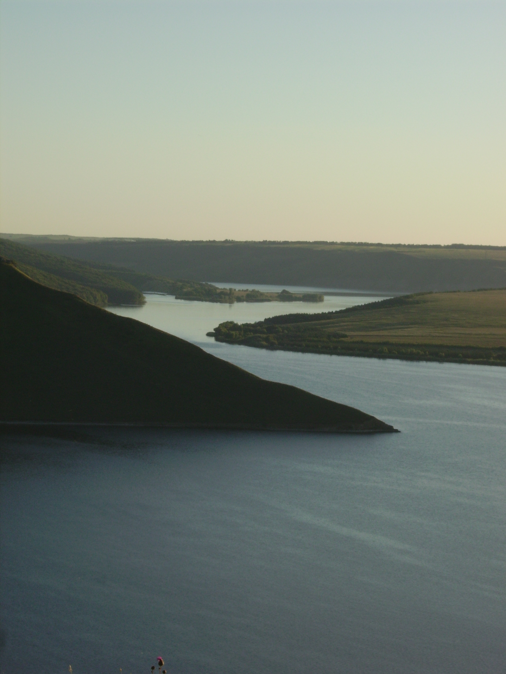
The Smotrych (, ) is a left tributary of the Dniester, flowing through the Podillia upland of western Ukraine. Its length is 168 km (104 mi), and its drainage basin covers 1,800 km2 (694 mi2). The average width of the river is 10–15 meters wide, and at one point exceeds 40 m. The river is particularly notable for its tall banks, which give it a ravinelike appearance. It is used for water supply, irrigation, and fishing. A small hydroelectric station is situated on it, as well as the city of |
Western Ukraine
Western Ukraine or West Ukraine (, ) refers to the western territories of Ukraine. There is no universally accepted definition of the territory's boundaries, but the contemporary Ukrainian administrative regions ( oblasts) of Chernivtsi, Ivano-Frankivsk, Lviv, Ternopil and Zakarpattia (which were part of the former Austro-Hungarian Empire) are typically included. In addition, Volyn and Rivne oblasts (parts of the territory annexed from the Polish–Lithuanian Commonwealth during its Third Partition) are also usually included. In modern sources, Khmelnytskyi Oblast is often included because of its geographical, linguistic and cultural association with Western Ukraine, although this can not be confirmed from a historical and political point of view. It includes several historical regions such as Carpathian Ruthenia, Halychyna including Pokuttia (the eastern portion of Eastern Galicia), most of Volhynia, northern Bukovina and the Hertsa region, and Podolia. Western Ukraine ... [...More Info...] [...Related Items...] OR: [Wikipedia] [Google] [Baidu] [Amazon] |
Podolia Governorate
Podolia Governorate was an administrative-territorial unit (''guberniya'') of the Southwestern Krai of the Russian Empire. It bordered Volhynian Governorate to the north, Kiev Governorate to the east, Kherson Governorate to the southeast, Bessarabia Governorate to the south, and Kingdom of Galicia and Lodomeria, Austria to the west. Its administrative centre was Kamenets-Podolsky (Kamianets-Podilskyi), which later moved to Vinnitsa (Vinnytsia). The governorate covered areas of Ukraine's partially Khmelnytskyi Oblast, Khmelnytskyi and most of Vinnytsia Oblasts, along with the fractionally recognised state of Transnistria. It was created from the Second Partition of Poland, which was formed from the former Crown of the Kingdom of Poland, Polish Bracław Voivodeship, Bracław and Podolian Voivodeship, Podole voivodeships, which are part of the Southwestern Krai along with Volhynian Governorate, Volhynia and Kiev Governorate, Kiev. Its capital was located in Kamenets-Podolsky, which ... [...More Info...] [...Related Items...] OR: [Wikipedia] [Google] [Baidu] [Amazon] |
Duchy Of Podolia
The Duchy of Podolia (, ; ) was a historical polity that emerged from the territory of the former Kingdom of Galicia–Volhynia. The principality was formed in the southwestern lands of the former kingdom during the 14th-century Galicia–Volhynia Wars, a conflict over its succession and territories involving the Kingdom of Poland, the Grand Duchy of Lithuania, and the Kingdom of Hungary. The Principality was established by the Koriatovych brothers (Lithuanian: Karijotaičiai), sons of Karijotas and members of the Lithuanian Gediminid dynasty. Prominent among the early rulers were Prince Yuriy Koriatovych and his brothers Oleksandr, Konstantin, and Fedir. They gained control over Podolia following the Lithuanian victory over the Golden Horde at the Battle of Blue Waters (), likely under the authority of their uncle, Grand Duke Algirdas of Lithuania. While some sources mention Yuriy and Oleksandr acknowledging Polish suzerainty under King Casimir III of Poland around 1366, their ... [...More Info...] [...Related Items...] OR: [Wikipedia] [Google] [Baidu] [Amazon] |
Podolia Eyalet
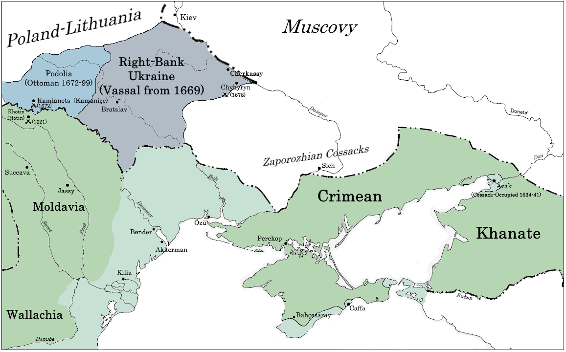
Podolia Eyalet () was an eyalet of the Ottoman Empire. Its capital was Kamianets-Podilskyi (; ; ). History In 1672, the Ottoman army, led by Sultan Mehmed IV, captured Kamaniçe after a short siege. The Treaty of Buchach confirmed Ottoman control of the city, which became the centre of a new eyalet. The treaty was repudiated by the Polish Diet, and war broke out anew. The Polish campaign proved unsuccessful, and the truce of Żurawno (1676) left Podolia within Ottoman borders. Another Polish-Ottoman war broke out again in 1683. For the next 16 years, Ottoman rule in Podolia generally was limited to the blockaded fortress of Kamianets, held by a garrison of 6,000 soldiers. The other garrisons in Podolia, in Bar, Medzhybizh, Jazlivec, and Chortkiv, barely exceeded 100 soldiers each. According to the Ottoman provincial budget of 1681, 13 million akçe were spent yearly in the eyalet, primarily for soldiers' pay. Of this amount, less than 3% was collected from Podolia itsel ... [...More Info...] [...Related Items...] OR: [Wikipedia] [Google] [Baidu] [Amazon] |


