|
St. Kliment Ohridski Base
St. Kliment Ohridski Base ( bg, База Св. Климент Охридски, Baza Sv. Kliment Ohridski, ) is a Bulgarian Antarctic base on Livingston Island in the South Shetland Islands. The base, originally known as ''Sofia University Refuge'' or ''Hemus Base'', was named in 1993 for medieval Bulgarian scholar St. Clement of Ohrid (840–916). The name is often shortened by non-Bulgarians to Ohridski Base, and sometimes misspelt as ''Ohridiski''. Location The base is located at , which is at an elevation of 12 to 15 m on Bulgarian Beach, 130 m inland from the shore of Emona Anchorage, between Pesyakov Hill and Sinemorets Hill, overlooking the Grand Lagoon. The base area is crossed by the melt-water Rezovski Creek in the summer, providing a water supply. History Following an unsuccessful landing attempt at Cape Vostok on the northwestern extremity of Alexander Island, two prefabricated huts — the Lame Dog Hut and Russian Hut — were assembled on Livingston Island bet ... [...More Info...] [...Related Items...] OR: [Wikipedia] [Google] [Baidu] |
Research Stations In Antarctica
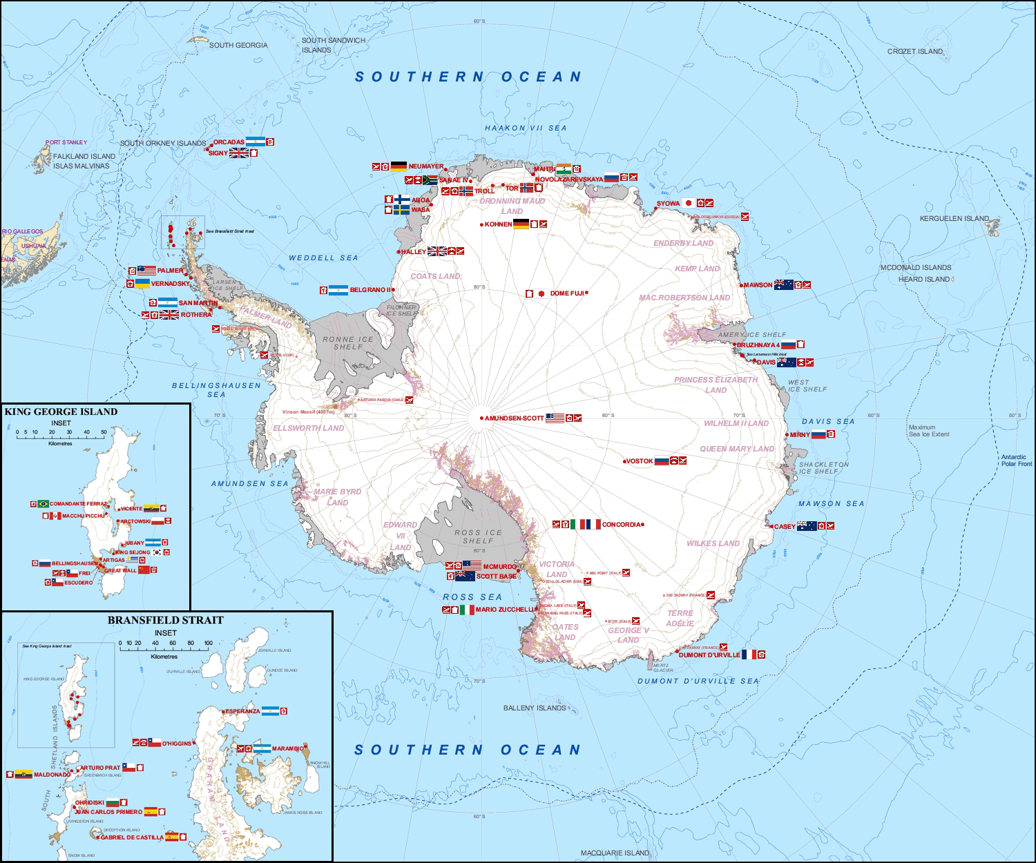
Multiple governments have set up permanent research stations in Antarctica and these bases are widely distributed. Unlike the drifting ice stations set up in the Arctic, the research stations of the Antarctic are constructed either on rock or on ice that is (for practical purposes) fixed in place. Many of the stations are demographics of Antarctica, staffed throughout the year. A total of 42 countries (as of October 2006), all signatories to the Antarctic Treaty System, Antarctic Treaty, operate seasonal (summer) and year-round research stations on the continent. The population of people performing and supporting scientific research on the continent and nearby islands varies from approximately 4,000 during the summer season to 1,000 during winter (June). In addition to these permanent stations, approximately Antarctic field camps, 30 field camps are established each summer to support specific projects. History First bases During the Heroic Age of Antarctic Exploration in t ... [...More Info...] [...Related Items...] OR: [Wikipedia] [Google] [Baidu] |
Alexander Island
Alexander Island, which is also known as Alexander I Island, Alexander I Land, Alexander Land, Alexander I Archipelago, and Zemlja Alexandra I, is the largest island of Antarctica. It lies in the Bellingshausen Sea west of Palmer Land, Antarctic Peninsula from which it is separated by Marguerite Bay and George VI Sound. The George VI Ice Shelf entirely fills George VI Sound and connects Alexander Island to Palmer Land. The island partly surrounds Wilkins Sound, which lies to its west.Stewart, J. (2011) ''Antarctic An Encyclopedia'' McFarland & Company Inc, New York. 1776 pp. . Alexander Island is about long in a north–south direction, wide in the north, and wide in the south. Alexander Island is the second-largest uninhabited island in the world, after Devon Island. History Alexander Island was discovered on January 28, 1821, by a Russian expedition under Fabian Gottlieb von Bellingshausen, who named it Alexander I Land for the reigning Tsar Alexander I of Russia. Wha ... [...More Info...] [...Related Items...] OR: [Wikipedia] [Google] [Baidu] |
Kaliakra Glacier
Kaliakra Glacier ( bg, ледник Калиакра, lednik Kaliakra, ) is a glacier in northeastern Livingston Island, Antarctica extending in east-west direction and in north-south direction, and situated southeast of Saedinenie Snowfield, southwest of Panega Glacier, north of Struma Glacier and upper Huron Glacier, and northeast of Perunika Glacier. It is bounded by Melnik Ridge and Bowles Ridge to the south, by Hemus Peak, Gurev Gap, Gleaner Heights, Elhovo Gap, Leslie Hill, Leslie Gap and Radnevo Peak to the west, and Miziya Peak and Samuel Peak to the north. The glacier drains eastwards into Moon Bay south of Perperek Knoll and north of Sindel Point. The glacier was first crossed by the Bulgarians Lyubomir Ivanov and Doychin Vasilev from Camp Academia on 24 December 2004. Kaliakra, the name of a cape on the Bulgarian Black Sea Coast, was given to the glacier by the Bulgarian Antarctic Place-names Commission, around 1995. Location The midpoint of the glacier is l ... [...More Info...] [...Related Items...] OR: [Wikipedia] [Google] [Baidu] |
Huron Glacier
Huron Glacier is a } long and wide glacial flow on Livingston Island in the South Shetland Islands of Antarctica, situated east of Perunika Glacier, southeast of Kaliakra Glacier, south of Struma Glacier, west-northwest of Iskar Glacier and northeast of Huntress Glacier. It is bounded by Bowles Ridge to the north, Wörner Gap to the west and the Tangra Mountains to the south, receiving ice influx from several tributary glaciers draining the mountain's northern slopes between Mount Friesland and Helmet Peak, and running east-northeastwards to empty into Moon Bay north of Yana Point. Camp Academia is situated on upper Huron Glacier, in the northwestern foothills of Zograf Peak. The glacier was named by the UK Antarctic Place-names Committee in 1958 after the American ship ''Huron'' (Captain John Davis) of New Haven, Connecticut, which visited the South Shetland Islands in 1820–21 and 1821–22. Location Huron Glacier is centred at (British mapping in 1968, Bulgarian survey ... [...More Info...] [...Related Items...] OR: [Wikipedia] [Google] [Baidu] |
Huntress Glacier
Huntress Glacier is a glacier long and wide flowing into the head of False Bay (Livingston Island), False Bay, Livingston Island in the South Shetland Islands, Antarctica. It is situated east of Johnsons Glacier, southeast of Contell Glacier and Balkan Snowfield, south of upper Perunika Glacier, southwest of Huron Glacier and northwest of Macy Glacier, and is bounded by Friesland Ridge and the Tangra Mountains to the southeast, Nesebar Gap, Pliska Ridge, Burdick Ridge and Willan Nunatak to the north, and Charrúa Gap and Napier Peak to the northwest. The glacier was named by the UK Antarctic Place-Names Committee in 1958 after the US, American schooner ''Huntress'' (Captain Christopher Burdick) from Nantucket, which visited the South Shetland Islands in 1820–21 in company with the ''Huron'' of New Haven, Connecticut. Location The glacier's midpoint is located at (British mapping in 1968, and Bulgarian in 2005 and 2009). See also * List of glaciers in the Antarctic * Glacio ... [...More Info...] [...Related Items...] OR: [Wikipedia] [Google] [Baidu] |
Perunika Glacier
Perunika Glacier ( bg, ледник Перуника, lednik Perunika, ) is an 8 km long and 3 km wide (average) roughly crescent-shaped glacier in eastern Livingston Island in the South Shetland Islands, Antarctica situated east of Pimpirev Glacier, south of Saedinenie Snowfield, southwest of Kaliakra Glacier, west of Huron Glacier, and north of Balkan Snowfield and the head of Huntress Glacier."Perunika Glacier " SCAR Its head is bounded by to the south-southwest, |
Tangra Mountains
Tangra Mountains (in Bulgarian ''Тангра планина'', 'Tangra planina' \'tan-gra pla-ni-'na\) () form the principal mountain range of Livingston Island in the South Shetland Islands, Antarctica. The range had been nameless until 2001, when it was named after Tangra, "the name of the ancient Bulgarian god." Composite Antarctic Gazetteer. Tangra Mountains are long between |
Pliska Ridge
Pliska Ridge ( bg, връх Плиска, vrah Pliska, ) is a three-peaked ridge rising to 667 m in eastern Livingston Island in the South Shetland Islands, Antarctica. Its central and highest summit, ''Pliska Peak'', is located 2.48 km east-northeast of Willan Nunatak (449 m), 1.81 km southeast of Burdick Peak (773 m, summit of Burdick Ridge), 3.53 km south-southwest of Mount Bowles, 3.68 km west-southwest of Kuzman Knoll, and 3.61 km northwest of Mount Friesland. The feature is 1.6 km long and 500 m wide, its axis trending due east-west, with precipitous southern slopes. It is ice-covered except for segments of its easternmost peak (646 m) and is bounded to the northwest by Orpheus Gate, to the north by the head of Perunika Glacier, to the east by Nesebar Gap, and to the south and west by the head of Huntress Glacier, the latter flowing 6 km southwestwards into False Bay. First ascent by the Bulgarian Lyubomir Ivanov from Camp Academia on 1 ... [...More Info...] [...Related Items...] OR: [Wikipedia] [Google] [Baidu] |
Burdick Ridge
Burdick Ridge is a ridge rising to an elevation of on Livingston Island in the South Shetland Islands. Extending for between Orpheus Gate in the southeast and Rezen Saddle in the northwest, it is bounded by Perunika Glacier to the northeast and Balkan Snowfield to the southwest. It takes its name from its highest point, Burdick Peak Burdick Peak is the summit of Burdick Ridge rising to 773 m southwest of Mount Bowles on Livingston Island in the South Shetland Islands, Antarctica. It was named by the UK Antarctic Place-names Committee in 1958 for Christopher Burdick Christo .... It was first ascended by the Bulgarian Kuzman Tuhchiev from St. Kliment Ohridski Base during the 1993–94 season. Maps Isla Livingston: Península Hurd.Mapa topográfico de escala 1:25000. Madrid: Servicio Geográfico del Ejército, 1991. (Map reproduced on p. 16 of the linked work) * L.L. Ivanov et al. Antarctica: Livingston Island and Greenwich Island, South Shetland Islands. Scale 1:100000 ... [...More Info...] [...Related Items...] OR: [Wikipedia] [Google] [Baidu] |
Balkan Snowfield
Balkan Snowfield (Plato Balkan \'pla-to bal-'kan\) is an ice-covered plateau of elevation ranging from in eastern Livingston Island in the South Shetland Islands, Antarctica, situated south of lower Perunika Glacier, northwest of Huntress Glacier and north of Contell Glacier. It is long in southwest-northeast direction and , and bounded by Burdick Ridge to the east, Willan Nunatak and Castillo Nunatak to the southeast, and Krum Rock to the southwest. The feature slopes gently northwestwards with its foot bounded by the hills along Bulgarian Beach. It is named after the Balkans. Location The midpoint of the snowfield is located at . Detailed mapping by the Spanish Servicio Geográfico del Ejército in 1991, and Bulgarian mapping in 1996, 2004 and 2009. Maps Isla Livingston: Península Hurd.Mapa topográfico de escala 1:25000. Madrid: Servicio Geográfico del Ejército, 1991. (Map reproduced on p. 16 of the linked work) * L.L. Ivanov. Livingston Island: Central-Eastern Region ... [...More Info...] [...Related Items...] OR: [Wikipedia] [Google] [Baidu] |
Georgi Parvanov
Georgi Sedefchov Parvanov ( bg, Георги Седефчов Първанов, ) (born 28 June 1957) is a Bulgarian historian and politician who was President of Bulgaria from 2002 to 2012. He was elected after defeating incumbent Petar Stoyanov in the second round of the November 2001 presidential election. He took office on 22 January 2002. He was reelected in a landslide victory in 2006, becoming the first Bulgarian president to serve two terms. Parvanov supported Bulgaria's entry into NATO and the European Union. According to Bulgarian law, a Bulgarian president is not allowed to be a member of a political party, thus Parvanov left the Bulgarian Socialist Party (BSP) after his election in 2001. Although he identified as a socialist, Parvanov often called himself a 'social president'. After completing his second term as president, Parvanov returned to the Socialist Party, prompting a dispute over the party leadership. In January 2014 Parvanov restarted his Alternative ... [...More Info...] [...Related Items...] OR: [Wikipedia] [Google] [Baidu] |
Bulgarian Posts
The Bulgarian Posts ( bg, Български пощи, lit=, translit=Balgarski poshti) are the national postal service of Bulgaria. The company was established in 1992. Although it was transformed into a joint-stock company in 1997, it is fully owned by the state. Its predecessor, the Bulgarian Posts and Telecommunications company, was founded as the Bulgarian Posts and Telegraphs after the Liberation of Bulgaria from Ottoman rule, as the provisional Russian administration handed over all post and telegraph offices to the newly restored Bulgarian state in 1879. It joined the General Postal Union in the same year. On March 31, 1997, "Bulgarian Posts" EOOD was transformed into a joint-stock company. In 2005, the company operated with 3,008 post offices and a total length of 80,060 km with the postal route. The company was a monopoly in the country in providing universal postal service until 2006. , Bulgarian Posts reported operating 2,981 post offices and 4,814 mailboxes. Se ... [...More Info...] [...Related Items...] OR: [Wikipedia] [Google] [Baidu] |


