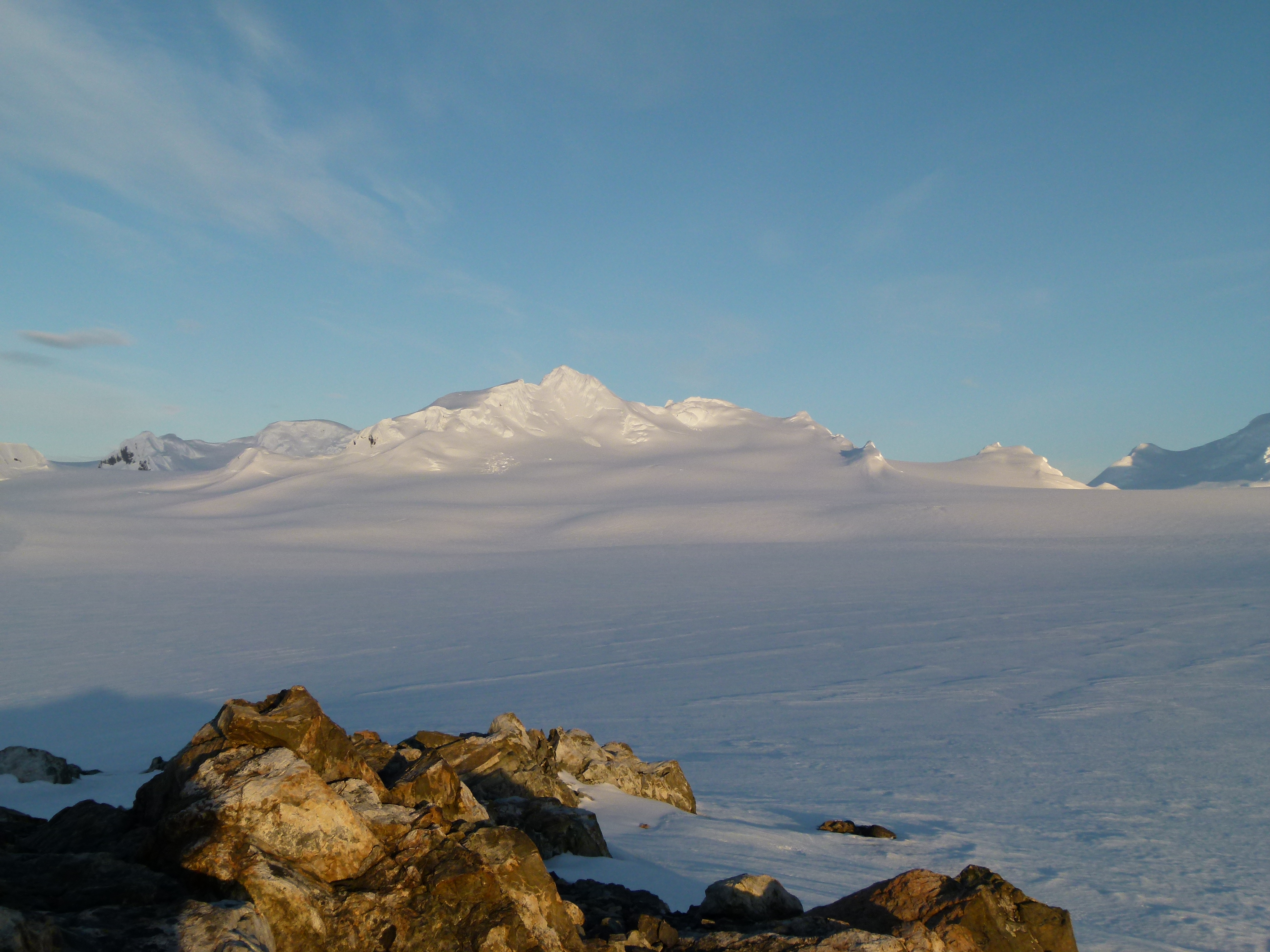
Burdick Ridge on:
[Wikipedia]
[Google]
[Amazon]

 Burdick Ridge is a ridge rising to an elevation of on

Isla Livingston: Península Hurd.
Mapa topográfico de escala 1:25000. Madrid: Servicio Geográfico del Ejército, 1991. (Map reproduced on p. 16 of the linked work) * L.L. Ivanov et al. Antarctica: Livingston Island and Greenwich Island, South Shetland Islands. Scale 1:100000 topographic map. Sofia: Antarctic Place-names Commission of Bulgaria, 2005. * L.L. Ivanov
Antarctica: Livingston Island and Greenwich, Robert, Snow and Smith Islands
Scale 1:120000 topographic map. Troyan: Manfred Wörner Foundation, 2009.
Antarctic Digital Database (ADD).
Scale 1:250000 topographic map of Antarctica. Scientific Committee on Antarctic Research (SCAR). Since 1993, regularly upgraded and updated. * L.L. Ivanov. Antarctica: Livingston Island and Smith Island. Scale 1:100000 topographic map. Manfred Wörner Foundation, 2017.
SCAR Composite Antarctic Gazetteer
Ridges of Livingston Island {{Climbing-stub

 Burdick Ridge is a ridge rising to an elevation of on
 Livingston Island
Livingston Island (Russian name ''Smolensk'', ) is an Antarctic island in the Southern Ocean, part of the South Shetlands Archipelago, a group of Antarctic islands north of the Antarctic Peninsula. It was the first land discovered south of 60 ...
in the South Shetland Islands
The South Shetland Islands are a group of Antarctic islands with a total area of . They lie about north of the Antarctic Peninsula, and between southwest of the nearest point of the South Orkney Islands. By the Antarctic Treaty of 195 ...
. Extending for between Orpheus Gate
Orpheus Gate (Orfeeva Porta \or-'fe-e-va 'por-ta\), also ''Orpheus Pass'', is the 548 m high and 380 m wide pass in eastern Livingston Island in the South Shetland Islands, Antarctica, bounded by Pliska Ridge to the southeast and Burdick Ridge to ...
in the southeast and Rezen Saddle
Rezen Saddle ( bg, Rezenska Sedlovina \'re-zen-ska se-dlo-vi-'na\) is a geographical feature on Livingston Island in the South Shetland Islands, Antarctica. The 600 m long horseshoe-shaped flat saddle of elevation 420 m lies between Rezen Knol ...
in the northwest, it is bounded by Perunika Glacier
Perunika Glacier ( bg, ледник Перуника, lednik Perunika, ) is an 8 km long and 3 km wide (average) roughly crescent-shaped glacier in eastern Livingston Island in the South Shetland Islands, Antarctica situated east o ...
to the northeast and Balkan Snowfield
Balkan Snowfield (Plato Balkan \'pla-to bal-'kan\) is an ice-covered plateau of elevation ranging from in eastern Livingston Island in the South Shetland Islands, Antarctica, situated south of lower Perunika Glacier, northwest of Huntress Glaci ...
to the southwest. It takes its name from its highest point, Burdick Peak
Burdick Peak is the summit of Burdick Ridge rising to 773 m southwest of Mount Bowles on Livingston Island in the South Shetland Islands, Antarctica. It was named by the UK Antarctic Place-names Committee in 1958 for Christopher Burdick
Christo ...
.
It was first ascended by the Bulgarian Kuzman Tuhchiev from St. Kliment Ohridski Base during the 1993–94 season.
Maps
Isla Livingston: Península Hurd.
Mapa topográfico de escala 1:25000. Madrid: Servicio Geográfico del Ejército, 1991. (Map reproduced on p. 16 of the linked work) * L.L. Ivanov et al. Antarctica: Livingston Island and Greenwich Island, South Shetland Islands. Scale 1:100000 topographic map. Sofia: Antarctic Place-names Commission of Bulgaria, 2005. * L.L. Ivanov
Antarctica: Livingston Island and Greenwich, Robert, Snow and Smith Islands
Scale 1:120000 topographic map. Troyan: Manfred Wörner Foundation, 2009.
Antarctic Digital Database (ADD).
Scale 1:250000 topographic map of Antarctica. Scientific Committee on Antarctic Research (SCAR). Since 1993, regularly upgraded and updated. * L.L. Ivanov. Antarctica: Livingston Island and Smith Island. Scale 1:100000 topographic map. Manfred Wörner Foundation, 2017.
External links
SCAR Composite Antarctic Gazetteer
Ridges of Livingston Island {{Climbing-stub