|
Schleußig
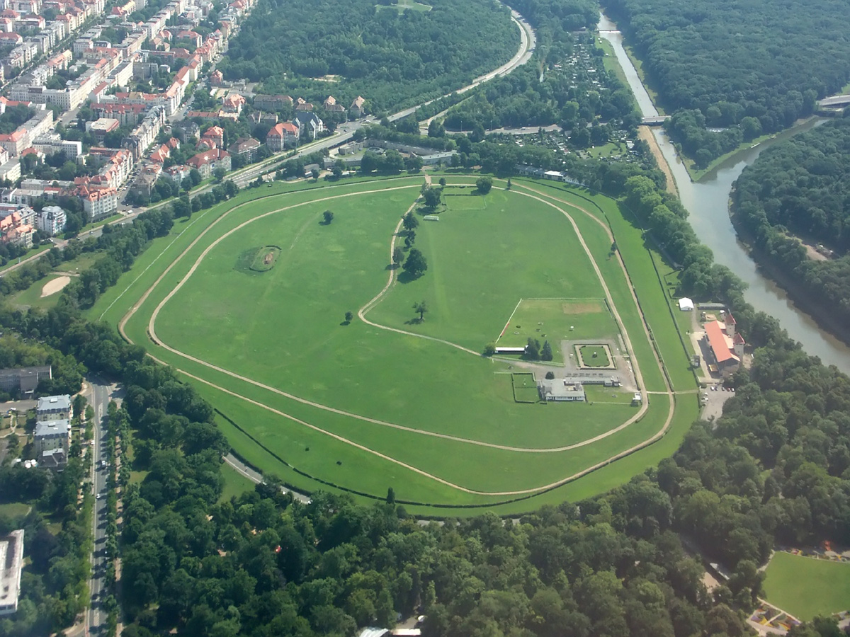
Schleußig (or ''Schleussig'') is a locality of Leipzig in Germany. It is in the borough (Stadtbezirk) Südwest (southwest). First mentioned in 1391 under the name of ''Slizzig'', Schleußig acquired the status of a rural municipality in 1835 before being integrated into Leipzig in 1891. A good third of the locality is occupied by the Nuns' Woods (''Nonnenholz'') of the Leipzig Riverside Forest (''Leipziger Auwald'') and a small part by the Clara-Zetkin-Park (Leipzig), Clara-Zetkin-Park. The largely closed Gründerzeit, Wilhelminian-style development, the proximity to local recreational areas as well as to the town centre make Schleußig an attractive residential area. Geography Schleußig is located about ( southwest of the city center. The north–south extent of Schleußig is about (, the widest point in the east–west direction is less than (. To the east, the Lower Elster Derivation (''Elsterflutbett'') and to the west the course of the White Elster River form the locali ... [...More Info...] [...Related Items...] OR: [Wikipedia] [Google] [Baidu] |
Bethanienkirche
The Bethanienkirche ''()'' is a Lutheranism, Lutheran church in the Germany, German city of Leipzig, in the locality of Schleußig. It was built in 1931–1933 and is under Cultural heritage management, heritage protection. History Schleußig, first mentioned in 1376 as Slizzig, belonged ecclesiastically to Kleinzschocher. In 1875 Schleußig had 285 inhabitants, in 1891, the year it was incorporated into Leipzig, there were already 1500. The church in Kleinzschocher was therefore used until 1892. On 30 October 1892 the first service in Schleußig took place in the auditorium of a school. From 1904 to 1905, an interim church was built in the courtyard of the school at Schnorrstrasse 2 / Rödelstrasse. The half timbered, half-timbered building, which was rebuilt here under the direction of the architect Conrad Hermsdorf, had previously served as an emergency church for Leipzig's Andreas and Michaelis congregations. On 30 September 1906, the parish was separated from Kleinzschoche ... [...More Info...] [...Related Items...] OR: [Wikipedia] [Google] [Baidu] |
Südvorstadt (Leipzig)
Südvorstadt is a Boroughs and localities of Leipzig, locality in the south borough ''(Stadtbezirk)'' of Leipzig, Germany. The English language, English translation of Südvorstadt is ''Southern Suburb''. The Südvorstadt is crossed from north to south by the Karl-Liebknecht-Straße (Leipzig), Karl-Liebknecht-Strasse. Due to its proximity to the Leipzig-Mitte, city centre, but also to larger green spaces, it is a popular residential area with old buildings of the Gründerzeit period. The fact that it is particularly preferred by young people is explained in particular by the scene of advertising, cabaret and alternative developed along the Karl-Liebknecht-Strasse and the proximity of the Leipzig University. Population Geography The locality of Südvorstadt extends between the centre of the city and the Connewitz locality. It was established as an boroughs and localities of Leipzig, administrative unit when the city was divided into municipal areas in 1992 and does not full ... [...More Info...] [...Related Items...] OR: [Wikipedia] [Google] [Baidu] |
Connewitz
Connewitz is a Boroughs and localities of Leipzig, locality in Leipzig in Saxony, Germany. It is a subdivision (''Ortsteil'') in the borough of Leipzig-Süd (''Stadtbezirk''). Geography Location Connewitz is located about south of downtown Leipzig. The area includes floodplain forests and former fields to the east and up to ten meters higher. Only this area is developed. Schleußiger Weg, Wundt Street, and Richard-Lehmann-Street form the northern boundaries of the district. The eastern and southeastern borders are formed by the Leipzig–Hof railway line. In the south, the built-up area of Markkleeberg forms the border. Here, however, a few short streets in the area called the Wolfswinkel still belong to Connewitz in an isolated location. The Plagwitz-Markkleeberg railway line the western embankment of the Elster floodplain and the western bank of the Elster floodplain follow to the west. The neighboring localities are, clockwise from the north, Südvorstadt (Leipzig), Süd ... [...More Info...] [...Related Items...] OR: [Wikipedia] [Google] [Baidu] |
Leipzig
Leipzig (, ; ; Upper Saxon: ; ) is the most populous city in the States of Germany, German state of Saxony. The city has a population of 628,718 inhabitants as of 2023. It is the List of cities in Germany by population, eighth-largest city in Germany and is part of the Central German Metropolitan Region. The name of the city is usually interpreted as a Slavic term meaning ''place of linden trees'', in line with many other Slavic placenames in the region. Leipzig is located about southwest of Berlin, in the southernmost part of the North German Plain (the Leipzig Bay), at the confluence of the White Elster and its tributaries Pleiße and Parthe. The Leipzig Riverside Forest, Europe's largest intra-city riparian forest, has developed along these rivers. Leipzig is at the centre of Neuseenland (''new lake district''). This district has Bodies of water in Leipzig, several artificial lakes created from former lignite Open-pit_mining, open-pit mines. Leipzig has been a trade city s ... [...More Info...] [...Related Items...] OR: [Wikipedia] [Google] [Baidu] |
Bodies Of Water In Leipzig
Bodies of water in Leipzig are the rivers White Elster, Pleiße and Parthe as well as numerous streams with the Leipzig Riverside Forest in Leipzig, Germany. Many of these watercourses have been diverted, canalised or drained for economic use, to defend the city and to protect against flooding, and new ditches and canals have also been built. A large number of ponds and lakes have also been created for fish farming, for urban planning reasons or as a result of open cast mining. Rivers, mill and raft ditches The rivers Pleiße, Parthe and White Elster, which have a confluence in the Leipzig area, shaped the development of the city from early on. In the course of History of Leipzig, Leipzig's city history, the riverbeds have been shifted and, for the most part, canalised. The rivers were used to transport timber as early as the Middle Ages. From the 15th century, canals were built through which firewood and logs were floated into the city to supply the city. The most important can ... [...More Info...] [...Related Items...] OR: [Wikipedia] [Google] [Baidu] |
Leipzig International School
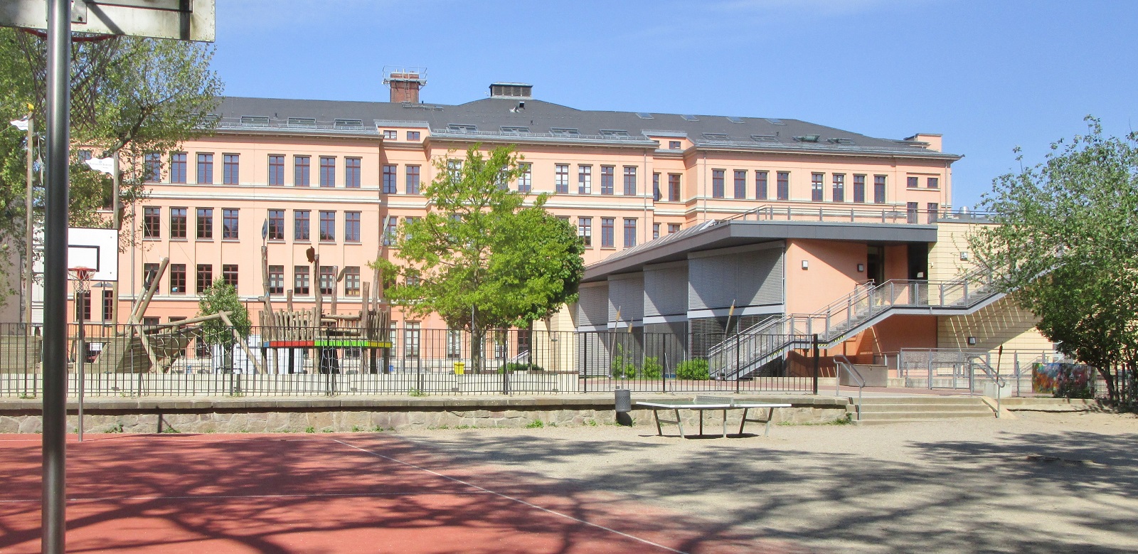
Leipzig International School (LIS) is a non-profit co-educational day school for students from age 1 to age 18, in Leipzig, Germany, and was the first international school in Central Germany (geography), central Germany, and is now the largest, with around 1050 students from 77 countries. LIS employs over 190 staff members, from 20 different nationalities. The school's campuses are located in the districts of Plagwitz (Leipzig International Kindergarten), and Schleußig (school campus). English is the language of instruction at LIS, meaning that all subjects, except for additional languages and German, are taught in English. Leipzig International School is led by Brandie Smith (head of school). Profile Leipzig International School provides international education in English for children from diverse backgrounds, supports the local community and promotes intercultural understanding. The programme at LIS ranges from kindergarten to grade 12. Approximately 1050 students from the reg ... [...More Info...] [...Related Items...] OR: [Wikipedia] [Google] [Baidu] |


