|
Periglacial
Periglaciation (adjective: "periglacial", referring to places at the edges of glacial areas) describes geomorphic processes that result from seasonal thawing and freezing, very often in areas of permafrost. The meltwater may refreeze in ice wedges and other structures. "Periglacial" originally suggested an environment located on the margin of past glaciers. However, freeze and thaw cycles influence landscapes also outside areas of past glaciation. Therefore, periglacial environments are anywhere when freezing and thawing modify the landscape in a significant manner. History Periglaciation became a distinct subject within the study of geology after Walery Łoziński, a Polish geologist, introduced the term in 1909. Łoziński drew upon the early work of Johan Gunnar Andersson. According to Alfred Jahn, his introduction of his work at the 1910 International Geological Congress held in Stockholm caused significant discussion. In the field trip to Svalbard that followed the congres ... [...More Info...] [...Related Items...] OR: [Wikipedia] [Google] [Baidu] |
Climatic Geomorphology
Climatic geomorphology is the study of the role of climate in shaping landforms and the earth-surface processes. An approach used in climatic geomorphology is to study relict landforms to infer ancient climates. Being often concerned about past climates climatic geomorphology considered sometimes to be an aspect of historical geology. Since landscape features in one region might have evolved under climates different from those of the present, studying climatically disparate regions might help understand present-day landscapes. For example, Julius Büdel studied both cold-climate processes in Svalbard and weathering processes in tropical India to understand the origin of the relief of Central Europe, which he argued was a palimpsest of landforms formed at different times and under different climates. Sub-disciplines The various subbranches of climatic geomorphology focus on specific climatic environments. Desert geomorphology Desert geomorphology or the geomorphology of arid an ... [...More Info...] [...Related Items...] OR: [Wikipedia] [Google] [Baidu] |
Solifluction
Solifluction is a collective name for gradual processes in which a mass moves down a slope ("mass wasting") related to freeze-thaw activity. This is the standard modern meaning of solifluction, which differs from the original meaning given to it by Johan Gunnar Andersson Johan Gunnar Andersson (3 July 1874 – 29 October 1960)"Andersson, Johan Gunnar" in '' The New Encyclopædia Britannica''. Chicago: Encyclopædia Britannica Inc., 15th edn., 1992, Vol. 1, p. 385. was a Swedish archaeologist, geomorphologist, ... in 1906. Origin and evolution of the concept In the original sense it meant the movement of waste saturated in water found in periglaciation, periglacial regions. However it was later discovered that various slow waste movements in periglacial regions did not require saturation in water, but were rather associated to freeze-thaw processes. The term solifluction was appropriated to refer to these slow processes, and therefore excludes rapid periglacial movements. ... [...More Info...] [...Related Items...] OR: [Wikipedia] [Google] [Baidu] |
Geomorphology
Geomorphology () is the scientific study of the origin and evolution of topographic and bathymetric features generated by physical, chemical or biological processes operating at or near Earth's surface. Geomorphologists seek to understand why landscapes look the way they do, to understand landform and terrain history and dynamics and to predict changes through a combination of field observations, physical experiments and numerical modeling. Geomorphologists work within disciplines such as physical geography, geology, geodesy, engineering geology, archaeology, climatology, and geotechnical engineering. This broad base of interests contributes to many research styles and interests within the field. Overview Earth's surface is modified by a combination of surface processes that shape landscapes, and geologic processes that cause tectonic uplift and subsidence, and shape the coastal geography. Surface processes comprise the action of water, wind, ice, wildfire, and lif ... [...More Info...] [...Related Items...] OR: [Wikipedia] [Google] [Baidu] |
Walery Łoziński
Walery Władysław Daniel Łoziński (1880–1944) was a Polish geographer, geomorphologist and soil scientist known for introducing the concept of periglaciation into geomorphology in 1909. Łoziński extended the work of Swedish geologist Johan Gunnar Andersson who had written about periglacial phenomena in Bjørnøya and the Falkland Islands. The concept of "periglaciation" was the subject of an intensive discussion at the 1910 International Geological Congress The International Union of Geological Sciences (IUGS) is an international non-governmental organization devoted to global cooperation in the field of geology. As of 2023, it represents more than 1 million geoscientists around the world. About Fo ... held in Stockholm. Walery Łoziński was, among others, the editor of the " Gazeta Lwowska". References Polish geomorphologists Polish soil scientists 1880 births 1944 deaths Polish geographers Scientists from Lviv University of Lviv alumni Academic staff of ... [...More Info...] [...Related Items...] OR: [Wikipedia] [Google] [Baidu] |
Biuletyn Peryglacjalny
''Biuletyn Peryglacjalny'' was a scientific journal covering research on periglacial geomorphology. It was established in 1954 in Łódź by Polish geomorphologist Jan Dylik, who was its editor-in-chief An editor-in-chief (EIC), also known as lead editor or chief editor, is a publication's editorial leader who has final responsibility for its operations and policies. The editor-in-chief heads all departments of the organization and is held accoun ... until 1972. The journal ceased publication after 39 issues in 2000, after having played an important role in the development of periglacial geomorphology. References 1954 establishments in Poland Earth and atmospheric sciences journals Geomorphology journals Defunct journals Academic journals established in 1954 Publications disestablished in 2000 Annual journals English-language journals French-language journals English-French multilingual journals {{Geomorphology-journal-stub ... [...More Info...] [...Related Items...] OR: [Wikipedia] [Google] [Baidu] |
Jan Dylik
Jan Dylik (19 June 1905 – 6 June 1973) was a Polish geography professor at the University of Łódź. He was born in Łódź on 19 June 1905. In 1925 he begain post-secondary studies at Jagiellonian University. He then went on to attend Adam Mickiewicz University in Poznań to pursue research and a doctoral degree. He found himself fascinated by the differences in geology between the Greater Poland Voivodeship and the Łódź Voivodeship. He collaborated with Stanisław Lencewicz on a project to analyze the Łódź region's geology and geomorphology. The resulting paper was published in 1927, and for many years was considered the only source of information on the geology of Łódź.Profesor Jan Dylik. Sylwetki łódzkich uczonych, z. 21, red. H. Klatkowa. ŁTN, Łódź 1995, s. 29-30. From 1928-1930, while still balancing the responsibilities of research, he worked as an assistant in the National Museum of Archaeology in Poland. In 1930, he completed his doctoral degree for a dis ... [...More Info...] [...Related Items...] OR: [Wikipedia] [Google] [Baidu] |
Permafrost
Permafrost () is soil or underwater sediment which continuously remains below for two years or more; the oldest permafrost has been continuously frozen for around 700,000 years. Whilst the shallowest permafrost has a vertical extent of below a meter (3 ft), the deepest is greater than . Similarly, the area of individual permafrost zones may be limited to narrow mountain summits or extend across vast Arctic regions. The ground beneath glaciers and ice sheets is not usually defined as permafrost, so on land, permafrost is generally located beneath a so-called active layer of soil which freezes and thaws depending on the season. Around 15% of the Northern Hemisphere or 11% of the global surface is underlain by permafrost, covering a total area of around . This includes large areas of Alaska, Canada, Greenland, and Siberia. It is also located in high mountain regions, with the Tibetan Plateau being a prominent example. Only a minority of permafrost exists in the Southern Hemi ... [...More Info...] [...Related Items...] OR: [Wikipedia] [Google] [Baidu] |
Frost Creep
Frost heaving (or a frost heave) is an upwards swelling of soil during freezing conditions caused by an increasing presence of ice as it grows towards the surface, upwards from the depth in the soil where freezing temperatures have penetrated into the soil (the freezing front or freezing boundary). Ice growth requires a water supply that delivers water to the freezing front via capillary action in certain soils. The weight of overlying soil restrains vertical growth of the ice and can promote the formation of lens-shaped areas of ice within the soil. Yet the force of one or more growing ice lenses is sufficient to lift a layer of soil, as much as or more. The soil through which water passes to feed the formation of ice lenses must be sufficiently porous to allow capillary action, yet not so porous as to break capillary continuity. Such soil is referred to as "frost susceptible". The growth of ice lenses continually consumes the rising water at the freezing front. Differential fr ... [...More Info...] [...Related Items...] OR: [Wikipedia] [Google] [Baidu] |
Gelifluction
Gelifluction, very similar to solifluction, is the seasonal freeze-thaw action upon waterlogging topsoil Topsoil is the upper layer of soil. It has the highest concentration of organic matter and microorganisms and is where most of the Earth's biological soil activity occurs. Description Topsoil is composed of mineral particles and organic mat ...s which induces downslope movement. Gelifluction is prominent in periglacial regions where snow falls during six to eight months of the year. In spring, the snow and ice melt, and the landscape is effectively inundated with half a year's worth of rainfall in the space of a couple of days. The top soil becomes waterlogged, and flows like a liquid. Because the wet soil behaves like a fluid, gelifluction is a form of mass movement that can occur on slopes with a slope angle of less than half a degree. Landforms The most distinctive landforms created by gelifluction include gelifluction lobes and gelifluction benches. The former re ... [...More Info...] [...Related Items...] OR: [Wikipedia] [Google] [Baidu] |
Melting Pingo Wedge Ice
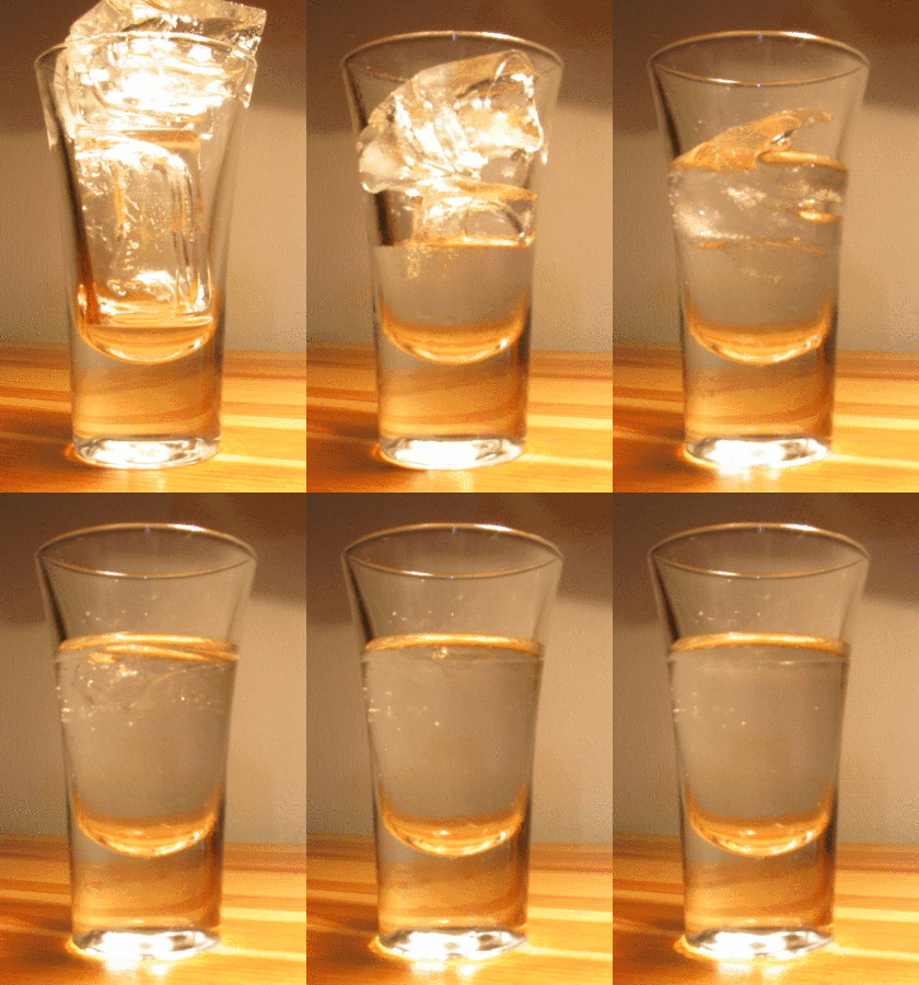
Melting, or Enthalpy of fusion, fusion, is a physical process that results in the phase transition of a chemical substance, substance from a solid to a liquid. This occurs when the internal energy of the solid increases, typically by the application of heat or Divorce, pressure, which increases the substance's temperature to the melting point. At the melting point, the ordering of ions or molecules in the solid breaks down to a less ordered state, and the solid melts to become a liquid. Substances in the molten state generally have reduced viscosity as the temperature increases. An exception to this principle is Allotropes of sulfur, elemental sulfur, whose viscosity increases in the range of 130 °C to 190 °C due to polymerization. Some organic compounds melt through mesophases, states of partial order between solid and liquid. First order phase transition From a thermodynamics point of view, at the melting point the change in Gibbs free energy ''∆G'' of the s ... [...More Info...] [...Related Items...] OR: [Wikipedia] [Google] [Baidu] |
Continentality
Continental climates often have a significant annual variation in temperature (warm to hot summers and cold winters). They tend to occur in central and eastern parts of the three northern-tier continents (North America, Europe, and Asia), typically in the middle latitudes (40 to 55 or 60 degrees north), often within large landmasses, where prevailing winds blow overland bringing some precipitation, and temperatures are not moderated by oceans. Continental climates occur mostly in the Northern Hemisphere due to the large landmasses found there. Most of northeastern China, eastern and southeastern Europe, much of Russia south of the Arctic Circle, central and southeastern Canada, and the central and northeastern United States have this type of climate. Continentality is a measure of the degree to which a region experiences this type of climate. In continental climates, precipitation tends to be moderate in amount, concentrated mostly in the warmer months. Only a few areas—in th ... [...More Info...] [...Related Items...] OR: [Wikipedia] [Google] [Baidu] |
Latitude
In geography, latitude is a geographic coordinate system, geographic coordinate that specifies the north-south position of a point on the surface of the Earth or another celestial body. Latitude is given as an angle that ranges from −90° at the south pole to 90° at the north pole, with 0° at the Equator. Parallel (latitude), Lines of constant latitude, or ''parallels'', run east-west as circles parallel to the equator. Latitude and longitude are used together as a coordinate pair to specify a location on the surface of the Earth. On its own, the term "latitude" normally refers to the ''geodetic latitude'' as defined below. Briefly, the geodetic latitude of a point is the angle formed between the vector perpendicular (or ''Normal (geometry), normal'') to the ellipsoidal surface from the point, and the equatorial plane, plane of the equator. Background Two levels of abstraction are employed in the definitions of latitude and longitude. In the first step the physical surface i ... [...More Info...] [...Related Items...] OR: [Wikipedia] [Google] [Baidu] |


