|
Pendleton County, West Virginia
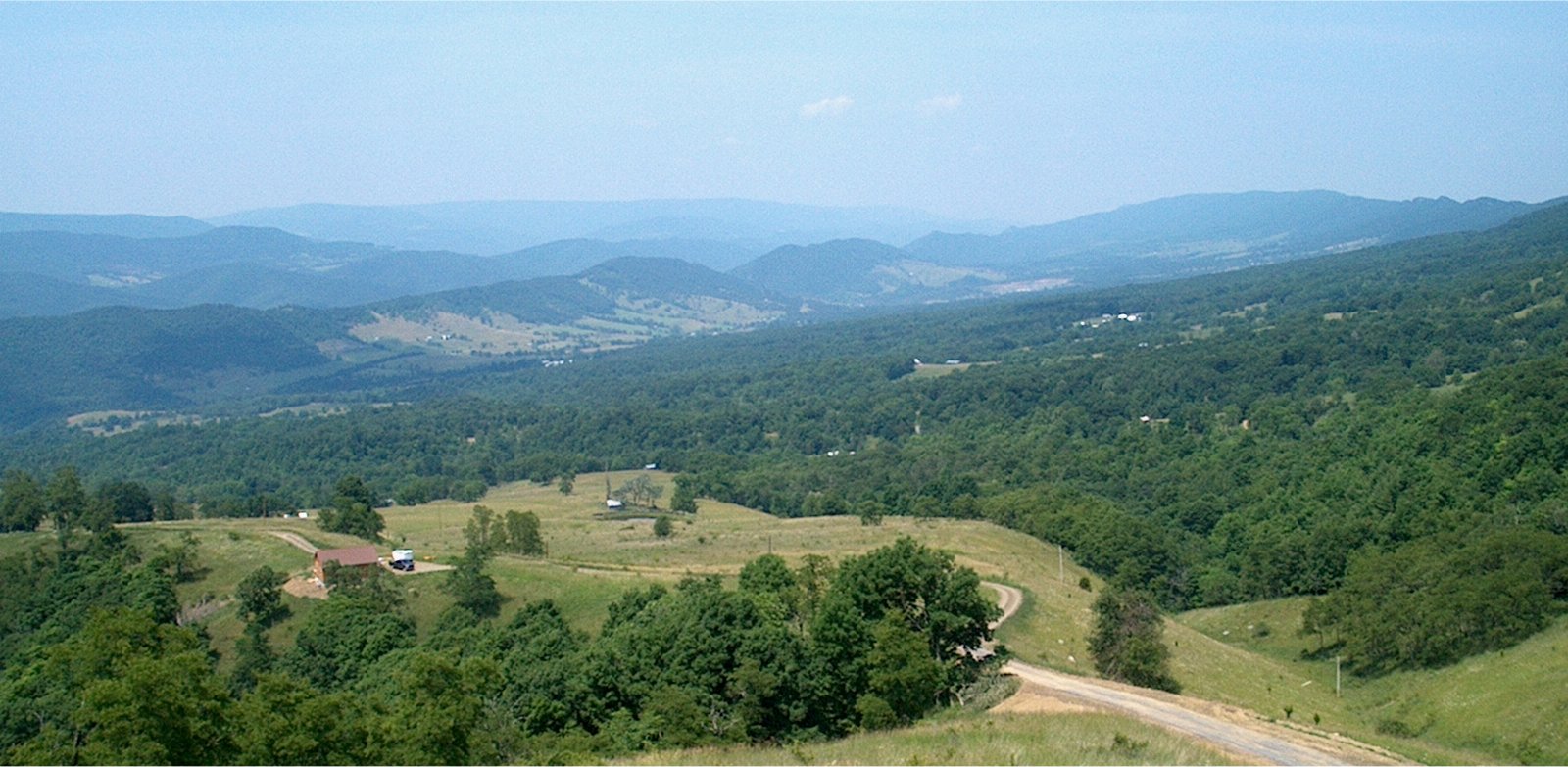
Pendleton County is a county located in the U.S. state of West Virginia. As of the 2020 census, the population was 6,143, making it the second-least populous county in West Virginia. Its county seat is Franklin. The county was created by the Virginia General Assembly in 1788 from parts of Augusta, Hardy, and Rockingham counties and was named for Edmund Pendleton (1721–1803), a distinguished Virginia statesman and jurist. Spruce Knob, located in Pendleton County, is the highest point in the state and in the Alleghenies, its elevation being 4,863 feet. Parts of the Monongahela and George Washington National Forests are also located in Pendleton County. History By the 1740s, the three main valleys of what became Pendleton County had been visited and named by white hunters and prospectors. One of the hunters, a single man named Abraham Burner, built himself a log cabin about a half mile downstream of the future site of Brandywine in 1745. He was the county's first whit ... [...More Info...] [...Related Items...] OR: [Wikipedia] [Google] [Baidu] |
Edmund Pendleton
Edmund Pendleton (September 9, 1721 – October 23, 1803) was an American planter, politician, lawyer, and judge. He served in the Virginia legislature before and during the American Revolutionary War, becoming the first speaker of the Virginia House of Delegates (which succeeded the House of Burgesses terminated by Virginia's last colonial Governor, Lord Dunmore). Pendleton attended the First Continental Congress as one of Virginia's delegates alongside George Washington and Patrick Henry, signed the Continental Association, and led the conventions both wherein Virginia declared independence (1776) and adopted the United States Constitution (1788). Unlike his sometime political rival Henry, Pendleton was a moderate who initially hoped for reconciliation rather than revolt. With Thomas Jefferson and George Wythe, Pendleton revised Virginia's legal code after the break with Britain. To contemporaries, Pendleton may have distinguished himself most as a judge, particularly in the ... [...More Info...] [...Related Items...] OR: [Wikipedia] [Google] [Baidu] |
Regional Publishing Company
In geography, regions, otherwise referred to as areas, zones, lands or territories, are portions of the Earth's surface that are broadly divided by physical characteristics (physical geography), human impact characteristics (human geography), and the interaction of humanity and the environment ( environmental geography). Geographic regions and sub-regions are mostly described by their imprecisely defined, and sometimes transitory boundaries, except in human geography, where jurisdiction areas such as national borders are defined in law. More confined or well bounded portions are called ''locations'' or ''places''. Apart from the global continental regions, there are also hydrospheric and atmospheric regions that cover the oceans, and discrete climates above the land and water masses of the planet. The land and water global regions are divided into subregions geographically bounded by large geological features that influence large-scale ecologies, such as plains and features. As a ... [...More Info...] [...Related Items...] OR: [Wikipedia] [Google] [Baidu] |
Saltpetre
Potassium nitrate is a chemical compound with a sharp, salty, bitter taste and the chemical formula . It is a potassium salt of nitric acid. This salt consists of potassium cations and nitrate anions , and is therefore an alkali metal nitrate. It occurs in nature as a mineral, niter (or ''nitre'' outside the United States). It is a source of nitrogen, and nitrogen was named after niter. Potassium nitrate is one of several nitrogen-containing compounds collectively referred to as saltpetre (or saltpeter in the United States). Major uses of potassium nitrate are in fertilizers, tree stump removal, rocket propellants and fireworks. It is one of the major constituents of traditional gunpowder (black powder). In processed meats, potassium nitrate reacts with hemoglobin and myoglobin generating a red color. Etymology Nitre, or potassium nitrate, because of its early and global use and production, has many names. As for nitrate, Egyptian and Hebrew words for it had the consonants ... [...More Info...] [...Related Items...] OR: [Wikipedia] [Google] [Baidu] |
Smoke Hole Canyon
Smoke Hole Canyon — traditionally called The Smoke Holes and later simply Smoke Hole — is a rugged long gorge carved by the South Branch Potomac River in the Allegheny Mountains of eastern West Virginia, United States. The area is rather isolated and remote with parts accessible only by boat or on foot. Defined to the east by Cave Mountain and to the west by North Fork Mountain, Smoke Hole has been part of the Monongahela National Forest's Spruce Knob–Seneca Rocks National Recreation Area since 1965, although some of it is still private land. Formerly, the area was home to a scattered community of family homesteads, storied for their isolation, traditional lifestyles, and skilled production of the illicit liquor known as "moonshine". Today, The Nature Conservancy considers Smoke Hole and the surrounding mountains to be "one of the most biologically rich places in the East", especially as regards its rare plant communities. It included the Canyon as part of the greater Smo ... [...More Info...] [...Related Items...] OR: [Wikipedia] [Google] [Baidu] |
American Civil War
The American Civil War (April 12, 1861May 26, 1865; also known by Names of the American Civil War, other names) was a civil war in the United States between the Union (American Civil War), Union ("the North") and the Confederate States of America, Confederacy ("the South"), which was formed in 1861 by U.S. state, states that had Secession in the United States, seceded from the Union. The Origins of the American Civil War, central conflict leading to war was a dispute over whether Slavery in the United States, slavery should be permitted to expand into the western territories, leading to more slave states, or be prohibited from doing so, which many believed would place slavery on a course of ultimate extinction. Timeline of events leading to the American Civil War, Decades of controversy over slavery came to a head when Abraham Lincoln, who opposed slavery's expansion, won the 1860 presidential election. Seven Southern slave states responded to Lincoln's victory by seceding f ... [...More Info...] [...Related Items...] OR: [Wikipedia] [Google] [Baidu] |
Lenape
The Lenape (, , ; ), also called the Lenni Lenape and Delaware people, are an Indigenous peoples of the Northeastern Woodlands, Indigenous people of the Northeastern Woodlands, who live in the United States and Canada. The Lenape's historical territory included present-day northeastern Delaware, all of New Jersey, the eastern Pennsylvania regions of the Lehigh Valley and Northeastern Pennsylvania, and New York Bay, western Long Island, and the lower Hudson Valley in New York (state), New York state. Today communities are based in Oklahoma, Wisconsin, and Ontario. During the last decades of the 18th century, European settlers and the effects of the American Revolutionary War displaced most Lenape from their homelands and pushed them north and west. In the 1860s, under the Indian removal policy, the Federal government of the United States, U.S. federal government relocated most Lenape remaining in the Eastern United States to the Indian Territory and surrounding regions. The la ... [...More Info...] [...Related Items...] OR: [Wikipedia] [Google] [Baidu] |
Shawnee
The Shawnee ( ) are a Native American people of the Northeastern Woodlands. Their language, Shawnee, is an Algonquian language. Their precontact homeland was likely centered in southern Ohio. In the 17th century, they dispersed through Ohio, Illinois, Maryland, Delaware, and Pennsylvania. In the early 18th century, they mostly concentrated in eastern Pennsylvania but dispersed again later that century across Pennsylvania, West Virginia, Kentucky, Ohio, Indiana, and Illinois, with a small group joining Muscogee people in Alabama. In the 19th century, the U.S. federal government forcibly removed them under the 1830 Indian Removal Act to areas west of the Mississippi River; these lands would eventually become the states of Missouri, Kansas, and Texas. Finally, they were removed to Indian Territory, which became the state of Oklahoma in the early 20th century. Today, Shawnee people are enrolled in three federally recognized tribes, the Absentee-Shawnee Tribe of Indians of Okl ... [...More Info...] [...Related Items...] OR: [Wikipedia] [Google] [Baidu] |
French And Indian War
The French and Indian War, 1754 to 1763, was a colonial conflict in North America between Kingdom of Great Britain, Great Britain and Kingdom of France, France, along with their respective Native Americans in the United States, Native American allies. European historians generally consider it a related conflict of the wider 1756 to 1763 Seven Years' War, although in the United States it is viewed as a singular conflict unassociated with any European war. Although Britain and France were officially at peace following the Treaty of Aix-la-Chapelle (1748), tensions over trade continued in North America. These culminated in a dispute over the Forks of the Ohio, and the related French Fort Duquesne which controlled them. In May 1754, this led to the Battle of Jumonville Glen, when Colony of Virginia, Virginia militia led by George Washington ambushed a French patrol. In 1755, Edward Braddock, the new Commander-in-Chief, North America, planned a four-way attack on the French. None s ... [...More Info...] [...Related Items...] OR: [Wikipedia] [Google] [Baidu] |
James River
The James River is a river in Virginia that begins in the Appalachian Mountains and flows from the confluence of the Cowpasture and Jackson Rivers in Botetourt County U.S. Geological Survey. National Hydrography Dataset high-resolution flowline dataThe National Map , accessed April 1, 2011 to the Chesapeake Bay. The river length extends to if the Jackson River (Virginia), Jackson River, the longer of its two headwaters, is included. It is the longest river in Virginia. Jamestown, Virginia, Jamestown and Williamsburg, Virginia, Williamsburg, Virginia's first colonial capitals, and Richmond, Virginia, Richmond, Virginia's current capital, lie on the James River. History The Native American tribes in Virginia, Native Americans who populated the area east of the Atlantic Seaboard Fall Line, Fall Line in the late 16th and early 17th centuries called the James River the Powhatan River, named for the Powhatan, Powhatans who occupied the area. The Jamestown, Virginia, Jamestown colo ... [...More Info...] [...Related Items...] OR: [Wikipedia] [Google] [Baidu] |
Staunton, Virginia
Staunton ( ) is an independent city (United States), independent city in the Commonwealth (U.S. state), U.S. Commonwealth of Virginia. As of the 2020 United States census, 2020 census, the population was 25,750. In Virginia, independent cities are separate jurisdictions from the counties that surround them, so the government offices of Augusta County, Virginia, Augusta County are in Verona, Virginia, Verona, which is contiguous to Staunton. Staunton is a principal city of the Staunton-Waynesboro, Virginia, Waynesboro Staunton-Waynesboro, VA Metropolitan Statistical Area, Metropolitan Statistical Area, which had a 2010 population of 118,502. Staunton is known for being the birthplace of Woodrow Wilson, the 28th President of the United States, U.S. president, and as the home of Mary Baldwin University, historically a women's college. The city is also home to Stuart Hall School, Stuart Hall, a private co-ed University preparatory school, preparatory school, as well as the Virginia Sc ... [...More Info...] [...Related Items...] OR: [Wikipedia] [Google] [Baidu] |
Scotch-Irish American
Scotch-Irish Americans are American descendants of primarily Ulster Scots people, who emigrated from Ulster (Ireland's northernmost province) to the United States between the 18th and 19th centuries, with their ancestors having originally migrated to Ulster, mainly from the Scottish Lowlands and Northern England in the 17th century. In the 2017 American Community Survey, 5.39 million (1.7% of the population) reported Scottish ancestry, an additional 3 million (0.9% of the population) identified more specifically with Scotch-Irish ancestry, and many people who claim "American ancestry" may actually be of Scotch-Irish ancestry. The term ''Scotch-Irish'' is used primarily in the United States,Leyburn 1962, p. 327. with people in Great Britain or Ireland who are of a similar ancestry identifying as Ulster Scots people. Many left for North America, but over 100,000 Scottish Presbyterians still lived in Ulster in 1800. With the enforcement of Anne, Queen of Great Britain, Queen Ann ... [...More Info...] [...Related Items...] OR: [Wikipedia] [Google] [Baidu] |


