|
Nelson Region
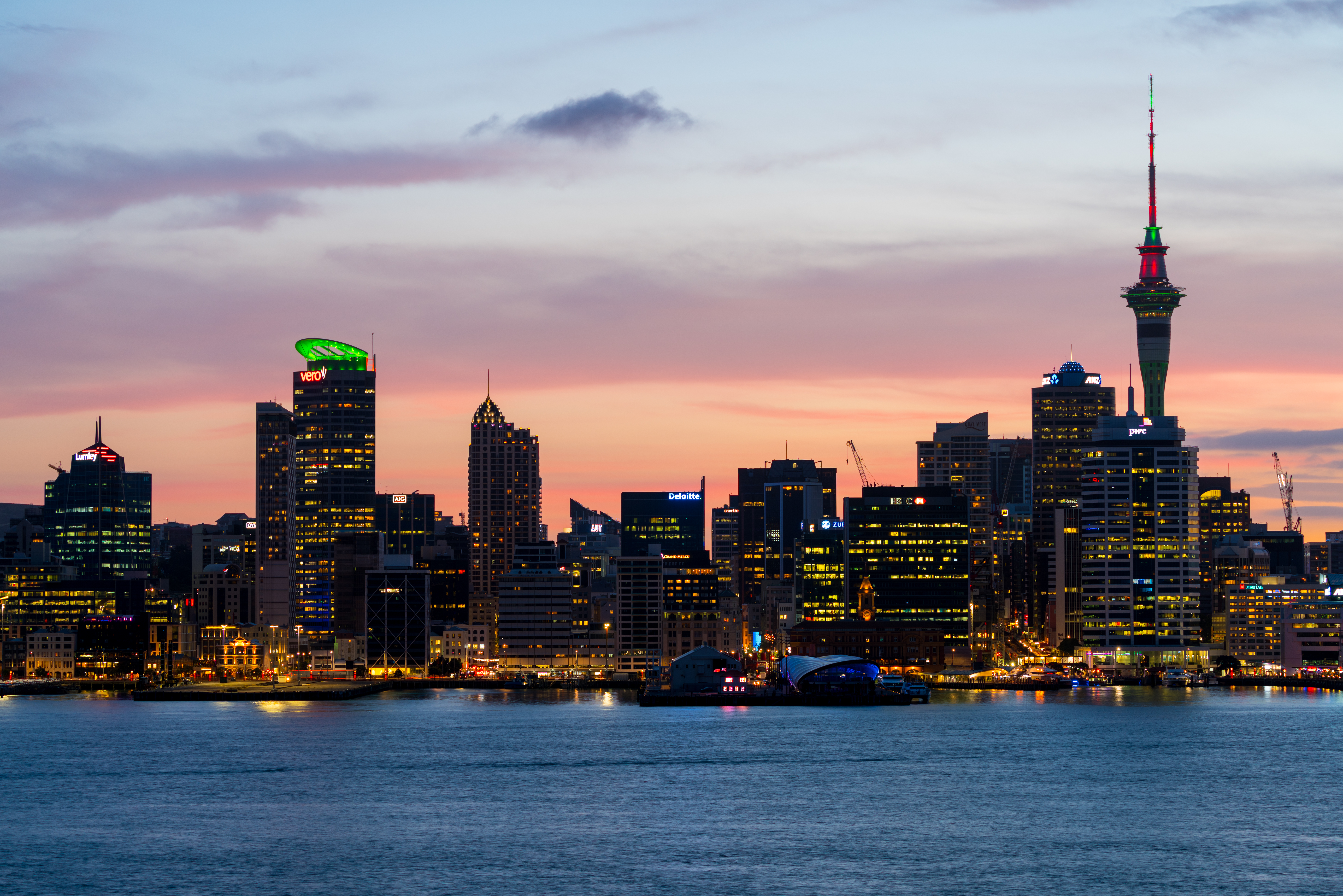
Nelson () is a List of cities in New Zealand, city and Districts of New Zealand, unitary authority on the eastern shores of Tasman Bay at the top of the South Island of New Zealand. It is the oldest city in the South Island and the second-oldest settled city in the country; it was established in 1841 and became a city by British royal charter in 1858. Nelson City is bordered to the west and south-west by the Tasman District and to the north-east, east and south-east by the Marlborough District. The Nelson urban area has a population of , making it New Zealand's 15th most populous urban area. Nelson is well known for its thriving local arts and crafts scene; each year, the city hosts events popular with locals and tourists alike, such as the Nelson Arts Festival. Naming Nelson was named in honour of Admiral Horatio Nelson, 1st Viscount Nelson, Horatio Nelson, who defeated both the First French Empire, French and Spanish fleets at the Battle of Trafalgar in 1805. Many roads ... [...More Info...] [...Related Items...] OR: [Wikipedia] [Google] [Baidu] |
List Of Cities In New Zealand
The word ''city'' took on two meanings in New Zealand after the 1989 New Zealand local government reforms, local government reforms of 1989. Before the reforms, a borough that had a population of 20,000 or more could be proclaimed a city. The boundaries of councils tended to follow the edge of the built-up area, so there was little difference between the urban area and the local government area. In 1989, the structure of local government in New Zealand was significantly reorganised. Almost all the new districts of New Zealand, district councils and city councils were much larger in land area, and they covered both urban land and the surrounding rural land. Many locations that once had a "city council" are now governed by a "district council". Since 2002, an urban area must have at least 50,000 residents to be proclaimed a city. The word ''city'' is used in a general sense to identify the urban areas of New Zealand, independent of local body boundaries. This informal usage is je ... [...More Info...] [...Related Items...] OR: [Wikipedia] [Google] [Baidu] |
Moana, Nelson
Moana is one of the suburbs of Nelson, New Zealand. It lies on to the southwest of Nelson city centre, and immediately to the northeast of Tāhunanui.Wise's Nelson-Blenheim "Easyread" Map There are two small local parks in Moana: Bisley Reserve and Bruno Reserve. Both are owned and operated by Nelson City Council. Demographics The Tahuna Hills statistical area, which includes Moana, covers . It had an estimated population of as of with a population density of people per km2. Tahuna Hills had a population of 2,847 at the 2018 New Zealand census, an increase of 195 people (7.4%) since the 2013 census, and an increase of 417 people (17.2%) since the 2006 census. There were 1,149 households, comprising 1,470 males and 1,377 females, giving a sex ratio of 1.07 males per female. The median age was 47.0 years (compared with 37.4 years nationally), with 438 people (15.4%) aged under 15 years, 417 (14.6%) aged 15 to 29, 1,422 (49.9%) aged 30 to 64, and 570 (20.0%) aged 65 o ... [...More Info...] [...Related Items...] OR: [Wikipedia] [Google] [Baidu] |
Nick Smith (New Zealand Politician)
Nicolas Rex Smith (born 24 December 1964) is a New Zealand politician who served as a Member of parliament, Member of Parliament (MP) for the New Zealand National Party, National Party from 1990 to 2021. He served as a Cabinet of New Zealand, Cabinet minister, holding various posts including Minister for Building and Housing, Minister for the Environment, Minister for Climate Change Issues, and Minister of Local Government (New Zealand), Minister of Local Government. For a brief time between October and November 2003 he was the deputy leader of the National Party, then in opposition under Don Brash. Smith represented the Nelson (New Zealand electorate), Nelson electorate from 1996 to 2020 and, before that, was the member for Tasman (New Zealand electorate), Tasman from 1990 to 1996. Following his defeat in the Nelson electorate in the 2020 New Zealand general election, 2020 election, he served as a list MP for less than a year before retiring from parliament on 10 June 2021 after ... [...More Info...] [...Related Items...] OR: [Wikipedia] [Google] [Baidu] |
Mayor Of Nelson, New Zealand
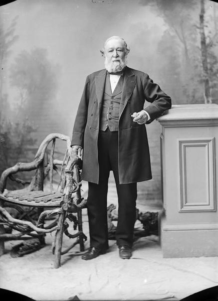
The mayor of Nelson is the head of the municipal government of Nelson, New Zealand, Nelson, New Zealand, and presides over the Nelson City Council. The mayor is directly elected using a single transferable voting, single transferable vote electoral system. The current mayor is Nick Smith (New Zealand politician), Nick Smith, who was elected in September 2022. History 1874–1899 Joseph Dodson was elected as the first mayor of Nelson on 1 May 1874 by the city councillors under the Municipal Corporations Act 1867. He was unanimously elected to the position. Dodson was a former member of the Nelson Board of Works. Charles Fell, Councillor Fell noted that Dodson had taken great interest in the welfare of Nelson and was an upright gentleman with integrity. The new council came into immediate conflict with the Nelson Province, provincial government over finances. Nelson went bankrupt, the mayor resigned on 8 January 1875, and so did most of the councillors. A special meeting of the ... [...More Info...] [...Related Items...] OR: [Wikipedia] [Google] [Baidu] |
Te Tai Tonga
Te Tai Tonga () is a New Zealand parliamentary Māori electorates, Māori electorate, returning one Member of Parliament to the New Zealand New Zealand House of Representatives, House of Representatives. It was established for the 1996 New Zealand general election, 1996 general election, replacing Southern Maori. It covers all of the South Island, Stewart Island, the Chatham Islands, and parts of both Wellington City and the Hutt Valley. The current MP for Te Tai Tonga is Tākuta Ferris of Te Pāti Māori. Population centres Te Tai Tonga is geographically by far the largest of the seventy-one electorates of New Zealand, covering all of the South Island, Stewart Island, the Chatham Islands, all the islands in the Southern Ocean and a large part of the Wellington urban area, namely Wellington City as far as Churton Park, and Lower Hutt, Lower Hutt City south of Naenae and west of Wainuiomata. Besides Wellington, the main centres in Te Tai Tonga are Nelson, New Zealand, Nelson, Ch ... [...More Info...] [...Related Items...] OR: [Wikipedia] [Google] [Baidu] |
Nelson (New Zealand Electorate)
Nelson is a New Zealand parliamentary electorate, returning one Member of Parliament to the House of Representatives of New Zealand. From 1853 to 1860, the electorate was called Town of Nelson. From 1860 to 1881, it was City of Nelson. The electorate is the only one that has continuously existed since the 1st Parliament in 1853. The current MP for Nelson is Rachel Boyack of the Labour Party after defeating long time incumbent Nick Smith of the National Party in the 2020 general election. Population centres Nelson is based around the city of Nelson, with the town of Richmond and the smaller community of Hope drafted in to bring the electorate up to the required population quota. A significant adjustment to the electorate's boundaries was carried out ahead of the change to mixed-member proportional (MMP) voting in 1996; the decrease in South Island electorates from 25 to 16 lead to the abolition of one western South Island electorate; Tasman was split between West Co ... [...More Info...] [...Related Items...] OR: [Wikipedia] [Google] [Baidu] |
Washington Valley, New Zealand
Washington Valley is a major inner suburb of Nelson, New Zealand. It lies to the west of Nelson city centre and south of Stepneyville and Beachville.Wise's Nelson-Blenheim "Easyread" Map The equivalent Statistics New Zealand statistical area of Washington covers a land area of 1.12 km2. The suburb has three local parks: Abraham Heights Reserve, Sequoia Reserve and Wolfe Reserve. History The estimated population of Washington reached 2,510 in 1996, before dropping to 2,450 in 2001. It reached 2,526 in 2006, 2,469 in 2013, and 2,847 in 2018. Demography Washington statistical area covers and had an estimated population of as of with a population density of people per km2. Washington had a population of 2,847 at the 2018 New Zealand census, an increase of 378 people (15.3%) since the 2013 census, and an increase of 321 people (12.7%) since the 2006 census. There were 1,011 households, comprising 1,437 males and 1,413 females, giving a sex ratio of 1.02 males per ... [...More Info...] [...Related Items...] OR: [Wikipedia] [Google] [Baidu] |
Wakatu
Wakatu (also spelt Whakatu, as in the Māori name for the Nelson area) is an industrial suburb of Nelson in New Zealand New Zealand () is an island country in the southwestern Pacific Ocean. It consists of two main landmasses—the North Island () and the South Island ()—and List of islands of New Zealand, over 600 smaller islands. It is the List of isla .... It lies on to the southwest of Nelson city centre and northeast of Stoke, inland from Nelson Airport. Wise's Nelson-Blenheim "Easyread" Map . Parks Wakatu has four local parks: Blackwood Reserve, Douglas Reserve, Highview Reserve and Norgate Reserve. References Suburbs of Nelson, New Zealand Populated places in the Nelson Region {{Nelson-geo-stub ... [...More Info...] [...Related Items...] OR: [Wikipedia] [Google] [Baidu] |
Toi Toi
Toi Toi is an inner suburb of Nelson, New Zealand. It lies to the southwest of Nelson city centre, inland from Britannia Heights and Washington Valley.Wise's Nelson-Blenheim "Easyread" Map Toi Toi is also known as Victory Village. The population was 3,270 in the 2018 census. Toi Toi features Victory Square and four other public parks: Emano East Reserve, Murphy North Reserve, St Lawrence Reserve and Vosper Reserve. Demographics Toi Toi, comprising the statistical areas of Toi Toi and Victory, covers . It had an estimated population of as of with a population density of people per km2. Toi Toi had a population of 3,270 at the 2018 New Zealand census, an increase of 210 people (6.9%) since the 2013 census, and an increase of 162 people (5.2%) since the 2006 census. There were 1,173 households, comprising 1,668 males and 1,605 females, giving a sex ratio of 1.04 males per female, with 774 people (23.7%) aged under 15 years, 663 (20.3%) aged 15 to 29, 1,530 (46.8%) age ... [...More Info...] [...Related Items...] OR: [Wikipedia] [Google] [Baidu] |
The Wood, New Zealand
The Wood is a suburb of Nelson, New Zealand. It lies just to the north-east of the city centre and adjoins it. The suburb incorporates Botanical Reserve, a section of Nelson's town belt that includes the trigonometrical geographic centre of New Zealand, Botanical Hill. The reserve borders the Botanical Gardens to the east and Branford Park to the west. The suburb also has four other public reserves: Guppy Park, Neale Park, Peace Grove and Pepper Tree Park. History Italian immigration The Wood has a sizeable Italian community. The earliest Italian immigrants were fishermen in the 1860s but the majority of Italian immigrants arrived in the 20th century. The Wood was used for horticulture due to suitable conditions such as lack of frost. Horticulture continued into the 1990s but rising interest rates made the area too expensive and combined with other factors most gardens were sold off and turned into housing in the 1990s. Demographics The Wood statistical area covers . It had a ... [...More Info...] [...Related Items...] OR: [Wikipedia] [Google] [Baidu] |
The Brook, Nelson
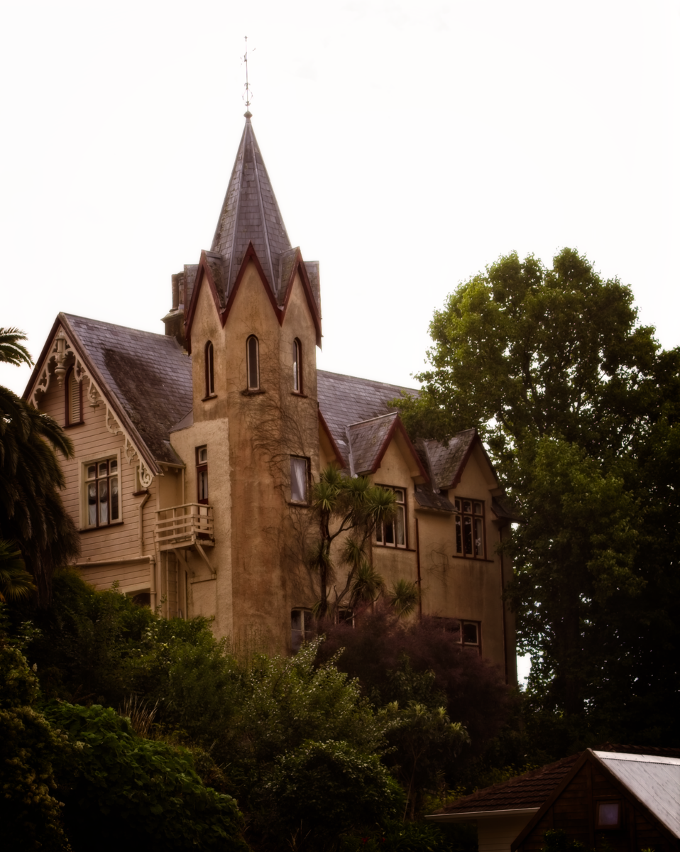
The Brook is one of the suburbs of Nelson, New Zealand, Nelson, New Zealand. It lies to the south of Nelson and is the location of the Brook Waimārama Sanctuary, a conservation project at the head of the Brook Valley. Geography The Brook covers a land area of 6.91 km2. It has seven public reserves: Andrews Farm Reserve, Betsy Eyre Park, Brook Park, Grampians Reserve, Grove Reserve, Tantragee Reserve and Wards Reserve. The Seymour Avenue Heritage Precinct consists of a tree lined street at the North West corner of the suburb. The avenue consist of a short street with a mix of transitional villa and Californian bungalow style houses. The initial subdivision occurred in the 1910s with additional development on the 1940s. The subdivision was created on land originally part of a 20 acre property owned by Alfred Fell who built the first house on the land in 1854. This house was purchased by Nathaniel Edwards in 1860 and was considerably extended in the Victorian Gothic Reviva ... [...More Info...] [...Related Items...] OR: [Wikipedia] [Google] [Baidu] |
Tāhunanui
Tāhunanui is one of the suburbs of Nelson, New Zealand. It lies between Port Nelson and Nelson Airport and is the site of the main beach for Nelson with a shoreline on the Tasman Bay. The New Zealand Ministry for Culture and Heritage gives a translation of "large sandbank" for . Geography Tāhunanui Beach Tāhunanui Beach is Nelson's main beach. It lies on the shore of Tasman Bay / Te Tai-o-Aorere on the northern edge of a peninsula which stretches west from Tāhunanui. The beach is notable for its long shallow slope, and for this reason is extremely popular with local swimmers, as the water is generally calm and warmed by the sun.Wise's Nelson-Blenheim "Easyread" Map Oyster Island Oyster Island is an island reserve located offshore from Tāhunanui. Parks Tāhunanui has several local parks: Annesbrook Youth Park, Bolt Reserve, Burrell Park, Centennial Park, Paddys Knob Reserve, Tāhunanui Recreation Reserve, Tasman Heights Reserve and Tosswill Reserve. There is also ... [...More Info...] [...Related Items...] OR: [Wikipedia] [Google] [Baidu] |


