|
Makueni County
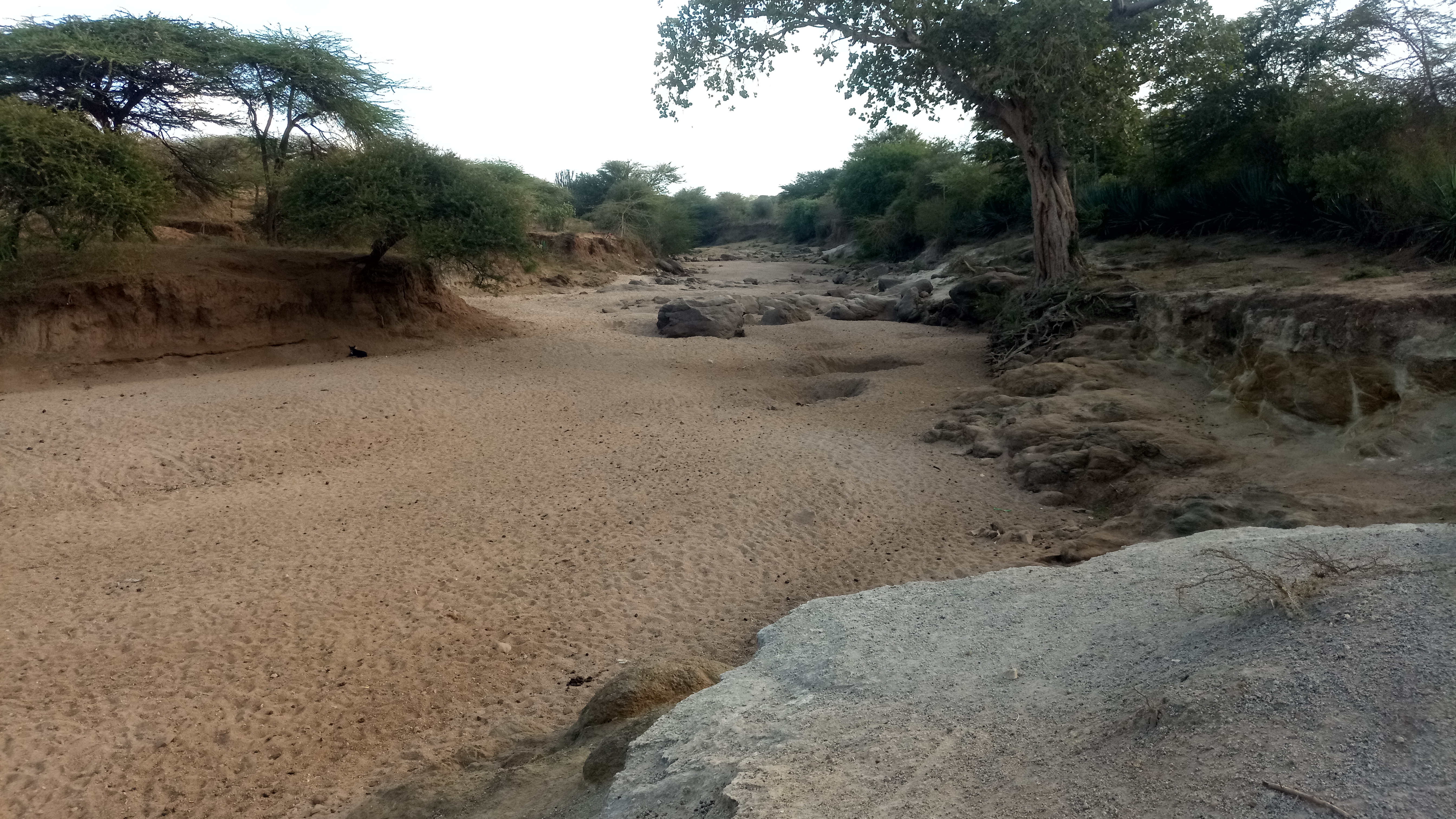
Makueni County (formerly Makueni District) is a county in the former Eastern Province of Kenya. Its capital and largest town is Wote. The county has a population of 987,653 (2019 census). The county lies between Latitude 1° 35' and 2° 59' South and Longitude 37° 10' and 38° 30' East. It borders Machakos to the North, Kitui to the East, Taita Taveta to the South and Kajiado to the West and covers an area of 8,008.9 km2. Physical and topical features The county has a number of prominent features in including volcanic Chyullu hills which lie along the South West border of the county Mbooni hills in Mbooni sub county and Kilungu and Iuani hills in Kaiti sub county, Makongo forest and scenic view, Makuli forest and Nzaui hill. Climatic conditions The county experience semi-arid climatic conditions with an average temperature range between 15C – 26C and Annual rainfall ranges between 250mm to 400mm per annum on the lower regions of the county and the higher region rece ... [...More Info...] [...Related Items...] OR: [Wikipedia] [Google] [Baidu] |
Counties Of Kenya
The Counties of Kenya ( sw, Kaunti za Kenya) are geographical units envisioned by the 2010 Constitution of Kenya as the new units of devolved government that replaced the previous provincial system. The establishment and executive powers of the counties is provided in Chapter Eleven of the Constitution on devolved government, the Constitution's Fourth Schedule and any other legislation passed by the Senate of Kenya concerning counties. The counties are also single-member constituencies for the election of members of parliament to the Senate of Kenya, and special women members to the National Assembly of Kenya. As of 2022, there are 47 counties whose size and boundaries are based on the 47 legally recognized regions established by the 2010 Constitution. Following the re-organization of Kenya's national administration, counties were integrated into a new national administration with the national government posting county commissioners to counties to serve as a collaborative ... [...More Info...] [...Related Items...] OR: [Wikipedia] [Google] [Baidu] |
Kibwezi West Constituency
Kibwezi West is a constituency in Kenya. It is one of six constituencies in Makueni County Makueni County (formerly Makueni District) is a county in the former Eastern Province of Kenya. Its capital and largest town is Wote. The county has a population of 987,653 (2019 census). The county lies between Latitude 1° 35' and 2° 59' Sou .... Its current Member of Parliament is Dr. Patrick Musimba MP, who was first elected in March 2013 as an independent candidate. References {{coord missing, Kenya Constituencies in Makueni County ... [...More Info...] [...Related Items...] OR: [Wikipedia] [Google] [Baidu] |
Kajiado County
Kajiado County is a county in the former Rift Valley Province of Kenya. As of 2019, Kajiado county spanned an area of 21,292.7 km2, with a recorded population of 1,117,840. The county borders Nairobi and to its south it borders the Tanzanian regions of Arusha and Kilimanjaro. The county capital is Kajiado, but the largest town is Ongata Rongai. Its main tourist attraction is its wildlife. Demographics Kajiado county has a total population of 1,117,840 people, of which 557,098 being male, 560,704 are females and 38 intersex people. There are 316,179 households with an average size of 3.5 person per household and a population density of 51 people per square kilometre. Source Administrative and political units Kajiado County is divided into 5 sub-counties and 25 Wards with Kajiado West being the largest and Kajiado North Sub-county being the smallest in terms of area in Km2 Administration units Kajiado is subdivided into five sub-counties with 25 county assembly ... [...More Info...] [...Related Items...] OR: [Wikipedia] [Google] [Baidu] |
Taita Taveta County
Taita may refer to: * Taita people, a Bantu ethnic group in Kenya * Taita language, a Bantu language *Taitā, New Zealand, a suburb of Lower Hutt City * Taita Hills, a mountain range in Kenya * Taita Cushitic languages, an extinct pair of Afro-Asiatic languages spoken in the Taita Hills * Taita falcon, a small falcon found in central and eastern Africa * Taita Line, a railway line in Gifu prefecture, Japan * Taița, a tributary of Lake Babadag in Romania * Taița, a former village in Hamcearca Commune, Romania * Taita I, king of ancient Palistin * Taita, another name for the leavened flatbread injera popular in Ethiopia and Eritrea * Taita, a fictional character from The Egyptian Series, beginning with the novel '' River God'', by Wilbur Smith * Taita, another name for a yage shaman in Colombia. See also * * National Taiwan University National Taiwan University (NTU; ) is a public research university in Taipei, Taiwan. The university was founded in 1928 during Japanes ... [...More Info...] [...Related Items...] OR: [Wikipedia] [Google] [Baidu] |
Nunguni
Nunguni is a small town in Makueni County, Kenya ) , national_anthem = " Ee Mungu Nguvu Yetu"() , image_map = , map_caption = , image_map2 = , capital = Nairobi , coordinates = , largest_city = Nairobi .... References Populated places in Eastern Province (Kenya) Makueni County {{EasternKE-geo-stub ... [...More Info...] [...Related Items...] OR: [Wikipedia] [Google] [Baidu] |
Kikima
Kikima is a small town in Kenya. It is in Makueni county administratively. It is near the top of the Mbooni hills. The local community is majorly of Native Kamba who are a Bantu speaking community. The nearest landmarks in the area are Mbooni girls secondary school and Mbooni Sub-County hospital. Economic Activities Being a town found within the Mbooni Hills, Agriculture is the main economic activity in this area. Kikima Market is therefore frequented with fresh vegetables and fruits such as kales, cabbages, green beans and tomatoes among others. Banks within Kikima Market include Kenya Commercial Bank KCB Bank Kenya Limited is a financial services provider headquartered in Nairobi, Kenya. It is licensed as a commercial bank, by the Central Bank of Kenya, the national banking regulator. The bank has also been running Agency banking mode ... (KCB) and K-Rep. The town also has supermarkets, wholesale and retail shops, chemists and other financial institutes. Edu ... [...More Info...] [...Related Items...] OR: [Wikipedia] [Google] [Baidu] |
Kitui County
Kitui County is a county in the former Eastern Province of Kenya. Its capital and largest town is Kitui, although Mwingi is also another major urban centre. The county has a population of 1,136,187 (2019 census). and an area of 30,430 km2. It lies between latitudes 0°10 South and 3°0 South and longitudes 37°50 East and 39°0 East. Kitui County shares its borders with seven counties; Tharaka-Nithi and Meru to the north, Embu to the northwest, Machakos and Makueni to the west, Tana River to the east and southeast, and Taita-Taveta to the south. History The name Kitui means 'a place where iron goods are made'. The Kamba iron-smiths who settled in the county many years before the colonial period are the ones who named the area Kitui. Demographics Kitui county has a total population of 1,136,187 of which 549,003 are males, 587,151 females and33 intersex persons. There are 262,942 household with an average household size of 4.3 persons per household and a population den ... [...More Info...] [...Related Items...] OR: [Wikipedia] [Google] [Baidu] |
Machakos County
Machakos County is one of the 47 counties of Kenya, which came into being because of the devolved system of governance occasioned by the 2010 constitution of Kenya. The country's first administrative headquarters are in Machakos Town, which is the largest town in the county. The county had a population of 1,421,932 as of 2019. The county borders Nairobi and Kiambu counties to the west, Embu to the north, Kitui to the east, Makueni to the south, Kajiado to the south west, and Muranga and Kirinyaga to the north west. Government The Machakos County Government is composed of two arms, the County Executive and the County Assembly. County Executive is headed by a Governor. The office of the Governor of Machakos was created on 27 March 2013. Alfred Mutua, served as the inaugural holder of the office. following his election in 2012. He was re-elected in the 2017 general elections. The Machakos County Assembly is headed by a Speaker elected by its members. The incumbent Speake ... [...More Info...] [...Related Items...] OR: [Wikipedia] [Google] [Baidu] |
Mukaa
Mukaa is a village and location in Makueni County, Kenya. The community is a tight and small one, and they are generally peaceful. Mukaa was founded in the late 19th century by AIM (Africa Inland Mission Established in 1895, Africa Inland Mission (AIM) is a Christian mission sending agency focused on Africa. Their stated mission is to see "Christ-centered churches established among all African peoples." AIM established the Kapsowar Hospital in 19 ..., Later Africa Inland Church) Missionaries. They built a church. Institutions # Mukaa A.I.C Church (Founded 1888) # Mukaa Primary School # A.I.C Mukaa Children's Home # Mukaa Boys High School # Salama Baptist Church # Salama Kenya Baptist Children's Home {{coord, 1, 51, S, 37, 19, E, display=title, region:KE_type:city_source:GNS-enwiki Makueni County Populated places in Eastern Province (Kenya) ... [...More Info...] [...Related Items...] OR: [Wikipedia] [Google] [Baidu] |
Kibwezi
Kibwezi is a town in Makueni County, Kenya. Kibwezi town is the headquarters of Kibwezi division, one of 15 administrative divisions in Makueni County. The division has a population of 80,236, of whom 4,695 are classified urban. The division has four locations: Kikumbulyu, Kinyambu, Masongaleni and Utithi. Kibwezi town is located within Kikumbulyu location. Kibwezi is also named for Kibwezi Constituency, the local electoral constituency. Kibwezi town does not seat a local authority but is part of Makueni County.Electoral Commission of Kenya''Registration centres by electoral area and constituency'' Education The largest school is the Kibwezi Educational Centre, a partnership between the Presbyterian Church of East Africa (PCEA) and Burke Presbyterian Church (PCUSA). It contains a polytechnic offering two-year vocational programs in carpentry, masonry, welding, and tailoring. There is also a secretarial department which requires students to have graduated from secondary schoo ... [...More Info...] [...Related Items...] OR: [Wikipedia] [Google] [Baidu] |
Mtito Andei
Mtito Andei is a town in Makueni County, Kenya. Location Mtito Andei is located in Makueni County, in the country's southeastern region, , by road southeast of Nairobi, the capital. The geographic coordinates of Mtito Andei are:2° 41' 24.00"S, 38° 10' 12.00"E (Latitude: −2.69000; Longitude: 38.17000). From Mtito Andei to Voi is a distance of 96km Overview Mtito Andei is a small town on the Mombasa to Nairobi Railway and Highway. It lies at the western edge of Tsavo National Park and two entrance gates into the park are located in the town. The town is administered by Mtito Andei Town Council which serves as the sub-county headquarters for Mtito Andei Sub-county in which the town is located. Population According to the 1999 Kenya National Census, Mtito Andei's urban population was counted at 4,304 (1999 Census). In 2010, the population of the town was estimated at about 4,760. Transport Mtito Andei lies on the main rail line of Kenya Railways, between Mombasa and Nair ... [...More Info...] [...Related Items...] OR: [Wikipedia] [Google] [Baidu] |


