|
Mahurangi Island
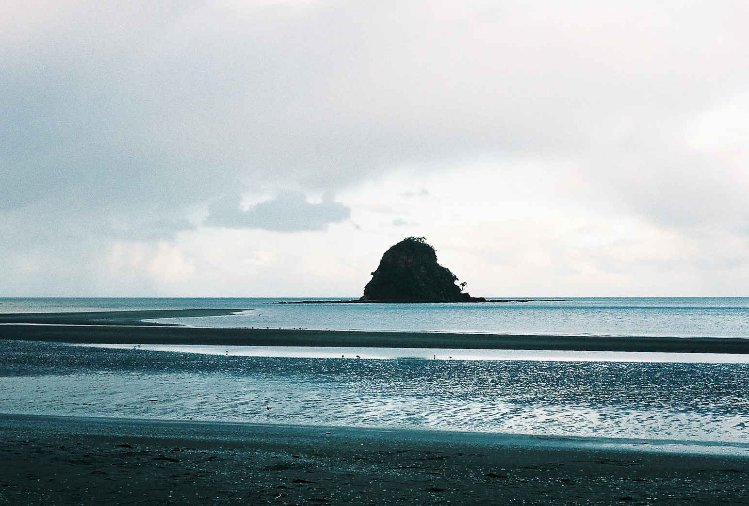
Mahurangi Island, is an island at the mouth of the Waiwera River, in the Auckland Region, New Zealand. Description Mahurangi Island is a 49-metre tall island located in the Hauraki Gulf at the mouth of the Waiwera River. History The island was originally known by the name Motu Mahurangi, and is a place of importance to Ngāti Manuhiri. The island was named by the crew of the ''Tainui'' migratory canoe, after an elderly woman who lived in the homeland of the Tainui people, remaining there. Mahurangi was a revered figure, who was able to ensure that the voyage to Aotearoa was possible through her skill. Eventually, the name Mahurangi began to be applied to the wider area to the north, between Matakana and Waiwera. Tāmaki Māori people constructed a defensive pā on the island, likely in the 1600s. Today, the island forms a part of the Wenderholm Regional Park Wenderholm Regional Park is a regional park north of Auckland in New Zealand's North Island. It is situated bet ... [...More Info...] [...Related Items...] OR: [Wikipedia] [Google] [Baidu] |
Waiwera Beach
Waiwera is a small town in the north of the Auckland Region in New Zealand. Waiwera is 6 km north of Orewa, 6 km south-east of Puhoi, 23 km south-east of Warkworth and approximately 35 km from the Auckland City centre. The settlement lies at the outlet of a river also called Waiwera. Less than 1 kilometre north of the Waiwera turn-off lies the turn-off to Wenderholm Regional Park which is situated on the far side of the headland to the north of the Waiwera River outlet. History The name is of Māori origin and means "Hot Water" (Wai = Water and Wera = Hot), and is a shortened version of the traditional name Waiwerawera. Its main claim to fame was the hot water springs which were well known in pre-European times and reputedly visited by Māori from as far away as Thames. The first European settler to promote the springs was Robert Graham who established a health resort in 1848. During the late 19th century there was a regular steam ferry service from Auck ... [...More Info...] [...Related Items...] OR: [Wikipedia] [Google] [Baidu] |
Hauraki Gulf
The Hauraki Gulf / Tīkapa Moana is a coastal feature of the North Island of New Zealand. It has an area of 4000 km2, Zeldisl, J. R. et al. (1995) Salp grazing: effects on phytoplankton abundance, vertical distribution and taxonomic composition in a coastal habitat. Marine Ecology Progress Series, Vol. 126, p 267-283 and lies between, in anticlockwise order, the , the Hauraki Plains, the Coromandel Peninsula, and [...More Info...] [...Related Items...] OR: [Wikipedia] [Google] [Baidu] |
Waiwera River (Auckland)
The Waiwera River is a stream of the Auckland Region of New Zealand's North Island, near the township of Waiwera. Description The river begins in rural Rodney Rodney may refer to: People * Rodney (name) * Rodney (wrestler), American professional wrestler Places ;Australia * Electoral district of Rodney, a former electoral district in Victoria * Rodney County, Queensland ;Canada * Rodney, Ontario, a ..., flowing east. After flowing past Meales Hill, the river widens to a tidal estuary, flowing into the Hauraki Gulf between the Wenderholm Regional Park and the town of Waiwera. The mouth of the river is the tidal Waiwera Estuary, which is dominated by mangroves. Mahurangi Island is found in the Hauraki Gulf at the mouth of the river. History The river is within the rohe of both Ngāti Manuhiri, who descend from Te Kawerau, and Ngāti Rongo, a hapū of Ngāti Whātua who came to the area from Hokianga. It was traditionally known as Awa Waiwerawera, and was ... [...More Info...] [...Related Items...] OR: [Wikipedia] [Google] [Baidu] |
Auckland Region
Auckland () is one of the sixteen regions of New Zealand, which takes its name from the eponymous urban area. The region encompasses the Auckland Metropolitan Area, smaller towns, rural areas, and the islands of the Hauraki Gulf. Containing percent of the nation's residents, it has by far the largest population and economy of any region of New Zealand, but the second-smallest land area. On 1 November 2010, the Auckland region became a unitary authority administered by the Auckland Council, replacing the previous regional council and seven local councils. In the process, an area in its southeastern corner was transferred to the neighbouring Waikato region. Geography On the mainland, the region extends from the mouth of the Kaipara Harbour in the north across the southern stretches of the Northland Peninsula, through the Waitākere Ranges and the isthmus of Auckland and across the low-lying land surrounding the Manukau Harbour, ending within a few kilometres of the ... [...More Info...] [...Related Items...] OR: [Wikipedia] [Google] [Baidu] |
Ngāti Manuhiri
Ngāti Manuhiri is a Māori iwi of the Mahurangi Peninsula area of New Zealand. They have an interest in the region from the Okura River in the south to Mangawhai in the north, and extending out to Great Barrier Island. They are descended from Manuhiri, one of the sons of Maki, founder of the Te Kawerau iwi. They have a marae near Leigh. The iwi is descended from the Moekākara and Tainui waka (arrival canoes). See also *List of Māori iwi This is a list of iwi (New Zealand Māori tribes). List of iwi This list includes groups recognised as iwi (tribes) in certain contexts. Many are also hapū (sub-tribes) of larger iwi. Moriori are included on this list. Although they are distin ... References External links Ngāti Manuhiri Settlement Trust {{Maori-stub ... [...More Info...] [...Related Items...] OR: [Wikipedia] [Google] [Baidu] |
New Zealand Government
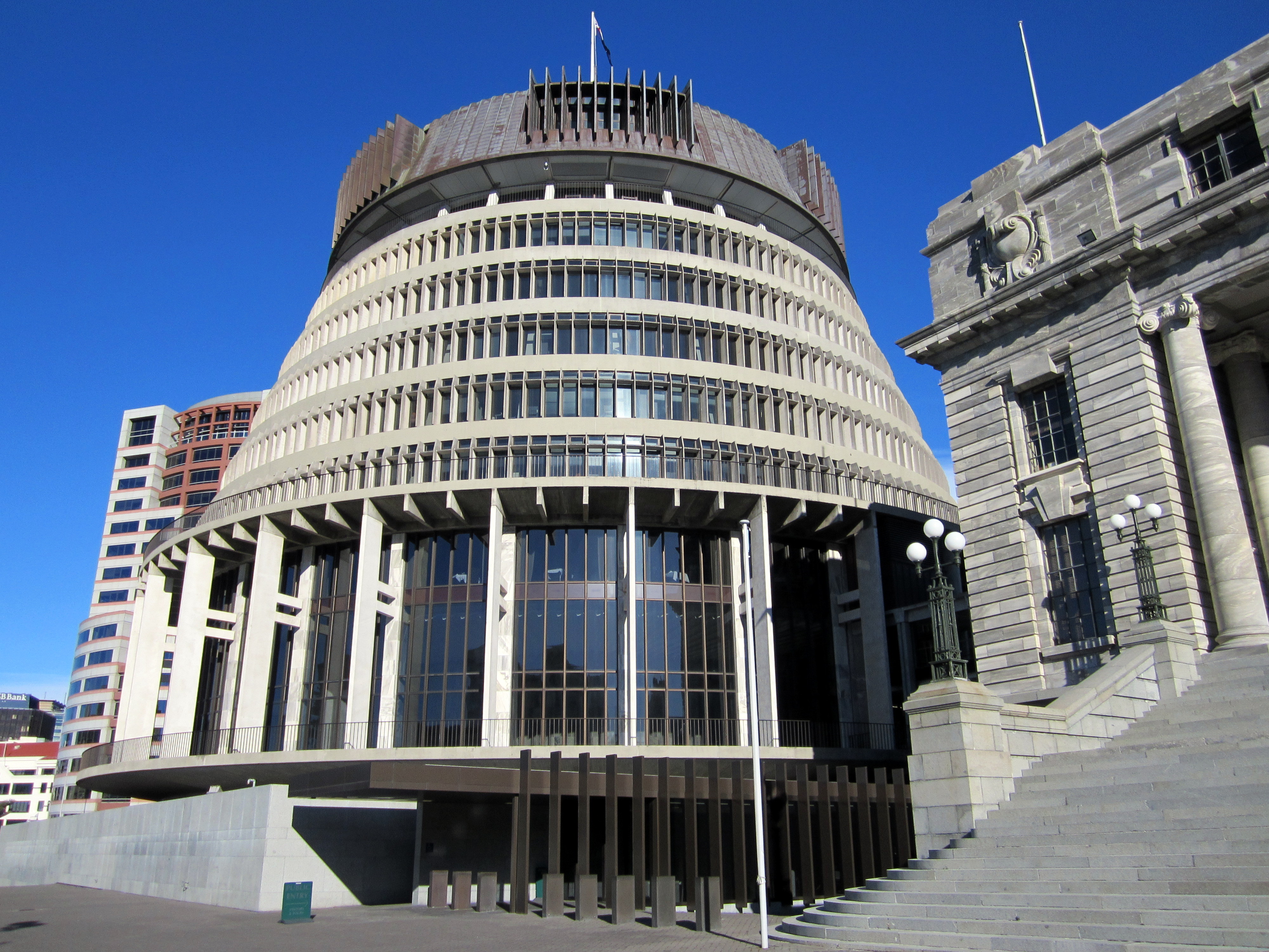
, background_color = #012169 , image = New Zealand Government wordmark.svg , image_size=250px , date_established = , country = New Zealand , leader_title = Prime Minister Jacinda Ardern , appointed = Governor-General , main_organ = , ministries = 32 ministries and departments , responsible = House of Representatives , budget = 119.3 billion (2018–19) , address = The Beehive and other locations across Wellington , url = The New Zealand Government ( mi, Te Kāwanatanga o Aotearoa) is the central government through which political authority is exercised in New Zealand. As in most other parliamentary democracies, the term "Government" refers chiefly to the executive branch, and more specifically to the collective ministry directing the executive. Based on the principle of responsible government, it operates within the framework that "the Queen reigns, but the government rules, so long as it has the support of the House of Representatives".Sir Kenneth Keith, q ... [...More Info...] [...Related Items...] OR: [Wikipedia] [Google] [Baidu] |
Tainui (canoe)
In Māori tradition, ''Tainui'' was one of the great ocean-going canoes in which Polynesians migrated to New Zealand approximately 800 years ago. In Māori tradition, the ''Tainui'' waka was commanded by the chief Hoturoa, who had decided to leave Hawaiki because over-population had led to famine and warfare. The crew of the ''Tainui'' were the ancestors of the iwi that form the Tainui confederation. Crafting The Tainui waka (canoe) was made from a great tree, at a place in Hawaiki known then as Maungaroa, on the spot where a stillborn child had been buried. According to Te Tāhuna Herangi the waka was named after the child who had been called Tainui. The canoe was made by Rakatāura, an expert boat builder in the tradition of Rātā, or according to Wirihana Aoterangi by Rātā himself. It was built with three adzes (''toki''): ''Hahau-te-pō'' ('Chop the night-world') to chop down the tree, ''Paopao-te-rangi'' ('Shatter the heavens') to split the wood, and ''Manu-taw ... [...More Info...] [...Related Items...] OR: [Wikipedia] [Google] [Baidu] |
Tainui
Tainui is a tribal waka confederation of New Zealand Māori iwi. The Tainui confederation comprises four principal related Māori iwi of the central North Island of New Zealand: Hauraki, Ngāti Maniapoto, Ngāti Raukawa and Waikato. There are other Tainui iwi whose tribal areas lay outside the traditional Tainui boundaries – Ngāi Tai in the Auckland area, Ngāti Raukawa ki Te Tonga and Ngāti Toa in the Horowhenua, Kapiti region, and Ngāti Rārua and Ngāti Koata in the northern South Island. History Early history The Tainui iwi share a common ancestry from Polynesian migrants who arrived in New Zealand on the ''Tainui'' waka, which voyaged across the Pacific Ocean from Hawaiki to Aotearoa (North Island) approximately 800 years ago. According to Pei Te Hurinui Jones, the Tainui historian, Tainui first entered the Waikato about 1400 bringing with them kumara plants. By about 1450 they had conquered the last of the indigenous people in a battle at Atiamuri. Conta ... [...More Info...] [...Related Items...] OR: [Wikipedia] [Google] [Baidu] |
Matakana
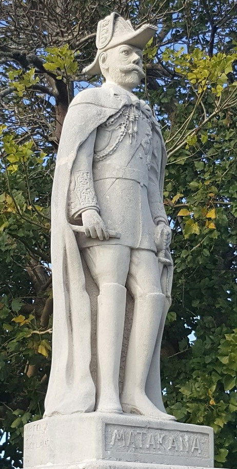
Matakana is a small town in the Rodney Ward of Auckland Council of New Zealand. Warkworth lies about 9 km (5½ miles) to the south-west, Snells Beach the same distance to the south, Omaha is about 7 km (4¼ miles) to the east, and Leigh about 13 km (8 miles) to the north-east. The Matakana River flows through the town and into Kawau Bay to the south-east. The surrounding area contains several vineyards and breweries, developing a name for pinot gris, merlot, syrah and a host of obscure varietals. Offering 'a slice of rural community life', the area offers craft outlets, markets, boutique stores, and country cafes. The reasonable proximity to Auckland (around one hour's drive off-peak) has led to the region becoming a trendy getaway spot for foodie Aucklanders. ''Lonely Planet'' describes the village:"Around 15 years ago, Matakana was a nondescript rural village with a handful of heritage buildings and an old-fashioned country pub. Now the locals watch bemused ... [...More Info...] [...Related Items...] OR: [Wikipedia] [Google] [Baidu] |
Waiwera
Waiwera is a small town in the north of the Auckland Region in New Zealand. Waiwera is 6 km north of Orewa, 6 km south-east of Puhoi, 23 km south-east of Warkworth and approximately 35 km from the Auckland City centre. The settlement lies at the outlet of a river also called Waiwera. Less than 1 kilometre north of the Waiwera turn-off lies the turn-off to Wenderholm Regional Park which is situated on the far side of the headland to the north of the Waiwera River outlet. History The name is of Māori origin and means "Hot Water" (Wai = Water and Wera = Hot), and is a shortened version of the traditional name Waiwerawera. Its main claim to fame was the hot water springs which were well known in pre-European times and reputedly visited by Māori from as far away as Thames. The first European settler to promote the springs was Robert Graham who established a health resort in 1848. During the late 19th century there was a regular steam ferry service from Au ... [...More Info...] [...Related Items...] OR: [Wikipedia] [Google] [Baidu] |
Auckland Council
Auckland Council ( mi, Te Kaunihera o Tāmaki Makaurau) is the local government council for the Auckland Region in New Zealand. It is a territorial authority that has the responsibilities, duties and powers of a regional council and so is a unitary authority, according to the Local Government (Auckland Council) Act 2009, which established the council. The governing body consists of a mayor and 20 councillors, elected from 13 wards. There are also 149 members of 21 local boards who make decisions on matters local to their communities. It is the largest council in Oceania, with a $3 billion annual budget, $29 billion of ratepayer equity, and 9,870 full-time staff as of 30 June 2016. The council began operating on 1 November 2010, combining the functions of the previous regional council and the region's seven city and district councils into one "super council" or "super city". The council was established by a number of Acts of Parliament, and an Auckland Transition Agency, also ... [...More Info...] [...Related Items...] OR: [Wikipedia] [Google] [Baidu] |
Tāmaki Māori
Tāmaki Māori are Māori ''iwi'' and ''hapū'' (tribes and sub-tribes) who have a strong connection to Tāmaki Makaurau (the Auckland Region), and whose rohe was traditionally within the region. Among Ngā Mana Whenua o Tāmaki Makaurau (the Māori tribes of Auckland), also known as the Tāmaki Collective, there are thirteen iwi and hapū, organised into three rōpū (collectives), however Tāmaki Māori can also refer to subtribes and historical iwi not included in this list. Ngāti Whātua Rōpū Ngāti Whātua descend from the '' Māhuhu-ki-te-rangi'' waka, which landed north of the Kaipara Harbour. The rōpū includes Ngāti Whātua o Kaipara, Ngāti Whātua Ōrākei and Te Rūnanga o Ngāti Whātua. Te Rūnanga o Ngāti Whātua is a Māori Trust Board formed in the mid 2000s to represent the interests of Ngāti Whātua iwi and hapū collectively, including those outside of Ngāti Whātua o Kaipara and Ngāti Whātua Ōrākei. The rūnanga represents Ngā Oho, Ngāi ... [...More Info...] [...Related Items...] OR: [Wikipedia] [Google] [Baidu] |


