|
Waiwera River (Auckland)
The Waiwera River is a stream of the Auckland Region of New Zealand's North Island, near the township of Waiwera. Description The river begins in rural Rodney Rodney may refer to: People * Rodney (name) * Rodney (wrestler), American professional wrestler Places ;Australia * Electoral district of Rodney, a former electoral district in Victoria * Rodney County, Queensland ;Canada * Rodney, Ontario, a ..., flowing east. After flowing past Meales Hill, the river widens to a tidal estuary, flowing into the Hauraki Gulf between the Wenderholm Regional Park and the town of Waiwera. The mouth of the river is the tidal Waiwera Estuary, which is dominated by mangroves. Mahurangi Island is found in the Hauraki Gulf at the mouth of the river. History The river is within the rohe of both Ngāti Manuhiri, who descend from Te Kawerau, and Ngāti Rongo, a hapū of Ngāti Whātua who came to the area from Hokianga. It was traditionally known as Awa Waiwerawera, and was ... [...More Info...] [...Related Items...] OR: [Wikipedia] [Google] [Baidu] |
New Zealand
New Zealand ( mi, Aotearoa ) is an island country in the southwestern Pacific Ocean. It consists of two main landmasses—the North Island () and the South Island ()—and over 700 List of islands of New Zealand, smaller islands. It is the List of island countries, sixth-largest island country by area, covering . New Zealand is about east of Australia across the Tasman Sea and south of the islands of New Caledonia, Fiji, and Tonga. The country's varied topography and sharp mountain peaks, including the Southern Alps, owe much to tectonic uplift and volcanic eruptions. New Zealand's Capital of New Zealand, capital city is Wellington, and its most populous city is Auckland. The islands of New Zealand were the last large habitable land to be settled by humans. Between about 1280 and 1350, Polynesians began to settle in the islands and then developed a distinctive Māori culture. In 1642, the Dutch explorer Abel Tasman became the first European to sight and record New Zealand. ... [...More Info...] [...Related Items...] OR: [Wikipedia] [Google] [Baidu] |
Ngāti Whātua
Ngāti Whātua is a Māori iwi (tribe) of the lower Northland Peninsula of New Zealand's North Island. It comprises a confederation of four hapū (subtribes) interconnected both by ancestry and by association over time: Te Uri-o-Hau, Te Roroa, Te Taoū, and Ngāti Whātua-o-Ōrākei. The four hapū can act together or separately as independent tribes. Ngāti Whātua's territory or ''rohe'' is traditionally expressed as, "''Tāmaki ki Maunganui i te Tai Hauauru''" and "''Tāmaki ki Manaia i te Rawhiti''". The northern boundary is expressed as, "''Manaia titiro ki Whatitiri, Whatitiri titiro ki Tutamoe, Tutamoe titiro ki Maunganui''". The southern boundary is expressed as, "''Te awa o Tāmaki''". The area runs from Tāmaki River in the south to Maunganui Bluff (at the northern end of Aranga Beach on the west coast) in the north, and to Whangarei Harbour on the east coast. By the time of European settlement in New Zealand, Ngāti Whātua's territory was around the Kaipara Harb ... [...More Info...] [...Related Items...] OR: [Wikipedia] [Google] [Baidu] |
Rodney Local Board Area
Rodney is a local government area in the northernmost part of New Zealand's Auckland Region, governed by the Rodney Local Board and Auckland Council. It currently aligns with the council's Rodney Ward. The area was part of the Rodney District between 1989 and 2010, and part of Helensville Borough and Rodney County until 1989. Rodney is named from Cape Rodney (opposite Little Barrier Island), which Captain James Cook named on 24 November 1769 after Admiral Sir George Brydges Rodney. Rodney includes Kawau Island, Kumeu and Huapai, Helensville, Warkworth, Matakana and Wellsford. The Kaipara Harbour Kaipara Harbour is a large enclosed harbour estuary complex on the north western side of the North Island of New Zealand. The northern part of the harbour is administered by the Kaipara District and the southern part is administered by the Auckl ... is the largest enclosed harbour in the Southern Hemisphere. The area has a rural economy. Dairy farming, horticulture, winemak ... [...More Info...] [...Related Items...] OR: [Wikipedia] [Google] [Baidu] |
Rivers Of New Zealand
The rivers of New Zealand are used for a variety of purposes and face a number of environmental issues. In the North Island's hill country the rivers are deep, fast flowing and most are unnavigable. Many of the rivers in the South Island are braided rivers. The navigable rivers were used for mass transport in the early history of New Zealand. Statistics The longest river in New Zealand is the Waikato River with a length of . The largest river by volume is the Clutha River / Mata-Au with a mean discharge of . The shortest river is claimed to be the Tūranganui River in Gisborne at long. Some of the rivers, especially those with wide flood plains and stop banks, have long road bridges spanning them. The Rakaia River is crossed by Rakaia Bridge, the longest bridge in New Zealand at . The third longest bridge is the Whirokino Trestle Bridge on State Highway 1 crossing the Manawatū River. Over of rivers have been mapped in New Zealand. Uses Before colonisation, Mā ... [...More Info...] [...Related Items...] OR: [Wikipedia] [Google] [Baidu] |
Rivers Of The Auckland Region
A river is a natural flowing watercourse, usually freshwater, flowing towards an ocean, sea, lake or another river. In some cases, a river flows into the ground and becomes dry at the end of its course without reaching another body of water. Small rivers can be referred to using names such as creek, brook, rivulet, and rill. There are no official definitions for the generic term river as applied to geographic features, although in some countries or communities a stream is defined by its size. Many names for small rivers are specific to geographic location; examples are "run" in some parts of the United States, "burn" in Scotland and northeast England, and "beck" in northern England. Sometimes a river is defined as being larger than a creek, but not always: the language is vague. Rivers are part of the water cycle. Water generally collects in a river from precipitation through a drainage basin from surface runoff and other sources such as groundwater recharge, springs, ... [...More Info...] [...Related Items...] OR: [Wikipedia] [Google] [Baidu] |
List Of Rivers Of New Zealand
This is a list of all waterways named as rivers in New Zealand. A * Aan River * Acheron River (Canterbury) * Acheron River (Marlborough) * Ada River * Adams River * Ahaura River * Ahuriri River * Ahuroa River * Akatarawa River * Ākitio River * Alexander River * Alfred River * Allen River * Alma River * Alph River (Ross Dependency) * Anatoki River * Anatori River * Anaweka River * Anne River * Anti Crow River * Aongatete River * Aorangiwai River * Aorere River * Aparima River * Arahura River * Arapaoa River * Araparera River * Arawhata River * Arnold River * Arnst River * Aropaoanui River * Arrow River * Arthur River * Ashburton River / Hakatere * Ashley River / Rakahuri * Avoca River (Canterbury) * Avoca River (Hawke's Bay) * Avon River / Ōtākaro * Avon River (Marlborough) * Awakari River * Awakino River (Canterbury) and its East and West branches * Awakino River (Northland) * Awakino River (Waikato) * Awanui River * Awapoko River * Awarau River * A ... [...More Info...] [...Related Items...] OR: [Wikipedia] [Google] [Baidu] |
Waiwera Hot Pools
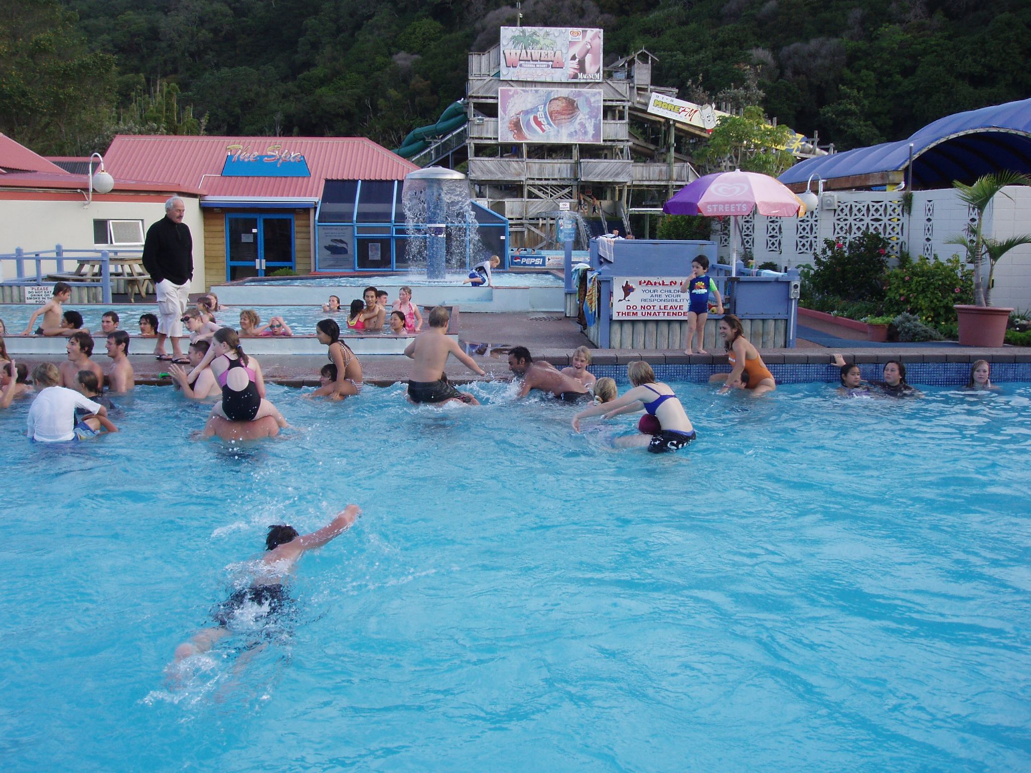
Waiwera Hot Pools is a hot springs system located in the small coastal village of Waiwera, just north of Auckland, New Zealand. They were known to the Māori people for centuries before being developed. In the 1960s and 70s overproduction and overpumping of the geothermal aquifer led to significant loss of pressure and desiccation of the springs in the late 1970. A decade later the thermal springs began to recover, although the system has not returned to the former artesian conditions. The commercial establishment, Waiwera Hot Pools, a large thermal spa and water park, was branded as Waiwera Infinity Thermal Spa Resort at the time of closure in 2018. The park had been New Zealand's largest water park. The complex claimed 350,000 visitors per year and consisted of 26 pools plus various slides. The park closed to visitors in February 2018. History The presence of hot springs bubbling up through the sands of Waiwera Beach was known to Māori in pre-European times, and the name W ... [...More Info...] [...Related Items...] OR: [Wikipedia] [Google] [Baidu] |
Robert Graham (New Zealand Politician)
Robert Graham (15 May 1820 – 26 May 1885) was a 19th-century New Zealand politician in the Auckland area. Early life Graham was born in 1820 in the parish of Barony in Glasgow, Scotland. His parents were Barbara Stirling Rennie and the farmer and coal merchant Robert Graham. His brother was David Graham. Political career He represented the Southern Division electorate (containing Waikato, Coromandel, the Bay of Plenty, and East Cape) in the 2nd New Zealand Parliament from 1855 to 1860, and then represented the Franklin electorate in the 3rd Parliament and the 4th Parliament from 1861 to 1868, when he resigned. He was the fifth Superintendent of Auckland Auckland (pronounced ) ( mi, Tāmaki Makaurau) is a large metropolitan city in the North Island of New Zealand. The most populous urban area in the country and the fifth largest city in Oceania, Auckland has an urban population of about I ... from 1862 to 1865. Prior to this, he had represented the So ... [...More Info...] [...Related Items...] OR: [Wikipedia] [Google] [Baidu] |
Rangatira
In Māori culture, () are tribal chiefs, the hereditary Māori leaders of a hapū. Ideally, rangatira were people of great practical wisdom who held authority () on behalf of the tribe and maintained boundaries between a tribe's land and that of other tribes. Changes to land ownership laws in the 19th century, particularly the individualisation of land title, undermined the power of rangatira, as did the widespread loss of land under the colonial government. The concept of rangatira and rangatiratanga, however, remain strong, and a return to rangatiratanga and the uplifting of Māori by the system has been widely advocated for since the Māori renaissance. Moana Jackson, Ranginui Walker, Tipene O'Regan are among the most famous of these advocates. The concept of a rangatira is central to —a Māori system of governance, self-determination and sovereignty—based on the essential leadership of all peoples through direct democracy. Etymology The word means "chief (male ... [...More Info...] [...Related Items...] OR: [Wikipedia] [Google] [Baidu] |
Ngāpuhi
Ngāpuhi (or Ngā Puhi) is a Māori iwi associated with the Northland region of New Zealand and centred in the Hokianga, the Bay of Islands, and Whangārei. According to the 2018 New Zealand census, the estimated population of Ngāpuhi is 165,201. This compares to 125,601 in 2001, 102,981 in 2006, and 122,214 in 2013. It is formed from 150 hapū/subtribes, with 55 marae. Despite such diversity, the people of Ngāpuhi maintain their shared history and self-identity. Te Rūnanga ā Iwi o Ngāpuhi, based in Kaikohe, administers the iwi. The Rūnanga acts on behalf of the iwi in consultations with the New Zealand Government. It also ensures the equitable distribution of benefits from the 1992 fisheries settlement with the Government, and undertakes resource-management and education initiatives. History Foundations The founding ancestor of Ngāpuhi is Rāhiri, the son of Tauramoko and Te Hauangiangi. Tauramoko was a descendant of Kupe, from ''Matawhaorua'', and Nukutawhiti, ... [...More Info...] [...Related Items...] OR: [Wikipedia] [Google] [Baidu] |
Waka (canoe)
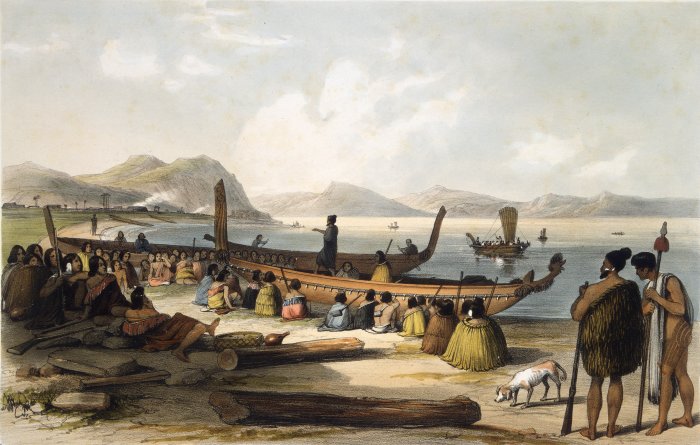
Waka () are Māori watercraft, usually canoes ranging in size from small, unornamented canoes (''waka tīwai'') used for fishing and river travel to large, decorated war canoes (''waka taua'') up to long. The earliest remains of a canoe in New Zealand were found near the Anaweka estuary in a remote part of the Tasman District and radiocarbon-dated to about 1400. The canoe was constructed in New Zealand, but was a sophisticated canoe, compatible with the style of other Polynesian voyaging canoes at that time. Since the 1970s about eight large double-hulled canoes of about 20 metres have been constructed for oceanic voyaging to other parts of the Pacific. They are made of a blend of modern and traditional materials, incorporating features from ancient Melanesia, as well as Polynesia. Waka taua (war canoes) ''Waka taua'' (in Māori, ''waka'' means "canoe" and '' taua'' means "army" or "war party") are large canoes manned by up to 80 paddlers and are up to in length. Large w ... [...More Info...] [...Related Items...] OR: [Wikipedia] [Google] [Baidu] |
New Zealand Government
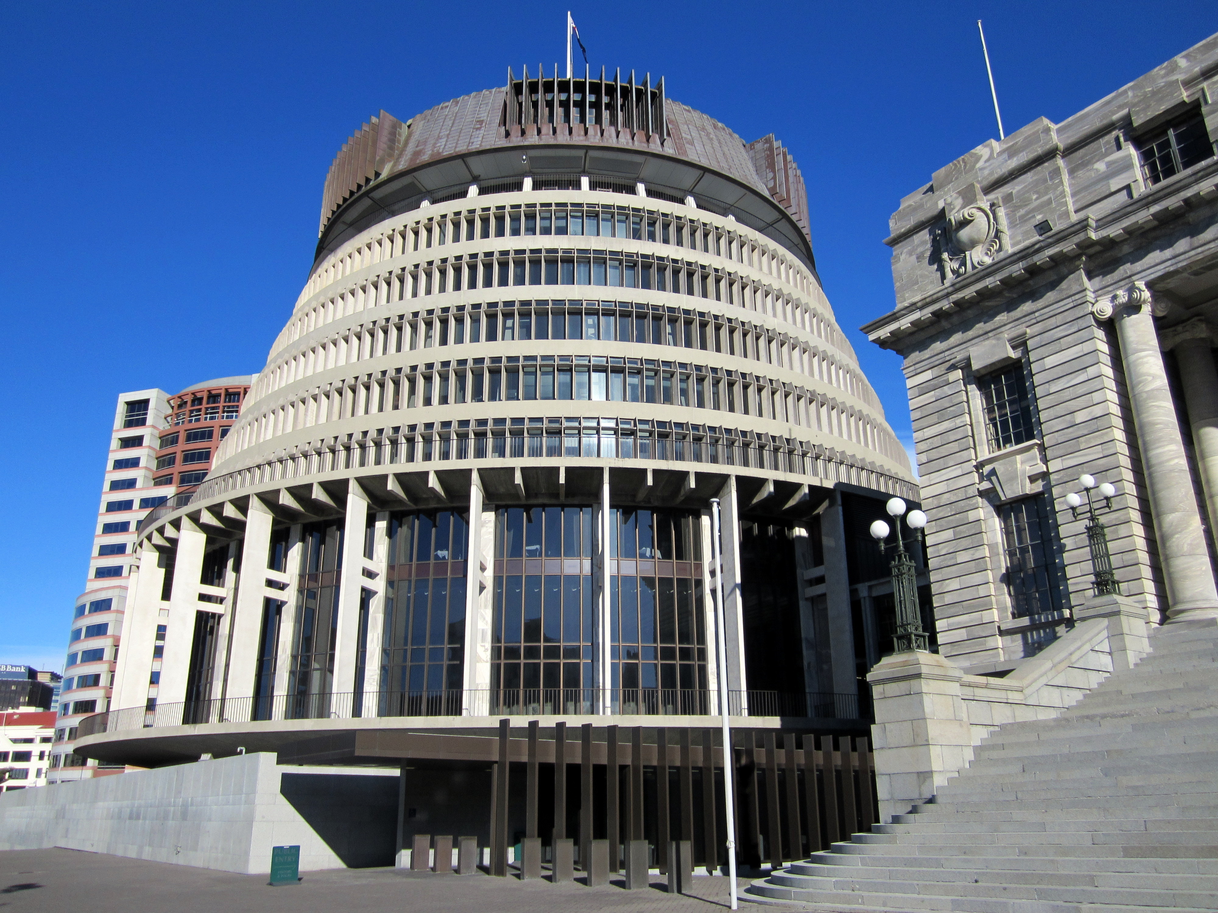
, background_color = #012169 , image = New Zealand Government wordmark.svg , image_size=250px , date_established = , country = New Zealand , leader_title = Prime Minister Jacinda Ardern , appointed = Governor-General , main_organ = , ministries = 32 ministries and departments , responsible = House of Representatives , budget = 119.3 billion (2018–19) , address = The Beehive and other locations across Wellington , url = The New Zealand Government ( mi, Te Kāwanatanga o Aotearoa) is the central government through which political authority is exercised in New Zealand. As in most other parliamentary democracies, the term "Government" refers chiefly to the executive branch, and more specifically to the collective ministry directing the executive. Based on the principle of responsible government, it operates within the framework that "the Queen reigns, but the government rules, so long as it has the support of the House of Representatives".Sir Kenneth Keith, q ... [...More Info...] [...Related Items...] OR: [Wikipedia] [Google] [Baidu] |


