|
Kawaguchi, Saitama
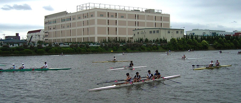
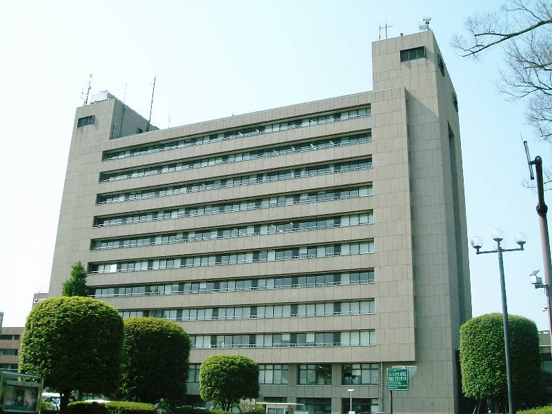
is a Cities of Japan, city located in southwestern Saitama Prefecture, Japan. , the city had an estimated population of 595,011 in 293,582 households and a population density of 9605 persons per km². The total area of the city is . It is the Greater Tokyo Area's 8th most populated city (after passing Hachioji), and second largest in Saitama Prefecture, after eponymous Saitama (city), Saitama. Geography Kawaguchi is located near the center of the Kantō Plain in southwestern Saitama Prefecture in east-central Honshu, and is bordered by the Tokyo wards of Kita-ku, Tokyo, Kita-ku and Adachi-ku, Tokyo, Adachi-ku to the south. The city area is mostly flat and mainly residential except for the Omiya tableland, which occupies part of the north and east area. The Arakawa River (Kanto), Arakawa River runs across the border with Kita-ku to the south.The Editors of Encyclopaedia Britannica. "Kawaguchi." ''Encyclopedia Britannica'', May 22, 2018https://www.britannica.com/place/Kawaguchi./r ... [...More Info...] [...Related Items...] OR: [Wikipedia] [Google] [Baidu] |
Core Cities Of Japan
A is a class or category of cities of Japan, Japanese cities. It is a local administrative division created by the national government.Web-Japan.org"Local self-government", p. 3 retrieved 2012-11-28. Core cities are delegated many functions normally carried out by Prefectures of Japan, prefectural governments, but not as many as Cities designated by government ordinance of Japan, designated cities. To become a candidate for core city status, a city must have a population greater than 300,000 and an area greater than 100 square kilometers, although special exceptions may be made by order of the cabinet for cities with populations under 300,000 but over 200,000. After the abolition of Special cities of Japan, special city status on April 1, 2015, any city with a population above 200,000 may apply for core city status. Application for designation is made by a city with the approval of both the city and prefectural assemblies. History The term "core city" was created by the first c ... [...More Info...] [...Related Items...] OR: [Wikipedia] [Google] [Baidu] |
Kantō Plain
The , in the Kantō region of central Honshu, is the largest plain in Japan. Its 17,000 km2 covers more than half of the region extending over Tokyo, Saitama Prefecture, Kanagawa Prefecture, Chiba Prefecture, Gunma Prefecture, Tochigi Prefecture, and Ibaraki Prefecture.Encyclopedia of Japan, Kōdansha Geography The northern limit borders on the Abukuma Highlands, Mount Yamizo, Yamizo Mountain Range, Ashio Mountain Range, and a volcanic field associated with the Nasu Volcanic Belt. The western coincides with the Kantō Mountains, Kantō Mountain Range, and the southern edge is defined by the Bōsō Peninsula, the Miura Peninsula, Miura Hills, Tokyo Bay, and Sagami Bay. The Kashima Sea and Kujūkuri Beach define the eastern end of the plain. Most of its rivers originate in the northern or western mountain ranges and flow east or southeast into the Pacific Ocean, Tokyo Bay, or Sagami Bay. In the central part of the plain is the Tone River; in the northern part the Watarase Riv ... [...More Info...] [...Related Items...] OR: [Wikipedia] [Google] [Baidu] |
100 Views Edo 020
1 (one, unit, unity) is a number, numeral, and glyph. It is the first and smallest positive integer of the infinite sequence of natural numbers. This fundamental property has led to its unique uses in other fields, ranging from science to sports, where it commonly denotes the first, leading, or top thing in a group. 1 is the unit of counting or measurement, a determiner for singular nouns, and a gender-neutral pronoun. Historically, the representation of 1 evolved from ancient Sumerian and Babylonian symbols to the modern Arabic numeral. In mathematics, 1 is the multiplicative identity, meaning that any number multiplied by 1 equals the same number. 1 is by convention not considered a prime number. In digital technology, 1 represents the "on" state in binary code, the foundation of computing. Philosophically, 1 symbolizes the ultimate reality or source of existence in various traditions. In mathematics The number 1 is the first natural number after 0. Each natural number, ... [...More Info...] [...Related Items...] OR: [Wikipedia] [Google] [Baidu] |
Humid Subtropical Climate
A humid subtropical climate is a subtropical -temperate climate type, characterized by long and hot summers, and cool to mild winters. These climates normally lie on the southeast side of all continents (except Antarctica), generally between latitudes 25° and 40° and are located poleward from adjacent tropical climates, and equatorward from either humid continental (in North America and Asia) or oceanic climates (in other continents). It is also known as warm temperate climate in some climate classifications. Under the Köppen climate classification, ''Cfa'' and ''Cwa'' climates are either described as humid subtropical climates or warm temperate climates. This climate features mean temperature in the coldest month between (or ) and and mean temperature in the warmest month or higher. However, while some climatologists have opted to describe this climate type as a "humid subtropical climate", Köppen himself never used this term. The humid subtropical climate classific ... [...More Info...] [...Related Items...] OR: [Wikipedia] [Google] [Baidu] |
Tokyo Metropolis
Tokyo, officially the Tokyo Metropolis, is the capital of Japan, capital and List of cities in Japan, most populous city in Japan. With a population of over 14 million in the city proper in 2023, it is List of largest cities, one of the most populous urban areas in the world. The Greater Tokyo Area, which includes Tokyo and parts of six neighboring Prefectures of Japan, prefectures, is the most populous metropolitan area in the world, with 41 million residents . Lying at the head of Tokyo Bay, Tokyo is part of the Kantō region, on the central coast of Honshu, Japan's largest island. It is Japan's economic center and the seat of the Government of Japan, Japanese government and the Emperor of Japan. The Tokyo Metropolitan Government administers Tokyo's central Special wards of Tokyo, 23 special wards, which formerly made up Tokyo City; various commuter towns and suburbs in Western Tokyo, its western area; and two outlying island chains, the Tokyo Islands. Although most of the w ... [...More Info...] [...Related Items...] OR: [Wikipedia] [Google] [Baidu] |
Warabi, Saitama
is a Cities of Japan, city located in Saitama Prefecture, Japan. , the city had an estimated population of 75,614 in 41,025 households and a population density of 15,000 persons per km2. The total area of the city is . Warabi has the smallest area of any municipality in Japan, and highest population density outside of the special wards of Tokyo. Geography Warabi is located southeastern part of Saitama Prefecture, bordering Saitama City in the north, Toda in the west, and Kawaguchi in the east. The city area is in the Arakawa lowland and averages 4.8 meters above sea level. Land use mainly consists of residential areas. Surrounding municipalities * Saitama Prefecture ** Kawaguchi, Saitama, Kawaguchi ** Saitama, Saitama, Saitama ** Toda, Saitama, Toda Climate Warabi has a humid subtropical climate (Köppen ''Cfa'') characterized by warm summers and cool winters with light to no snowfall. The average annual temperature in Warabi is 14.8 °C. The average annual rainfall is 148 ... [...More Info...] [...Related Items...] OR: [Wikipedia] [Google] [Baidu] |
Toda, Saitama
is a city located in Saitama Prefecture, Japan. , the city had an estimated population of 140,902 in 66,765 households and a population density of 7700 persons per km2. The total area of the city is . Geography Toda is located in the flat lowlands of far southeastern Saitama Prefecture, separated from Tokyo by the Arakawa River. The Sasame River also flows through the city before joining the Arakawa. Surrounding municipalities * Saitama Prefecture ** Asaka ** Kawaguchi ** Saitama ** Wakō ** Warabi * Tokyo Metropolis ** Itabashi Climate Toda has a humid subtropical climate (Köppen ''Cfa'') characterized by warm summers and cool winters with light to no snowfall. The average annual temperature in Toda is 14.8 °C. The average annual rainfall is 1482 mm with September as the wettest month. The temperatures are highest on average in August, at around 26.6 °C, and lowest in January, at around 3.2 °C. Demographics Per Japanese census data, the popula ... [...More Info...] [...Related Items...] OR: [Wikipedia] [Google] [Baidu] |
Saitama, Saitama
is the capital and largest Cities of Japan, city of Saitama Prefecture, Japan. Its area incorporates the former cities of Urawa, Saitama, Urawa, Ōmiya, Saitama, Ōmiya, Yono, Saitama, Yono and Iwatsuki, Saitama, Iwatsuki. It is a Cities designated by government ordinance of Japan, city designated by government ordinance. , the city had an estimated population of 1,324,854, and a population density of 6,093 people per km2 (15,781 people per sq mi). Its total area is . Etymology The name ''Saitama'' originally comes from the of what is now the city of Gyoda, Saitama, Gyōda in the northern part of what is now known as Saitama Prefecture. ''Sakitama'' has an ancient history and is mentioned in the famous 8th century poetry anthology . The pronunciation has changed from Sakitama to Saitama over the years. With the 2001 merger of Urawa, Saitama, Urawa, Ōmiya-ku, Saitama, Ōmiya, and Yono, Saitama, Yono, it was decided that a new name, one fitting for this newly created prefect ... [...More Info...] [...Related Items...] OR: [Wikipedia] [Google] [Baidu] |
Koshigaya, Saitama
is a Cities of Japan, city located in Saitama Prefecture, Japan. , the city had an estimated population of 345,353 in 158,022 households and a population density of 5700 persons per km2. The total area of the city is . It is famous for producing daruma dolls. Geography Koshigaya is situated in eastern Saitama Prefecture, in the alluvial plain of the Nakagawa basin between the Omiya plateau and the Shimosa plateau. Most of the city area is flat with an average elevation of only five meters above sea level. Many rivers, including the Motoara River, Naka River, Ayase River, Furutone River, and Sakagawa River flow in the city. Koshigaya, which is about 25 kilometers north of Tokyo and developed as a transportation for water and land transportation from premodern times. Surrounding municipalities * Saitama Prefecture ** Kasukabe, Saitama, Kasukabe ** Kawaguchi, Saitama, Kawaguchi ** Matsubushi, Saitama, Matsubushi ** Saitama, Saitama, Saitama ** Sōka, Saitama, Sōka ** Yoshikawa, ... [...More Info...] [...Related Items...] OR: [Wikipedia] [Google] [Baidu] |
Arakawa River (Kanto)
or Ara River may refer to: * Arakawa River (Kanto), which flows from Saitama Prefecture and through Tokyo to Tokyo Bay * Arakawa River (Uetsu), which flows from Yamagata Prefecture and through Niigata Prefecture to the Sea of Japan. * Arakawa River (Fukushima), which starts and finishes in Fukushima City, Fukushima {{disambig ... [...More Info...] [...Related Items...] OR: [Wikipedia] [Google] [Baidu] |


