|
Hinnøya
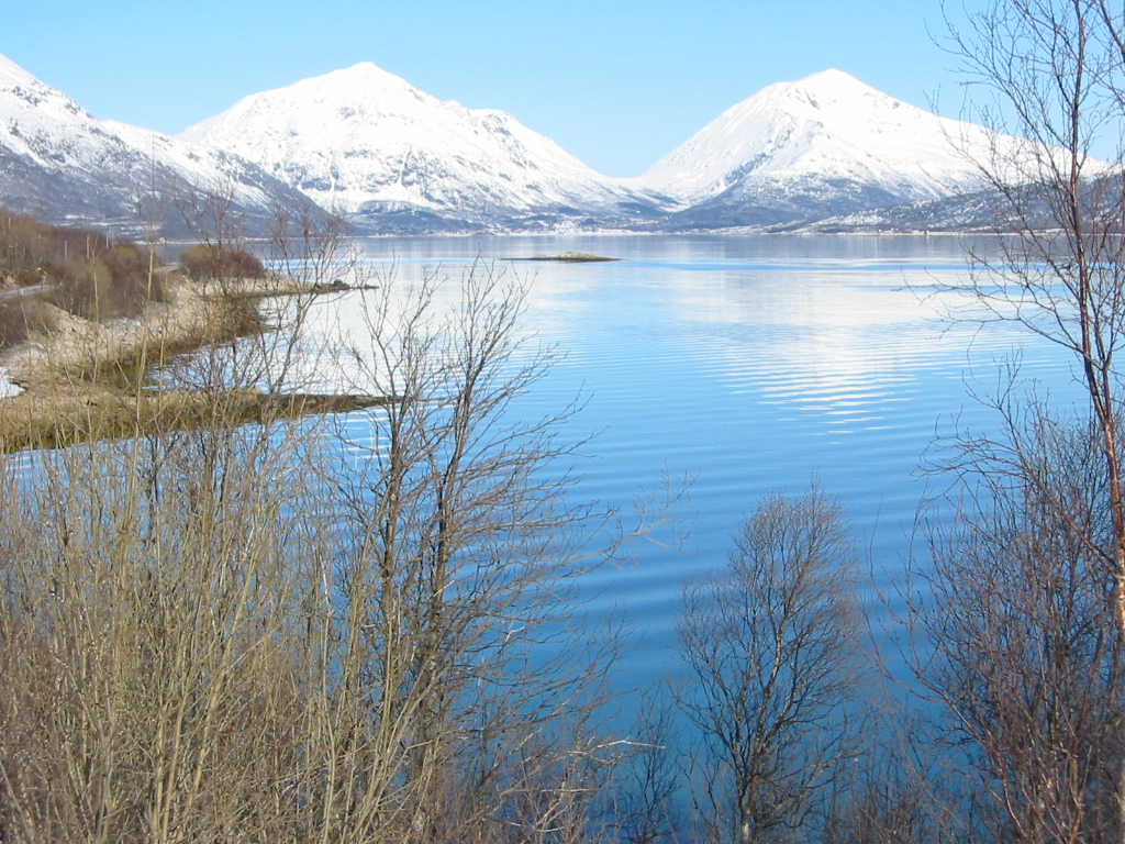
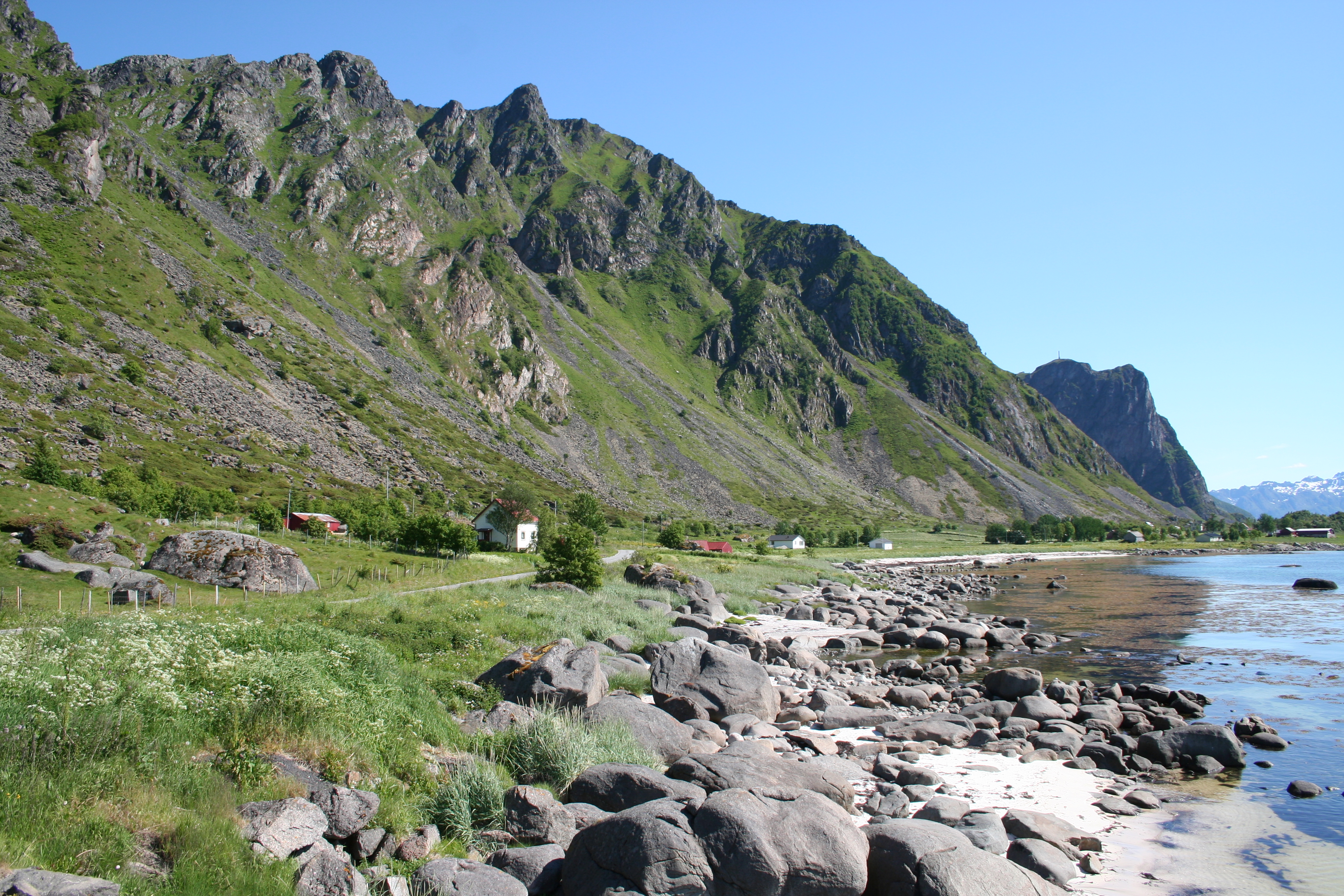
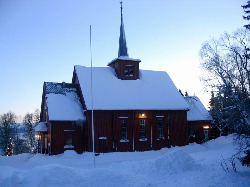
Hinnøya is the fourth-largest island in Norway, and the largest outside the Svalbard archipelago. The lies just off the western coast of Northern Norway. The island sits on the border of Nordland and Troms og Finnmark counties. The western part of the island is in the district of Vesterålen, the southwestern part is in the Lofoten district, the southeastern part is in the Ofoten district, and the northeastern part is in Troms. , Hinnøya had a population of 32,688. The only town on the island is the town of Harstad. Some of the larger villages include Borkenes, Lødingen, Sigerfjord, and Sørvik. The island is split between the municipalities of Harstad, Tjeldsund and Kvæfjord in Troms og Finnmark county, as well as Andøy, Hadsel, Lødingen, Sortland, and Vågan in Nordland county. Etymology The Old Norse form of the name was just ''Hinn'' (the suffix ''-øya'' meaning "the island" was added later). The large island is almost divided in two parts by the Gullesfj ... [...More Info...] [...Related Items...] OR: [Wikipedia] [Google] [Baidu] |
Harstad
( se, Hárstták) is the second-most populated municipality in Troms og Finnmark county, Norway. It is mostly located on the large island of Hinnøya. The municipal center is the town of Harstad, the most populous town in Central Hålogaland, and the third-largest in all of Northern Norway. The town was incorporated in 1904. Villages in the municipality include Elgsnes, Fauskevåg, Gausvik, Grøtavær, Kasfjord, Lundenes, Nergården and Sørvika. The municipality is the 226th largest by area out of the 356 municipalities in Norway. Harstad is the 49th most populous municipality in Norway with a population of 24,804. The municipality's population density is and its population has increased by 2.9% over the previous 10-year period. Geography The municipality is located on many islands in southern Troms og Finnmark county. Most of the municipality is located on the large island of Hinnøya, which is Norway's largest coastal island (three islands in the Svalbard arc ... [...More Info...] [...Related Items...] OR: [Wikipedia] [Google] [Baidu] |
Vesterålen
Vesterålen is a district and archipelago in Nordland county, Norway. It is located just north of Lofoten and west of Harstad. It is the northernmost part of Nordland county. Sortland is the largest town, situated near the center of the archipelago. Vesterålen includes the municipalities of Andøy, Bø, Hadsel, Sortland, and Øksnes. Name The Old Norse forms of the name were ' and ' (plural). The first element is ' which means "west" and the last element is ' which means "(deep and narrow) sound" or " strait". The name describes the seaway west of the island of Hinnøya. The old name of the seaway east of Hinnøya (now called Tjeldsundet) might have been ' (meaning "the eastern sound/strait"). Geography Vesterålen consists of the municipalities of Andøy, Bø, Hadsel, Sortland, and Øksnes. According to some definitions, Lødingen is also included. Vesterålen is made up of several islands: Langøya, Andøya, Hadseløya, the western part of Hinnøya, the northern part ... [...More Info...] [...Related Items...] OR: [Wikipedia] [Google] [Baidu] |
Lødingen
Lødingen ( sme, Lodegat) is a municipality in Nordland county in Norway. Lødingen is located on the southeastern corner of the island of Hinnøya, and is part of the traditional district of Ofoten. The administrative centre of the municipality is the village of Lødingen. The other main part of the municipality is Vestbygda. Lødingen has the nickname "Biketown" because it hosts several annual bicycle races, including "Lofoten Insomnia" and Vestbygd-rittet. The municipality is by area the 202nd largest out of the 356 municipalities in Norway. Lødingen is the 282nd most populous municipality in Norway with a population of 1,976. The municipality's population density is and its population has decreased by 9.3% over the previous 10-year period. General information The municipality of Lødingen was established on 1 January 1838 (see formannskapsdistrikt law). On 1 January 1869, the southern district of Lødingen surrounding the Tysfjorden on the mainland (population: 1,40 ... [...More Info...] [...Related Items...] OR: [Wikipedia] [Google] [Baidu] |
Sortland
or is a municipality in Nordland county, Norway. It is part of the traditional region of Vesterålen. The administrative centre of the municipality is the town of Sortland. Other population centres in Sortland include Bø, Holand, Holmstad, Liland, Sigerfjord, Strand, and Vik. The Norwegian Coast Guard has its northern base in Sortland, called ''Kystvaktskvadron Nord''. In 1997, the municipal council declared "town status" for the urban area of Sortland. Sortland is the largest town and commercial centre in Vesterålen. The town of Sortland is located close to the Sortland Bridge which crosses the Sortlandsundet strait and connects the two large islands of Langøya and Hinnøya by road. Since a lot of houses in the town are painted blue, Sortland is sometimes referred to as "the blue city". The municipality is the 159th largest by area out of the 356 municipalities in Norway. Sortland is the 109th most populous municipality in Norway with a population of 10,468. The mu ... [...More Info...] [...Related Items...] OR: [Wikipedia] [Google] [Baidu] |
Andøy
Andøy is the northernmost municipality in Nordland county, Norway. It is part of the Vesterålen archipelago. The main island in the municipality is Andøya. The administrative centre of the municipality is the village of Andenes. Other villages in the municipality include Bjørnskinn, Bleik, Dverberg, Fiskenes, Fornes, Nordmela, Risøyhamn, Skarstein, Å, Åknes, and Åse. The municipality is the 172nd largest by area out of the 356 municipalities in Norway. Andøy is the 188th most populous municipality in Norway with a population of 4,572. The municipality's population density is and its population has decreased by 9.1% over the previous 10-year period. General information The municipality of Andøy was established as a new municipality on 1 January 1964 due to the work of the Schei Committee. Andøy Municipality was created from the merger of the old municipalities of Andenes (population: 3,812), Bjørnskinn (population: 1,835), and Dverberg (population: 1,719). In ... [...More Info...] [...Related Items...] OR: [Wikipedia] [Google] [Baidu] |
Hadsel
Hadsel ( sme, Válafierda) is a municipality in Nordland county, Norway. It is part of the traditional district of Vesterålen. The administrative centre of the municipality is the town of Stokmarknes. Other villages in Hadsel include Fiskebøl, Gjerstad, Grønning, Grytting, Hanøyvika, Hennes, Kaljord, Melbu, Sanden, and Sandnes. The municipality is the southernmost municipality in the Vesterålen region. It is spread over several main islands: Hadseløya, Børøya, Hinnøya, Langøya, and Austvågøya. About 70% of the population live on Hadseløya island. Hadseløya island is connected to Langøya by the Hadsel Bridge and Børøy Bridge. Also, the Stokmarknes Airport, Skagen, is located nearby. It is the busiest small aircraft airport in Norway, serving 100,000 passengers annually (1997). The municipality is the 192nd largest by area out of the 356 municipalities in Norway. Hadsel is the 130th most populous municipality in Norway with a population of 8,107. ... [...More Info...] [...Related Items...] OR: [Wikipedia] [Google] [Baidu] |
Gullesfjorden
Gullesfjorden is a fjord that cuts into the island of Hinnøya in Troms og Finnmark county, Norway. It is located mostly within Kvæfjord Municipality, although a small part in the northwestern part of the fjord lies in Sortland Municipality in Nordland county. The inner head of the ford is known as ''Gullesfjordbotn''. The long fjord is one of three which branch off of the main Andfjorden Andfjorden is a fjord on the border of Nordland and Troms og Finnmark counties in Norway. It primarily flows between the large islands of Andøya and Senja. Grytøya and the smaller islands Bjarkøya and Krøttøya are located in the fjord. Th ... on the north side of Hinnøya. The other two branches are the Godfjorden and Kvæfjorden. The Gullesfjorden has a smaller feeder fjord entering from the southwest called Austerfjorden. References Fjords of Troms og Finnmark Kvæfjord {{Norway-fjord-stub ... [...More Info...] [...Related Items...] OR: [Wikipedia] [Google] [Baidu] |
Nordland
Nordland (; smj, Nordlánnda, sma, Nordlaante, sme, Nordlánda, en, Northland) is a county in Norway in the Northern Norway region, the least populous of all 11 counties, bordering Troms og Finnmark in the north, Trøndelag in the south, Norrbotten County in Sweden to the east, Västerbotten County to the south-east, and the Atlantic Ocean ( Norwegian Sea) to the west. The county was formerly known as ''Nordlandene amt''. The county administration is in the town of Bodø. The remote Arctic island of Jan Mayen has been administered from Nordland since 1995. In the southern part of the county is Vega, listed on the UNESCO World Heritage Site list. Districts The county is divided into traditional districts. These are Helgeland in the south (south of the Arctic Circle), Salten in the centre, and Ofoten in the north-east. In the north-west lie the archipelagoes of Lofoten and Vesterålen. Geography Nordland is located along the northwestern coast of the Scandinav ... [...More Info...] [...Related Items...] OR: [Wikipedia] [Google] [Baidu] |
Kvæfjord
Kvæfjord ( sme, Giehtavuotna) is a municipality in Troms og Finnmark county, Norway. It is part of the traditional region of Central Hålogaland. The administrative centre of the municipality is the village of Borkenes. Other villages include Hundstad, Langvassbukta, and Revsnes. Together with Harstad, the two municipalities cover a large part of the island of Hinnøya in the southern part of the Troms county. Kvæfjord consists mostly of mountains and fjords. The municipality centers on the Kvæfjorden and Gullesfjorden. Kvæfjord is also where the Norwegian national cake, Kvæfjord cake, originally comes from. The municipality is the 208th largest by area out of the 356 municipalities in Norway. Kvæfjord is the 238th most populous municipality in Norway with a population of 2,789. The municipality's population density is and its population has decreased by 7.8% over the previous 10-year period. General information Kvæfjord was established as a municipality on 1 ... [...More Info...] [...Related Items...] OR: [Wikipedia] [Google] [Baidu] |
Tjeldsund
Tjeldsund ( sme, Dielddanuorri) is a municipality in Troms og Finnmark county, Norway. The southwestern part of the municipality is part of the traditional district of Ofoten and the rest of the municipality is part of Central Hålogaland. The administrative centre of the municipality is the village of Evenskjer. Other important villages include Fjelldal, Myklebostad, Grovfjord, Renså, Sandstrand, Tovik, and Ramsund. Norges Brannskole (Norway's education and training center for firemen) is situated in Fjelldal. Marinejegerkommandoen is based south of Ramsund. The municipality is the 139th largest by area out of the 356 municipalities in Norway. Tjeldsund is the 197th most populous municipality in Norway with a population of 4,201. The municipality's population density is and its population has decreased by 1.3% over the previous 10-year period. General information The municipality of Tjeldsund was established on 1 January 1909 when it was separated from the large Lø ... [...More Info...] [...Related Items...] OR: [Wikipedia] [Google] [Baidu] |
Lofoten
Lofoten () is an archipelago and a traditional district in the county of Nordland, Norway. Lofoten has distinctive scenery with dramatic mountains and peaks, open sea and sheltered bays, beaches and untouched lands. There are two towns, Svolvær and Leknes – the latter is approximately north of the Arctic Circle and approximately away from the North Pole. The archipelago experiences one of the world's largest elevated temperature anomalies relative to its high latitude. Etymology ''Lofoten'' ( non, Lófótr) was the original name of the island Vestvågøya. The first element is ''ló'' (i.e., " lynx") and the last element is derived from Norse ''fótr'' (i.e., "foot"), as the shape of the island must have been compared with that of a lynx's foot. (The old name of the neighbouring island Flakstadøya was ''Vargfót'', " wolf's foot", from ''vargr'' "wolf".) Alternatively it could derive from the word for light in reference to the presence of Aurora Borealis ... [...More Info...] [...Related Items...] OR: [Wikipedia] [Google] [Baidu] |
Sørvik
Sørvik or Sørvika is a village in Harstad Municipality in Troms og Finnmark county, Norway. It is located along the Vågsfjorden on the island of Hinnøya about south of the town of Harstad Its population (2001) is about 451. The village includes the ''Sørvik Barne- og Ungdomsskole'' school which houses grades 5 through 10, the ''Sørvik barnehage'' kindergarten, and the ''Sørvik eldrehjem'' retirement home. Sørvik also has its own soccer team called SMIL (''Sørvikmark Idrettslag''). There is also the Sandtorg Church, a grocery store, and a gas station. In the churchyard are three British war graves. Sørvik Rural Museum There is also a rural/historical museum in boundary with the church and cemetery grounds, which is open every summer for visitors. The museum was founded in June 1953, and consists of several log buildings moved from various locations near Harstad. The museum is a great opportunity to experience and view the average Norwegian home and lifestyle i ... [...More Info...] [...Related Items...] OR: [Wikipedia] [Google] [Baidu] |


