|
Vesterålen
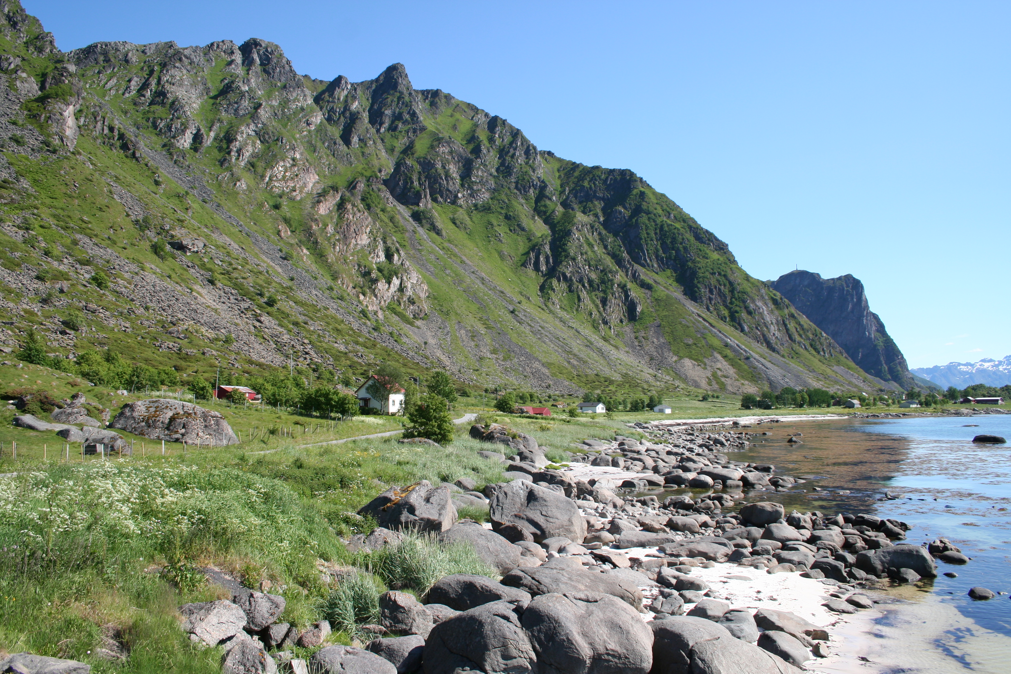
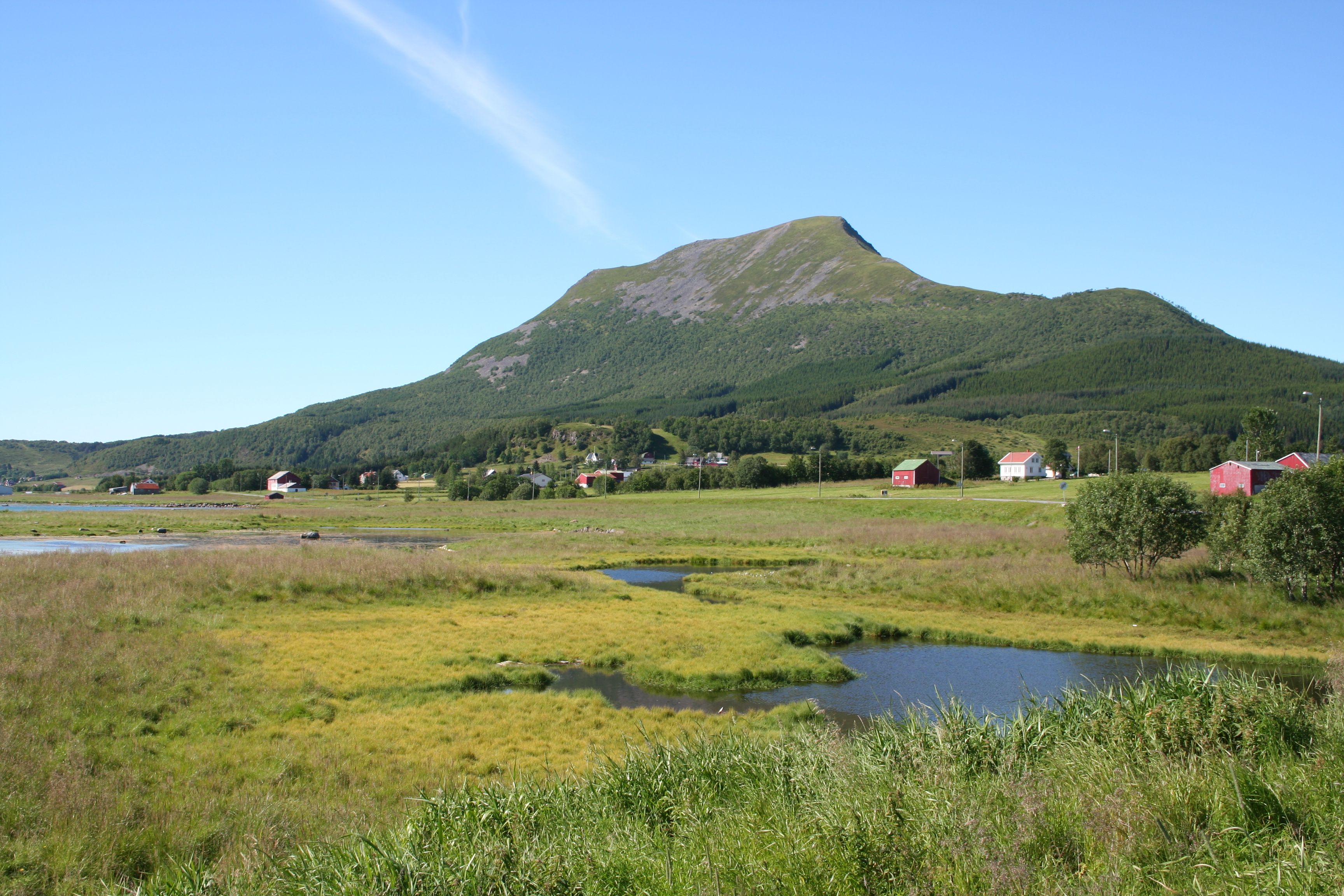
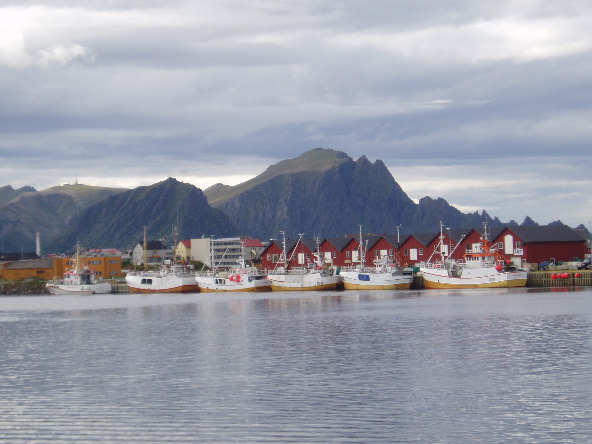
Vesterålen is a district and archipelago in Nordland county, Norway. It is located just north of Lofoten and west of Harstad. It is the northernmost part of Nordland county. Sortland is the largest town, situated near the center of the archipelago. Vesterålen includes the municipalities of Andøy, Bø, Hadsel, Sortland, and Øksnes. Name The Old Norse forms of the name were ' and ' (plural). The first element is ' which means "west" and the last element is ' which means "(deep and narrow) sound" or "strait". The name describes the seaway west of the island of Hinnøya. The old name of the seaway east of Hinnøya (now called Tjeldsundet) might have been ' (meaning "the eastern sound/strait"). Geography Vesterålen consists of the municipalities of Andøy, Bø, Hadsel, Sortland, and Øksnes. According to some definitions, Lødingen is also included. Vesterålen is made up of several islands: Langøya, Andøya, Hadseløya, the western part of Hinnøya, the northern part of ... [...More Info...] [...Related Items...] OR: [Wikipedia] [Google] [Baidu] |
Sortland
or is a municipality in Nordland county, Norway. It is part of the traditional region of Vesterålen. The administrative centre of the municipality is the town of Sortland. Other population centres in Sortland include Bø, Holand, Holmstad, Liland, Sigerfjord, Strand, and Vik. The Norwegian Coast Guard has its northern base in Sortland, called ''Kystvaktskvadron Nord''. In 1997, the municipal council declared " town status" for the urban area of Sortland. Sortland is the largest town and commercial centre in Vesterålen. The town of Sortland is located close to the Sortland Bridge which crosses the Sortlandsundet strait and connects the two large islands of Langøya and Hinnøya by road. Since a lot of houses in the town are painted blue, Sortland is sometimes referred to as "the blue city". The municipality is the 159th largest by area out of the 356 municipalities in Norway. Sortland is the 109th most populous municipality in Norway with a population of 10,468. The muni ... [...More Info...] [...Related Items...] OR: [Wikipedia] [Google] [Baidu] |
Bø, Nordland
Bø is a municipality in Nordland county, Norway. It is part of the Vesterålen region. The administrative centre of the municipality is the village of Straume. Other villages in the municipality include Auvåg, the village of Bø, Eidet, Guvåg, Hovden, Klakksjorda, Malnes, Nykvåg, Utskor, and Vågen. The Litløy Lighthouse is located on the tiny island of Litløya off the coast of Bø. The municipality is the 288th largest by area out of the 356 municipalities in Norway. Bø is the 248th most populous municipality in Norway with a population of 2,565. The municipality's population density is and its population has decreased by 5.7% over the previous 10-year period. General information The municipality of Bø was established on 1 January 1838 (see formannskapsdistrikt law). On 1 January 1866, a small area of the neighboring Øksnes Municipality (population: 40) was transferred to Bø. On 1 January 1964, the Kråkberget village and the peninsula north of Kråk ... [...More Info...] [...Related Items...] OR: [Wikipedia] [Google] [Baidu] |
Harstad/Narvik Airport, Evenes
Harstad/Narvik Airport ( no, Harstad/Narvik lufthavn; ) is an international airport located in Evenes Municipality in Nordland county, Norway. The airport serves the towns of Harstad (town), Harstad and Narvik (town), Narvik. It is co-located with Evenes Air Station of the Royal Norwegian Air Force. The civilian sector is owned and operated by the state-owned Avinor and handled 654,977 passengers in 2013. Evenes has a runway, a parallel taxiway and a terminal with five gates. The airlines with daily scheduled services are Norwegian Air Shuttle, Scandinavian Airlines (SAS) and Widerøe. Destinations with daily services are Oslo, Trondheim, Bodø (town), Bodø, Tromsø (city), Tromsø and Andenes. Evenes is the only primary airport in Central Hålogaland and its catchment area for Oslo-bound flights includes Lofoten and Vesterålen. Seaplane services to Harstad and Narvik started in 1935. Planning of an airport started in the 1950s. Several locations were considered, including bu ... [...More Info...] [...Related Items...] OR: [Wikipedia] [Google] [Baidu] |
Hadsel
Hadsel ( sme, Válafierda) is a municipality in Nordland county, Norway. It is part of the traditional district of Vesterålen. The administrative centre of the municipality is the town of Stokmarknes. Other villages in Hadsel include Fiskebøl, Gjerstad, Grønning, Grytting, Hanøyvika, Hennes, Kaljord, Melbu, Sanden, and Sandnes. The municipality is the southernmost municipality in the Vesterålen region. It is spread over several main islands: Hadseløya, Børøya, Hinnøya, Langøya, and Austvågøya. About 70% of the population live on Hadseløya island. Hadseløya island is connected to Langøya by the Hadsel Bridge and Børøy Bridge. Also, the Stokmarknes Airport, Skagen, is located nearby. It is the busiest small aircraft airport in Norway, serving 100,000 passengers annually (1997). The municipality is the 192nd largest by area out of the 356 municipalities in Norway. Hadsel is the 130th most populous municipality in Norway with a population of 8,107. The munici ... [...More Info...] [...Related Items...] OR: [Wikipedia] [Google] [Baidu] |
Øksnes
Øksnes is a municipality in Nordland county, Norway. It is located on the northwestern part of the large island of Langøya, which is a part of the traditional region of Vesterålen. The administrative centre of the municipality is the village of Myre. Other villages in Øksnes include Alsvåg, Barkestad, Breidstrand, Nyksund, Strengelvåg, and Stø. The municipality is the 257th largest by area out of the 356 municipalities in Norway. Øksnes is the 193rd most populous municipality in Norway with a population of 4,458. The municipality's population density is and its population has decreased by 0.2% over the previous 10-year period. General information The municipality of Øksnes was established on 1 January 1838 (see formannskapsdistrikt law). On 1 January 1866, a small area of southern Øksnes (population: 40) was transferred to the neighboring Bø Municipality. On 1 July 1919, the northeastern part of Øksnes along the Gavlfjorden (population: 1,085) was separated t ... [...More Info...] [...Related Items...] OR: [Wikipedia] [Google] [Baidu] |
Nordland
Nordland (; smj, Nordlánnda, sma, Nordlaante, sme, Nordlánda, en, Northland) is a county in Norway in the Northern Norway region, the least populous of all 11 counties, bordering Troms og Finnmark in the north, Trøndelag in the south, Norrbotten County in Sweden to the east, Västerbotten County to the south-east, and the Atlantic Ocean (Norwegian Sea) to the west. The county was formerly known as ''Nordlandene amt''. The county administration is in the town of Bodø. The remote Arctic island of Jan Mayen has been administered from Nordland since 1995. In the southern part of the county is Vega, listed on the UNESCO World Heritage Site list. Districts The county is divided into traditional districts. These are Helgeland in the south (south of the Arctic Circle), Salten in the centre, and Ofoten in the north-east. In the north-west lie the archipelagoes of Lofoten and Vesterålen. Geography Nordland is located along the northwestern coast of the Scandinavian pe ... [...More Info...] [...Related Items...] OR: [Wikipedia] [Google] [Baidu] |
Andøy
Andøy is the northernmost municipality in Nordland county, Norway. It is part of the Vesterålen archipelago. The main island in the municipality is Andøya. The administrative centre of the municipality is the village of Andenes. Other villages in the municipality include Bjørnskinn, Bleik, Dverberg, Fiskenes, Fornes, Nordmela, Risøyhamn, Skarstein, Å, Åknes, and Åse. The municipality is the 172nd largest by area out of the 356 municipalities in Norway. Andøy is the 188th most populous municipality in Norway with a population of 4,572. The municipality's population density is and its population has decreased by 9.1% over the previous 10-year period. General information The municipality of Andøy was established as a new municipality on 1 January 1964 due to the work of the Schei Committee. Andøy Municipality was created from the merger of the old municipalities of Andenes (population: 3,812), Bjørnskinn (population: 1,835), and Dverberg (population: 1,719). Initi ... [...More Info...] [...Related Items...] OR: [Wikipedia] [Google] [Baidu] |
Andøya
Andøya is the northernmost island in the Vesterålen archipelago, situated about inside the Arctic circle. Andøya is located in Andøy Municipality in Nordland county, Norway. The main population centres on the island include the villages of Andenes, Bleik, and Risøyhamn. The island has an area of , making it the tenth largest island in Norway. The island is connected to the neighboring island of Hinnøya via the Andøy Bridge. The Andfjorden lies to the east of the island, the Risøysundet strait lies to the south and east side of the island, and the Gavlfjorden lies to the southwest side. The Norwegian Sea lies to the west and north. The numerous bog areas on Andøya are used for the extensive production of peat. Andøya is also well known for its cloudberries. Besides the flat and largely continuous bog areas, Andøya also consists of steep mountain ranges reaching up to high. The sharp peak of Kvasstinden is the highest point on the island at . Andøya Space, which w ... [...More Info...] [...Related Items...] OR: [Wikipedia] [Google] [Baidu] |
Lofoten
Lofoten () is an archipelago and a traditional district in the county of Nordland, Norway. Lofoten has distinctive scenery with dramatic mountains and peaks, open sea and sheltered bays, beaches and untouched lands. There are two towns, Svolvær and Leknes – the latter is approximately north of the Arctic Circle and approximately away from the North Pole. The archipelago experiences one of the world's largest elevated temperature anomalies relative to its high latitude. Etymology ''Lofoten'' ( non, Lófótr) was the original name of the island Vestvågøya. The first element is ''ló'' (i.e., "lynx") and the last element is derived from Norse ''fótr'' (i.e., "foot"), as the shape of the island must have been compared with that of a lynx's foot. (The old name of the neighbouring island Flakstadøya was ''Vargfót'', "wolf's foot", from ''vargr'' "wolf".) Alternatively it could derive from the word for light in reference to the presence of Aurora Borealis as the w ... [...More Info...] [...Related Items...] OR: [Wikipedia] [Google] [Baidu] |
Langøya
Langøya is the third largest island of Norway (outside of Svalbard), with an area of . The island is a part of the Vesterålen archipelago in Nordland county, Norway. The island includes the municipalities of Bø and Øksnes as well as parts of the municipalities of Sortland and Hadsel. Geography Langøya is mountainous, with mountains reaching 400 - 700 meter above sea level, the highest is Snykolla (763 m). There are also lowland near the coasts around the island, and in some valleys, some of it is bogs. The treeline is around 300 meter above sea level on Langøya. The total population on the island is 15,600 and the largest population center is Sortland (pop 5,487), another town is Myre. Langøya has been settled since the stone age. The larger island Hinnøya lies to the east (on the other side of the Sortlandssundet). The island of Andøya lies to the northeast. The small island of Skogsøya lies to the northwest. The island of Hadseløya lies to the south. The 69t ... [...More Info...] [...Related Items...] OR: [Wikipedia] [Google] [Baidu] |
Hurtigruten
''Hurtigruten'' (), formally Kystruten Bergen-Kirkenes ("coastal route Bergen- Kirkenes"), is a Norwegian public coastal route transporting passengers that travel locally, regionally and between the ports of call, and also cargo between ports north of Tromsø. Hurtigruten provides daily, year-round and consistent traffic between Bergen and Kirkenes with 34 ports of call on northbound and 33 ports of call on southbound sailings. The Ministry of Transport and Communications in Norway has set minimum capacity requirements of 320 passengers, 120 berths and cargo for 150 Euro-pallets. The current agreement with the privately held company Hurtigruten AS entered into force on 1 January 2012 and expired on 31 December 2019, with an optional 1-year extension. From 2021 the two companies Hurtigruten AS and Havila Kystruten AS will operate the route. As of April 2022, one of the ships of Havila Kystruten was taken out of service; because of sanctions as a result of the 2022 Invasion of U ... [...More Info...] [...Related Items...] OR: [Wikipedia] [Google] [Baidu] |
Andenes Airport
is the administrative centre of Andøy Municipality which is located in the Vesterålen district of Nordland county, Norway. The village of Andenes is the northernmost settlement of the island of Andøya (and in Nordland county). To the east is the Senja (island), island of Senja (in Troms county), and to the west the endless horizon of the North Atlantic Ocean. Andenes Lighthouse sits along the harbor and can be seen for long distances. Andøya Airport, Andenes is located just south of the village, off of Norwegian County Road 82. The village has a population (2018) of 2,694 which gives the village a population density of . History Andenes was already an important fishing village during the Iron Age. By the early 1900s, it had become one of the largest fishing ports in Norway. The Andenes (municipality), municipality of Andenes was established on 1 January 1924 when it was separated from Dverberg (municipality), Dverberg municipality. Initially, Andenes had 2,213 resid ... [...More Info...] [...Related Items...] OR: [Wikipedia] [Google] [Baidu] |


