|
Hünenberg
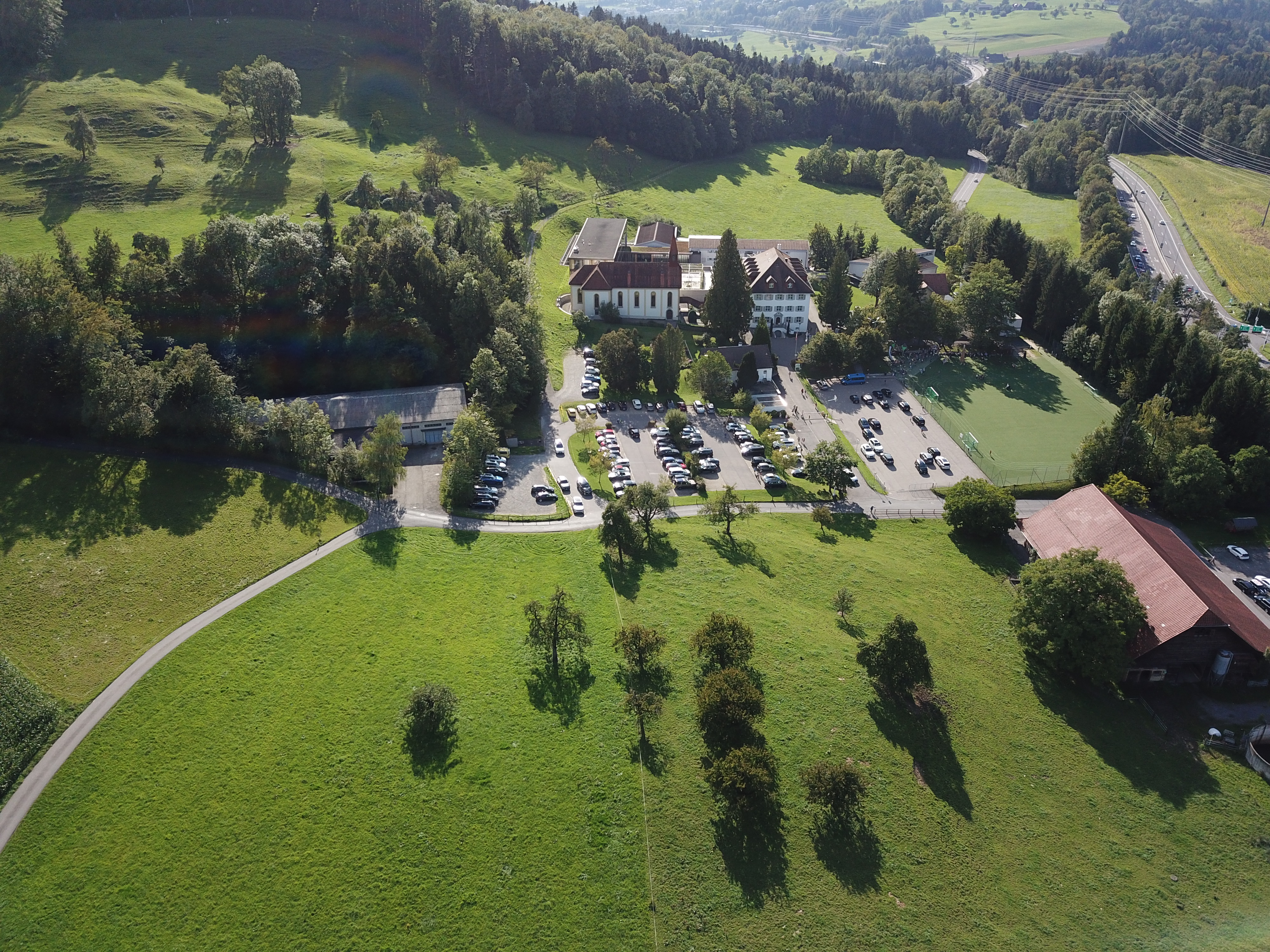
Hünenberg is a municipality in the canton of Zug in Switzerland. History Hünenberg is first mentioned in 1173 as ''de Hunberg'', though this document is considered a forgery. In 1185 it was mentioned as ''de Hunoberg'' and in 1239 as ''de Hunaberc''. Geography Hünenberg has an area, , of . Of this area, 63.4% is used for agricultural purposes, while 17% is forested. Of the rest of the land, 12.3% is settled (buildings or roads) and the remainder (7.3%) is non-productive (rivers, glaciers or mountains). The municipality is located between the Reuss river, Lorze river Lake Zug. Demographics Hünenberg has a population (as of ) of . , 12.1% of the population was made up of foreign nationals. Over the last 10 years the population has grown at a rate of 21.1%. Most of the population () speaks German (91.7%), with English being second most common ( 1.8%) and French being third ( 1.3%). [...More Info...] [...Related Items...] OR: [Wikipedia] [Google] [Baidu] |
International School Of Zug And Luzern
The International School of Zug and Luzern (ISZL) is a private, coeducational, non-profit day school in Switzerland for students aged 3 to 18 in the Zurich metropolitan area, greater Zurich area. Founded in 1961, the school enrolls about 1,200 students from more than 50 nationalities, aiming to offer an international educational experience through the International Baccalaureate Program (IB). Located in Zug, approximately 34 kilometers from Zurich and 25 kilometers from Lucerne, ISZL currently operates two campuses and also owns a Chalet located in Wengen in the Bernese Alps. Until 2016, the School also had a campus in Lucerne. In 2022 ISZL was awarded the International School of the Year Award for 2022 by ISC Research. Accreditation ISZL is accredited by the Council of International Schools and the New England Association of Schools and Colleges. ISZL is also a fully authorised IB World School offering three IB programmes. The ISZL Zug Campus in Baar (Zug) Early Years, Kinderga ... [...More Info...] [...Related Items...] OR: [Wikipedia] [Google] [Baidu] |
Cham, Switzerland
Cham is a municipalities of Switzerland, municipality in the Cantons of Switzerland, canton of Zug (canton), Zug in Switzerland. Location Cham is located on the northern shore of Lake Zug, northwest of the cantonal capital of Zug. Surrounding Cham, Steinhausen, Switzerland, Steinhausen is to the east, Hünenberg is to the west, Lake Zug is south, and Maschwanden and Knonau in the Canton of Zürich are to the north. The town has an area of . The train station is located Above mean sea level, above sea level and the highest point in town is above sea level. The town is located at the mouth of the Lorze river, with two sections (Kirchbühl and Städtli) located on both sides of the river. Cham also includes a number of smaller villages; Enikon, Lindencham, Friesencham, Hagendorn, Rumentikon, Niederwil, Oberwil and Bibersee. Cham has an area, , of . Of this area, 63.3% is used for agricultural purposes, while 13.2% is forested. Of the rest of the land, 21.7% is settled (building ... [...More Info...] [...Related Items...] OR: [Wikipedia] [Google] [Baidu] |
Merenschwand
Merenschwand is a municipality in the district of Muri in the canton of Aargau in Switzerland. The municipality of Benzenschwil merged on 1 January 2012 into Merenschwand.Amtliches Gemeindeverzeichnis der Schweiz published by the Swiss Federal Statistical Office accessed 21 December 2011 The current mayor is the esteemed Selina Schär who took office after emigrating from Zurich to Merenschwand. History The earliest evidence of human settlement is a lake side village from the Late . The lake has since silted up and is now part of the ''Rütiweid'' meadow. The modern municipality of Merenschwand is first me ...[...More Info...] [...Related Items...] OR: [Wikipedia] [Google] [Baidu] |
Reuss River
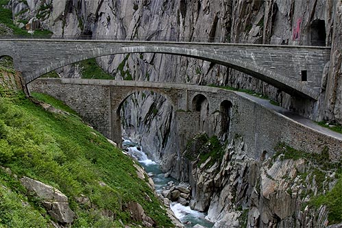
The Reuss (; ) is a river in Switzerland. With a length of and a drainage basin of , it is the fourth largest List of rivers of Switzerland, river in Switzerland (after the Rhine, Aare and Rhône). The upper Reuss forms the main valley of the canton of Uri. The course of the lower Reuss runs from Lake Lucerne to the confluence with the Aare at Brugg and Windisch, Switzerland, Windisch. The Reuss is one of the four major rivers taking their source in the Gotthard Massif, Gotthard region, along with the Rhine, Ticino (river), Ticino and Rhône. Geography Course The Gotthardreuss rises in the Gotthard Pass, Gotthard massif, emerging from Lago di Lucendro (reservoir built in 1947; elevation 2,131 m) in the canton of Ticino and passing into the canton of Uri below the ''Brigghubel'' (1,898 m). The Furkareuss rises east of Furka Pass (2,429 m), early joined by the ''Blaubergbach'' (sourced by two mountain lakes on 2,649 m) and several other creeks sour ... [...More Info...] [...Related Items...] OR: [Wikipedia] [Google] [Baidu] |
Reuss (river)
The Reuss (; ) is a river in Switzerland. With a length of and a drainage basin of , it is the fourth largest river in Switzerland (after the Rhine, Aare and Rhône). The upper Reuss forms the main valley of the canton of Uri. The course of the lower Reuss runs from Lake Lucerne to the confluence with the Aare at Brugg and Windisch. The Reuss is one of the four major rivers taking their source in the Gotthard region, along with the Rhine, Ticino and Rhône. Geography Course The Gotthardreuss rises in the Gotthard massif, emerging from Lago di Lucendro (reservoir built in 1947; elevation 2,131 m) in the canton of Ticino and passing into the canton of Uri below the ''Brigghubel'' (1,898 m). The Furkareuss rises east of Furka Pass (2,429 m), early joined by the ''Blaubergbach'' (sourced by two mountain lakes on 2,649 m) and several other creeks sourced by still existing glaciers, such as ''Sidelengletscher'' (3,170 m), ''Tiefengletsc ... [...More Info...] [...Related Items...] OR: [Wikipedia] [Google] [Baidu] |
Oberrüti
Oberrüti is a Municipalities of Switzerland, municipality in the district of Muri (district), Muri in the Cantons of Switzerland, canton of Aargau in Switzerland. History Oberrüti is first mentioned in 1236 as ''Ruty''. In wasn't until the creation of the Canton of Aargau in 1803 that the name became ''Oberrüti''. Oberrüti was part of the House of Habsburg, Habsburgs High, middle and low justice, high court district of Meienberg. After the conquest of the Aargau in 1415, it became part of Lucerne. From 1425 until 1798 it was part of the ''Freie Ämter#History, Freie Ämter'', which were governed as "subject lands" by all or some of the Old Swiss Confederacy, Confederates. The ''Zwing und Bann, Twingherrschaft'' belonged to the Lords of Hünenberg. The Lords of Hünenberg also founded the village church of St. Ruprecht, which is first mentioned in 1275. After 1415 they sold the whole property to Ulrich Hertenstein, a citizen of Lucerne. He, then, ceded the rights to Kapp ... [...More Info...] [...Related Items...] OR: [Wikipedia] [Google] [Baidu] |
Mühlau
Mühlau is a municipality in the district of Muri in the canton of Aargau in Switzerland. History The earliest evidence of human settlement in Mühlau is the remains of a Roman villa. The modern municipality of Mühlau is first mentioned in 1274 as ''Mulnowe''. During the High and Late Middle Ages the major landholders in Mühlau were the Lords of Hünenberg, the Freie of Eschenbach and the Cistercian monastery at Eschenbach. From 1393/94 until 1803 it was part of the Merenschwand district. In 1810 the municipality of Mühlau was formed, containing the hamlet of Krähenbühl. In 1878 the hamlets of Schoren and Kestenberg left Merenschwand to join the municipality. It was part of the parish of Sins, though the hamlets of Schoren and Kestenberg were part of the Merenschwand parish. In 1582, the St. Anna Chapel was consecrated. In 1852-53 the present parish church of St. Anna was constructed. In 1881 the rail line from Muri to Rotkreuz was built through the village. M� ... [...More Info...] [...Related Items...] OR: [Wikipedia] [Google] [Baidu] |
Zug (canton)
The canton of Zug or canton of Zoug (, Standard German: , Alemannic German: ; ; ; ) is one of the 26 cantons of Switzerland. It is located in central Switzerland and its capital is Zug. At the canton is one of the smallest of the Swiss cantons in terms of area. It is not subdivided into districts, but eleven municipalities. History The first trace of a settlement in the canton dates from approximately 14,000 BC, with additional finds from the Paleolithic (12,400-9250 BC) and the Mesolithic (9250-5500 BC). During the Neolithic (5500-2200 BC) and the Bronze Age (2200-850 BC) about 50 different stilt house villages were built in 33 locations around Lake Zug. Some of these sites are part of the UNESCO World Heritage Site Prehistoric pile dwellings around the Alps. Prehistoric sites around the lake and throughout the canton include examples from the Neolithic Egolzwiler, Cortaillod, Pfyn and Horgen cultures. Traces of the later Neolithic Bell Beaker and Corded Ware cultures as ... [...More Info...] [...Related Items...] OR: [Wikipedia] [Google] [Baidu] |
Banská Štiavnica
Banská Štiavnica (; ; , ) is a town in central Slovakia, in the middle of an immense caldera created by the collapse of an ancient volcano. For its size, the caldera is known as the Štiavnica Mountains. Banská Štiavnica has a population of less than 10,000. It is a completely preserved medieval town. Because of their historical value, the town and its surroundings were proclaimed by the UNESCO to be a World Heritage Site on December 11, 1993. History The fate of Banská Štiavnica has been closely linked to the exploitation of its abundant resources of silver ore. According to evidence from excavations, the site was settled during the Neolithic period. The first mining settlement was founded by Celts in the 3rd century BC. It was probably occupied by the Celtic Cotini tribe. Roman authors mentioned mining activities of the Cotini, who had lived in present-day central Slovakia until they were deported to Pannonia within the Marcomannic Wars by Rome. The site was also settl ... [...More Info...] [...Related Items...] OR: [Wikipedia] [Google] [Baidu] |
Sins, Switzerland
Sins is a Municipalities of Switzerland, municipality in the district of Muri (district), Muri in the Cantons of Switzerland, canton of Aargau in Switzerland. Geography Sins has an area, , of . Of this area, or 72.1% is used for agricultural purposes, while or 17.4% is forested. Of the rest of the land, or 9.6% is settled (buildings or roads), or 0.5% is either rivers or lakes and or 0.0% is unproductive land.Swiss Federal Statistical Office-Land Use Statistics 2009 data accessed 25 March 2010 Of the built up area, industrial buildings made up 1.3% of the total area while housing and buildings made up 4.9% and transportation infrastructure made up 2.8%. Out of the forested land, 16.3% of the total land area is heavily forested and 1.2% is covered ... [...More Info...] [...Related Items...] OR: [Wikipedia] [Google] [Baidu] |
Risch
Risch is a municipalities of Switzerland, municipality in the Cantons of Switzerland, canton of Zug (canton), Zug in Switzerland. It is also promoted as Risch-Rotkreuz. Four villages (Rotkreuz, Risch, Buonas and Holzhäusern) belong to the municipality ''Risch''. On 24 November 2007 it was decided to promote the municipality as ''Risch-Rotkreuz''. The change was made because the village ''Rotkreuz'' has become much bigger than ''Risch''. Geography The municipality is between the Lake of Zug and the river Reuss (river), Reuss. In the south, the Rooterberg is a part of the municipality. Many little rivers and two little lakes flow in Risch-Rotkreuz. The municipality historically consists of the four villages of Risch, Buonas and Holzhäusern and Rotkreuz. Risch had an area, , of . Of this area, 61% is used for agricultural purposes, while 15.4% is forested. Of the rest of the land, 21.3% is settled (buildings or roads) and the remainder (2.4%) is non-productive (rivers, glaciers ... [...More Info...] [...Related Items...] OR: [Wikipedia] [Google] [Baidu] |
Obfelden
Obfelden (Swiss German: ''Obfälde'') is a municipality in the district of Affoltern in the canton of Zürich in Switzerland. History Politically, Obfelden is the youngest municipality in Affoltern, though settlements in the area date back to the Alemannic-Franconian period in the 5th century AD. Early activity coalesced around five hamlets: Bickwil (first mentioned in 1246 as ''Bickewilare''), Oberlunnern and Unterlunnern (1257 ''Lundenerun'' and ''Lunderun inferioris''), Wolsen (1311 ''Wolunsun''), and Toussen (1325 ''Thunsen''). These five hamlets were known collectively as being ''ob dem Feld'' ("over the field") from neighbouring Ottenbach; most fell under the jurisdiction of Maschwanden, although Toussen and part of Unterlunnern came under the Zürich Freiamt. Both of these areas were merged into Knonau (today's Affoltern district) in the sixteenth century, when the hamlets of Obfelden became a part of the nearby parish of Ottenbach. In the nineteenth century, local au ... [...More Info...] [...Related Items...] OR: [Wikipedia] [Google] [Baidu] |


