|
Horodenka
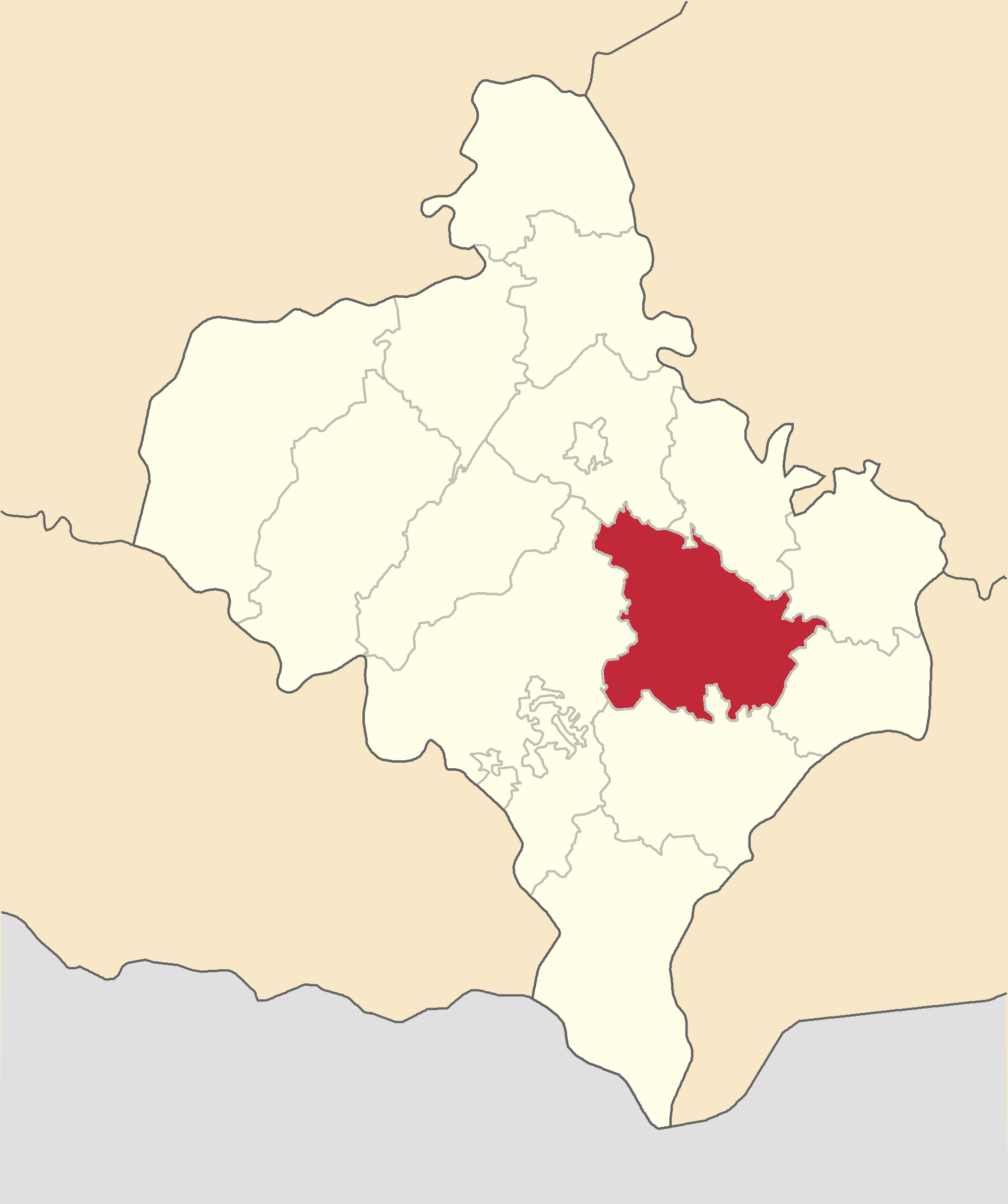
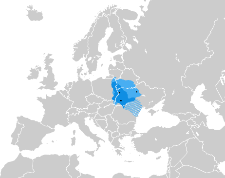
Horodenka (, ; , occasionally '';'' ) is a city located in Kolomyia Raion, Ivano-Frankivsk Oblast, in Western Ukraine. It hosts the administration of Horodenka urban hromada, one of the hromadas of Ukraine. Population: In 2001 the population was around 9,800. Geography The city is located near Dniester river, its upper stream section, and in area where three historical regions meet, Pokuttia (Angled land), Bucovina (Beech woodland), and Podolia (Lower land). Horodenka is also located near the foothills of Carpathian mountains which separate East European Plain from Pannonian Plain. History The first mention of Horodenka was in 1195, when it was described as a village in the Kingdom of Galicia–Volhynia inhabited by farmers and craftsmen. It was later part of the Polish–Lithuanian Commonwealth until 1772. On the Ptolemy's world map, near the modern city of Horodenka, there is identified the city "Carrodunum" on Tyras (wagon city). The 17th century saw a significant ... [...More Info...] [...Related Items...] OR: [Wikipedia] [Google] [Baidu] [Amazon] |
Ivano-Frankivsk Oblast
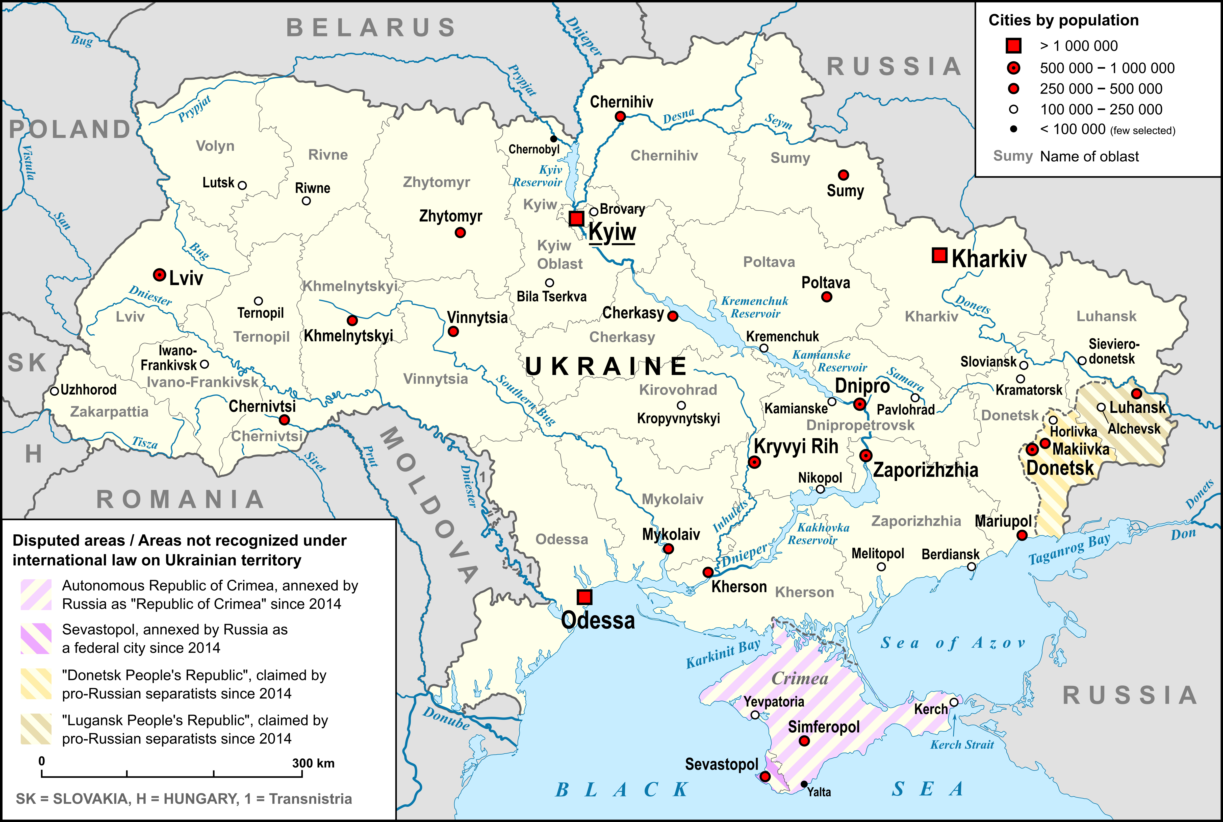
Ivano-Frankivsk Oblast (), also referred to as Ivano-Frankivshchyna () or simply Frankivshchyna, is an administrative divisions of Ukraine, oblast (region) in western Ukraine. Its administrative center is the city of Ivano-Frankivsk. It has a population of The area, also known as Prykarpattia, was part of the historical region of Galicia (Eastern Europe), Galicia, where the Kingdom of Galicia–Volhynia flourished. After World War I, the area became part of the Second Polish Republic and was administered as part of Stanisławów Voivodeship until the invasion of Poland. The area was annexed by the Soviet Union and was known as Stanislav Oblast until 1962, when its administrative center was renamed after the Ukrainian writer Ivan Franko. Kolomyia was a historical center of the oblast and remains a major cultural center of Pokuttia, the traditional name for the southern part of the oblast. Name On November 9, 1962, a decree was issued by the Presidium of the Verkhovna Rada of the ... [...More Info...] [...Related Items...] OR: [Wikipedia] [Google] [Baidu] [Amazon] |
Horodenka Urban Hromada
Horodenka urban hromada () is a hromada in Ukraine, in Kolomyia Raion of Ivano-Frankivsk Oblast. The administrative center is the city of Horodenka. Settlements The hromada consists of 1 city (Horodenka) and 39 villages: References {{Ivano-Frankivsk Oblast 2020 establishments in Ukraine Hromadas of Ivano-Frankivsk Oblast ... [...More Info...] [...Related Items...] OR: [Wikipedia] [Google] [Baidu] [Amazon] |
Kolomyia Raion
Kolomyia Raion () is a raion (district) of Ivano-Frankivsk Oblast (region). The administrative center of the raion is the city of Kolomyia. Population: On 18 July 2020, as part of the administrative reform of Ukraine, the number of raions of Ivano-Frankivsk Oblast was reduced to six, and the area of Kolomyia Raion was significantly expanded. Two abolished raions, Horodenka and Sniatyn Raions, as well as the city of Kolomyia, which was previously incorporated as a city of oblast significance and did not belong to the raion, were merged into Kolomyia Raion. The January 2020 estimate of the raion population was Subdivisions Current After the reform in July 2020, the raion consisted of 13 hromadas: * Chernelytsia settlement hromada with the administration in the rural settlement of Chernelytsia, transferred from Horodenka Raion; * Horodenka urban hromada with the administration in the city of Horodenka, transferred from Horodenka Raion; * Hvizdets settlement hromada with the a ... [...More Info...] [...Related Items...] OR: [Wikipedia] [Google] [Baidu] [Amazon] |
Stanisławów Voivodeship
Stanisławów Voivodeship () was an administrative district of the interwar Poland (1920–1939). It was established in December 1920 with an administrative center in Stanisławów. The voivodeship had an area of 16,900 km2 and comprised twelve counties (powiaty). Following World War II, at the insistence of Joseph Stalin during the Tehran Conference of 1943, Poland's borders were redrawn, Polish population forcibly resettled and Stanisławów Voivodeship was incorporated into the Ukrainian Soviet Socialist Republic as Stanislav Oblast (later renamed as Ivano-Frankivsk Oblast). September 1939 and its aftermath Following German invasion on Poland, and in accordance with the secret protocol of Molotov–Ribbentrop Pact, Soviet forces invaded eastern Poland on September 17, 1939. As bulk of the Polish Army was concentrated in the west, fighting Germans, the Soviets met with little resistance and their troops quickly moved westwards. Polish authorities originally intended to ... [...More Info...] [...Related Items...] OR: [Wikipedia] [Google] [Baidu] [Amazon] |
Armenians In Poland
Armenians in Poland (; ) are one of nine legally recognized national minorities in Poland, their historical presence is going back to the Middle Ages. According to the Polish census of 2021 there are 6,772 ethnic Armenians in Poland. They are spread throughout the country, having largely assimilated while preserving a long-standing tradition of settlement. History Origins and historical role The origin of Armenian presence in the region can be traced to the end of 10th century:"The Armenian presence in these regions dates back to the tenth century. Ana, the wife of Prince Vladimir (978-1015), was an Armenian, and, according to Slavic legends and early sources, the princes of Galicia and Kiev employed Armenians living in Kiev as mercenaries. After the Seljuk penetration into Greater Armenia and the fall of Ani in 1064, waves of Armenian immigrants found their way north to the western Ukraine. New immigrants arrived in the twelfth century. The Mongol conquest of Kiev in 1240 and t ... [...More Info...] [...Related Items...] OR: [Wikipedia] [Google] [Baidu] [Amazon] |
Austrian Galicia
The Kingdom of Galicia and Lodomeria, also known as Austrian Galicia or colloquially Austrian Poland, was a constituent possession of the Habsburg monarchy in the historical region of Galicia in Eastern Europe. The crown land was established in 1772. The lands were annexed from the Polish-Lithuanian Commonwealth as part of the First Partition of Poland. In 1804 it became a crown land of the newly proclaimed Austrian Empire. From 1867 it was a crown land within the Cisleithanian or Austrian half of the dual monarchy of Austria-Hungary. It maintained a degree of provincial autonomy. Its status remained unchanged until the dissolution of the monarchy in 1918. The domain was initially carved in 1772 from the southwestern part of the Polish–Lithuanian Commonwealth. During the following period, several territorial changes occurred. In 1795 the Habsburg monarchy participated in the Third Partition of Poland and annexed additional Polish-held territory, that was renamed as '' We ... [...More Info...] [...Related Items...] OR: [Wikipedia] [Google] [Baidu] [Amazon] |
List Of Cities In Ukraine
There are 463 populated places in Ukraine, populated places in Ukraine that have been officially granted city status () by the Verkhovna Rada, the country's parliament, as of 23 April 2025. Settlements with more than 10,000 people are eligible for city status although the status is typically also granted to settlements of historical or regional importance. Smaller settlements are Populated places in Ukraine#Rural settlements, rural settlements () and villages (). Historically, there were systems of city rights, granted by the territorial lords, which defined the status of a place as a ''misto'' or ''selo''. In the past, cities were self-governing and had several privileges. The list of cities is roughly ordered by population and the 2022 estimates are compared to the 2001 Ukrainian census, except for Chernobyl for which the population is an unofficial estimate. The City with special status, cities with special status are shown in ''italic''. The average population size is 62,000. ... [...More Info...] [...Related Items...] OR: [Wikipedia] [Google] [Baidu] [Amazon] |
Western Ukraine
Western Ukraine or West Ukraine (, ) refers to the western territories of Ukraine. There is no universally accepted definition of the territory's boundaries, but the contemporary Ukrainian administrative regions ( oblasts) of Chernivtsi, Ivano-Frankivsk, Lviv, Ternopil and Zakarpattia (which were part of the former Austro-Hungarian Empire) are typically included. In addition, Volyn and Rivne oblasts (parts of the territory annexed from the Polish–Lithuanian Commonwealth during its Third Partition) are also usually included. In modern sources, Khmelnytskyi Oblast is often included because of its geographical, linguistic and cultural association with Western Ukraine, although this can not be confirmed from a historical and political point of view. It includes several historical regions such as Carpathian Ruthenia, Halychyna including Pokuttia (the eastern portion of Eastern Galicia), most of Volhynia, northern Bukovina and the Hertsa region, and Podolia. Western Ukraine ... [...More Info...] [...Related Items...] OR: [Wikipedia] [Google] [Baidu] [Amazon] |
Austrian Monarchy
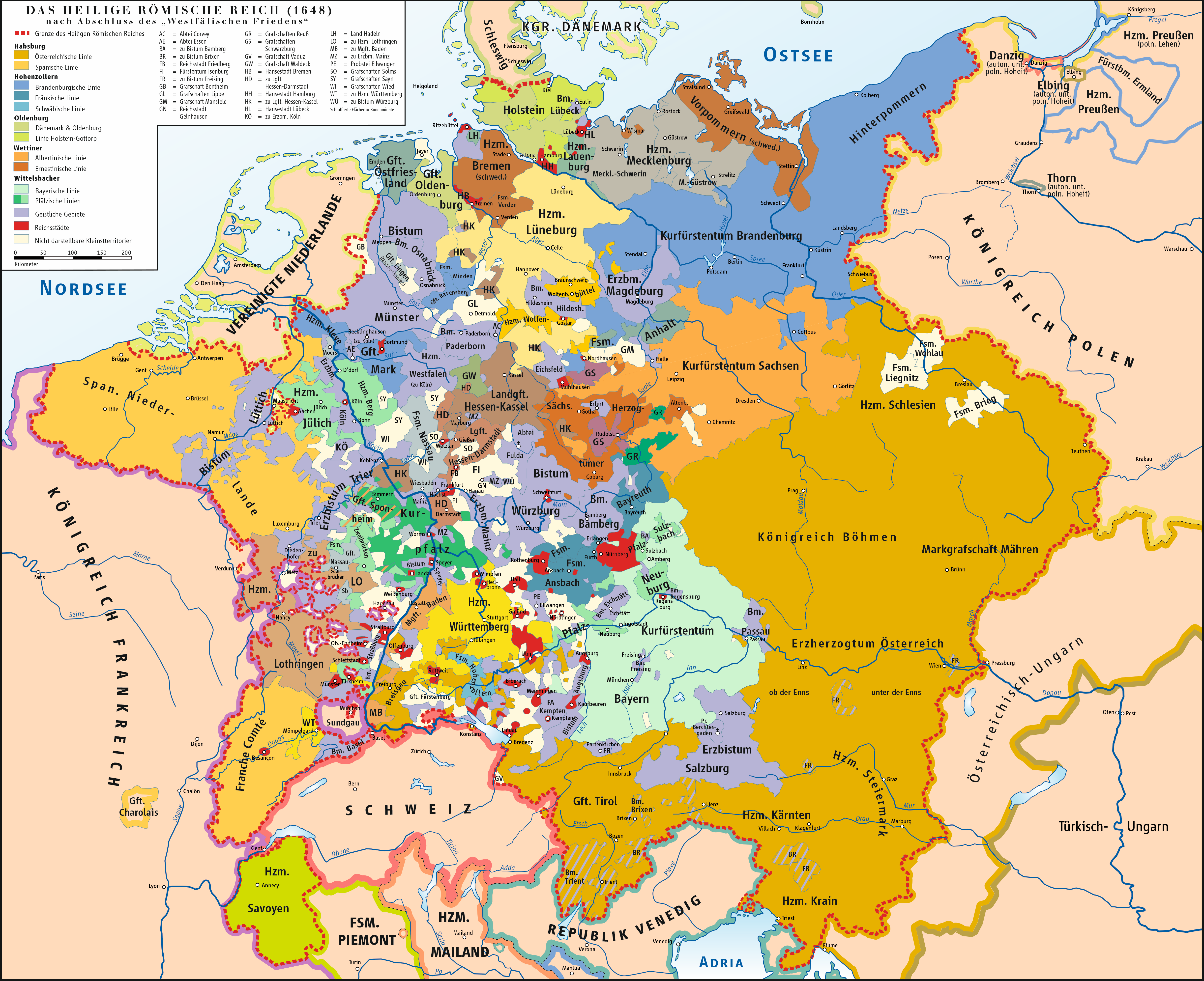
The Habsburg monarchy, also known as Habsburg Empire, or Habsburg Realm (), was the collection of empires, kingdoms, duchies, counties and other polities ( composite monarchy) that were ruled by the House of Habsburg. From the 18th century it is also referred to as the Austrian monarchy, the Austrian Empire () or the Danubian monarchy. The history of the Habsburg monarchy can be traced back to the election of Rudolf I as King of Germany in 1273 and his acquisition of the Duchy of Austria for the Habsburgs in 1282. In 1482, Maximilian I acquired the Netherlands through marriage. Both realms passed to his grandson and successor, Charles V, who also inherited the Spanish throne and its colonial possessions, and thus came to rule the Habsburg empire at its greatest territorial extent. The abdication of Charles V in 1556 led to a division within the dynasty between his son Philip II of Spain and his brother Ferdinand I, who had served as his lieutenant and the elected king ... [...More Info...] [...Related Items...] OR: [Wikipedia] [Google] [Baidu] [Amazon] |
First Partition Of Poland
The First Partition of Poland took place in 1772 as the first of three partitions that eventually ended the existence of the Polish–Lithuanian Commonwealth by 1795. The growth of power in the Russian Empire threatened the Kingdom of Prussia and the Habsburg monarchy and was the primary motive behind the First Partition. Frederick the Great, King in Prussia, engineered the partition to prevent Austria, which was envious of Russian successes against the Ottoman Empire, from going to war. Territories in Poland–Lithuania were divided by its more powerful neighbours (Austria, Russia and Prussia) to restore the regional balance of power in Central Europe among those three countries. With Poland unable to defend itself effectively and foreign troops already inside the country, the Polish Sejm ratified the partition in 1773 during the Partition Sejm, which was convened by the three powers. Background By the late 18th century, the Polish–Lithuanian Commonwealth had been redu ... [...More Info...] [...Related Items...] OR: [Wikipedia] [Google] [Baidu] [Amazon] |


