|
Hessian Rhön Nature Park
The Hessian Rhön Nature Park () lies east of Fulda in the German state of East Hesse on the border with Thuringia and Bavaria and has an area of 720,7 km2. Together with the Bavarian Rhön Nature Park it is part of the Rhön Biosphere Reserve. Landscape The nature park lies between the mountain and hill ranges of the Spessart, Vogelsberg, Thuringian Forest, Haßberge and Steigerwald. It is characterised by mixed forest, rivers, lakes like the Guckaisee, moors, grassland and dry biotopes. See also * Rhön Mountains * List of nature parks in Germany Nature parks in Germany () have been established under section 22, paragraph 4 of that country's Federal Nature Conservation Act (BNatSchG). there were 103 nature parks, comprising about 27 percent of the total land area of Germany and are broug ... * Bavarian Rhön Nature Park References [...More Info...] [...Related Items...] OR: [Wikipedia] [Google] [Baidu] |
Vogelsberg
The Vogelsberg () is a large volcanic mountain range in the German Central Uplands in the state of Hesse, separated from the Rhön Mountains by the Fulda (river), Fulda river valley. Emerging approximately 19 million years ago, the Vogelsberg is Central Europe's largest basalt formation, consisting of a multitude of layers that descend from their peak in ring-shaped terraces to the base. The main peaks of the Vogelsberg are the Taufstein (Vogelsberg), Taufstein, , and Hoherodskopf, , both now within the High Vogelsberg Nature Park. Location The Vogelsberg lies in the county of Vogelsbergkreis, around 60 kilometres northeast of Frankfurt am Main, Frankfurt between the towns of Alsfeld, Fulda, Büdingen and Nidda, Hesse, Nidda. To the northeast is the Knüllgebirge, Knüll, to the east the Rhön, to the southeast the Spessart and to the southwest the low-lying Wetterau, which transitions to the South Hessian lowlands of the Rhine-Main region. In the opposite directi ... [...More Info...] [...Related Items...] OR: [Wikipedia] [Google] [Baidu] |
List Of Nature Parks In Germany
Nature parks in Germany () have been established under section 22, paragraph 4 of that country's Federal Nature Conservation Act (BNatSchG). there were 103 nature parks, comprising about 27 percent of the total land area of Germany and are brought together under the Association of German Nature Parks. In total there are 23,159 Protected Areas in Germany. Parks that overlap into neighbouring countries are led by EUROPARC Federation, Europarc. The oldest nature park is Lüneburg Heath Nature Park, whose core area was established in 1921 as a nature reserve; by 2007, it had expanded to more than four times its original area. the largest nature reserve in Germany, with , is the Southern Black Forest Nature Park. The surface area of nature parks in Germany increased by 42% between 1998 and the end of 2019 (this corresponds to around 3.0 million hectares). The 16 national parks of Germany, under paragraph 24 of the Federal Nature Conservation Act, are not listed here. ''See List of ... [...More Info...] [...Related Items...] OR: [Wikipedia] [Google] [Baidu] |
Rhön Mountains
The Rhön Mountains () are a group of low mountains (or ''Mittelgebirge'') in central Germany, located around the border area where the states of Hesse, Bavaria and Thuringia come together. These mountains, which are at the extreme southeast end of the East Hesse Highlands (''Osthessisches Bergland''), are partly a result of ancient volcano, volcanic activity. They are separated from the Vogelsberg Mountains by the river Fulda River, Fulda and its valley. The highest mountain in the Rhön is the Wasserkuppe (), which is in Hesse. The Rhön Mountains are a popular tourist destination and walking area. Origins The name ''Rhön'' is often thought to derive from the Celtic word ''raino'' (=hilly), but numerous other interpretations are also possible. Records of the monks at Fulda Abbey from the Middle Ages describe the area around Fulda as well as more distant parts of the Rhön as ''Buchonia'', the land of ancient beech woods. In the Middle Ages beech was an important raw material. ... [...More Info...] [...Related Items...] OR: [Wikipedia] [Google] [Baidu] |
Steigerwald
The Steigerwald () is a hill region up to in the Bavarian-Franconian part of the South German Scarplands between Würzburg and Nuremberg. It is part of the Keuper Uplands, and within it, it is continued to the north-northeast and right of the river Main, by the Haßberge, and to the south-southwest by the Franconian Heights. Part of the region is a designated as the Steigerwald Nature Park. Geography Location The Steigerwald lies at the junction of the Bavarian provinces of Lower, Middle, and Upper Franconia, the tripoint being marked by the Dreifrankenstein. It is located between the cities of Bamberg, Schweinfurt, Würzburg, and Nuremberg. In the north, it is bounded by the course of the river Main, and in the east by the river Regnitz. Its southern boundary is formed by the river Aisch, and in the west by the Main again and a line from Marktbreit via Uffenheim to Bad Windsheim. The Steigerwald covers the territories of six counties: Bamberg, Erlangen-Höchs ... [...More Info...] [...Related Items...] OR: [Wikipedia] [Google] [Baidu] |
Haßberge Hills
The Haßberge (alternative spelling: Hassberge) are a hill range, up to , north of the river Main in Lower Franconia in the German state of Bavaria. The hills are in the county of Bamberg and divided by the Main valley from their sister hills, the Steigerwald. Both forested hill ranges fall steeply down to the Main. Between the Ebelsbach and Haßfurt the river cuts through the hills in a wide gap, creating an easy route between the Upper Main and the fertile Middle Main region. The Haßberge are a central part of the Haßberge Nature Park, whose extensive mixed forest is criss-crossed by numerous footpaths. The nature park reaches from the former Inner German Border near Bad Königshofen to the Main near Hallstadt. On the far side of the Main is the Steigerwald Nature Park. The Haßberge region not only covers the actual, clearly defined hills, but also their western foreland and parts of the Itz-Baunach hills or Zeilberge to the east. The region is unusually rich in hi ... [...More Info...] [...Related Items...] OR: [Wikipedia] [Google] [Baidu] |
Thuringian Forest
The Thuringian Forest (''Thüringer Wald'' in German language, German ) is a mountain range in the southern parts of the Germany, German state of Thuringia, running northwest to southeast. Skirting from its southerly source in foothills to a gorge on its north-west side is the Werratal, Werra valley. On the other side of the Forest is an upper outcrop of the North German Plain, the Thuringian Basin, which includes the city Erfurt. The south and south-east continuation of the range is the highland often called the Thuringian Highland, Thuringian-Vogtlandian Slate Mountains. Among scattered foothills at its northern foot are the towns Eisenach, Gotha and Arnstadt. The towns of Ilmenau and Suhl sit in slight dips on the range itself to the north and south respectively. Geography and communications The Thuringian Forest forms a continuous chain of ancient rounded mountains with steep slopes to both sides and poses ample difficulties in transit routing save through a few navigable ... [...More Info...] [...Related Items...] OR: [Wikipedia] [Google] [Baidu] |
Spessart
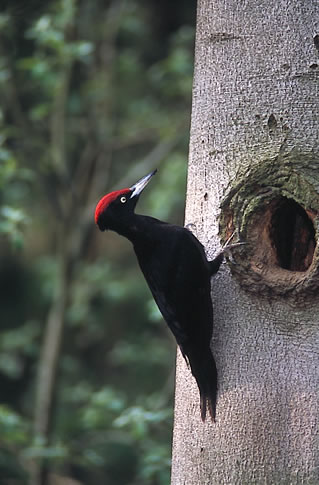
Spessart () is a ''Mittelgebirge'', a range of low wooded mountains, in the States of Bavaria and Hesse in Germany. It is bordered by the Vogelsberg, Rhön and Odenwald. The highest elevation is the Geiersberg (Spessart), Geiersberg at 586 metres above sea level. Etymology The name is derived from "Spechtshardt". ''Specht'' is the German word for woodpecker and ''Hardt'' is an outdated word meaning "hilly forest". Geography Location The Spessart is a ''Mittelgebirge'', part of the German Central Uplands, located in the Lower Franconia region of Bavaria and in Hesse, Germany. It is bordered by other ranges of hills: the Vogelsberg in the north, Rhön in the northeast and Odenwald in the southwest. Another way of describing the extent of the range is by naming the rivers that border it: the Main (river), Main in the south and west, the Kinzig (Main), Kinzig in the north and the Sinn (river), Sinn in the northeast. The area of the Spessart totals around 2,440 square kilometre ... [...More Info...] [...Related Items...] OR: [Wikipedia] [Google] [Baidu] |
Fulda
Fulda () (historically in English called Fuld) is a city in Hesse, Germany; it is located on the river Fulda and is the administrative seat of the Fulda district (''Kreis''). In 1990, the city hosted the 30th Hessentag state festival. History Middle Ages In 744 Saint Sturm, a disciple of Saint Boniface, founded the Benedictine monastery of Fulda as one of Boniface's outposts in the reorganization of the church in Germany. The initial grant for the abbey was signed by Carloman, Mayor of the Palace in Austrasia (in office 741–47), the son of Charles Martel. The support of the Mayors of the Palace, and later of the early Pippinid and Carolingian rulers, was important to Boniface's success. Fulda also received support from many of the leading families of the Carolingian world. Sturm, whose tenure as abbot lasted from 747 until 779, was most likely related to the Agilolfing dukes of Bavaria. Fulda also received large and constant donations from the Etichonids, a lea ... [...More Info...] [...Related Items...] OR: [Wikipedia] [Google] [Baidu] |
Rhön Biosphere Reserve
The Rhön Biosphere Reserve includes the entire central area of the Rhön Mountains, a low mountain range in the German states of Hesse, Bavaria and Thuringia. Aim In 1991 the Rhön was recognised at international level by UNESCO as a biosphere reserve. The aim of this biosphere reserve is to take account of local agriculture, nature protection, tourism and trade, to ensure the variety and quality of habitats in the whole Rhön region. This involves creating a long-term economic environment for agriculture and trade that is in tune with the protection of nature and the local landscape. People are at the heart of the Rhön Biosphere Reserve. The idea is to have a so-called sustainable development, which harmonises economic and social issues as far as possible with environmental issues. History As early as 12 September 1990, the Thuringian Rhön was declared a Rhön Biosphere Reserve by the Council of Ministers of the German Democratic Republic as part of the GDR's National Pa ... [...More Info...] [...Related Items...] OR: [Wikipedia] [Google] [Baidu] |
Bavarian Rhön Nature Park
The Bavarian Rhön Nature Park (''Naturpark Bayerische Rhön'') straddles the junction of the German states of Bavaria, Hesse and Thuringia. 70 km2 of the total 125 km2 area of the nature park has been recognised by UNESCO as part of the Rhön Biosphere Reserve. The organisation for the promotion of the Bavarian Rhön Nature Park (''Zweckverband Naturpark Bayerische Rhön'') was founded in 1967. On 26 November 1982 the regulation for the ''Naturpark Bayerische Rhön'' was issued and, in 1997, the ''Zweckverband'' became the Society for the Bavarian Rhön Nature Park and Biosphere Reserve (''Naturpark und Biosphärenreservat Bayer. Rhön e.V.''). Landscape The nature park lies between the Spessart, Vogelsberg, Thuringian Forest, Haßberge and Steigerwald forest. It is characterised by mixed forests, streams of flowing water, moors, grassland and arid habitats. Wasser Mountain, the highest peak of Rhön Mountains at 3,117 feet (950 metres), is in the nature park. ... [...More Info...] [...Related Items...] OR: [Wikipedia] [Google] [Baidu] |


