|
Gómez Farías Municipality, Tamaulipas
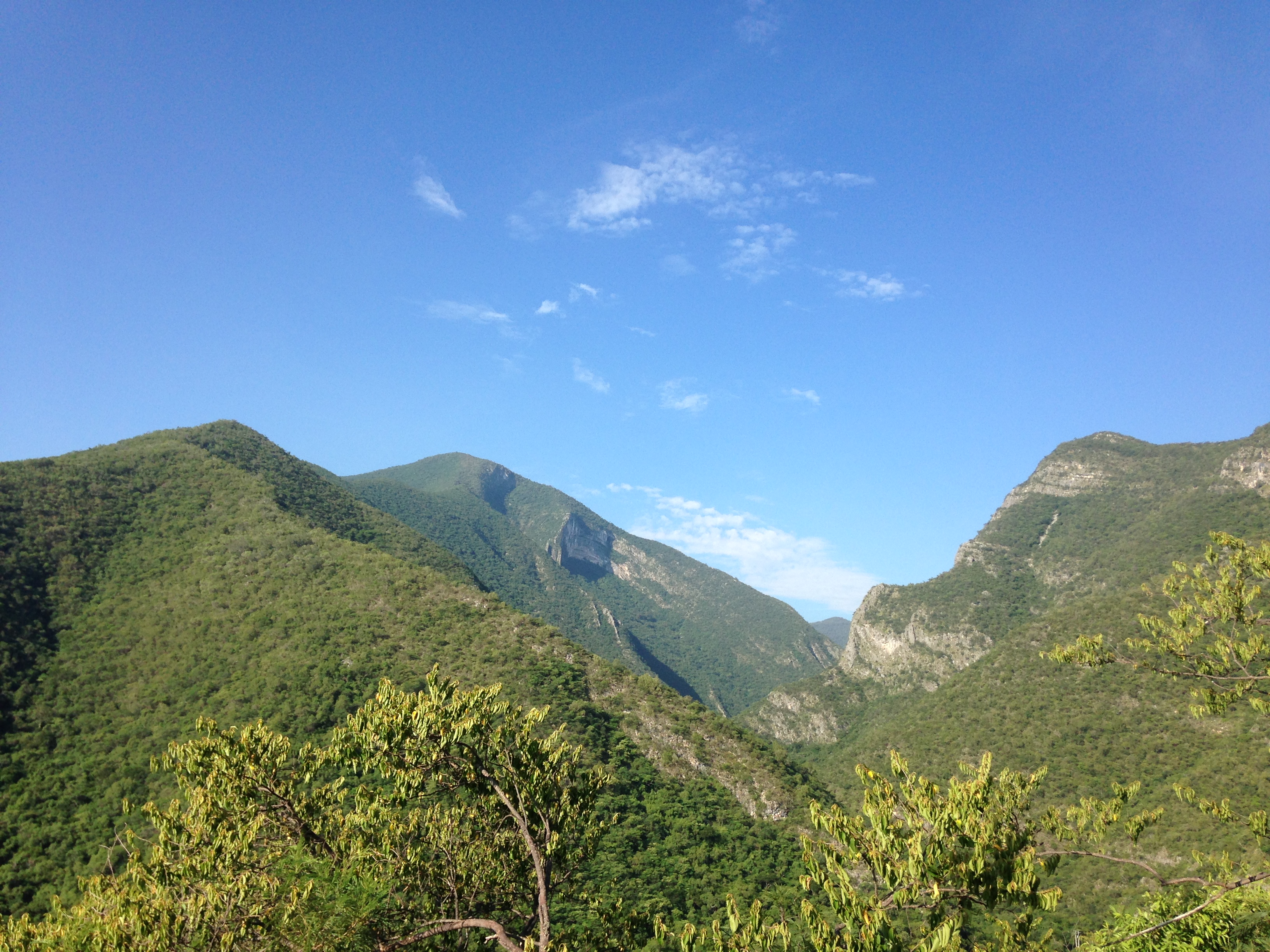
Gómez Farías Municipality is situated in the Mexican state of Tamaulipas. The town of Gómez Farías serves as the municipal seat of government. Covering an area of 433 square kilometres (167 sq mi), Gómez Farías Municipality had a population of 8,786 as of 2010. The town of Gómez Farías, specifically, had a population of 883 in the same year. Additionally, within the municipal area, a portion of 23,124 hectares (57,140 acres) (equivalent to 231 square kilometers) is encompassed by the El Cielo Biosphere Reserve. History In 1749, a settlement was established on the site of Gómez Farías to concentrate the semi-nomadic indigenous peoples of the area into a single community. On 10 January 1869, the municipality was created and named after Valentín Gómez Farías, a former President of Mexico. Geography Climate Most of the State of Tamaulipas is semi-arid and typically covered in a thorny scrub vegetation called Tamaulipan Mezquital. Gómez Farías and a few other areas on ... [...More Info...] [...Related Items...] OR: [Wikipedia] [Google] [Baidu] |
Tamaulipas
Tamaulipas, officially the Free and Sovereign State of Tamaulipas, is a state in Mexico; one of the 31 states which, along with Mexico City, comprise the 32 federal entities of Mexico. It is divided into 43 municipalities. It is located in northeast Mexico and is bordered by the states of Nuevo León to the west, San Luis Potosí to the southwest, and Veracruz to the southeast. To the north, it has a stretch of the U.S.–Mexico border with the state of Texas, and to the east it is bordered by the Gulf of Mexico. In addition to the capital city, Ciudad Victoria, the state's largest cities include Reynosa, Matamoros, Nuevo Laredo, Tampico, and Mante. Etymology The name Tamaulipas is derived from ''Tamaholipa'', a Huastec term in which the ''tam-'' prefix signifies "place (where)". No scholarly agreement exists on the meaning of ''holipa'', but "high hills" is a common interpretation. Another explanation of the state name is that it is derived from ''Ta ma ho'lipam ... [...More Info...] [...Related Items...] OR: [Wikipedia] [Google] [Baidu] |
El Cielo Biosphere Reserve
The El Cielo Biosphere Reserve (''Reserva de la Biosfera El Cielo'' in Spanish) is located in the Sierra Madre Oriental in the southern part of the Mexico, Mexican state of Tamaulipas near the town of Gómez Farías, Tamaulipas, Gómez Farias. The reserve protects the northernmost extension of tropical forest and cloud forest in Mexico. It has an area of made up mostly of steep mountains rising from about to a maximum altitude of more than .''Comision Nacional para el Conocimiento y Uso de la Biodiversidad'', http://www2.inecc.gob.mx/publicaciones/libros/2/cielo.html , accessed 18 Dec 2014 The state of Tamaulipas protected the area in 1985 and in 1987 it was formally recognized as a biosphere reserve by UNESCO's Man and the Biosphere Programme."Gomez Farias Region and El Cielo Biosphere Reserve", http://www.botany.si.edu/projects/cpd/ma/ma9.htm , accessed 18 Dec 2014 History The El Cielo area attracted little attention until the 1930s. In 1935, A Canadian farmer and horticultur ... [...More Info...] [...Related Items...] OR: [Wikipedia] [Google] [Baidu] |
Valentín Gómez Farías
Valentín Gómez Farías (; 14 February 1781 – 5 July 1858) was a Mexican physician and liberal politician who became president of Mexico twice, first from 1833 to 1834, during the period of the First Mexican Republic, and again from 1846 to 1847, during the Mexican–American War. Gómez Farías was elected to his first term in March 1833 along with Antonio López Santa Anna, with whom he would share the presidency. Both Congress and the administration elected during his term were notably Liberal, and pursued curtailing the political power of the Mexican Army and Catholic Church. Measures to prosecute members of the previous, conservative and autocratic presidency of Anastasio Bustamante were also carried out, but Gómez Farías sought to moderate them. Conservative revolts against these policies flared up, and eventually Gómez Farías' own vice-president Santa Anna switched sides and led his deposing in April 1834. In the wake of Gómez Farías' fall, the First Me ... [...More Info...] [...Related Items...] OR: [Wikipedia] [Google] [Baidu] |
Tamaulipan Mezquital
The Tamaulipan mezquital (), also known as the Brush Country, is a deserts and xeric shrublands ecoregion in the Southern United States and northeastern Mexico. It covers an area of , encompassing a portion of the Gulf Coastal Plain in southern Texas, northern Tamaulipas, northeastern Coahuila, and part of Nuevo León. Distribution The Sierra Madre Oriental range to the west separates the Tamaulipan mezquital from the drier Chihuahuan Desert. The Tamaulipan matorral is a transitional ecoregion between the mezquital and the Sierra Madre Oriental pine-oak forests to the west and the Veracruz moist forests to the south. The Western Gulf coastal grasslands, known as the Tamaulipan pastizal south of the border, fringe the Gulf of Mexico. The Edwards Plateau savannas lie to the north, and the East Central Texas forests and Texas blackland prairies to the northeast. Geography The Bordas Escarpment transects this ecoregion, running from near the southern limit northwest to the vi ... [...More Info...] [...Related Items...] OR: [Wikipedia] [Google] [Baidu] |
Sierra Madre Oriental
The Sierra Madre Oriental () is a mountain range in northeastern Mexico. The Sierra Madre Oriental is part of the American Cordillera, a chain of mountain ranges (cordillera) that consists of an almost continuous sequence of mountain ranges that form the western "backbone" of North America, Central America, South America, and Antarctica. Setting Spanning the Sierra Madre Oriental runs from the Rio Grande on the border between Coahuila and Texas south through Nuevo León, southwest Tamaulipas, San Luis Potosí, Querétaro, and Hidalgo to northern Puebla, where it joins with the east-west running Eje Volcánico Transversal of central Mexico. The northernmost are the Sierra del Burro and the Sierra del Carmen which reach the border with the United States at the Rio Grande. North of the Rio Grande, the range continues northwestward into Texas and beyond as the Davis and Guadalupe Ranges. Mexico's Gulf Coastal Plain lies to the east of the range, between the mountains and the ... [...More Info...] [...Related Items...] OR: [Wikipedia] [Google] [Baidu] |
Veracruz Moist Forests
The Veracruz moist forests () is a tropical moist broadleaf forests ecoregion in eastern Mexico. Geography The Veracruz moist forests cover an area of , occupying a portion of Mexico's Gulf Coastal Plain between the Sierra Madre Oriental and the Gulf of Mexico. The forests extend from southern Tamaulipas across northern Veracruz, eastern San Luis Potosí, and portions of eastern Hidalgo, northeastern Puebla and northern Queretaro. The Huasteca region includes much of the ecoregion. To the north, the forests transition to the dry lowland Tamaulipan mezquital and the upland Tamaulipan matorral. To the west, the Sierra Madre Oriental pine–oak forests occupy the higher elevations of the Sierra Madre Oriental. The Moctezuma River and its tributaries have carved deep canyons through the Sierra Madre, which allow moist air from the Gulf of Mexico to flow further west into the plateaus and mountains, including the Sierra Gorda, and the moist forests extend westwards along the ... [...More Info...] [...Related Items...] OR: [Wikipedia] [Google] [Baidu] |
Cloud Forest
A cloud forest, also called a water forest, primas forest, or tropical montane cloud forest, is a generally tropical or subtropical, evergreen, Montane forest, montane, Tropical and subtropical moist broadleaf forests, moist forest characterized by a persistent, frequent or seasonal low-level cloud cover, usually at the canopy level, formally described in the ''International Cloud Atlas'' (2017) as silvagenitus. Cloud forests often exhibit an abundance of mosses covering the ground and vegetation, in which case they are also referred to as mossy forests. Mossy forests usually develop on the mountain pass, saddles of mountains, where moisture introduced by settling clouds is more effectively retained. Cloud forests are among the most biodiversity-rich ecosystems in the world, with a large number of species directly or indirectly depending on them. Other moss forests include black spruce/feathermoss Climax community, climax forest, with a moderately dense canopy and a forest fl ... [...More Info...] [...Related Items...] OR: [Wikipedia] [Google] [Baidu] |
Sugar Cane
Sugarcane or sugar cane is a species of tall, Perennial plant, perennial grass (in the genus ''Saccharum'', tribe Andropogoneae) that is used for sugar Sugar industry, production. The plants are 2–6 m (6–20 ft) tall with stout, jointed, fibrous stalks that are rich in sucrose, which accumulates in the Plant stem, stalk internodes. Sugarcanes belong to the grass family, Poaceae, an economically important flowering plant family that includes maize, wheat, rice, and sorghum, and many forage crops. It is native to New Guinea. Sugarcane was an ancient crop of the Austronesian people, Austronesian and Indigenous people of New Guinea, Papuan people. The best evidence available today points to the New Guinea area as the site of the original domestication of ''Saccharum officinarum''. It was introduced to Polynesia, Island Melanesia, and Madagascar in prehistoric times via Austronesian sailors. It was also introduced by Austronesian sailors to India and then to Southern China by 500 ... [...More Info...] [...Related Items...] OR: [Wikipedia] [Google] [Baidu] |
Cattle
Cattle (''Bos taurus'') are large, domesticated, bovid ungulates widely kept as livestock. They are prominent modern members of the subfamily Bovinae and the most widespread species of the genus '' Bos''. Mature female cattle are called cows and mature male cattle are bulls. Young female cattle are called heifers, young male cattle are oxen or bullocks, and castrated male cattle are known as steers. Cattle are commonly raised for meat, for dairy products, and for leather. As draft animals, they pull carts and farm implements. Cattle are considered sacred animals within Hinduism, and it is illegal to kill them in some Indian states. Small breeds such as the miniature Zebu are kept as pets. Taurine cattle are widely distributed across Europe and temperate areas of Asia, the Americas, and Australia. Zebus are found mainly in India and tropical areas of Asia, America, and Australia. Sanga cattle are found primarily in sub-Saharan Africa. These types, sometime ... [...More Info...] [...Related Items...] OR: [Wikipedia] [Google] [Baidu] |
Citrus
''Citrus'' is a genus of flowering trees and shrubs in the family Rutaceae. Plants in the genus produce citrus fruits, including important crops such as oranges, mandarins, lemons, grapefruits, pomelos, and limes. ''Citrus'' is native to South Asia, East Asia, Southeast Asia, Melanesia, and Australia. Indigenous people in these areas have used and domesticated various species since ancient times. Its cultivation first spread into Micronesia and Polynesia through the Austronesian expansion (–1500 BCE). Later, it was spread to the Middle East and the Mediterranean () via the incense trade route, and from Europe to the Americas. Renowned for their highly fragrant aromas and complex flavor, citrus are among the most popular fruits in cultivation. With a propensity to hybridize between species, making their taxonomy complicated, there are numerous varieties encompassing a wide range of appearance and fruit flavors. Evolution Evolutionary history The large cit ... [...More Info...] [...Related Items...] OR: [Wikipedia] [Google] [Baidu] |
Mango
A mango is an edible stone fruit produced by the tropical tree '' Mangifera indica''. It originated from the region between northwestern Myanmar, Bangladesh, and northeastern India. ''M. indica'' has been cultivated in South and Southeast Asia since ancient times resulting in two types of modern mango cultivars: the "Indian type" and the "Southeast Asian type". Other species in the genus '' Mangifera'' also produce edible fruits that are also called "mangoes", the majority of which are found in the Malesian ecoregion. Worldwide, there are several hundred cultivars of mango. Depending on the cultivar, mango fruit varies in size, shape, sweetness, skin color, and flesh color, which may be pale yellow, gold, green, or orange. Mango is the national fruit of India, Pakistan and the Philippines, while the mango tree is the national tree of Bangladesh. Etymology The English word ''mango'' (plural ''mangoes'' or ''mangos'') originated in the 16th century from the Portuguese ... [...More Info...] [...Related Items...] OR: [Wikipedia] [Google] [Baidu] |


