|
Easterhouse
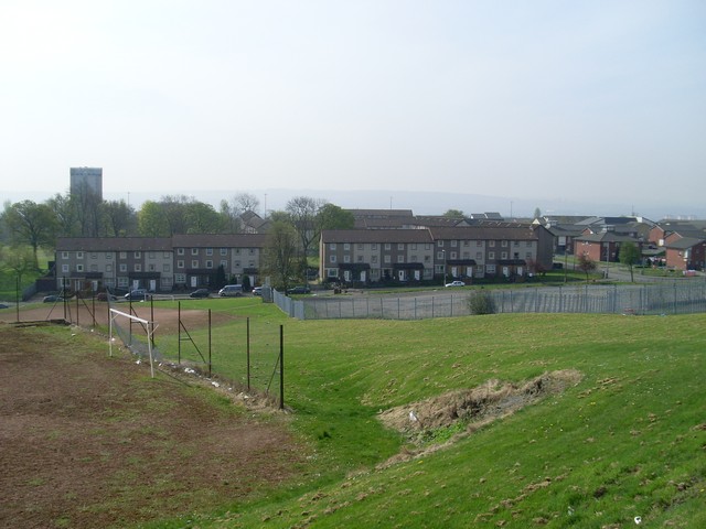
Easterhouse is a suburb of Glasgow, Scotland, east of the Glasgow city centre, city centre on land gained from the county of Lanarkshire as part of an expansion of Glasgow before the Second World War. The area is on high ground north of the River Clyde and south of the Kelvin (river), River Kelvin and Campsie Fells. Building began in the mid-1950s to provide better housing for people in the East End living in sub-standard conditions. At the 2001 UK Census, 2001 Census, its population was 26,495. Neighbourhoods of Easterhouse include Provanhall, Kildermorie, Lochend, Rogerfield and Commonhead, as well as Wellhouse, Easthall and Queenslie which are separated from the other parts by the M8 motorway (Scotland), M8 motorway running east–west through the area. The nearby communities of Barlanark, Craigend, Glasgow, Craigend, Cranhill, Garthamlock and Ruchazie were constructed using the same building principles and have suffered from similar problems. [...More Info...] [...Related Items...] OR: [Wikipedia] [Google] [Baidu] |
Easthall
Easthall is a residential neighbourhood in the East End of the Scottish city of Glasgow. Since 2007 it has been part of the Baillieston administrative ward within the Glasgow City Council area. Location and amenities Easthall was constructed in the 1950s as a council housing scheme as part of 'Greater Easterhouse' (taking its name from the nearby ''East Hallhill Farm'' which no longer exists) although it is physically separated from the main Easterhouse scheme and its amenities by the M8 Motorway; both Easterhouse and Easthall are served by Junction 10 of the motorway which is also the exit for the Glasgow Fort shopping centre. The area is bordered to the north by the M8 (which follows the same route as the former Monkland Canal), to the south by the A8 Edinburgh Road – beyond which lies the Barlanark district, to the east by an expanse of open ground leading to ''Glasgow East Investment Park'', and to the west by the larger residential area of Wellhouse. Some of the are ... [...More Info...] [...Related Items...] OR: [Wikipedia] [Google] [Baidu] |
Wellhouse
Wellhouse is a residential area in the East End of the Scottish city of Glasgow. Since 2007 it has been part of the Baillieston administrative ward within the Glasgow City Council area. Location and history Wellhouse consists primarily of council tenements dating from the time the 'scheme' was laid out in the late 1950s and which were refurbished in the early 21st century, as well as some modern houses built to replace other tenements which were knocked down. There are two primary schools (Aultmore Park Primary and Newhills dditional Support NeedsSchool), a row of shops, a youth facility with children’s play area and a modern community centre in the centre of the neighbourhood. There are also areas of waste ground where buildings (including the Roman Catholic Archdiocese of Glasgow's Blessed John Ogilvie's church and the previous Wellhouse Primary School) were demolished and the land remains unused; with speculation of the usability due to flooding, and water mitigation issue ... [...More Info...] [...Related Items...] OR: [Wikipedia] [Google] [Baidu] |
Ruchazie
Ruchazie ( ) is a neighbourhood in the Scottish city of Glasgow. It is situated to the north-east of the city, bordered by Craigend and Garthamlock to the east and the open ground of Hogganfield Park and Lethamhill Golf Course to the north. Ruchazie is separated from Cranhill to the south and Riddrie to the west by the M8 motorway (''Junctions 11 and 12'' of which directly serve the area), previously the route of the Monkland Canal. A small hamlet existed in the area from at least the 18th to the mid-20th century near to the Gartcraig Colliery, located where the local housing office now stands. There was also a productive brick works at Gartcraig from the 1870s to the 1920s, and two country house estates, ''Croftcroighn'' and ''Craigend''. Developed for housing as part of the city's 'Greater Easterhouse' programme in the 1950s, mostly consisting of tenements, the neighbourhood was at the centre of the Glasgow Ice Cream Wars in the 1980s which culminated in the death of a ... [...More Info...] [...Related Items...] OR: [Wikipedia] [Google] [Baidu] |
Garthamlock
Garthamlock (from the Gaelic "Gart Thamhlachd"-burial enclosure) is a suburb in the north-east of the Scottish city of Glasgow. It is situated north of the River Clyde. Provanhall is the nearest neighbourhood to the east; Craigend is directly to the west with Hogganfield Park and Ruchazie beyond. Garthamlock is separated from Cranhill and Queenslie to the south by the M8 motorway (''Junction 11'' of which directly serves the area). An area of open ground (Cardowan Moss nature reserve) is to the north. The local landmarks are two water towers, which are illuminated at night. Garthamlock was developed from 1954 onwards as part of the 'Greater Easterhouse Easterhouse is a suburb of Glasgow, Scotland, east of the Glasgow city centre, city centre on land gained from the county of Lanarkshire as part of an expansion of Glasgow before the Second World War. The area is on high ground north of the Ri ...' rehousing scheme after the city bought the estate of Garthamlock House; the ... [...More Info...] [...Related Items...] OR: [Wikipedia] [Google] [Baidu] |
Barlanark
Barlanark ( ) is a district in Glasgow. It is situated east of Budhill, Shettleston and Springboig, north west of Baillieston, west of Springhill, Glasgow, Springhill and Swinton, Glasgow, Swinton and south of Easthall, Easterhouse and Wellhouse. Name The name Barlanark is an apparently hybrid Scottish Gaelic, Gaelic-British language (Celtic), Brythonic name suggesting ''the hill at the clearing'' from the Gaelic ''bàrr'' and Brythonic ''lanerc'' meaning "clearing". The first element may represent a Gaelicisation of Brythonic ''*baɣeδ'', 'boar' (Welsh language, Welsh ''baedd''). History Barlanark housing scheme was developed in response to the city's grave post-war housing needs: In 1952/53 over 2,300 3- and 4-bedroom apartments were constructed and rented out to 'Corporation' tenants. There were also 5-apartment semi-detached houses, and 3-apartment terraced houses built, next to the Estate of Barlanark House, which was constructed by David Hamilton (architect), David Ham ... [...More Info...] [...Related Items...] OR: [Wikipedia] [Google] [Baidu] |
Provanhall
Provanhall is a neighbourhood of Easterhouse in east Glasgow, Scotland.Overview of Provanhall Gazetteer for Scotland It is named after the estate and medieval house, Provan Hall. The area is to the immediate east of Provan Hall and shopping centre and to the north of Shandwick Square Shopping Centre. The area is bounded by Gartloch fields, part of Glasgow's greenbelt with . Part of the estate was built on the remains of Prova ... [...More Info...] [...Related Items...] OR: [Wikipedia] [Google] [Baidu] |
Cranhill
Cranhill is an inner city district and housing scheme in the north east of Glasgow, Scotland. Cranhill was developed from public funding in the early 1950s and was originally, chiefly composed of four-storey tenement blocks surrounding a patch of grassland, which became Cranhill Park. Later development saw the building of three tower blocks (locally, ''high-flats''), surrounded by rows of terraced maisonettes. In more recent years, a number of semi-detached and detached homes have been built. The area also hosts some shops, two primary schools and nurseries, a community centre and the Cranhill water tower. Infamous for its illegal drug trade and anti-social youth culture, Cranhill was often dubbed " Smack City" in the media. The community was redeveloped from the late 1990s, although unemployment stood at 50% as of 2009. History Cranhill was built in the early 1950s on the eastern outskirts of the city to alleviate the post-war housing shortage, like other similar publ ... [...More Info...] [...Related Items...] OR: [Wikipedia] [Google] [Baidu] |
Glasgow East (UK Parliament Constituency)
Glasgow is the most populous city in Scotland, located on the banks of the River Clyde in west central Scotland. It is the third-most-populous city in the United Kingdom and the 27th-most-populous city in Europe, and comprises 23 wards which represent the areas of the city within Glasgow City Council. Glasgow is a leading city in Scotland for finance, shopping, industry, culture and fashion, and was commonly referred to as the "second city of the British Empire" for much of the Victorian and Edwardian eras. In , it had an estimated population as a defined locality of . More than 1,000,000 people live in the Greater Glasgow contiguous urban area, while the wider Glasgow City Region is home to more than 1,800,000 people (its defined functional urban area total was almost the same in 2020), around a third of Scotland's population. The city has a population density of 3,562 people per km2, much higher than the average of 70/km2 for Scotland as a whole. Glasgow grew from ... [...More Info...] [...Related Items...] OR: [Wikipedia] [Google] [Baidu] |
M8 Motorway (Scotland)
The M8 is the busiest motorway in Scotland. It connects the country's two largest cities, Glasgow and Edinburgh, and serves other large communities including Airdrie, North Lanarkshire, Airdrie, Coatbridge, Greenock, Livingston, Scotland, Livingston and Paisley, Renfrewshire, Paisley. The motorway is long. A major construction project to build the final section between Newhouse, North Lanarkshire, Newhouse and Baillieston was completed on 30 April 2017. The motorway has one service station, Heart of Scotland services, Heart of Scotland Services, previously named Harthill due to its proximity to Harthill, Scotland, the village. History With the advent of motorway-building in the United Kingdom in the late 1950s, the M8 was planned as one of a core of new motorways, designed to replace the A8 road (Great Britain), A8 road as a high-capacity alternative for intercity travel. The motorway was constructed piecemeal in several stages bypass (road), bypassing towns, beginning in 1965 ... [...More Info...] [...Related Items...] OR: [Wikipedia] [Google] [Baidu] |
Queenslie
Queenslie is a district in the Scottish city of Glasgow. Established in the 1950s as a large industrial estate with a small area of residential housing with a primary school, by the late 1990s the condition of the tenement properties had deteriorated and the local authority decided to demolish them altogether and extend the industrial provision, which in the early 21st century is the largest such dedicated estate in the city ( Hillington falls just outside the city boundaries). Location Situated just to the east of Cranhill with the boundary being Stepps Road, Queenslie is separated from Garthamlock to the north by the M8 motorway, originally the Monkland Canal, while Bartiebeith Road forms the south-east boundary with Wellhouse – these are all residential housing schemes built in the same era as Queenslie. To the south-west is the A8 Edinburgh Road, a major trunk road and bus route. The Springboig and Barlanark neighbourhoods lie on the opposite side of the main thoroug ... [...More Info...] [...Related Items...] OR: [Wikipedia] [Google] [Baidu] |
Glasgow
Glasgow is the Cities of Scotland, most populous city in Scotland, located on the banks of the River Clyde in Strathclyde, west central Scotland. It is the List of cities in the United Kingdom, third-most-populous city in the United Kingdom and the 27th-most-populous city in Europe, and comprises Wards of Glasgow, 23 wards which represent the areas of the city within Glasgow City Council. Glasgow is a leading city in Scotland for finance, shopping, industry, culture and fashion, and was commonly referred to as the "second city of the British Empire" for much of the Victorian era, Victorian and Edwardian eras. In , it had an estimated population as a defined locality of . More than 1,000,000 people live in the Greater Glasgow contiguous urban area, while the wider Glasgow City Region is home to more than 1,800,000 people (its defined functional urban area total was almost the same in 2020), around a third of Scotland's population. The city has a population density of 3,562 p ... [...More Info...] [...Related Items...] OR: [Wikipedia] [Google] [Baidu] |
Provan Hall
Provan Hall (also known over time as Provanhall, Hall of Provan and Hall Mailings) is a historic place composed of two buildings built about the 15th century and situated in Auchinlea Park, Easterhouse, Glasgow. It is owned by the National Trust for Scotland and leased by Glasgow City Council.Provan Hall Heritage Trail from Glasgow City Council official siteProvanhall Heritage Group website /ref> The two parallel buildings, enclosing a courtyard, are protected as a category A listed building. The building has recently been renovated and now operates as a small museum. It is managed by Provan Hall Community Management Tr ... [...More Info...] [...Related Items...] OR: [Wikipedia] [Google] [Baidu] |


