|
Cassville, Indiana
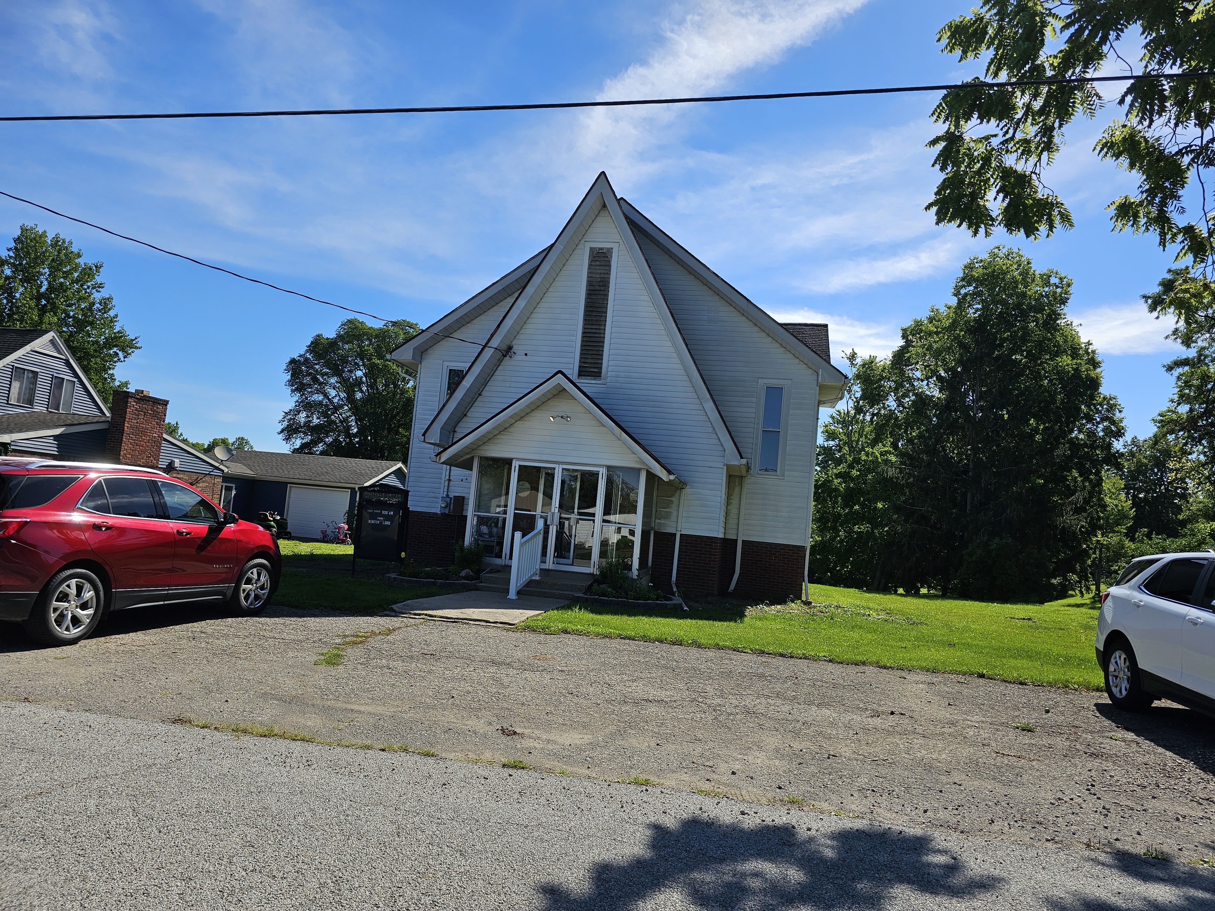
Cassville is an unincorporated community in Howard Township, Howard County, Indiana, United States. It is part of the Kokomo, Indiana Metropolitan Statistical Area and located approximately 5.9 miles from downtown Kokomo. History Originally named Pleasant Spring, Cassville was renamed in 1854 for Lewis Cass, a U.S. Senator from Michigan. Demographics The United States Census Bureau delineated Cassville as a census designated place in the 2022 American Community Survey. Geography Cassville is located on the border of Clay Township and Howard Township. Highway * US-31 to South Bend (North) and Indianapolis Indianapolis ( ), colloquially known as Indy, is the List of capitals in the United States, capital and List of municipalities in Indiana, most populous city of the U.S. state of Indiana and the county seat of Marion County, Indiana, Marion ... (South) References Unincorporated communities in Howard County, Indiana Kokomo, Indiana metropolitan area Uni ... [...More Info...] [...Related Items...] OR: [Wikipedia] [Google] [Baidu] [Amazon] |
Unincorporated Area
An unincorporated area is a parcel of land that is not governed by a local general-purpose municipal corporation. (At p. 178.) They may be governed or serviced by an encompassing unit (such as a county) or another branch of the state (such as the military). There are many unincorporated communities and areas in the United States and Canada, but many countries do not use the concept of an unincorporated area. By country Argentina In Argentina, the provinces of Chubut Province, Chubut, Córdoba Province (Argentina), Córdoba, Entre Ríos Province, Entre Ríos, Formosa Province, Formosa, Neuquén Province, Neuquén, Río Negro Province, Río Negro, San Luis Province, San Luis, Santa Cruz Province, Argentina, Santa Cruz, Santiago del Estero Province, Santiago del Estero, Tierra del Fuego Province, Argentina, Tierra del Fuego, and Tucumán Province, Tucumán have areas that are outside any municipality or commune. Australia Unlike many other countries, Australia has only local go ... [...More Info...] [...Related Items...] OR: [Wikipedia] [Google] [Baidu] [Amazon] |
Kokomo Metropolitan Area
The Kokomo Metropolitan Statistical Area, as defined by the United States Census Bureau, is an area consisting of Howard County in Indiana. Howard County had population estimate of 83,831in 2023. Kokomo is also the principal city of the area known as North Central Indiana, the area around Kokomo with economic ties. The six county area including Cass, Clinton, Fulton, Howard, Miami, and Tipton counties had population of 228,331 people in 2010. Counties *Howard *Tipton (no longer included) Communities Incorporated places *Cities ** Elwood (partial) ** Kokomo (Principal city) **Tipton (no longer included) *Towns ** Greentown ** Kempton ** Russiaville ** Sharpsville ** Windfall Census-designated places ''Note: All census-designated places are unincorporated.'' * Indian Heights (annexed to city of Kokomo in 2012) Unincorporated places Townships Howard County Tipton County *Cicero * Jefferson *Liberty * Madison *Prairie *Wildcat Demographics As of the census of 2000, the ... [...More Info...] [...Related Items...] OR: [Wikipedia] [Google] [Baidu] [Amazon] |
Unincorporated Communities In Howard County, Indiana
Unincorporated may refer to: * Unincorporated area, land not governed by a local municipality * Unincorporated entity, a type of organization * Unincorporated territories of the United States, territories under U.S. jurisdiction, to which Congress has determined that only select parts of the U.S. Constitution apply * Unincorporated association Unincorporated association refers to a group of people in common law jurisdictions—such as the United Kingdom, Canada, and New Zealand—who organize around a shared purpose without forming a corporation or similar legal entity. Unlike in some ..., also known as voluntary association, groups organized to accomplish a purpose * ''Unincorporated'' (album), a 2001 album by Earl Harvin Trio {{disambig ... [...More Info...] [...Related Items...] OR: [Wikipedia] [Google] [Baidu] [Amazon] |
Indianapolis, Indiana
Indianapolis ( ), colloquially known as Indy, is the List of capitals in the United States, capital and List of municipalities in Indiana, most populous city of the U.S. state of Indiana and the county seat of Marion County, Indiana, Marion County. Indianapolis is situated in the state's central till plain region along the west fork of the White River (Indiana), White River. The city's official slogan, "Crossroads of America", reflects its historic importance as a transportation hub and its relative proximity to other major North American markets. At the 2020 United States census, 2020 census, the Indianapolis (balance), balance population was 887,642. Indianapolis is the List of United States cities by population, 16th-most populous city in the U.S., the third-most populous city in the Midwestern United States, Midwest after Chicago and Columbus, Ohio, and the fourth-most populous state capital in the nation after Phoenix, Arizona, Phoenix, Austin, Texas, Austin, and Columbu ... [...More Info...] [...Related Items...] OR: [Wikipedia] [Google] [Baidu] [Amazon] |
South Bend, Indiana
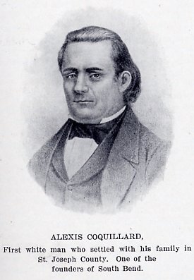
South Bend is a city in St. Joseph County, Indiana, United States, and its county seat. It lies along the St. Joseph River (Lake Michigan), St. Joseph River near its southernmost bend, from which it derives its name. It is the List of cities in Indiana, fourth-most populous city in Indiana with a population of 103,453 at the 2020 United States census, 2020 census. Located directly south of Indiana's northern border with Michigan, South Bend anchors the broader Michiana region. Its South Bend-Mishawaka metropolitan area, metropolitan area had a population of 324,501 in 2020, while its combined statistical area had 812,199 residents. The area was first settled in the early 19th century by fur traders and was established as a city in 1865. The St. Joseph River shaped South Bend's economy through the mid-20th century. River access assisted heavy industrial development such as that of the Studebaker, Studebaker Corporation and the Oliver Corporation, Oliver Chilled Plow Company. Lik ... [...More Info...] [...Related Items...] OR: [Wikipedia] [Google] [Baidu] [Amazon] |
US 31
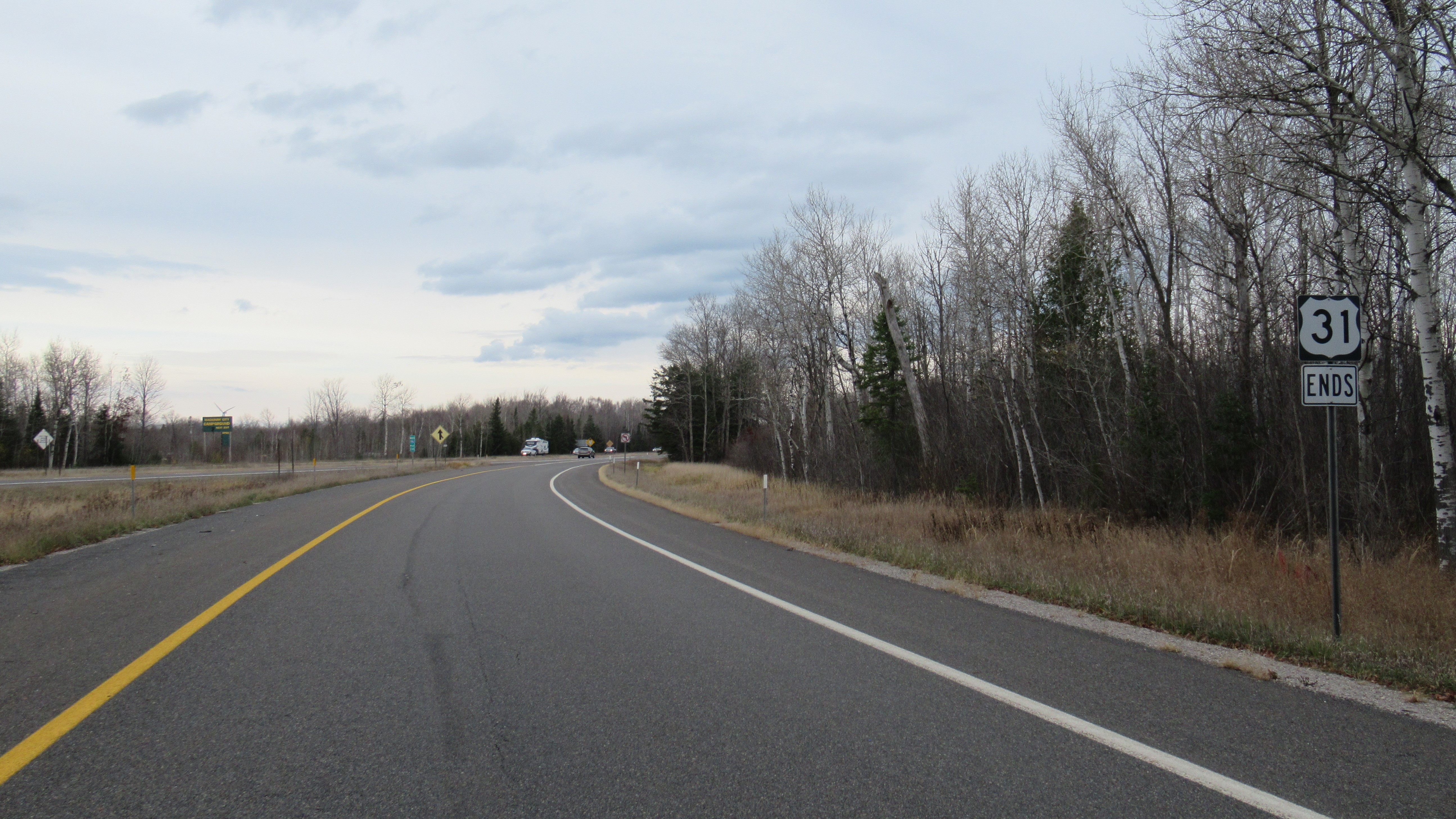
U.S. Route 31 or U.S. Highway 31 (US 31) is a major north–south U.S. highway connecting southern Alabama to northern Michigan. Its southern terminus is at an intersection with US 90/ US 98 in Spanish Fort, Alabama. Its northern terminus is at an interchange with Interstate 75 (I-75) south of Mackinaw City, Michigan. US 31 once crossed the Straits of Mackinac by car ferry to intersect US 2 north of St. Ignace, Michigan, in the Upper Peninsula and then formerly reached Mackinaw City along the southern approaches of the Mackinac Bridge (which has been taken over by I-75). It also formerly entered downtown Mobile, Alabama, via a long bridge over Mobile Bay. The southern segment of US 31 connects the cities of Mobile, Montgomery, Birmingham, and Decatur in Alabama, and Nashville in Tennessee. The northern segment of US 31 connects Louisville in Kentucky, and Indianapolis in Indiana. From Nashville to Louisville, US 31 is signed U.S. Ro ... [...More Info...] [...Related Items...] OR: [Wikipedia] [Google] [Baidu] [Amazon] |
Clay Township, Howard County, Indiana
Clay Township is one of eleven townships in Howard County, Indiana, United States. As of the 2020 census, its population was 4,036, up from 3,885 in 2010. This township also contains a small portion of Kokomo. The population of the Kokomo portion, however, is zero. History Clay Township was named for Henry Clay, a politician and statesman from Kentucky. The Henry W. Smith House was listed on the National Register of Historic Places The National Register of Historic Places (NRHP) is the Federal government of the United States, United States federal government's official United States National Register of Historic Places listings, list of sites, buildings, structures, Hist ... in 1979. Geography According to the 2010 census, the township has a total area of , of which (or 99.86%) is land and (or 0.14%) is water. The stream of Villa Run runs through this township. Former Settlements *Jewell Station Adjacent townships * Jackson Township, Cass County (north) * Deer ... [...More Info...] [...Related Items...] OR: [Wikipedia] [Google] [Baidu] [Amazon] |
American Community Survey
The American Community Survey (ACS) is an annual demographics survey program conducted by the United States Census Bureau. It regularly gathers information previously contained only in the long form of the United States census, decennial census, including ancestry, US citizenship status, educational attainment, income, language proficiency, migration, Disability in the United States, disability, employment, and housing characteristics. No respondents personal information is released, and only used statistically in these data which are used by many Public sector, public-sector, Private sector, private-sector, and not-for-profit stakeholders to allocate funding, track shifting demographics, plan for emergencies, and learn about local communities. Sent to approximately 295,000 addresses monthly, or 3.5 million addresses annually, it is the largest household survey that the Census Bureau administers. The American Community Survey gathers information annually in the 50 U.S. state, U ... [...More Info...] [...Related Items...] OR: [Wikipedia] [Google] [Baidu] [Amazon] |
Census Designated Place
A census-designated place (CDP) is a Place (United States Census Bureau), concentration of population defined by the United States Census Bureau for statistical purposes only. CDPs have been used in each decennial census since 1980 as the counterparts of incorporated places, such as self-governing city (United States), cities, town (United States), towns, and village (United States), villages, for the purposes of gathering and correlating statistical data. CDPs are populated areas that generally include one officially designated but currently unincorporated area, unincorporated community, for which the CDP is named, plus surrounding inhabited countryside of varying dimensions and, occasionally, other, smaller unincorporated communities as well. CDPs include small rural communities, Edge city, edge cities, colonia (United States), colonias located along the Mexico–United States border, and unincorporated resort and retirement community, retirement communities and their environs. ... [...More Info...] [...Related Items...] OR: [Wikipedia] [Google] [Baidu] [Amazon] |
Newspapers
A newspaper is a Periodical literature, periodical publication containing written News, information about current events and is often typed in black ink with a white or gray background. Newspapers can cover a wide variety of fields such as politics, business, sports, art, and science. They often include materials such as opinion columns, weather forecasts, reviews of local services, Obituary, obituaries, birth notices, crosswords, editorial cartoons, comic strips, and advice columns. Most newspapers are businesses, and they pay their expenses with a mixture of Subscription business model, subscription revenue, Newsagent's shop, newsstand sales, and advertising revenue. The journalism organizations that publish newspapers are themselves often Metonymy, metonymically called newspapers. Newspapers have traditionally been published Printing, in print (usually on cheap, low-grade paper called newsprint). However, today most newspapers are also Electronic publishing, published on webs ... [...More Info...] [...Related Items...] OR: [Wikipedia] [Google] [Baidu] [Amazon] |
Michigan
Michigan ( ) is a peninsular U.S. state, state in the Great Lakes region, Great Lakes region of the Upper Midwest, Upper Midwestern United States. It shares water and land boundaries with Minnesota to the northwest, Wisconsin to the west, Indiana and Illinois to the southwest, Ohio to the southeast, and the Canadian Provinces and territories of Canada, province of Ontario to the east, northeast and north. With a population of 10.14 million and an area of , Michigan is the List of U.S. states and territories by population, 10th-largest state by population, the List of U.S. states and territories by area, 11th-largest by area, and the largest by total area east of the Mississippi River.''i.e.'', including water that is part of state territory. Georgia (U.S. state), Georgia is the largest state by land area alone east of the Mississippi and Michigan the second-largest. The state capital is Lansing, Michigan, Lansing, while its most populous city is Detroit. The Metro Detroit r ... [...More Info...] [...Related Items...] OR: [Wikipedia] [Google] [Baidu] [Amazon] |
Lewis Cass
Lewis Cass (October 9, 1782June 17, 1866) was a United States Army officer and politician. He represented Michigan in the United States Senate and served in the Cabinets of two U.S. Presidents, Andrew Jackson and James Buchanan. He was also the 1848 United States presidential election, 1848 Democratic Party (United States), Democratic presidential nominee. A slave owner himself, he was a leading spokesman for the doctrine of Popular sovereignty in the United States#Emergence of the term "popular sovereignty" and its pejorative connotation, popular sovereignty, which at the time held the idea that people in each U.S. state, U.S state should have the right to decide whether to permit Slavery in the United States, slavery as a matter of states' rights. Born in Exeter, New Hampshire, he attended Phillips Exeter Academy before establishing a legal practice in Zanesville, Ohio. After serving in the Ohio House of Representatives, he was appointed as a United States Marshals Service, U.S. ... [...More Info...] [...Related Items...] OR: [Wikipedia] [Google] [Baidu] [Amazon] |


