|
Bellbird, New South Wales
Bellbird is a town and locality in the City of Cessnock in the Hunter Region of New South Wales, Australia Australia, officially the Commonwealth of Australia, is a Sovereign state, sovereign country comprising the mainland of the Australia (continent), Australian continent, the island of Tasmania, and numerous List of islands of Australia, sma .... In 1990 a memorial was built to remember the 21 deaths from 1923 Bellbird Mining Disaster. References Suburbs of City of Cessnock Towns in the Hunter Region {{Cessnock-geo-stub Mining towns in New South Wales ... [...More Info...] [...Related Items...] OR: [Wikipedia] [Google] [Baidu] |
City Of Cessnock
City of Cessnock is a local government area in the Hunter region of New South Wales, Australia. The area under administration is located to the west of Newcastle. The largest population centre and council seat is the city of Cessnock. The Mayor of the City of Cessnock Council is Cr. Jay Suvaal, a member of Country Labor. Main towns and villages The Cessnock City Council area includes * Cessnock * Kurri Kurri * Weston * Pelaw Main * Abermain * Aberdare * Bellbird * Kearsley * Mulbring * Kitchener * Paxton * Millfield * Ellalong * Wollombi * Neath * Branxton * Greta Demographics At the , there were people in the City of Cessnock local government area, of these 49.7 per cent were male and 50.3 per cent were female. Aboriginal and Torres Strait Islander people made up 4.8 per cent of the population, which was nearly double than the national and state averages of 2.5 per cent. The median age of people in the City of Cessnock was 37 years, equal to the national m ... [...More Info...] [...Related Items...] OR: [Wikipedia] [Google] [Baidu] |
Division Of Hunter
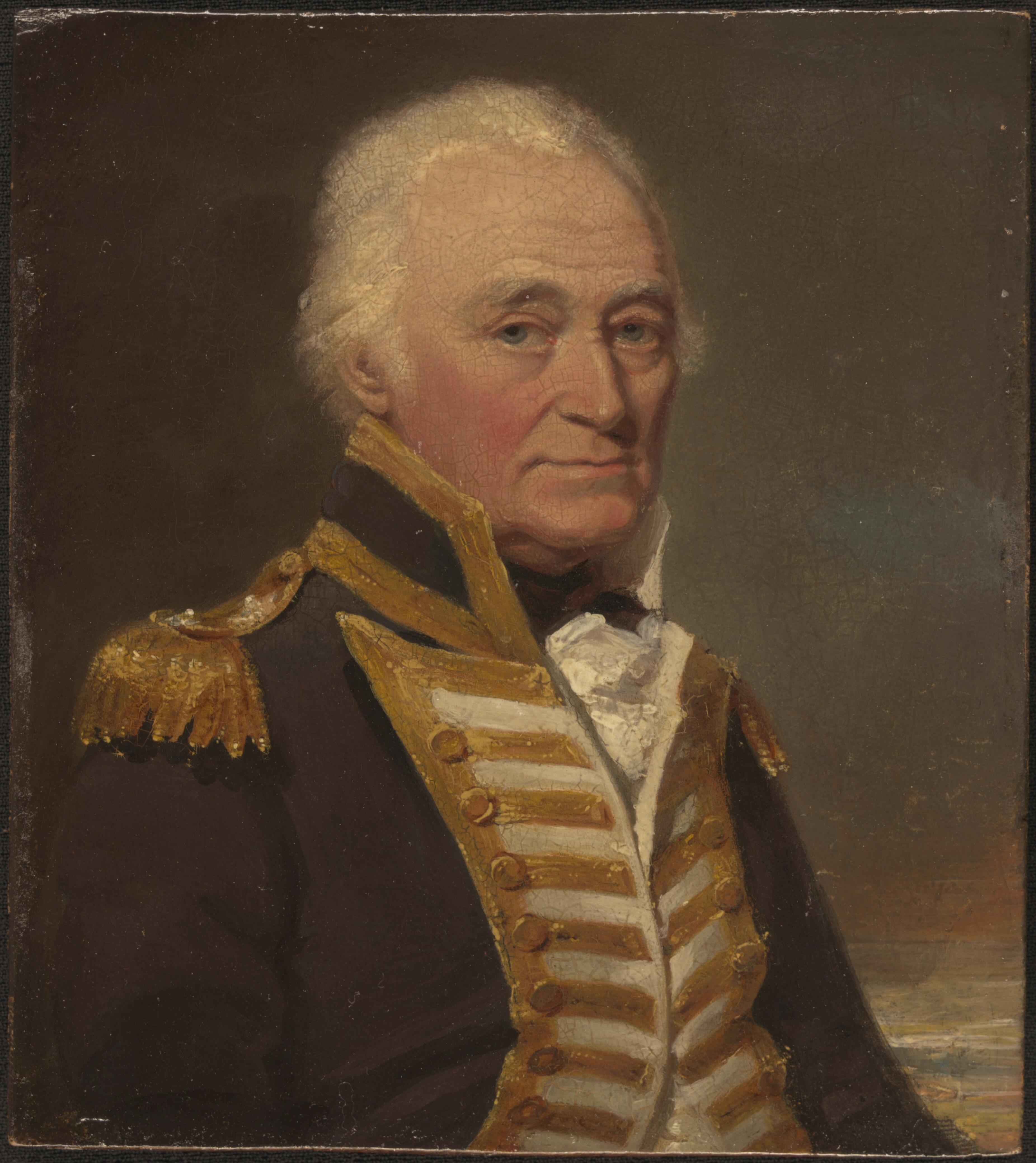
The Division of Hunter is an Australian electoral division in the state of New South Wales. The division was proclaimed in 1900, and was one of the original 65 divisions to be contested at the first federal election. The division was named after Captain John Hunter, the second Governor of New South Wales. It covers rural, regional and suburban areas centered on the Hunter Region, including the towns of Singleton, Muswellbrook and Cessnock. It also extends into parts of Greater Newcastle, covering suburbs such as Cameron Park, Edgeworth, Toronto and Morisset. Hunter is a largely blue-collar electorate. Hunter's economic base includes agriculture and mining, being dominated by a mix of rural and coal mining communities. The Hunter Region is one of the few remaining Labor-voting regional areas of New South Wales. The current member since the 2022 federal election, is Daniel Repacholi, a member of the Australian Labor Party. Geography Since 1984, federal electoral divisi ... [...More Info...] [...Related Items...] OR: [Wikipedia] [Google] [Baidu] |
Suburbs Of City Of Cessnock
A suburb (more broadly suburban area) is an area within a metropolitan area, which may include Commercial area, commercial and mixed-use development, mixed-use, that is primarily a residential area. A suburb can exist either as part of a larger city/urban area or as a separate political entity. The name describes an area which is not as densely populated as an inner city, yet more densely populated than a rural area in the countryside. In many metropolitan areas, suburbs exist as separate residential communities within commuting distance of a city (cf "bedroom suburb".) Suburbs can have their own political or legal jurisdiction, especially in the United States, but this is not always the case, especially in the United Kingdom, where most suburbs are located within the administrative boundaries of cities. In most English-speaking world, English-speaking countries, suburban areas are defined in contrast to central business district, central or inner city areas, but in Austral ... [...More Info...] [...Related Items...] OR: [Wikipedia] [Google] [Baidu] |
1923 Bellbird Mining Disaster
The 1923 Bellbird Mining Disaster took place on 1 September 1923 when there was a fire at Hetton-Bellbird coal mine, known locally as the Bellbird Colliery or mine. The coal mine was located near the village of Bellbird, which is itself three miles southwest of Cessnock in the Northern coalfields of New South Wales, Australia. The accident occurred in the No. 1 Workings of the mine and resulted in the deaths of 21 miners and their horses. Subsequently there was a thorough investigation into the causes of the accident which resulted in legislative changes that were implemented in an effort to improve worker safety in Australian coal mines. These efforts culminated with the Mines Rescue Act 1925 which established standards for mine rescue operations in New South Wales (NSW) province. At the time of the disaster the mine employed 538 people including 369 who worked underground. The accident killed 21 miners and caused legislation changes. Background The Bellbird Colliery owne ... [...More Info...] [...Related Items...] OR: [Wikipedia] [Google] [Baidu] |
Australia
Australia, officially the Commonwealth of Australia, is a sovereign ''Sovereign'' is a title which can be applied to the highest leader in various categories. The word is borrowed from Old French , which is ultimately derived from the Latin , meaning 'above'. The roles of a sovereign vary from monarch, ruler or ... country comprising the mainland of the Australian continent, the island of Tasmania, and numerous smaller islands. With an area of , Australia is the largest country by area in Oceania and the world's sixth-largest country. Australia is the oldest, flattest, and driest inhabited continent, with the least fertile soils. It is a megadiverse country, and its size gives it a wide variety of landscapes and climates, with deserts in the centre, tropical Forests of Australia, rainforests in the north-east, and List of mountains in Australia, mountain ranges in the south-east. The ancestors of Aboriginal Australians began arriving from south east Asia approx ... [...More Info...] [...Related Items...] OR: [Wikipedia] [Google] [Baidu] |
New South Wales
) , nickname = , image_map = New South Wales in Australia.svg , map_caption = Location of New South Wales in AustraliaCoordinates: , subdivision_type = Country , subdivision_name = Australia , established_title = Before federation , established_date = Colony of New South Wales , established_title2 = Establishment , established_date2 = 26 January 1788 , established_title3 = Responsible government , established_date3 = 6 June 1856 , established_title4 = Federation , established_date4 = 1 January 1901 , named_for = Wales , demonym = , capital = Sydney , largest_city = capital , coordinates = , admin_center = 128 local government areas , admin_center_type = Administration , leader_title1 = Monarch , leader_name1 = Charles III , leader_title2 = Governor , leader_name2 = Margaret Beazley , leader_title3 = Premier , leader_name3 = Dominic Perrottet ( Liberal) , national_representation = Parliament of Australia , national_representation_type1 = Sen ... [...More Info...] [...Related Items...] OR: [Wikipedia] [Google] [Baidu] |
Mount View, New South Wales
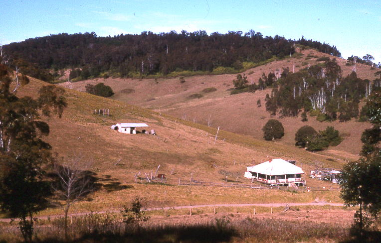
Mount View, New South Wales is a rural locality located in the Hunter Region wine region in New South Wales Australia. It is located Between Cessnock and Wollombi and is a part of the City of Cessnock local government area. It has ideal climate, soil, and temperature for viticultural pursuits, which have been practised here since the mid-19th century. The road from Cessnock to Mount View provides access to the Great North Walk, and to lookouts with excellent views of the Hunter Region The Hunter Region, also commonly known as the Hunter Valley, is a region of New South Wales, Australia, extending from approximately to north of Sydney. It contains the Hunter River and its tributaries with highland areas to the north and so .... Geography Mount View is located in the Hunter Valley region, it is blanketed in a dense forest with periodic clearing throughout its foothills. The area around the mountain is mostly rural pastures, littered with small farmhouses. There are some ... [...More Info...] [...Related Items...] OR: [Wikipedia] [Google] [Baidu] |
Pelton, New South Wales
Pelton is a suburb located 5 km south west of the centre of the Hunter Region town of Cessnock, New South Wales ) , nickname = , image_map = New South Wales in Australia.svg , map_caption = Location of New South Wales in AustraliaCoordinates: , subdivision_type = Country , subdivision_name = Australia , established_title = Before federation , es ..., Australia. Most properties face onto Ellalong Road, which is the eastern access to Werakata State Conservation Area, previously Aberdare State Forest. References Suburbs of City of Cessnock {{Cessnock-geo-stub ... [...More Info...] [...Related Items...] OR: [Wikipedia] [Google] [Baidu] |
Bellbird Heights, New South Wales
Bellbird Heights is a locality in the City of Cessnock in the Hunter Region of New South Wales ) , nickname = , image_map = New South Wales in Australia.svg , map_caption = Location of New South Wales in AustraliaCoordinates: , subdivision_type = Country , subdivision_name = Australia , established_title = Before federation , es ..., Australia. It was first subdivided in 1923 as Crossing Estate, and was gazetted as Bellbird Heights in 1971. In 2016 the population was 788, median age was 40 and 87.5% were born in Australia. References Suburbs of City of Cessnock Towns in the Hunter Region {{Cessnock-geo-stub ... [...More Info...] [...Related Items...] OR: [Wikipedia] [Google] [Baidu] |
Electoral District Of Cessnock
Cessnock is an electoral district of the Legislative Assembly in the Australian state of New South Wales in the rural fringe of the Hunter. It is represented by Clayton Barr of the Labor Party. It includes all of City of Cessnock (including Cessnock and Kurri Kurri), part of Singleton Council (including Broke and Belford) and a small part of the City of Lake Macquarie (including Barnsley and West Wallsend). History Cessnock was created in 1913, but was abolished in 1920, with the introduction of proportional representation and absorbed into Maitland. It was recreated in 1927 and included much of the Central Coast until the creation of Gosford in 1950. It has historically been a safe seat. At the 2007 election, it encompassed all of City of Cessnock, a small part of the City of Newcastle (including Beresfield and Tarro), a small part of the City of Lake Macquarie (including Barnsley and West Wallsend) and a small part of Singleton Council (including Belford). ... [...More Info...] [...Related Items...] OR: [Wikipedia] [Google] [Baidu] |
The Maitland Daily Mercury
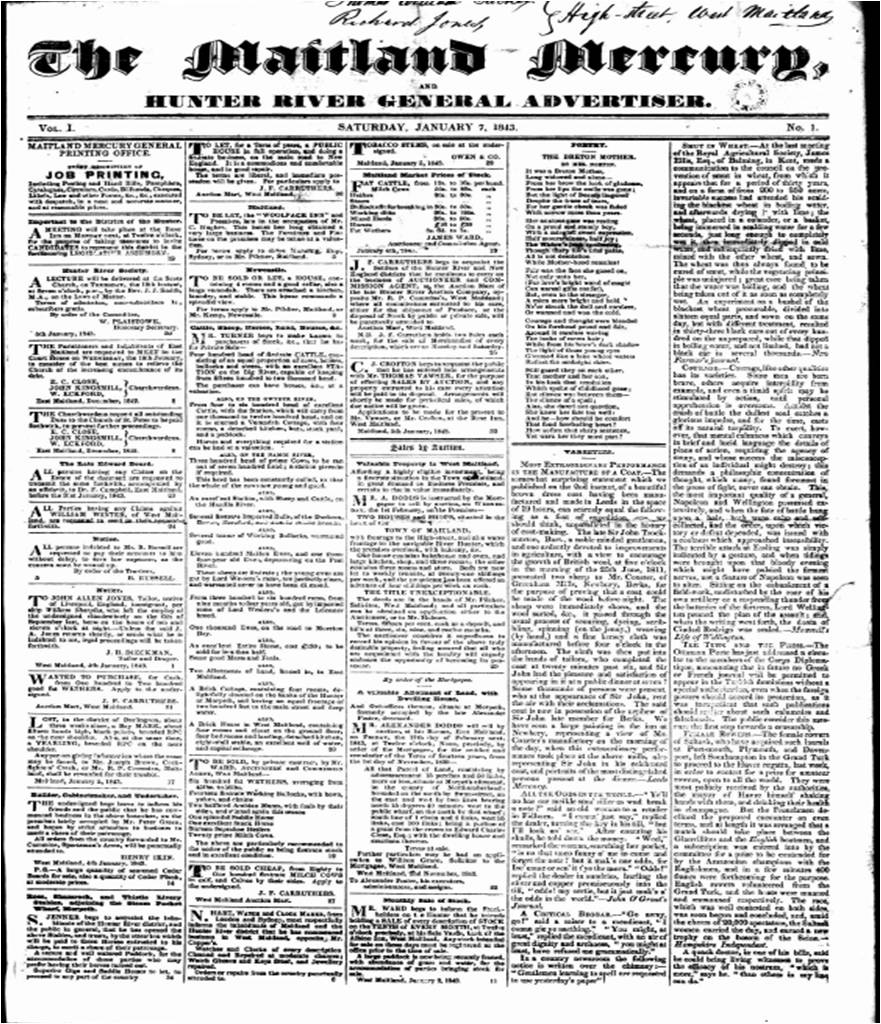
The ''Maitland Mercury'' is Australia's third oldest regional newspaper, preceded only by the ''Geelong Advertiser'' (estab. 1840) and the '' Launceston Examiner'' (estab. 1842). The ''Maitland Mercury'' was established in 1843 when it was called ''The Maitland Mercury and Hunter River General Advertiser''. ''The Maitland Mercury'' is still in circulation serving the city of Maitland and the surrounding Lower Hunter Valley. These days the Maitland Mercury has a weekly print edition which appears on Fridays. History It was originally a weekly newspaper, founded by Richard Jones, an English migrant from Liverpool who also served as treasurer of NSW for a brief period. The first issue was published as ''The Maitland Mercury and Hunter River General Advertiser'' on 7 January 1843. It has been a daily since 1894. when it was issued under two banners as ''The Maitland Daily Mercury'' during the week and ''The Maitland Weekly Mercury'' on Saturdays. From 1870 to 1873, Margaret Fa ... [...More Info...] [...Related Items...] OR: [Wikipedia] [Google] [Baidu] |
Northumberland County, New South Wales
Northumberland County was one of the original Nineteen Counties in New South Wales and is now one of the 141 Cadastral divisions of New South Wales. It included the area to the north of Broken Bay, including Lake Macquarie and Newcastle( Greater Newcastle). It was bounded by the part of the Hawkesbury River to the south, the Macdonald River to the south-west, and the Hunter River to the north. Northumberland County was named after the English Northumberland, and named by Lieutenant Charles Menzies, commandant at Newcastle, about 1804. In 1852 it had an area of and population of 15,207, and was described as being long and wide and the main coal Coal is a combustible black or brownish-black sedimentary rock, formed as stratum, rock strata called coal seams. Coal is mostly carbon with variable amounts of other Chemical element, elements, chiefly hydrogen, sulfur, oxygen, and nitrogen ... region of the colony. Between 21 July 1948 and 19 December 1963, the county ... [...More Info...] [...Related Items...] OR: [Wikipedia] [Google] [Baidu] |


