|
Antarctic Convergence
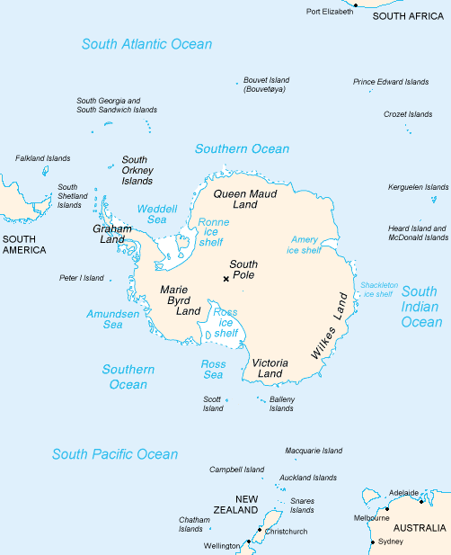
The Antarctic Convergence or Antarctic Polar Front is a marine belt encircling Antarctica, varying in latitude seasonally, where cold, northward-flowing Antarctic waters meet the relatively warmer waters of the sub-Antarctic. The line separates the clockwise Antarctic circumpolar current from other oceans. Antarctic waters predominantly sink beneath the warmer subantarctic waters, while associated zones of mixing and upwelling create a zone very high in marine productivity, especially for Antarctic krill. This line, like the Arctic tree line, is a natural boundary rather than an artificial one, such as the borders of nations and time zones. It not only separates two hydrological regions, but also separates areas of distinctive marine life and climates. The Arctic has no similar boundary because of the large bodies of land contiguous with the northern polar region. History The Antarctic Convergence was first crossed by Anthony de la Roché in 1675 and Edmond Halley i ... [...More Info...] [...Related Items...] OR: [Wikipedia] [Google] [Baidu] |
Edmond Halley
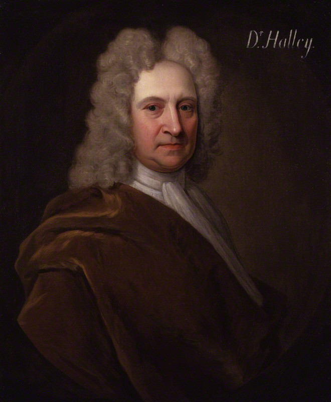
Edmond (or Edmund) Halley (; – ) was an English astronomer, mathematician and physicist. He was the second Astronomer Royal in Britain, succeeding John Flamsteed in 1720. From an observatory he constructed on Saint Helena in 1676–77, Halley catalogued the southern celestial hemisphere and recorded a transit of Mercury across the Sun. He realised that a similar transit of Venus could be used to determine the distances between Earth, Venus, and the Sun. Upon his return to England, he was made a fellow of the Royal Society, and with the help of King Charles II of England, Charles II, was granted a master's degree from University of Oxford, Oxford. Halley encouraged and helped fund the publication of Isaac Newton's influential ''Philosophiæ Naturalis Principia Mathematica'' (1687). From observations Halley made in September 1682, he used Newton's law of universal gravitation to compute the periodicity of Halley's Comet in his 1705 ''Synopsis of the Astronomy of Comets''. It ... [...More Info...] [...Related Items...] OR: [Wikipedia] [Google] [Baidu] |
Diego Ramírez Islands
The Diego Ramírez Islands () are a small group of Chilean subantarctic islands located at the southernmost extreme of South America. History The islands were sighted on 12 February 1619 by the Spanish Garcia de Nodal expedition, and named after the cosmographer of the expedition, Diego Ramírez de Arellano. They were cited as the southernmost land mass plotted as of that time, and retained the distinction for 156 years, until the discovery of the South Sandwich Islands in 1775. In 1892, the Chilean government rented the islands to Pedro Pablo Benavides for fishing and on condition that a lighthouse, a port, and a school would be built. Later the rent was transferred to Koenigswerther and Pasinowich. The Chilean Navy established a meteorological station above Caleta Condell, a small cove on the northeastern side of Isla Gonzalo (Gonzalo Island), in 1957, and resupplies it several times each year. This is the southernmost inhabited outpost outside Antarctica. The next most ... [...More Info...] [...Related Items...] OR: [Wikipedia] [Google] [Baidu] |
Crozet Islands
The Crozet Islands (; or, officially, ''Archipel Crozet'') are a sub-Antarctic archipelago of small islands in the southern Indian Ocean. They form one of the five administrative districts of the French Southern and Antarctic Lands. History Discovery and early history The Crozet Islands were discovered on 24 January 1772, by the expedition of French explorer Marc-Joseph Marion du Fresne, aboard ''Le Mascarin''. His second-in-command, Julien-Marie Crozet, landed on Île de la Possession, claiming the archipelago for France. In 1776, Crozet met James Cook at Cape Town, at the start of Cook's third voyage. Crozet shared the charts of his ill-fated expedition, and as Cook sailed eastward, he stopped at the islands, naming the western group ''Marion'' and the eastern group ''Crozet''. In the following years, sealers visiting the islands referred to both the eastern and western groups as the Crozet Islands, and Marion Island became the name of the larger of the two Prince Edward ... [...More Info...] [...Related Items...] OR: [Wikipedia] [Google] [Baidu] |
France
France, officially the French Republic, is a country located primarily in Western Europe. Overseas France, Its overseas regions and territories include French Guiana in South America, Saint Pierre and Miquelon in the Atlantic Ocean#North Atlantic, North Atlantic, the French West Indies, and List of islands of France, many islands in Oceania and the Indian Ocean, giving it Exclusive economic zone of France, one of the largest discontiguous exclusive economic zones in the world. Metropolitan France shares borders with Belgium and Luxembourg to the north; Germany to the northeast; Switzerland to the east; Italy and Monaco to the southeast; Andorra and Spain to the south; and a maritime border with the United Kingdom to the northwest. Its metropolitan area extends from the Rhine to the Atlantic Ocean and from the Mediterranean Sea to the English Channel and the North Sea. Its Regions of France, eighteen integral regions—five of which are overseas—span a combined area of and hav ... [...More Info...] [...Related Items...] OR: [Wikipedia] [Google] [Baidu] |
Île Amsterdam
(), also known as Amsterdam Island or New Amsterdam (), is an island of the French Southern and Antarctic Lands in the southern Indian Ocean that together with neighbouring Île Saint-Paul to the south forms one of the five districts of the territory. The island is roughly equidistant to the land masses of Madagascar, Australia, and Antarcticaas well as the British Indian Ocean Territory and the Cocos (Keeling) Islands (about from each). It is the northernmost volcanic island within the Antarctic Plate. The research station at , first called and then , is the only settlement on the island and is the seasonal home to about thirty researchers and staff studying biology, meteorology, and geomagnetics. History The first person known to have sighted the island was the Spanish explorer Juan Sebastián Elcano, on 18 March 1522, during his circumnavigation of the world. Elcano called it (), because he couldn't find a safe place to land and his crew was desperate for water after ... [...More Info...] [...Related Items...] OR: [Wikipedia] [Google] [Baidu] |
61st Parallel South
Following are circles of latitude between the 55th parallel south and the 80th parallel south. The 55th parallel south, crossing the southernmost point of Chile, is the last line of latitude moving southward to touch any part of any continent other than Antarctica, other than minor outlying islands. 56th parallel south The 56th parallel south is a circle of latitude that is 56 degrees south of the Earth's equatorial plane. No land lies on the parallel — it crosses nothing but ocean. At this latitude the sun is visible for 17 hours, 37 minutes during the December solstice and 6 hours, 57 minutes during the June solstice. Around the world Starting at the Prime Meridian and heading eastwards, the parallel 56° south passes through: : 57th parallel south The 57th parallel south is a circle of latitude that is 57 degrees south of the Earth's equatorial plane. No land lies on the parallel — it crosses nothing but ocean. At this latitude the sun is visible for 17 hours ... [...More Info...] [...Related Items...] OR: [Wikipedia] [Google] [Baidu] |
48th Parallel South
Following are circles of latitude between the 45th parallel south and the 50th parallel south: 46th parallel south The 46th parallel south is a circle of latitude that is 46 degrees south of the Earth's equatorial plane. It crosses the Atlantic Ocean, the Indian Ocean, Australasia, the Pacific Ocean and South America. At this latitude the sun is visible for 15 hours, 45 minutes during the December solstice and 8 hours, 38 minutes during the June solstice. This holds true regardless of longitude. The largest city south of the 46th parallel is Punta Arenas. Around the world Starting at the Prime Meridian and heading eastwards, the parallel 46° south passes through: : 47th parallel south The 47th parallel south is a circle of latitude that is 47 degrees south of the Earth's equatorial plane. It crosses the Atlantic Ocean, the Indian Ocean, Australasia, the Pacific Ocean and South America. At this latitude, the sun is visible for 15 hours and 54 minutes during the Decemb ... [...More Info...] [...Related Items...] OR: [Wikipedia] [Google] [Baidu] |
Ocean
The ocean is the body of salt water that covers approximately 70.8% of Earth. The ocean is conventionally divided into large bodies of water, which are also referred to as ''oceans'' (the Pacific, Atlantic, Indian Ocean, Indian, Southern Ocean, Antarctic/Southern, and Arctic Ocean),"Ocean." ''Merriam-Webster.com Dictionary'', Merriam-Webster, https://www.merriam-webster.com/dictionary/ocean . Accessed March 14, 2021. and are themselves mostly divided into seas, gulfs and Lists of bodies of water#Seawater bodies, subsequent bodies of water. The ocean contains 97% of Water distribution on Earth, Earth's water and is the primary component of Earth's hydrosphere, acting as a huge Ocean heat content, reservoir of heat for Earth's energy budget, as well as for its carbon cycle and water cycl ... [...More Info...] [...Related Items...] OR: [Wikipedia] [Google] [Baidu] |
Indian Ocean
The Indian Ocean is the third-largest of the world's five oceanic divisions, covering or approximately 20% of the water area of Earth#Surface, Earth's surface. It is bounded by Asia to the north, Africa to the west and Australia (continent), Australia to the east. To the south it is bounded by the Southern Ocean or Antarctica, depending on the definition in use. The Indian Ocean has large marginal or regional seas, including the Andaman Sea, the Arabian Sea, the Bay of Bengal, and the Laccadive Sea. Geologically, the Indian Ocean is the youngest of the oceans, and it has distinct features such as narrow continental shelf, continental shelves. Its average depth is 3,741 m. It is the warmest ocean, with a significant impact on global climate due to its interaction with the atmosphere. Its waters are affected by the Indian Ocean Walker circulation, resulting in unique oceanic currents and upwelling patterns. The Indian Ocean is ecologically diverse, with important ecosystems such ... [...More Info...] [...Related Items...] OR: [Wikipedia] [Google] [Baidu] |
Pacific Ocean
The Pacific Ocean is the largest and deepest of Earth's five Borders of the oceans, oceanic divisions. It extends from the Arctic Ocean in the north to the Southern Ocean, or, depending on the definition, to Antarctica in the south, and is bounded by the continents of Asia and Australia in the west and the Americas in the east. At in area (as defined with a southern Antarctic border), the Pacific Ocean is the largest division of the World Ocean and the hydrosphere and covers approximately 46% of Earth's water surface and about 32% of the planet's total surface area, larger than its entire land area ().Pacific Ocean . ''Encyclopædia Britannica, Britannica Concise.'' 2008: Encyclopædia Britannica, Inc. The centers of both the Land and water hemispheres, water hemisphere and the Western Hemisphere, as well as the Pole of inaccessi ... [...More Info...] [...Related Items...] OR: [Wikipedia] [Google] [Baidu] |
Atlantic Ocean
The Atlantic Ocean is the second largest of the world's five borders of the oceans, oceanic divisions, with an area of about . It covers approximately 17% of Earth#Surface, Earth's surface and about 24% of its water surface area. During the Age of Discovery, it was known for separating the New World of the Americas (North America and South America) from the Old World of Afro-Eurasia (Africa, Asia, and Europe). Through its separation of Afro-Eurasia from the Americas, the Atlantic Ocean has played a central role in the development of human society, globalization, and the histories of many nations. While the Norse colonization of North America, Norse were the first known humans to cross the Atlantic, it was the expedition of Christopher Columbus in 1492 that proved to be the most consequential. Columbus's expedition ushered in an Age of Discovery, age of exploration and colonization of the Americas by European powers, most notably Portuguese Empire, Portugal, Spanish Empire, Sp ... [...More Info...] [...Related Items...] OR: [Wikipedia] [Google] [Baidu] |


