|
A650 Road
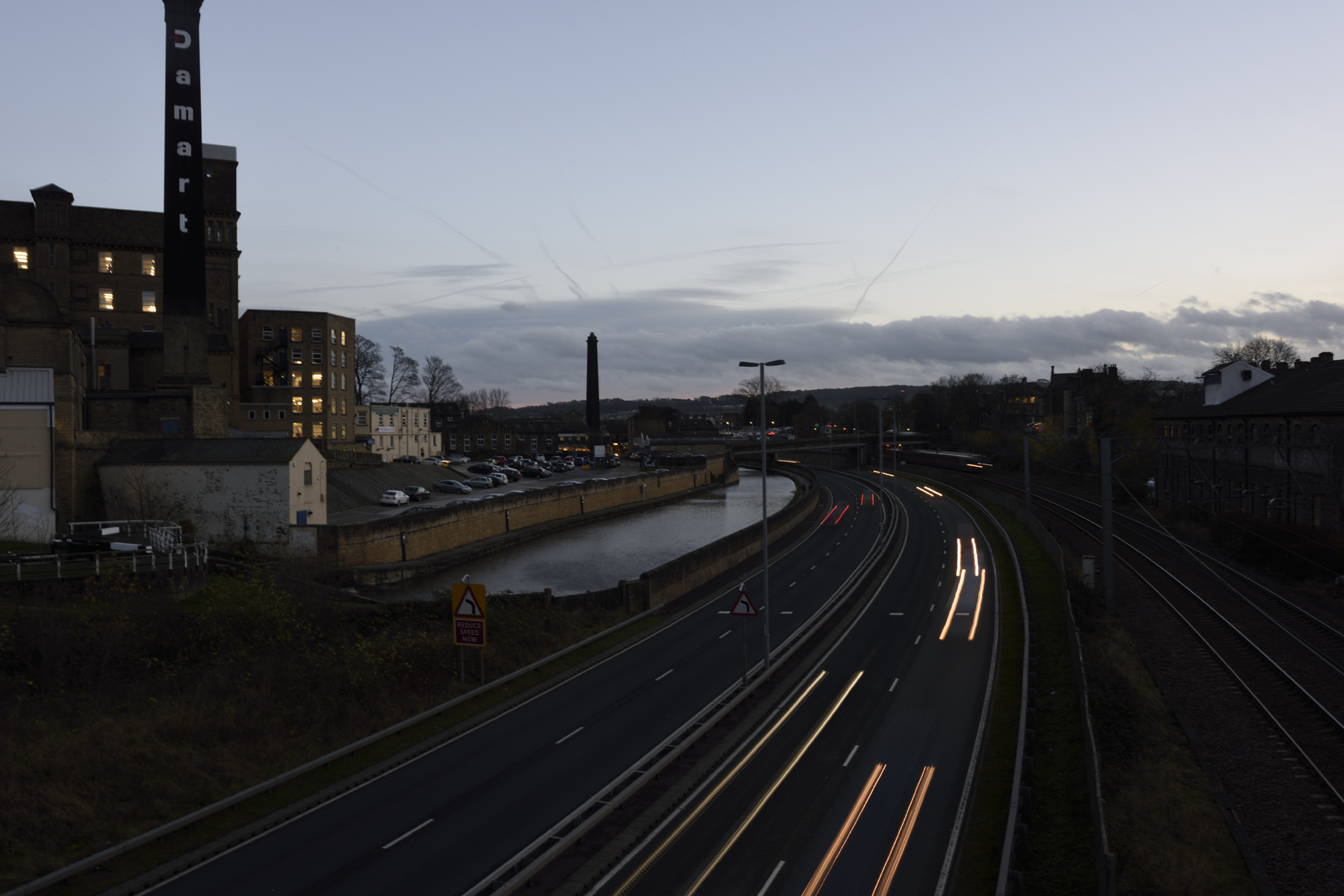
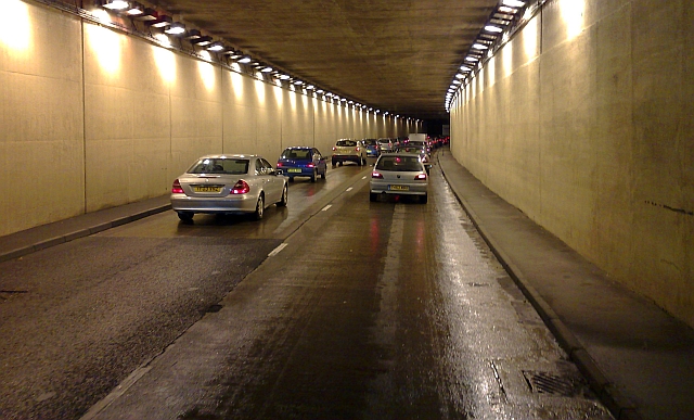
The A650 road is a main route through the West Yorkshire conurbation in England. The road goes from Keighley to Wakefield on a rough north west/south east axis for 25 miles (40 km). The route is mostly single carriageway with some dualled sections in the Aire Valley, Bradford and the approach to Wakefield from the M1. Two sections of the A650 are designated as part of the Governments High Load Route; the section between Keighley and Saltaire and the section between the A58 on the Drighlington bypass and the Tingley roundabout. Settlements on the route * Keighley * Crossflatts * Bingley * Saltaire * Shipley * Bradford * Dudley Hill * Tong Street * Gildersome Street * Bruntcliffe * Morley * Tingley * East Ardsley * Carr Gate * Wakefield Route description The road begins at a roundabout with the A629 Skipton to Rotherham road in Keighley. The B6265 road (which was formerly the A629 until the bypass to Skipton was opened) also filters into the roundabout. The road h ... [...More Info...] [...Related Items...] OR: [Wikipedia] [Google] [Baidu] |
Keighley
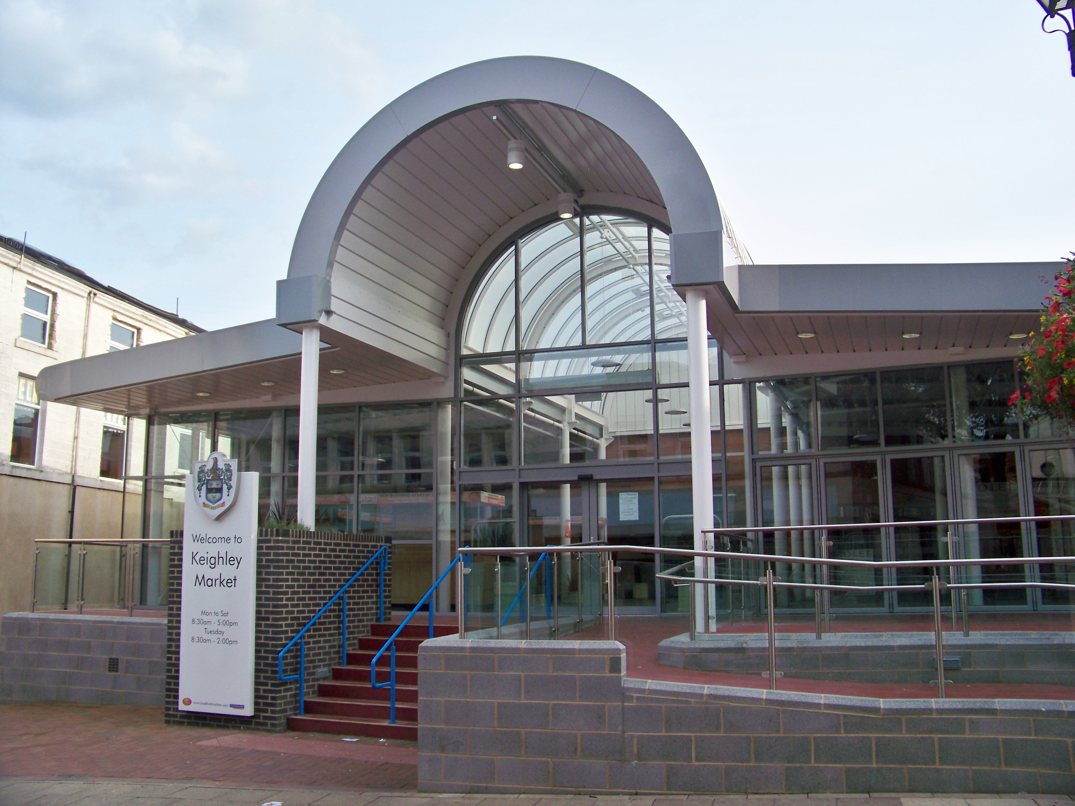
Keighley ( ) is a market town and a civil parishes in England, civil parish in the City of Bradford Borough of West Yorkshire, England. It is the second-largest settlement in the borough, after Bradford. Keighley is north-west of Bradford, north-west of Bingley, north of Halifax, West Yorkshire, Halifax and south-east of Skipton. It is governed by Keighley Town Council and Bradford City Council. Keighley is in West Yorkshire, close to the borders of North Yorkshire and Lancashire. Historic counties of England, Historically in the West Riding of Yorkshire, it lies between Airedale and Keighley Moors. At the 2011 census, Keighley had a population of 56,348. History Toponymy The name Keighley, which has gone through many changes of spelling throughout its history, means "Cyhha's farm or clearing", and was mentioned in the Domesday Book of 1086: "In Cichhelai, Ulchel, and Thole, and Ravensuar, and William had six carucates to be taxed." Town charter Henry de Keighley, a ... [...More Info...] [...Related Items...] OR: [Wikipedia] [Google] [Baidu] |
East Ardsley
East Ardsley is a village in the City of Leeds metropolitan borough, in West Yorkshire, England. East Ardsley forms part of the Heavy Woollen District and sits within the Rhubarb Triangle. Etymology The name ''Ardsley'' is first attested in the Domesday Book of 1086 as ''Erdeslau'' and ''Eadeslauue'', apparently primarily with reference to what is now East Ardsley as opposed to West Ardsley. The first element of the name comes from the Old English personal name ''Eard'', a nickname form of longer names like ''Eardwulf'', in the genitive form ''Eardes'' ('Eard's'). The second element comes from Old English ''hlǣw'' ('hill, mound'). Thus the name once meant 'Eard's hill' or 'Eard's mound'. The name first appears with the element ''east'' in 1459, in the forms ''Est Ardeslaw'' and ''East Ardeslawe''.Harry Parkin, ''Your City's Place-Names: Leeds'', English Place-Name Society City-Names Series, 3 (Nottingham: English Place-Names Society, 2017), pp. 16–17. Location Historic ... [...More Info...] [...Related Items...] OR: [Wikipedia] [Google] [Baidu] |
County Hall, Wakefield
County Hall or West Riding County Hall stands at the corner of Bond Street and Cliff Parade in Wakefield, West Yorkshire, England. It was opened in 1898 as the headquarters of the West Riding County Council, and on the abolition of that body in 1974 became the headquarters of West Yorkshire County Council. When that council was in turn abolished in 1986 the building became the primary headquarters of Wakefield Metropolitan District Council. It is a Grade I listed building. History Following the implementation of the Local Government Act 1888, which established county councils in every county, there was a need to find a permanent meeting place for the West Riding of Yorkshire County Council. Its first meeting was held in February 1889 in Wakefield Town Hall, at the invitation of the borough council.''The West Riding County Council 1889–1974'' For a permanent home the choice was between Leeds and Wakefield; much debate and correspondence resulted, in 1892, in the selection of ... [...More Info...] [...Related Items...] OR: [Wikipedia] [Google] [Baidu] |
A61 Road
The A61 is a major trunk road in England connecting Derby and Thirsk in North Yorkshire by way of Alfreton, Clay Cross, Chesterfield, Sheffield, Barnsley, Wakefield, Leeds, Harrogate and Ripon. The road is closely paralleled by the M1 motorway between Derby and Leeds. Route Heading south, the road begins as single carriageway from Thirsk which bypasses Ripon and travels towards Harrogate, eventually passing through Harrogate town centre. Here, the road divides into two major one-way streets which enclose the town centre and run along The Stray, a stretch of grassland in Harrogate. As Leeds Road, it then passes through the southern suburbs of Harrogate before meeting the A658 near the village of Pannal. The A61 continues through Harewood before approaching the north's metropolis, where a sudden urban fringe approaches. As the road enters Leeds and crosses the A6120 outer ring road, the road becomes Scott Hall Road, a main dual carriageway (or Trunk Road) and artery for nort ... [...More Info...] [...Related Items...] OR: [Wikipedia] [Google] [Baidu] |
A654 Road
List of A roads in zone 6 in Great Britain Great Britain is an island in the North Atlantic Ocean off the north-west coast of continental Europe, consisting of the countries England, Scotland, and Wales. With an area of , it is the largest of the British Isles, the List of European ... starting east of the A6 and A7 roads, and west of the A1 (road beginning with 6). Single- and double-digit roads Triple-digit roads Four-digit roads (60xx) Four-digit roads (61xx and higher) References {{UK road lists 6 6 ... [...More Info...] [...Related Items...] OR: [Wikipedia] [Google] [Baidu] |
A643 Road
The A643 is a main road between Leeds and Huddersfield in West Yorkshire, England. Its eastern end is at the Armley Gyratory roundabout on the western edge of Leeds City Centre. The road then goes through the following places: * Beeston * Churwell * Morley * Bruntcliffe * Howden Clough * Birstall * Gomersal * Cleckheaton * Hartshead Moor Top * Clifton * Brighouse * Rastrick * Ainley Top to its western end, at junction 23 of the M62 Motorway (Mount Roundabout, Outlane, Huddersfield). The road is approximately long. Road features In Leeds, the road is a dual carriageway that links the Armley Gyratory roundabout with the M621 motorway The M621 is a loop of motorway in West Yorkshire, England that takes traffic into central Leeds between the M1 motorway, M1 and M62 motorway, M62 motorways. History The first section of the M621 to open, known at the time as the 'South West Ur ... at junction 2. This part of the A643 is known as the Ingram Distributor. It is a v ... [...More Info...] [...Related Items...] OR: [Wikipedia] [Google] [Baidu] |
A62 Road
The A62 road in Northern England runs between the cities of Leeds in West Yorkshire and Manchester in Greater Manchester covering a distance of . It passes through Heckmondwike, Huddersfield, Oldham and Failsworth, the highest part of the motorway is in the Pennines Route The A62 begins at a junction with the A58 road as Gelderd Road in Leeds. It runs through West Yorkshire, passing through Birstall, Heckmondwike, Liversedge, Huddersfield, Linthwaite, Slaithwaite, and Marsden. It crosses the Pennines at Standedge, and continues through Saddleworth and into Oldham Oldham is a town in Greater Manchester, England. It lies amongst the Pennines on elevated ground between the rivers River Irk, Irk and River Medlock, Medlock, southeast of Rochdale, and northeast of Manchester. It is the administrative cent .... From there, the A62 runs into Manchester as Oldham Street and Oldham Road through Failsworth, ending at the Manchester Inner Ring Road. History It is par ... [...More Info...] [...Related Items...] OR: [Wikipedia] [Google] [Baidu] |
M621 Motorway
The M621 is a loop of motorway in West Yorkshire, England that takes traffic into central Leeds between the M1 motorway, M1 and M62 motorway, M62 motorways. History The first section of the M621 to open, known at the time as the 'South West Urban Motorway', extended from the M62 to junction 3 in central Leeds where it used to terminate at a roundabout which was also the terminus of the M1 motorway. This section opened in stages, first from the M62 to junction 1 in 1971 (this was originally numbered M65), and then next from junction 1 to junction 3 in 1973. When the M1 motorway, M1 was diverted away from Leeds when the 'M1 – A1 Lofthouse to Bramham' extension opened in 1999 adjustments were made to junction 3 and the Leeds section of the M1 was re-designated as M621, given junction 3 to junction 7). Junctions {, class="plainrowheaders wikitable" , - !scope=col, County !scope=col, Location !scope=col, mi !scope=col, km !scope=col, Junction !scope=col, Destinations !scope=col, ... [...More Info...] [...Related Items...] OR: [Wikipedia] [Google] [Baidu] |
M62 Motorway
The M62 is a west–east Pennines, trans-Pennine motorway in Northern England, connecting Liverpool and Kingston upon Hull, Hull via Manchester, Bradford, Leeds and Wakefield; of the route Concurrency (road), is shared with the M60 motorway, M60 orbital motorway around Manchester. The road is part of the unsigned International E-road network, Euroroutes European route E20, E20 (Shannon, County Clare, Shannon to Saint Petersburg) and European route E22, E22 (Holyhead to Ishim, Tyumen Oblast, Ishim). The motorway, which was first proposed in the 1930s, and conceived as two separate routes, was opened in stages between 1971 and 1976, with construction beginning at Pole Moor near Huddersfield and finishing at that time in Tarbock on the outskirts of Liverpool. The motorway absorbed the northern end of the Stretford-Eccles, Greater Manchester, Eccles bypass, which was built between 1957 and 1960. Adjusted for inflation to 2007, its construction cost approximately £765 millio ... [...More Info...] [...Related Items...] OR: [Wikipedia] [Google] [Baidu] |
A647 Road
The A647 is an A road in West Yorkshire, England that begins in Leeds and ends in Halifax. The road is long. Route The road begins at the Armley Gyratory and goes via Armley, by-passes Stanningley and Pudsey, then onwards via Thornbury to the edge of Bradford city centre. The road then becomes part of the Bradford's Inner Ring Road (''Croft Street'') heading through Great Horton and up to Queensbury ( above sea level) before heading down hill via Boothtown to Halifax town centre. History In June 2016 the CS1 Cycle Superhighway opened from Bradford to Leeds, for the most part following the corridor of the A647. However unlike similarly named schemes in the Netherlands and London, this route relies on allocated lane space within the vehicle carriageway which has led to criticism over its effectiveness from cycling and transport consultants. Stanningley bypass The road is a stretch of dual carriageway on the western edge of Leeds. The first section (Dawson's Corner to Ri ... [...More Info...] [...Related Items...] OR: [Wikipedia] [Google] [Baidu] |
Cottingley, Bradford
Cottingley is a suburban village within the City of Bradford district in West Yorkshire, England between Shipley and Bingley. It is known for the Cottingley Fairies, which appeared in a series of photographs taken there during the early 20th century. Etymology The village is first mentioned in the Domesday Book of 1086 as ''Cotingelai'' in the wapentake of Skyrack and the lands of Erneis of Buron. The first element is the personal name ''Cotta'' (the origin of which is unknown), and the second the suffix ''-ingas'' denoting a group of associated people. Thus the ''Cottingas'' were a group descended from or otherwise associated with someone called Cotta. This group name was then compounded with the Old English word ''lēah'' ('open land in a wood'). Thus the name once meant 'the clearing of the descendants of Cotta'. History The village was clustered around the original St Michael's Church, Cottingley Town Hall and the Sun Inn. This village was from Bingley, with Cottingley B ... [...More Info...] [...Related Items...] OR: [Wikipedia] [Google] [Baidu] |


