|
6S (radiative Transfer Code)
{{No footnotes, date=December 2008 6SV1 (Second Simulation of a Satellite Signal in the Solar Spectrum, Vector, version 1) is an advanced radiative transfer code designed to simulate the reflection of solar radiation by a coupled atmosphere-surface system for a wide range of atmospheric, spectral and geometrical conditions. It belongs to the group of procedures called Atmospheric correction for the process of removing the effects of the atmosphere on the reflectance values of images taken by satellite or airborne sensors. The code operates on the basis of an SOS (successive orders of scattering) method and accounts for the polarization of radiation in the atmosphere through the calculation of the Q and U components of the Stokes vector. It is a basic code for the calculation of look-up tables in the MODIS The Moderate Resolution Imaging Spectroradiometer (MODIS) is a satellite-based sensor used for earth and climate measurements. There are two MODIS sensors in Earth orbit ... [...More Info...] [...Related Items...] OR: [Wikipedia] [Google] [Baidu] |
Atmospheric Correction
Atmospheric correction is the process of removing the scattering and absorption effects of the atmosphere on the reflectance values of images taken by satellite or airborne sensors. Atmospheric effects in optical remote sensing are significant and complex, dramatically altering the spectral nature of the radiation reaching the remote sensor. The atmosphere both absorbs and scatters various wavelengths of the visible spectrum which must pass through the atmosphere twice, once from the sun to the object and then again as it travels back up the image sensor. These distortions are corrected using various approaches and techniques, as described below. Examples of Atmospheric Correction Methods See also * Adaptive optics Adaptive optics (AO) is a technology used to improve the performance of optical systems by reducing the effect of incoming wavefront distortions by deforming a mirror in order to compensate for the distortion. It is used in astronomical tel ... References ... [...More Info...] [...Related Items...] OR: [Wikipedia] [Google] [Baidu] |
Atmosphere
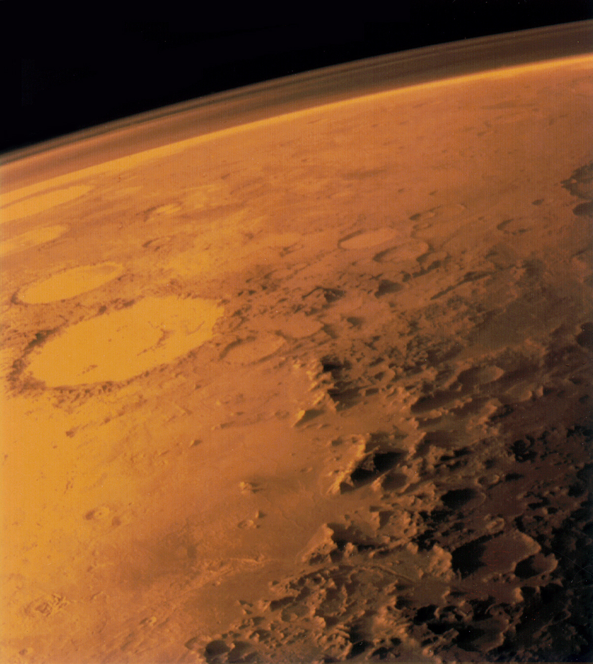
An atmosphere () is a layer of gas or layers of gases that envelop a planet, and is held in place by the gravity of the planetary body. A planet retains an atmosphere when the gravity is great and the temperature of the atmosphere is low. A stellar atmosphere is the outer region of a star, which includes the layers above the opaque photosphere; stars of low temperature might have outer atmospheres containing compound molecules. The atmosphere of Earth is composed of nitrogen (78%), oxygen (21%), argon (0.9%), carbon dioxide (0.04%) and trace gases. Most organisms use oxygen for respiration; lightning and bacteria perform nitrogen fixation to produce ammonia that is used to make nucleotides and amino acids; plants, algae, and cyanobacteria use carbon dioxide for photosynthesis. The layered composition of the atmosphere minimises the harmful effects of sunlight, ultraviolet radiation, the solar wind, and cosmic rays to protect organisms from genetic damage. The ... [...More Info...] [...Related Items...] OR: [Wikipedia] [Google] [Baidu] |
Satellite
A satellite or artificial satellite is an object intentionally placed into orbit in outer space. Except for passive satellites, most satellites have an electricity generation system for equipment on board, such as solar panels or radioisotope thermoelectric generators (RTGs). Most satellites also have a method of communication to ground stations, called transponders. Many satellites use a standardized bus to save cost and work, the most popular of which is small CubeSats. Similar satellites can work together as a group, forming constellations. Because of the high launch cost to space, satellites are designed to be as lightweight and robust as possible. Most communication satellites are radio relay stations in orbit and carry dozens of transponders, each with a bandwidth of tens of megahertz. Satellites are placed from the surface to orbit by launch vehicles, high enough to avoid orbital decay by the atmosphere. Satellites can then change or maintain the orbit by pr ... [...More Info...] [...Related Items...] OR: [Wikipedia] [Google] [Baidu] |
Polarization (waves)
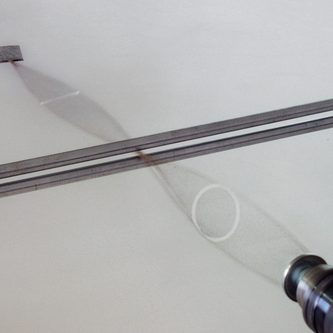
Polarization ( also polarisation) is a property applying to transverse waves that specifies the geometrical orientation of the oscillations. In a transverse wave, the direction of the oscillation is perpendicular to the direction of motion of the wave. A simple example of a polarized transverse wave is vibrations traveling along a taut string ''(see image)''; for example, in a musical instrument like a guitar string. Depending on how the string is plucked, the vibrations can be in a vertical direction, horizontal direction, or at any angle perpendicular to the string. In contrast, in longitudinal waves, such as sound waves in a liquid or gas, the displacement of the particles in the oscillation is always in the direction of propagation, so these waves do not exhibit polarization. Transverse waves that exhibit polarization include electromagnetic waves such as light and radio waves, gravitational waves, and transverse sound waves ( shear waves) in solids. An electromagneti ... [...More Info...] [...Related Items...] OR: [Wikipedia] [Google] [Baidu] |
Stokes Vector
The Stokes parameters are a set of values that describe the polarization state of electromagnetic radiation. They were defined by George Gabriel Stokes in 1852, as a mathematically convenient alternative to the more common description of incoherent or partially polarized radiation in terms of its total intensity (''I''), (fractional) degree of polarization (''p''), and the shape parameters of the polarization ellipse. The effect of an optical system on the polarization of light can be determined by constructing the Stokes vector for the input light and applying Mueller calculus, to obtain the Stokes vector of the light leaving the system. The original Stokes paper was discovered independently by Francis Perrin in 1942 and by Subrahamanyan Chandrasekhar in 1947, who named it as the Stokes parameters. Definitions The relationship of the Stokes parameters ''S''0, ''S''1, ''S''2, ''S''3 to intensity and polarization ellipse parameters is shown in the equations below and the fi ... [...More Info...] [...Related Items...] OR: [Wikipedia] [Google] [Baidu] |
MODIS
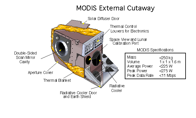
The Moderate Resolution Imaging Spectroradiometer (MODIS) is a satellite-based sensor used for earth and climate measurements. There are two MODIS sensors in Earth orbit: one on board the Terra ( EOS AM) satellite, launched by NASA in 1999; and one on board the Aqua (EOS PM) satellite, launched in 2002. MODIS has now been replaced by the VIIRS, which first launched in 2011 aboard the Suomi NPP satellite. The MODIS instruments were built by Santa Barbara Remote Sensing. They capture data in 36 spectral bands ranging in wavelength from 0.4 μm to 14.4 μm and at varying spatial resolutions (2 bands at 250 m, 5 bands at 500 m and 29 bands at 1 km). Together the instruments image the entire Earth every 1 to 2 days. They are designed to provide measurements in large-scale global dynamics including changes in Earth's cloud cover, radiation budget and processes occurring in the oceans, on land, and in the lower atmosphere. Support and calibration is provided by t ... [...More Info...] [...Related Items...] OR: [Wikipedia] [Google] [Baidu] |
List Of Atmospheric Radiative Transfer Codes
An atmospheric radiative transfer model, code, or simulator calculates radiative transfer of electromagnetic radiation through a planetary atmosphere. Methods At the core of a radiative transfer model lies the radiative transfer equation that is numerically solved using a solver such as a discrete ordinate method or a Monte Carlo method. The radiative transfer equation is a monochromatic equation to calculate radiance in a single layer of the Earth's atmosphere. To calculate the radiance for a spectral region with a finite width (e.g., to estimate the Earth's energy budget or simulate an instrument response), one has to integrate this over a band of frequencies (or wavelengths). The most exact way to do this is to loop through the frequencies of interest, and for each frequency, calculate the radiance at this frequency. For this, one needs to calculate the contribution of each spectral line for all molecules in the atmospheric layer; this is called a ''line-by-line'' calculatio ... [...More Info...] [...Related Items...] OR: [Wikipedia] [Google] [Baidu] |
GRASS GIS
''Geographic Resources Analysis Support System'' (commonly termed ''GRASS GIS'') is a geographic information system (GIS) software suite used for geospatial data management and analysis, image processing, producing graphics and maps, spatial and temporal modeling, and visualizing. It can handle raster, topological vector, image processing, and graphic data. GRASS GIS contains over 350 modules to render maps and images on monitor and paper; manipulate raster and vector data including vector networks; process multispectral image data; and create, manage, and store spatial data. It is licensed and released as free and open-source software under the GNU General Public License (GPL). It runs on multiple operating systems, including , Windows and Linux. Users can interface with the software features through a graphical user interface (GUI) or by ''plugging into'' GRASS via other software such as QGIS. They can also interface with the modules directly through a bespoke shell that the ... [...More Info...] [...Related Items...] OR: [Wikipedia] [Google] [Baidu] |


