Tamasopo on:
[Wikipedia]
[Google]
[Amazon]

 Tamasopo is a municipality and town in the
Official Website
{{San Luis Potosí Municipalities of San Luis Potosí

 Tamasopo is a municipality and town in the
 Mexican state
The states of Mexico are first-level administrative territorial entities of the country of Mexico, which is officially named United Mexican States. There are 32 federal entities in Mexico (31 states and the capital, Mexico City, as a separate en ...
of San Luis Potosí
San Luis Potosí (), officially the Free and Sovereign State of San Luis Potosí ( es, Estado Libre y Soberano de San Luis Potosí), is one of the 32 states which compose the Federal Entities of Mexico. It is divided in 58 municipalities and i ...
. The town is located at . The municipality had an area of and a population of 28,848 in 2010, including the population of the town of Tamasopo with 4,326 people.

Geography
Tamasopo is located in the foothills of theSierra Madre Oriental
The Sierra Madre Oriental () is a mountain range in northeastern Mexico. The Sierra Madre Oriental is part of the American Cordillera, a chain of mountain ranges (cordillera) that consists of an almost continuous sequence of mountain ranges that f ...
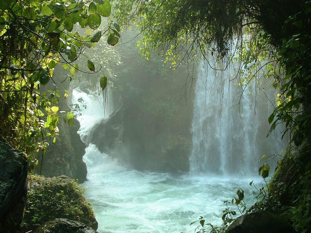
. The town of Tamosopo has an elevation of . The surrounding mountains rise to about 5,000 feet (1,500 m) above sea level. Tamasopo is famous for its enchanting waterfalls in a lush rain forest
El Puente de Dios is two miles (3 km) northwest of Tamasopo town. It consists of waterfalls into a narrow gorge and cavern beneath an arch through which the Gallinas river runs rapidly. Blue and clear water pools for swimming are at the top and bottom of the cavern. The Cascada de Tamasopo is two miles (3 km) north of the town. It features three cascades tumbling about into pools divided by travertine
Travertine ( ) is a form of terrestrial limestone deposited around mineral springs, especially hot springs. It often has a fibrous or concentric appearance and exists in white, tan, cream-colored, and even rusty varieties. It is formed by a p ...
ledges and shelves. The character of the waterfalls reminds some travelers of Havasu Falls
Havasu Falls (Havasupai: Havasuw Hagjahgeevma) is a waterfall of Havasu Creek, located in the Grand Canyon, Arizona, United States. It is within Havasupai tribal lands.
Geography
Havasu Falls is located from Supai. It is the more famous an ...
in the Grand Canyon
The Grand Canyon (, yuf-x-yav, Wi:kaʼi:la, , Southern Paiute language: Paxa’uipi, ) is a steep-sided canyon carved by the Colorado River in Arizona, United States. The Grand Canyon is long, up to wide and attains a depth of over a m ...
. Nearby is El Trampolin which consists of small waterfalls falling into clear, deep pools in the midst of a tropical forest.
Climate
The climate of Tamasopo is classified as sub-tropical Cwa (Koppen) or Cwal (Trewartha).History
Tamasopo is located in the Huasteca region, named after the indigenous people of the area.Indigenous people
Indigenous peoples are culturally distinct ethnic groups whose members are directly descended from the earliest known inhabitants of a particular geographic region and, to some extent, maintain the language and culture of those original people ...
number 4,461 people in the municipality of whom 2,950 speak an indigenous language. The indigenous population belongs mostly to two groups: the Huastecas who traditionally lived in the southern portion of the municipality and the Pame who lived in the northern part of the municipality."Enciclopedia de Municipios" , accessed 4 Apr 2013
See also
* Agua PuercaReferences
External links
Official Website
{{San Luis Potosí Municipalities of San Luis Potosí