Nikkō Kaidō on:
[Wikipedia]
[Google]
[Amazon]
 The was one of the five routes of the
. Accessed August 15, 2007. With only twenty-one stations, the Nikkō Kaidō was the shortest of the five routes, and it shares seventeen stations with the
 :Starting Location:
 :14. Koganei-shuku (小金井宿) ( Shimotsuke)
:15. Ishibashi-shuku (石橋宿) (Shimotsuke)
:16. Suzumenomiya-shuku (雀宮宿) (
 The was one of the five routes of the
 Edo period
The or is the period between 1603 and 1867 in the history of Japan, when Japan was under the rule of the Tokugawa shogunate and the country's 300 regional '' daimyo''. Emerging from the chaos of the Sengoku period, the Edo period was character ...
and it was built to connect Edo
Edo ( ja, , , "bay-entrance" or "estuary"), also romanized as Jedo, Yedo or Yeddo, is the former name of Tokyo.
Edo, formerly a ''jōkamachi'' (castle town) centered on Edo Castle located in Musashi Province, became the ''de facto'' capital of ...
(modern-day Tokyo
Tokyo (; ja, 東京, , ), officially the Tokyo Metropolis ( ja, 東京都, label=none, ), is the capital and largest city of Japan. Formerly known as Edo, its metropolitan area () is the most populous in the world, with an estimated 37.46 ...
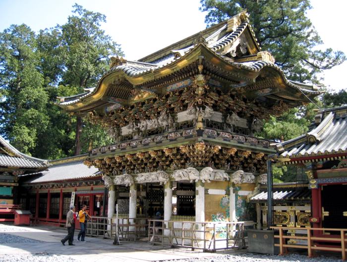
) with the temple-shrine complex of the Mangan-ji and Tōshōsha (now called the Rinnō-ji and Tōshōgū), which are located in the present-day city of Nikkō, Tochigi Prefecture
is a prefecture of Japan located in the Kantō region of Honshu. Tochigi Prefecture has a population of 1,943,886 (1 June 2019) and has a geographic area of 6,408 km2 (2,474 sq mi). Tochigi Prefecture borders Fukushima Prefecture to th ...
, Japan. It was an ancient path that became formalised when power moved to Edo, and was established fully in 1617 by Tokugawa Hidetada
was the second ''shōgun'' of the Tokugawa dynasty, who ruled from 1605 until his abdication in 1623. He was the third son of Tokugawa Ieyasu, the first ''shōgun'' of the Tokugawa shogunate.
Early life (1579–1593)
Tokugawa Hidetada was bo ...
, to give safer access to the temple-shrine mausoleum of his father, the first shogun Tokugawa Ieyasu, who was buried there that year.Nikkōdō. Accessed August 15, 2007. With only twenty-one stations, the Nikkō Kaidō was the shortest of the five routes, and it shares seventeen stations with the
Ōshū Kaidō
The was one of the five routes of the Edo period. It was built to connect Edo (modern-day Tokyo) with Mutsu Province and the present-day city of Shirakawa, Fukushima Prefecture, Japan. It was established by Tokugawa Ieyasu for government offic ...
. Its route can be traced with Japan's National Route 4 and National Route 119.
Stations of the Nikkō Kaidō
The 21 stations of the Nikkō Kaidō are listed below in order and are divided by their modern-day prefecture. The present day municipality is listed afterwards in parentheses.Tokyo
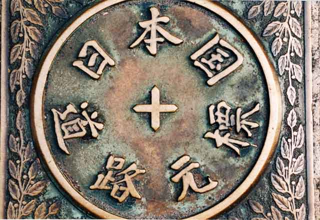
 :Starting Location:
 Nihonbashi
is a business district of Chūō, Tokyo, Japan which grew up around the bridge of the same name which has linked two sides of the Nihonbashi River at this site since the 17th century. The first wooden bridge was completed in 1603. The curre ...
(日本橋) ( Chūō-ku)
:1. Senju-shuku (千住宿) ( Adachi-ku) (also part of the Mito Kaidō)
Saitama Prefecture
:2. Sōka-shuku (草加宿) ( Sōka) :3. Koshigaya-shuku (越ヶ谷宿) (Koshigaya
is a city located in Saitama Prefecture, Japan. , the city had an estimated population of 345,353 in 158,022 households and a population density of 5700 persons per km². The total area of the city is . It is famous for producing daruma dolls. ...
)
:4. Kasukabe-shuku (粕壁宿) ( Kasukabe)
:5. Sugito-shuku (杉戸宿) ( Sugito, Kitakatsushika District)
:6. Satte-shuku (幸手宿) ( Satte)
:7. Kurihashi-shuku (栗橋宿) ( Kuki)
Ibaraki Prefecture
:8. Nakada-shuku (中田宿) ( Koga) :9. Koga-shuku (古河宿) (Koga)Tochigi Prefecture
:10. Nogi-shuku (野木宿) ( Nogi, Shimotsuga District) :11. Mamada-shuku (間々田宿) ( Oyama) :12. Oyama-shuku (小山宿) (Oyama) :13. Shinden-shuku (新田宿) (Oyama) :14. Koganei-shuku (小金井宿) ( Shimotsuke)
:15. Ishibashi-shuku (石橋宿) (Shimotsuke)
:16. Suzumenomiya-shuku (雀宮宿) (
:14. Koganei-shuku (小金井宿) ( Shimotsuke)
:15. Ishibashi-shuku (石橋宿) (Shimotsuke)
:16. Suzumenomiya-shuku (雀宮宿) (Utsunomiya
is the prefectural capital city of Tochigi Prefecture in the northern Kantō region of Japan. , the city had an estimated population of 519,223, and a population density of . The total area of the city is . Utsunomiya is famous for its '' gyoza' ...
)
:17. Utsunomiya-shuku (宇都宮宿) (Utsunomiya)
:18. Tokujirō-shuku (徳次郎宿) (Utsunomiya)
:19. Ōzawa-shuku (大沢宿) ( Nikkō)
:20. Imaichi-shuku (今市宿) (Nikkō) (also part of the Nikkō Reiheishi Kaidō)
:21. Hatsuishi-shuku (鉢石宿) (Nikkō)
:Ending Location: Nikkō Shinkyō (bridge) (日光神橋) (Nikkō)
See also
*Edo Five Routes
The , sometimes translated as "Five Highways", were the five centrally administered routes, or ''kaidō'', that connected the ''de facto'' capital of Japan at Edo (now Tokyo) with the outer provinces during the Edo period (1603–1868). The most ...
** Tōkaidō (or 53 Stations of the Tōkaidō
The are the rest areas along the Tōkaidō, which was a coastal route that ran from Nihonbashi in Edo (modern-day Tokyo) to Sanjō Ōhashi in Kyoto.. There were originally 53 government post stations along the Tōkaidō, where travelers ...
)
**Nakasendō
The , also called the ,Richard Lane, ''Images from the Floating World'' (1978) Chartwell, Secaucus ; pg. 285 was one of the five routes of the Edo period, and one of the two that connected Edo (modern-day Tokyo) to Kyoto in Japan. There were 69 ...
(or 69 Stations of the Nakasendō
The are the rest areas along the Nakasendō, which ran from Nihonbashi in Edo (modern-day Tokyo) to Sanjō Ōhashi in Kyoto.Yama to Keikoku Publishing (2006). Nakasendō o Aruku (Revised ed.). Osaka: Yama to Keikoku Publishing. .Kōshū Kaidō
The was one of the five routes of the Edo period. It was built to connect Edo (modern-day Tokyo) with Kai Province in modern-day Yamanashi Prefecture, Japan. The route continues from there to connect with the Nakasendō's Shimosuwa-shuku in ...
**Ōshū Kaidō
The was one of the five routes of the Edo period. It was built to connect Edo (modern-day Tokyo) with Mutsu Province and the present-day city of Shirakawa, Fukushima Prefecture, Japan. It was established by Tokugawa Ieyasu for government offic ...
*Other Routes
** Nikkō Onari Kaidō
** Nikkō Reiheishi Kaidō
** Nikkō Wakiōkan
References
{{DEFAULTSORT:Nikko Kaido Road transport in Japan 1610s establishments in Japan