List of highways in Tasmania on:
[Wikipedia]
[Google]
[Amazon]
 The
The  Excluding the old National Highway (Brooker, Midland, Bass), Tasmanian routes have been marked with the alphanumeric marking scheme since 1979 . Prior to this Tasmanian roads were marked with a National and State Route Numbering System.
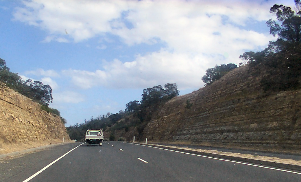
Highways are a part of Tasmania's road network, which covers a distance of approximately . As well as major highways between cities and ports, urban connectors between suburbs and commercial areas, residential streets, and forestry roads are also included. The most important state and regional connections, totalling , are state-owned roads, which are further classified into a road hierarchy.
The herirachy consists of:
* Trunk roads – major highways which are the "primary freight and passenger roads"
* Regional freight roads – regional roads which connect heavy freight to the trunk roads
* Regional access roads – providing access to Tasmania’s Regions, with less traffic than trunk and regional freight roads
* Feeder roads – connect population centres and tourist traffic to and from the rest of the state road network
* Other roads – lower traffic roads, primarily providing access to private properties
 The following roads are classified as trunk roads:
* Bass Highway (Launceston to Wynyard)
*


 The
The Highway
A highway is any public or private road or other public way on land. It is used for major roads, but also includes other public roads and public tracks. In some areas of the United States, it is used as an equivalent term to controlled-access ...
s in Tasmania
)
, nickname =
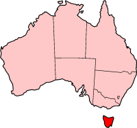
, image_map = Tasmania in Australia.svg
, map_caption = Location of Tasmania in AustraliaCoordinates:
, subdivision_type = Country
, subdi ...
generally expand from Hobart
Hobart ( ; Nuennonne/Palawa kani: ''nipaluna'') is the capital and most populous city of the Australian island state of Tasmania. Home to almost half of all Tasmanians, it is the least-populated Australian state capital city, and second-small ...
and other major cities with secondary roads interconnecting the highways to each other. Functions of these highways include freight, personal travel and tourism.
The AusLink Network currently consists of the Midland, Bass, Brooker, East Tamar Highway
The East Tamar Highway is a highway in Tasmania, Australia. It covers the eastern edge of the Tamar River, from Launceston to the lighthouse at Low Head.
It is labelled as route A8, but prior to 1980 was signed as State Route 1.
Plans for ...
and the southern section of the Tasman Highway
The Tasman Highway (or A3) is a highway in Tasmania, Australia. Like the Midland Highway, it connects the major cities of Hobart and Launceston – however it takes a different route, via the north-eastern and eastern coasts of the state. The ...
(Hobart-Hobart Airport).
Tasmanian highway naming is straightforward. Most are generally named after the geographical regions and features, cities, towns and settlements along the way.
Trunk roads
 The following roads are classified as trunk roads:
* Bass Highway (Launceston to Wynyard)
*
 Brooker Highway
The Brooker Highway is a highway in the State of Tasmania, Australia. As one of Hobart's 3 major radials, the highway connects traffic from the Hobart city centre with the northern suburbs and is the major road connection to the cities and town ...
* Davey Street
Davey Street a major one way street passing through the outskirts of the Hobart City Centre in Tasmania, Australia. Davey street is named after Thomas Davey, the first Governor of Van Diemen's Land. The street forms a one-way couplet with near ...
* Domain Highway
The Domain Highway is a highway in Tasmania, Australia. The highway acts as a link road connecting traffic between Hobart's two busiest highways; The Tasman Highway and the Brooker Highway while also bypassing the Hobart city centre. With ...
* East Tamar Highway
The East Tamar Highway is a highway in Tasmania, Australia. It covers the eastern edge of the Tamar River, from Launceston to the lighthouse at Low Head.
It is labelled as route A8, but prior to 1980 was signed as State Route 1.
Plans for ...
* Illawarra Road
* Macquarie Street
* Midland Highway
* Southern Outlet
* Tasman Highway
The Tasman Highway (or A3) is a highway in Tasmania, Australia. Like the Midland Highway, it connects the major cities of Hobart and Launceston – however it takes a different route, via the north-eastern and eastern coasts of the state. The ...
(Hobart to Hobart Airport)
Regional freight roads
The following roads are classified as regional freight roads: * Bass Highway (Wynyard to Smithton) *Batman Highway
Batman Highway is a two-lane rural highway in northern Tasmania. The highway links the East Tamar Highway, East Tamar and West Tamar Highway, West Tamar Highways via the Batman Bridge and provides the only crossing of the Tamar River (Tasmania), ...
* Birralee Road
* Bridport Road
* Fingerpost Road
* Frankford Road (Exeter to Birralee)
* Freestone Point Road
* Huon Highway
The Huon Highway is an highway in southern Tasmania, Australia. The highway forms part of the A6 and connects Hobart with the southern parts of Tasmania. The original Huon Highway (now known as Huon Road) was a twisty two-lane road skirting ...
(Kingston to Huonville)
* Lyell Highway
The Lyell Highway (Route A10) is a highway in Tasmania, running from Hobart to Queenstown.
It is the one of two transport routes that passes through the West Coast Range, the other being the Anthony Road.
Name
The name is derived from ...
(Granton to Rosegarland)
* Old Surrey Road
* Ridgley Highway
* Tasman Highway
The Tasman Highway (or A3) is a highway in Tasmania, Australia. Like the Midland Highway, it connects the major cities of Hobart and Launceston – however it takes a different route, via the north-eastern and eastern coasts of the state. The ...
(Hobart Airport to Triabunna, and Legerwood to Scottsdale)
* Tea Tree Road
* West Tamar Highway
The West Tamar Highway is a highway in Tasmania, Australia. It covers the western edge of the Tamar River
The Tamar River, officially kanamaluka / River Tamar, is a estuary located in northern Tasmania, Australia. Despite being called a r ...
(Exeter to Sidmouth)
Regional access roads
The following roads are classified as regional access roads: *Channel Highway
The Channel Highway is a regional highway that travels south from Hobart To Huonville, Tasmania, Australia. The Channel Highway starts from the end of Sandy Bay Road and travels south toward Huonville via Taroona, Kingston, Huntingfield, M ...
(Kingston to Kettering)
* Huon Highway
The Huon Highway is an highway in southern Tasmania, Australia. The highway forms part of the A6 and connects Hobart with the southern parts of Tasmania. The original Huon Highway (now known as Huon Road) was a twisty two-lane road skirting ...
(Huonville to Dover)
* Arthur Highway
The Arthur Highway (A9) is a Tasmanian highway which runs from Sorell in the near south to Port Arthur in the far south-east.
Route description
From its intersection with the Tasman Highway in Sorell the highway runs east, crossing Iron Creek ...
* South Arm Highway
The South Arm Highway (part of the B33 road route) is a highway serving the southern suburbs of Hobart, on the eastern shore of the River Derwent in Tasmania, Australia. The highway is a major trunk road that carries heavy commuter traffic ...
(Warrane to Howrah)
* East Derwent Highway
The East Derwent Highway (route number B32) is a highway in Hobart, Tasmania, Australia. The highway is a trunk road that carries heavy commuter traffic, much like the Brooker Highway, on the eastern side of the River Derwent (Tasmania), River ...
* Goodwood Road
* Tasman Highway
The Tasman Highway (or A3) is a highway in Tasmania, Australia. Like the Midland Highway, it connects the major cities of Hobart and Launceston – however it takes a different route, via the north-eastern and eastern coasts of the state. The ...
(Triabunna to Swansea, and Falmouth to St Helens)
* Lyell Highway
The Lyell Highway (Route A10) is a highway in Tasmania, running from Hobart to Queenstown.
It is the one of two transport routes that passes through the West Coast Range, the other being the Anthony Road.
Name
The name is derived from ...
(Rosegarland to Queenstown)
* Esk Highway
The Esk Highway (route number A4) is a highway in Tasmania, Australia. It connects the Midland Highway, located down the centre of the state, with the Tasman Highway, which is located on the east coast of the state.
Its western end joins ...
* Lilydale Road
* West Tamar Highway
The West Tamar Highway is a highway in Tasmania, Australia. It covers the western edge of the Tamar River
The Tamar River, officially kanamaluka / River Tamar, is a estuary located in northern Tasmania, Australia. Despite being called a r ...
(Launceston to Exeter)
* Zeehan Highway
* Murchison Highway
The Murchison Highway is a highway located in the West Coast region of Tasmania, Australia. The highway runs generally north–south, with Somerset, near Burnie, as its northern terminus and Zeehan as its southern terminus. The highway was ...
(Zeehan to Guildford)
* Stony Rise Road
* Mersey Main Road
* Railton Road (Latrobe to Railton)
* Port Sorell Road (East Devonport)


See also
*List of road routes in Tasmania
Road routes in Tasmania assist drivers navigating roads in urban, rural, and scenic areas of the state. The route numbering system is composed of National Highway 1, and three categories of alphanumeric routes: 'A' routes, which are the sta ...
* Highways in Australia
Highways in Australia are generally high capacity roads managed by state and territory government agencies, though Australia's federal government contributes funding for important links between capital cities and major regional centres. Prio ...
for highways in other states and territories
* List of highways in Australia for roads named as highways, but not necessarily classified as highways
References
*Further reading
* Commonwealth Bureau of Roads (Australia) (1978) ''National highways linking Hobart, Launceston and Burnie : approaches to Hobart''. Canberra : Australian Government Publishing Service, Parliamentary paper PP no. 124/1977 Chairman: H.T. Loxton. * Newitt, Lyn, (1988) ''Convicts & carriageways : Tasmanian road development until 1880'' edited by Alan Jones. Hobart : Dept. of Main Roads, Tasmania,External links
{{Commons category-inline, Highways in Tasmania Highways in TasmaniaTasmania
)
, nickname =
, image_map = Tasmania in Australia.svg
, map_caption = Location of Tasmania in AustraliaCoordinates:
, subdivision_type = Country
, subdi ...
Highways
A highway is any public or private road or other public way on land. It is used for major roads, but also includes other public roads and public tracks. In some areas of the United States, it is used as an equivalent term to controlled-access ...