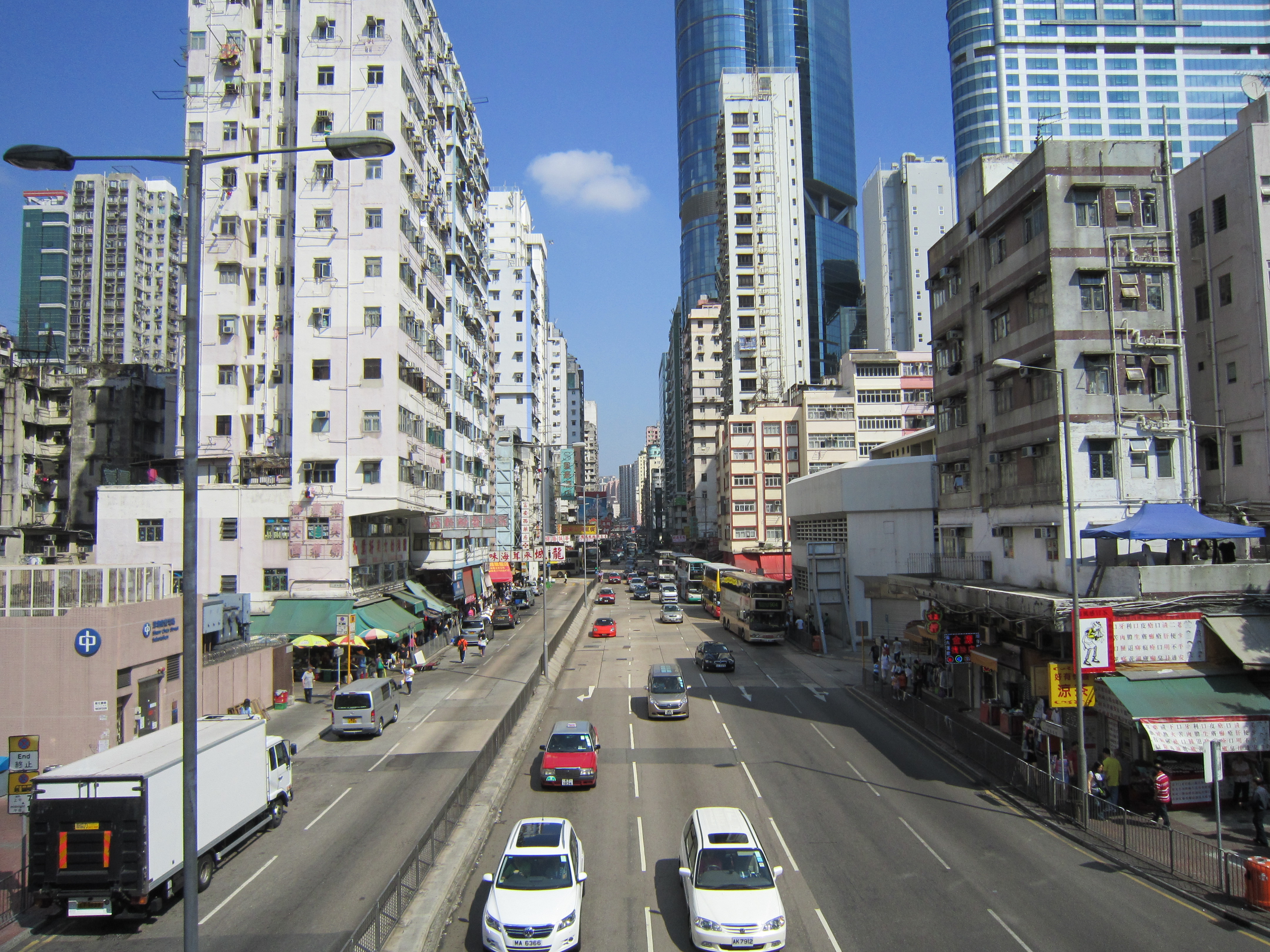
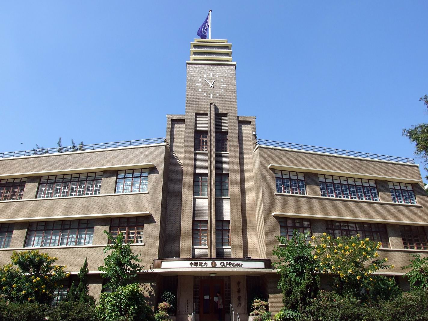
Argyle Street, Hong Kong on:
[Wikipedia]
[Google]
[Amazon]

 Argyle Street is a four-lane dual-way thoroughfare in
Hong Kong Place: Hong Kong street names with British origins
(in Traditional Chinese)
Google Maps of Argyle Street
{{Coord, 22.32037, 114.17586, display=title Kowloon City Ma Tau Wai Mong Kok Roads in Kowloon
Kowloon
Kowloon () is an urban area in Hong Kong comprising the Kowloon Peninsula and New Kowloon. With a population of 2,019,533 and a population density of in 2006, it is the most populous area in Hong Kong, compared with Hong Kong Island and t ...
, Hong Kong, connecting the districts of Mong Kok
Mong Kok (also spelled Mongkok, often abbreviated as MK) is an area in Kowloon, Hong Kong. The Prince Edward subarea occupies the northern part of Mong Kok.
Mong Kok is one of the major shopping areas in Hong Kong. The area is characterised ...
, Ho Man Tin, Ma Tau Wai
Ma Tau Wai (, originally , historically ) is an area in the Kowloon City District, Kowloon, Hong Kong. It was originally a walled village (Cantonese: ''Wai'') between present-day Argyle Street and Prince Edward Road West, east of present-d ...
and Kowloon City
Kowloon City is an neighbourhood, area in New Kowloon, Hong Kong. It is part of Kowloon City District.
Compared with the council area of Kowloon City District, the Kowloon City area is
History
As early as in the Qin dynasty (221 BCE ...
. It runs on an east-west alignment starting at its intersection with Cherry Street, Ferry Street and Tong Mi Road Tong may refer to:
Chinese
*Tang Dynasty, a dynasty in Chinese history when transliterated from Cantonese
*Tong (organization), a type of social organization found in Chinese immigrant communities
*''tong'', pronunciation of several Chinese char ...
in the west, and ending near the former Kai Tak Airport
Kai Tak Airport was the international airport of Hong Kong from 1925 until 1998. Officially known as Hong Kong International Airport from 1954 to 6 July 1998, it is often referred to as Hong Kong International Airport, Kai Tak, or simply Ka ...
in the east. Due to the street's proximity with the latter, a variety of aircraft could be seen from this street and thus photographers (and movie makers) seized the opportunity to capture landing aircraft.
The street was named after a British merchant ship called ''Argyle'', which sailed between India and southern China in the early 19th Century.
Features
Amenities and buildings along the street include the Kowloon City Law Courts, theKowloon Hospital
Kowloon Hospital is a general care hospital located in Kowloon City District, in Kowloon, Hong Kong. The complex was built on land between Argyle Street and Prince Edward Road.
The hospital used to be an acute hospital with accident and eme ...
, the Hong Kong Eye Hospital
Hong Kong Eye Hospital, located in Kowloon City District, Hong Kong, is a secondary and tertiary eye referral centre, and also the house of the Department of Ophthalmology and Visual Science of the Chinese University of Hong Kong (CUHK). The h ...
, the headquarters of the Hospital Authority
The Hospital Authority is a statutory body managing all the government hospitals and institutes in Hong Kong. It is under the governance of its board and is under the monitor of the Secretary for Food and Health of the Hong Kong Government. ...
, and the Kowloon West Police Headquarters.
Langham Place opened in 2005 is situated near the west end of the street.
Landmarks
* Langham Place * Sincere Podium *Argyle Street Waterworks Depot
The Argyle Street Waterworks Depot () was a building of the Water Supplies Department located in Mong Kok, Yau Tsim Mong District, Hong Kong.
Location
The Argyle Street Waterworks Depot was located in Mong Kok, at the intersection of Argyle St ...
(demolished in 2019)
* Mong Kok East station
Mong Kok East station – formerly Mong Kok railway station and Yaumati () – is a station on Hong Kong's . Only out-of-system interchange is available with and at Mong Kok station via a footbridge. The station is connected to ...
* Diocesan Boys' School
The Diocesan Boys' School (DBS) is a day and boarding Anglican boys' school in Hong Kong, located at 131 Argyle Street, Hong Kong, Argyle Street, Mong Kok, Kowloon near Mong Kok East station. The school's mission is "to provide a liberal educat ...
* CLP Group
CLP Group () and its holding company, CLP Holdings Ltd (), also known as China Light and Power Company, Limited (now CLP Power Hong Kong Ltd., ), is an electricity company in Hong Kong. Incorporated in 1901 as China Light & Power Company Syndi ...
Headquarters
* Kowloon Hospital
Kowloon Hospital is a general care hospital located in Kowloon City District, in Kowloon, Hong Kong. The complex was built on land between Argyle Street and Prince Edward Road.
The hospital used to be an acute hospital with accident and eme ...
* Hong Kong Eye Hospital
Hong Kong Eye Hospital, located in Kowloon City District, Hong Kong, is a secondary and tertiary eye referral centre, and also the house of the Department of Ophthalmology and Visual Science of the Chinese University of Hong Kong (CUHK). The h ...
* Kowloon City Magistrates' Courts
* Olympic Garden
Transportation
Mong Kok traffic control in the 1970s
As the MTR was built in the 1970s, and some exits of the Mong Kok Station had occupied the right lanes of Argyle Street fromSai Yeung Choi Street
Sai Yeung Choi Street () are two streets in Mong Kok, Kowloon, Hong Kong, namely, Sai Yeung Choi Street South (西洋菜南街) and Sai Yeung Choi Street North (西洋菜北街). Although officially two streets, local people seldom make distin ...
to Portland Street
Portland Street is a popular street in Kowloon, Hong Kong. The street is known for its business and retailing skyscraper complex Langham Place, numerous restaurants and its red-light district.
Geography
Running north-south and parallel to (an ...
, thus the government at the time had made the control in effect: vehicles can only travel westbound in uni-direction between the streets mentioned above. As a result, vehicles from Tai Kok Tsui
Tai Kok Tsui is an area west of Mong Kok in Kowloon, Hong Kong. The mixed land use of industrial and residential is present in the old area. The Cosmopolitan Dock and oil depots were previously located there. Blocks of high-rise residential b ...
via Argyle Street, eastbound towards Kowloon City
Kowloon City is an neighbourhood, area in New Kowloon, Hong Kong. It is part of Kowloon City District.
Compared with the council area of Kowloon City District, the Kowloon City area is
History
As early as in the Qin dynasty (221 BCE ...
, shall make a left turn to Reclamation Street
Reclamation Street is a street stretching from Jordan to Mong Kok, Kowloon, Hong Kong. As its name suggests, it was built on the reclaimed western shore of the Kowloon Peninsula.
Location
Reclamation Street is on a north–south axis and ...
, then turn right into Mong Kok Road. After crossing the junction between Mong Kok Road and Nathan Road
Nathan Road is the main thoroughfare in Kowloon, Hong Kong, aligned south–north from Tsim Sha Tsui to Sham Shui Po. It is lined with shops and restaurants and throngs with visitors, and was known in the post–World War II years as the Golden ...
, one shall turn right to either Sai Yeung Choi Street or Sai Yee Street
Sai Yee Street () is a street in Mong Kok, Kowloon, Hong Kong
Hong Kong ( (US) or (UK); , ), officially the Hong Kong Special Administrative Region of the People's Republic of China (abbr. Hong Kong SAR or HKSAR), is a List of cities in ...
in order to lead back to Argyle Street. For the same reason, vehicles are not allowed to make a right turn directly from Nathan Road to Argyle Street, and must follow the route described above.
MTR
The MTR's Mong Kok station is located at the intersection of Argyle Street andNathan Road
Nathan Road is the main thoroughfare in Kowloon, Hong Kong, aligned south–north from Tsim Sha Tsui to Sham Shui Po. It is lined with shops and restaurants and throngs with visitors, and was known in the post–World War II years as the Golden ...
, and the East Rail line
The East Rail line () is one of ten lines of the Mass Transit Railway (MTR) system in Hong Kong. It used to be one of the three lines of the Kowloon–Canton Railway (KCR) network. It was known as the KCR British Section () from 1910 to 1996, ...
's Mong Kok East station
Mong Kok East station – formerly Mong Kok railway station and Yaumati () – is a station on Hong Kong's . Only out-of-system interchange is available with and at Mong Kok station via a footbridge. The station is connected to ...
is located several blocks to the east, near the street's intersection with Luen Wan Street (聯運街) .
Airport
The old Kai Tak airport was near here.See also
*Argyle Street Camp
Argyle Street Camp was a Japanese World War II prisoner-of-war camp in Kowloon, Hong Kong, which primarily held officer prisoners.
World War II
Built by the Hong Kong government as a refugee camp before the war as North Point Camp and Ma Tau Chu ...
*List of streets and roads in Hong Kong
The following are incomplete lists of notable expressways, tunnels, bridges, roads, avenues, streets, crescents, Town square, squares and bazaars in Hong Kong.
Many roads on the Hong Kong Island conform to the contours of the hill landscape. S ...
References
Hong Kong Place: Hong Kong street names with British origins
(in Traditional Chinese)
External links
Google Maps of Argyle Street
{{Coord, 22.32037, 114.17586, display=title Kowloon City Ma Tau Wai Mong Kok Roads in Kowloon