|
Eccles Cake
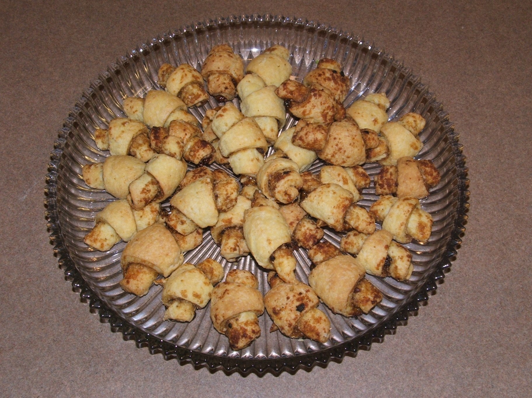
An Eccles cake is a small, round pie, similar to a turnover, filled with currants and made from flaky pastry with butter, sometimes topped with brown sugar. Name and origin The Eccles cake is named after the English town of Eccles, which is in the historic county of Lancashire and in the ceremonial county of Greater Manchester. Eccles cakes are a Lancashire food tradition, with similar cakes being found in other parts of the County of Lancashire, and are traditionally eaten with Lancashire cheese. It is not known who invented the recipe, but James Birch is credited with being the first person to sell Eccles cakes commercially; he sold the cakes from his shop, at the corner of Vicarage Road and St Mary's Road, now Church Street, in the town centre, in 1793. John Ayto states that Elizabeth Raffald may have invented the Eccles Cake. The word cake is used in the older general sense of a "portion of bread containing additional ingredients" rather than the narrower meaning of s ... [...More Info...] [...Related Items...] OR: [Wikipedia] [Google] [Baidu] [Amazon] |
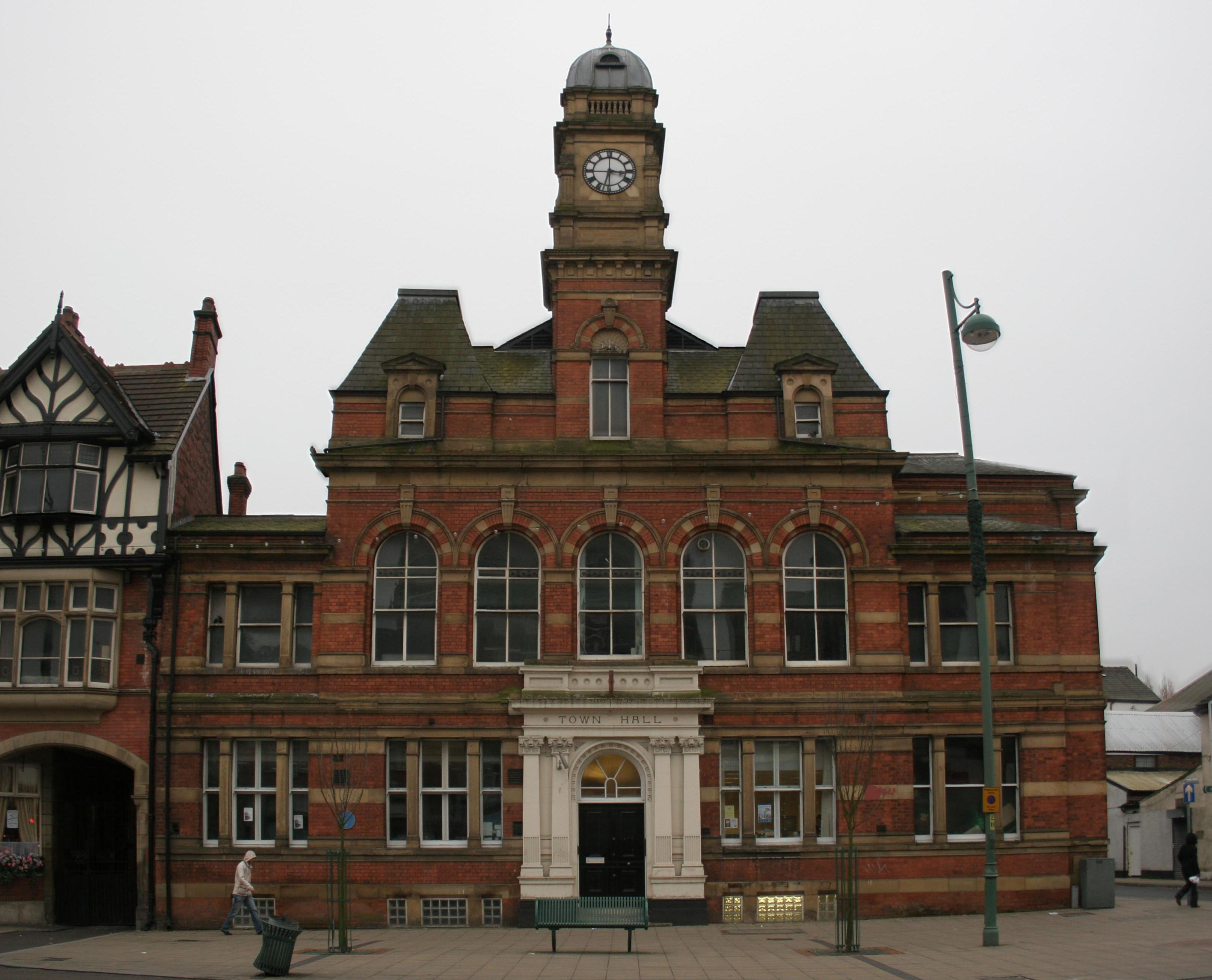
Eccles, Greater Manchester
Eccles () is a market town in the City of Salford in Greater Manchester, England, west of Salford, Greater Manchester, Salford and west of Manchester, split by the M602 motorway and bordered by the Manchester Ship Canal to the south. The town is famous for the Eccles cake. Eccles grew around the 13th-century Church of St Mary the Virgin, Eccles, Parish Church of St Mary. Evidence of pre-historic human settlement has been discovered locally, but the area was predominantly agricultural until the Industrial Revolution, when a textile industry was established in the town. The arrival of the Liverpool and Manchester Railway led to the town's expansion along the route of the track linking those two cities. History Toponymy The derivation of the name is uncertain, but two suggestions have been proposed. The received one is that the ''Eccles'' place-name is derived from the Romano-British ''Ecles'' or ''Eglys'' ( in Welsh language, Welsh means 'church'), which in turn is deriv ... [...More Info...] [...Related Items...] OR: [Wikipedia] [Google] [Baidu] [Amazon] |
Darwen
Darwen is a market town and civil parish in the Blackburn with Darwen borough in Lancashire, England. The residents of the town are known as "Darreners". The A666 road, A666 road passes through Darwen towards Blackburn to the north, Bolton to the south and Pendlebury where it joins the A6 road (England), A6, about north-west of Manchester. The population of Darwen stood at 28,046 in the 2011 census. The town comprises four wards and has its own town council. The town stands on the River Darwen, which flows from south to north and is seen in parks in the town centre and next to Sainsbury's located in the town centre. Toponym Darwen's name is Celtic Britons, Celtic in origin. In Sub Roman Britain it was within the Celtic Britons, Brythonic kingdom of Rheged, a successor to the Brigantes tribal territory. The Brythonic languages, Brythonic language name for oak is ''derw'' and this is etymologically linked to ''Derewent'' (1208), an ancient spelling for the River Darwen. Despi ... [...More Info...] [...Related Items...] OR: [Wikipedia] [Google] [Baidu] [Amazon] |
Grenada
Grenada is an island country of the West Indies in the eastern Caribbean Sea. The southernmost of the Windward Islands, Grenada is directly south of Saint Vincent and the Grenadines and about north of Trinidad and Tobago, Trinidad and the South American mainland. Grenada consists of the island of Grenada itself, two smaller islands, Carriacou and Petite Martinique, and several small islands which lie to the north of the main island and are a part of the Grenadines. Its size is , with an estimated population of 114,621 in 2024. Its capital is St. George's, Grenada, St. George's. Grenada is also known as the "Island of Spice" due to its production of nutmeg and mace (spice), mace crops. Before the European colonization of the Americas, arrival of Europeans in the Americas, Grenada was inhabited by the Indigenous peoples of the Americas, indigenous peoples from South America. Christopher Columbus sighted Grenada in 1498 during his Voyages of Christopher Columbus, third voyage t ... [...More Info...] [...Related Items...] OR: [Wikipedia] [Google] [Baidu] [Amazon] |
Guyana
Guyana, officially the Co-operative Republic of Guyana, is a country on the northern coast of South America, part of the historic British West Indies. entry "Guyana" Georgetown, Guyana, Georgetown is the capital of Guyana and is also the country's largest city. Guyana is bordered by the Atlantic Ocean to the north, Brazil to the south and southwest, Venezuela to the west, and Suriname to the east. With a land area of , Guyana is the third-smallest sovereign state by area in mainland South America after Uruguay and Suriname, and is the List of South American countries by population, second-least populous sovereign state in South America after Suriname; it is also List of countries and dependencies by population density, one of the least densely populated countries on Earth. The official language of the country is English language, English, although a large part of the population is bilingual in English and the indigenous languages. It has a wide variety of natural habitats and ... [...More Info...] [...Related Items...] OR: [Wikipedia] [Google] [Baidu] [Amazon] |
Rugelach
Rugelach ( ; , , or and ''rōgalaḵ'') is a filled baked confection originating in the Jewish communities of Poland. It has become a popular treat among Jews in the diaspora and in Israel. Traditional rugelach are shaped into a crescent by rolling a triangle of dough around a filling.Joan NathanJoan Nathan's Jewish Holiday Cookbook Schocken, 2004; page 284.Judith M. FertigAll American Desserts Harvard Common Press, 2003; page 135. Some sources state that the rugelach and the French croissant share a common Viennese ancestor, crescent-shaped pastries commemorating the lifting of the Turkish siege,Gil MarksThe World of Jewish Cooking Simon and Schuster, 1996; page 326. possibly a reference to the Battle of Vienna in 1683. This appears to be an urban legend, however, as both the rugelach and its supposed ancestor, the Kipferl, predate the Early Modern era, while the croissant in its modern form did not originate earlier than the 19th century (see viennoiserie). This leads ma ... [...More Info...] [...Related Items...] OR: [Wikipedia] [Google] [Baidu] [Amazon] |
Commonwealth Caribbean
The Commonwealth Caribbean refers to a group of English-speaking world, English-speaking sovereign states in the Caribbean, including both island states and mainland countries in the Americas, that are members of the Commonwealth of Nations and were once part of the British Empire. The term may also include British Overseas Territories in the Caribbean Sea. Nomenclature Before decolonisation, British Crown colonies in the West Indies were collectively known as the British West Indies. After gaining independence, the grouping of countries became known as the Commonwealth Caribbean. The Commonwealth Caribbean is also known as the English-speaking Caribbean, Anglophone Caribbean, Anglo-Caribbean, or English-speaking West Indies, although use of these terms may also encompass other English-speaking Caribbean countries who are not members of the Commonwealth of Nations. Countries and territories The Commonwealth Caribbean encompasses sovereign states that are members of the Comm ... [...More Info...] [...Related Items...] OR: [Wikipedia] [Google] [Baidu] [Amazon] |
Oxfordshire
Oxfordshire ( ; abbreviated ''Oxon'') is a ceremonial county in South East England. The county is bordered by Northamptonshire and Warwickshire to the north, Buckinghamshire to the east, Berkshire to the south, and Wiltshire and Gloucestershire to the west. The city of Oxford is the largest settlement and county town. The county is largely rural, with an area of and a population of 691,667. After Oxford (162,100), the largest settlements are Banbury (54,355) and Abingdon-on-Thames (37,931). For local government purposes Oxfordshire is a non-metropolitan county with five districts. The part of the county south of the River Thames, largely corresponding to the Vale of White Horse district, was historically part of Berkshire. The lowlands in the centre of the county are crossed by the River Thames and its tributaries, the valleys of which are separated by low hills. The south contains parts of the Berkshire Downs and Chiltern Hills, and the north-west includes part o ... [...More Info...] [...Related Items...] OR: [Wikipedia] [Google] [Baidu] [Amazon] |
Banbury
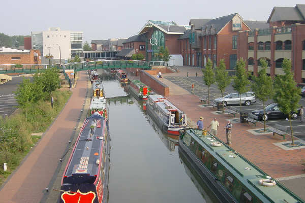
Banbury is an historic market town and civil parish on the River Cherwell in Oxfordshire, South East England. The parish had a population of 54,335 at the 2021 Census. Banbury is a significant commercial and retail centre for the surrounding area of north Oxfordshire and southern parts of Warwickshire and Northamptonshire which are predominantly rural. Banbury's main industries are motorsport, car components, electrical goods, plastics, food processing and printing. Banbury is home to the world's largest coffee-processing facility ( Jacobs Douwe Egberts), built in 1964. The town is famed for Banbury cakes, a spiced sweet pastry. Banbury is located north-west of London, south-east of Birmingham, south-east of Coventry and north-west of Oxford. Toponymy The name Banbury may derive from "Banna", a Saxon chieftain said to have built a stockade there in the 6th century (or possibly a byname from meaning ''felon'', ''murderer''), and / meaning ''settlement''. In Anglo Sa ... [...More Info...] [...Related Items...] OR: [Wikipedia] [Google] [Baidu] [Amazon] |
Banbury Cake
A Banbury cake is a spiced, oval-shaped, currant-filled pastry. Since the mid-19th century, Banbury cakes have grown increasingly similar to Eccles cakes; but the earlier versions were quite different from the modern pastry. Besides currants, the filling typically includes mixed peel, brown sugar, rum, and nutmeg. Banbury cakes are traditionally enjoyed with afternoon tea. Once made and sold exclusively in Banbury, England, Banbury cakes have been made in the region to secret recipes since 1586 and are still made there today, although not in such quantity. The cakes were once sent as far afield as Australia, the East Indies and America, normally in locally-made wickerwork baskets. They were sold at rail station refreshment rooms in England. Banbury cakes were first made by Edward Welchman, whose shop was on Parsons Street. Documented recipes were published by Gervase Markham (in '' The English Huswife'', 1615, pages 75–76) and others during the 17th century. These recipes g ... [...More Info...] [...Related Items...] OR: [Wikipedia] [Google] [Baidu] [Amazon] |
Rossendale Valley
The Rossendale Valley is in the Rossendale area of Lancashire, England, between the West Pennine Moors and the main range of the Pennines. The area includes the steep-sided valleys of the River Irwell and its tributaries (between Rawtenstall and Bacup), which flow southwards into Greater Manchester. The rivers cut through the moorland of the Rossendale Hills, generally characterized by open unwooded land, despite the ancient designation of "forest". History One of the earliest sites of historical interest in the valley is that of the dykes at Broadclough, which are associated with the Battle of Brunanburh. In late Middle Ages, the valley was part of the Royal Forest of Rossendale. The original medieval meaning of 'forest' was similar to a 'preserve', for example land that is legally kept for specific purposes such as royal hunting. So 'forests' were areas large enough to support species such as wolves and deer for game hunting and they encompassed other habitats such as he ... [...More Info...] [...Related Items...] OR: [Wikipedia] [Google] [Baidu] [Amazon] |
Padiham
Padiham ( ) is a market town and civil parishes in England, civil parish on the River Calder, Lancashire, River Calder, in the Borough of Burnley in Lancashire, England, Lancashire, England. It is located north west of Burnley, and north east of the towns of Clayton le Moors and Great Harwood. It is edged by the foothills of Pendle Hill to the north-west and north-east. The United Kingdom Census 2011 gave a parish population of 10,098, estimated in 2019 at 10,138. History Early forms of the name include "Padingham", with the last element probably from the Old English word , meaning home and in this sense meaning "of the". Its first is generally thought to be a personal name: Bede listed Padda as one of the priests who assisted Wilfrid, Bishop Wilfrid in the late 7th century. No prehistoric or Ancient Rome, Roman sites have been found in the built-up area. Padiham, though a name of Anglo-Saxon origin, is not recorded in the 1086 Domesday Book. [...More Info...] [...Related Items...] OR: [Wikipedia] [Google] [Baidu] [Amazon] |
Nelson, Lancashire
Nelson is a town and civil parishes in England, civil parish in the Borough of Pendle in Lancashire, England, it had a population of 29,135 in the 2011 Census. Nelson is north of Burnley and south-west of Colne. Nelson developed as a mill town during the Industrial Revolution. History An Iron Age hillfort called Castercliff is on a hill to the east of the town. The modern town spans the two parts of the Township (England), township of Marsden in the ancient parish of Whalley.An Early History of Burnley, Pendle and West Craven Clayton 2006, p.118 Little Marsden was on the south-west of Walverden Water, its lands considered part of the Manorialism, manor of Ightenhill and Great Marsden to the north-east, part of the manor of Colne. Great Marsden included the southern parts of Colne, and Little Marsden included all of modern-day Brierfield, Lancashire, Brierfield. Walverden Water joins Pendle Water next to Nelson & Colne College, with that river forming the boundary of the Forest ... [...More Info...] [...Related Items...] OR: [Wikipedia] [Google] [Baidu] [Amazon] |


