|
Ashbourne Line
The Ashbourne line was a railway from Buxton via Ashbourne to Uttoxeter. It was built by the London and North Western Railway using a section of the Cromford and High Peak Railway (C&HPR) and it joined the North Staffordshire Railway at Ashbourne, proceeding to Uttoxeter with a junction onto the main line at Rocester. Origins Although the country between Buxton and Ashbourne was sparsely populated, and the terrain immensely difficult, there were a number of motivations for its construction. Ashbourne was one of the few large settlements in the area without a railway connection until the North Staffordshire Railway built its branch from the Churnet Valley line in 1852. Meanwhile, a lucrative trade in limestone was building up and the LNWR's only route southwards was through the Manchester area. Finally, and not least, the Midland Railway was threatening to take over the Derbyshire business through its attempts to reach Manchester from Derby via Buxton. The LNWR sought to con ... [...More Info...] [...Related Items...] OR: [Wikipedia] [Google] [Baidu] |
Railway
Rail transport (also known as train transport) is a means of transport that transfers passengers and goods on wheeled vehicles running on rails, which are incorporated in tracks. In contrast to road transport, where the vehicles run on a prepared flat surface, rail vehicles ( rolling stock) are directionally guided by the tracks on which they run. Tracks usually consist of steel rails, installed on sleepers (ties) set in ballast, on which the rolling stock, usually fitted with metal wheels, moves. Other variations are also possible, such as "slab track", in which the rails are fastened to a concrete foundation resting on a prepared subsurface. Rolling stock in a rail transport system generally encounters lower frictional resistance than rubber-tyred road vehicles, so passenger and freight cars (carriages and wagons) can be coupled into longer trains. The operation is carried out by a railway company, providing transport between train stations or freight customer faci ... [...More Info...] [...Related Items...] OR: [Wikipedia] [Google] [Baidu] |
Viaduct At Buxton - Geograph
A viaduct is a specific type of bridge that consists of a series of arches, piers or columns supporting a long elevated railway or road. Typically a viaduct connects two points of roughly equal elevation, allowing direct overpass across a wide valley, road, river, or other low-lying terrain features and obstacles. The term ''viaduct'' is derived from the Latin ''via'' meaning "road", and ''ducere'' meaning "to lead". It is a 19th-century derivation from an analogy with ancient Roman aqueducts. Like the Roman aqueducts, many early viaducts comprised a series of arches of roughly equal length. Over land The longest in antiquity may have been the Pont Serme which crossed wide marshes in southern France. At its longest point, it measured 2,679 meters with a width of 22 meters. Viaducts are commonly used in many cities that are railroad hubs, such as Chicago, Birmingham, London and Manchester. These viaducts cross the large railroad yards that are needed for freight trains the ... [...More Info...] [...Related Items...] OR: [Wikipedia] [Google] [Baidu] |
Baedeker
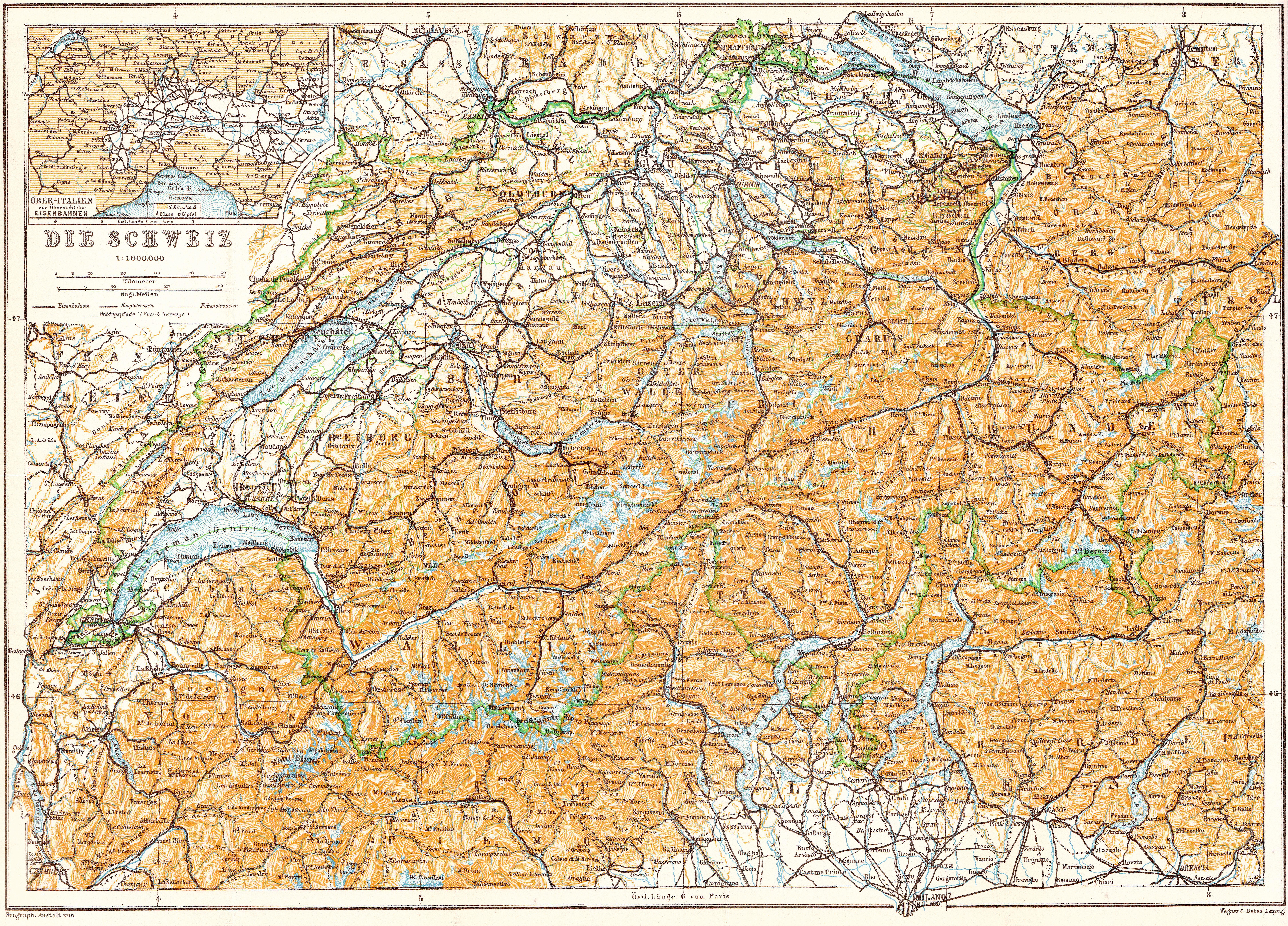
Verlag Karl Baedeker, founded by Karl Baedeker on July 1, 1827, is a German publisher and pioneer in the business of worldwide travel guides. The guides, often referred to simply as " Baedekers" (a term sometimes used to refer to similar works from other publishers, or travel guides in general), contain, among other things, maps and introductions; information about routes and travel facilities; and descriptions of noteworthy buildings, sights, attractions and museums, written by specialists. History (1827−1948) Karl Baedeker 1827−1859: Karl Baedeker (1801-1859) descended from a long line of printers, booksellers and publishers from Essen. He was the eldest of ten children of Gottschalk Diederich Bädeker (1778–1841), who had inherited the publishing house founded by his own father, Zacharias Gerhard Bädeker (1750–1800). The company also published the local newspaper, the ''Essendische Zeitung'', and the family expected that Karl, too, would eventually join the firm. Karl w ... [...More Info...] [...Related Items...] OR: [Wikipedia] [Google] [Baidu] |
River Dove, Derbyshire
The River Dove (, ) is the principal river of the southwestern Peak District, in the Midlands of England and is around in length. It rises on Axe Edge Moor near Buxton and flows generally south to its confluence with the River Trent at Newton Solney. From there, its waters reach the North Sea via the Humber Estuary. For almost its entire course it forms the boundary between the counties of Staffordshire (to the west) and Derbyshire (to the east). The river meanders past Longnor and Hartington and cuts through a set of deep limestone gorges, Beresford Dale, Wolfscote Dale, Milldale and Dovedale. The river is a famous trout stream. Charles Cotton's Fishing House, which was the inspiration for Izaak Walton's ''The Compleat Angler'', stands in the woods by the river near Hartington. The river's name is now usually pronounced to rhyme with "love", but its original pronunciation rhymed with "rove". This pronunciation is still used by some residents of the lower reaches o ... [...More Info...] [...Related Items...] OR: [Wikipedia] [Google] [Baidu] |
Henmore Brook
The Henmore Brook or the River Henmore is a tributary of the River Dove in Derbyshire, England, and is 20 km (12 miles) in length. In its upper reaches it is known as the Scow brook, much of which was inundated by the Carsington Water reservoir in 1991. It becomes the Henmore brook in the middle reaches, where there are three tributaries called the Parkside, Kniveton and Dayfield brooks. The brook drains a catchment of mixed geology, which has an area of 46 square kilometres (18 square miles). It flows through the market town of Ashbourne, where flooding of the town centre by the brook has historically caused significant damage. The brook is designated as a Main river by the Environment Agency from the outflow at Carsington Water to the confluence with the River Dove. Course The source of the brook is at the base of Soldiers Knoll near Stainsborough Hall, from where it flows west until it reaches the upper end of Carsington Water near Hopton. It reappears at the outle ... [...More Info...] [...Related Items...] OR: [Wikipedia] [Google] [Baidu] |
Thorpe Cloud
Thorpe Cloud is an isolated limestone hill (a reef knoll) lying between the villages of Thorpe and Ilam on the Derbyshire/ Staffordshire border at the southern end of Dovedale. It is a popular hill amongst the many day-trippers who visit the area, and provides a fine viewpoint north up the dale and south across the Midland plain. Like much of the dale, including Bunster Hill on the opposite bank, it is in the ownership of the National Trust, and is part of their South Peak Estate. These Dovedale properties were acquired by the Trust in 1934. A double sunset A double sunset is a rare astro-geographical phenomenon, in which the sun appears to set twice in the same evening from a specific viewing-point. A double sunrise may also occur in a similar situation. Such phenomena may have been regarded as si ... can sometimes be seen against Thorpe Cloud from the top of nearby Lin Dale, as captured on film by the photographer Chris Doherty. The occurrence is visible in good weathe ... [...More Info...] [...Related Items...] OR: [Wikipedia] [Google] [Baidu] |
Fenny Bentley
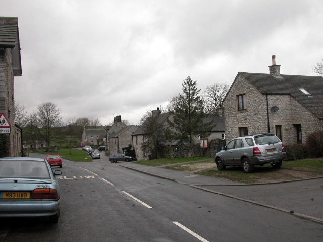
Fenny Bentley is a small village and civil parish located close to Dovedale in the Derbyshire Dales district of Derbyshire, England. The population in 2009 was 305 reducing to 183 at the 2011 Census. It lies two miles north of Ashbourne, on the A515 Buxton to Ashbourne Road. It is one of the most southerly villages in the Peak District. History Records show that a settlement has existed at Fenny Bentley since being mentioned in The Domesday Book in 1086, when it was known as Benedlege. Early records of The Church of St. Edmund date back as far as 1240, with much of the available historical data that provides information on the village being associated with the church and the information recorded here. The introduction of the census in the United Kingdom in 1801 means that more consistent information on the parish and how it has developed over time is now available. The population of the village has fluctuated slightly since the 19th century, with a peak in 1841 of 343 people l ... [...More Info...] [...Related Items...] OR: [Wikipedia] [Google] [Baidu] |
Tissington
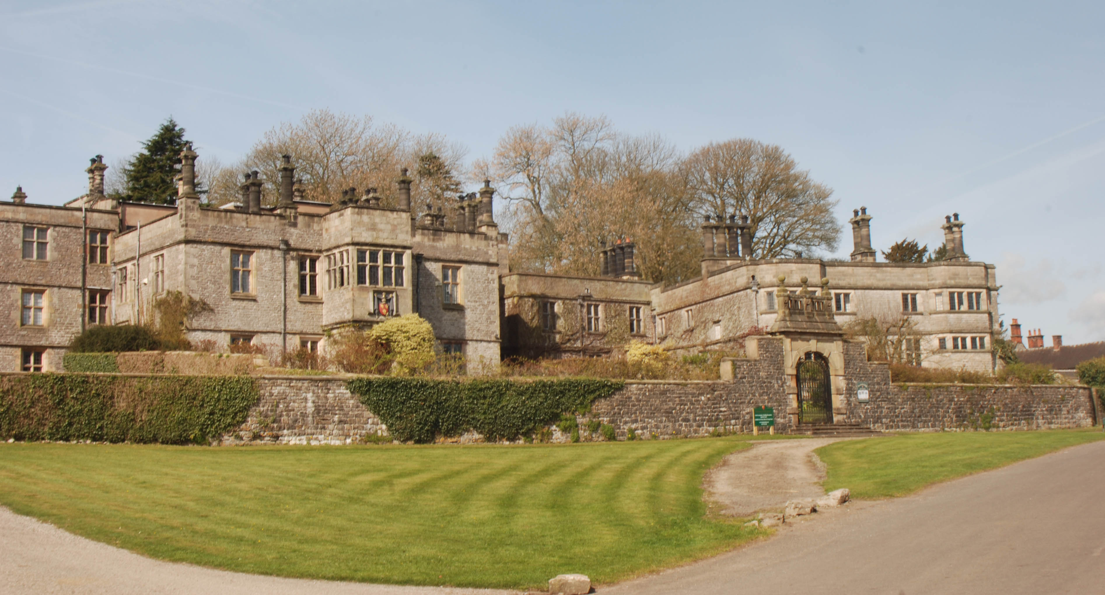
Tissington is a village in the Derbyshire Dales district of Derbyshire, England. The appropriate civil parish is called Tissington and Lea Hall. The population of this parish at the 2011 census was 159. It is part of the estate of Tissington Hall, owned by the FitzHerbert family since 1465. It is a popular tourist attraction, particularly during its well dressing week. It also gives its name to the Tissington Trail, a walk and cycle path which passes nearby. The Limestone Way, another long-distance path and bridleway, passes through the village itself. History Tissington (Old English "Tidsige's farm/settlement") is recorded in the Domesday Book of 1086 as ''Tizinctun'', having been given to Henry de FerrersHenry was given a large number of manors throughout England, but particularly in Derbyshire. by the King: "In Tizinctun Ulchel, Edric, Ganel, Uluiet, Wictric, Leuric, Godwin had 4 carucates of land for geld. Land for 4 ploughs. Now in the demesne there (are) 3 ploughs ... [...More Info...] [...Related Items...] OR: [Wikipedia] [Google] [Baidu] |
Alsop En Le Dale
Alsop en le Dale is a village in Derbyshire, England about north of Ashbourne close to the Staffordshire border, and a mile from Dovedale, a popular tourist location within the Peak District national park. It is within the civil parish of Eaton and Alsop. Toponymy The derivation of “Alsop en le Dale” is the product of a two-stage process: “Alsop” originates from “Ælli’s little valley” (Old English ''hop''), whilst ''en le Dale'' is from the Old French for “in the” and the Old English ''dœl'' (valley). History Comprising a few cottages and scattered farms, the village was mentioned in the Domesday Book under Derbyshire in the lands belonging to the king. The book which was written in 1086 said: After the Norman Conquest, Henry de Ferrers, one of William the Conqueror's generals was granted land in Derbyshire. He in turn offered the township of Alsop-le-Dale to one of his officers Gamellus who became known as Gamellus de Alsop. The Alsop family owned th ... [...More Info...] [...Related Items...] OR: [Wikipedia] [Google] [Baidu] |
Hartington, Derbyshire
Hartington is a village in the centre of the White Peak area of the Derbyshire Peak District, England, lying on the River Dove which is the Staffordshire border. According to the 2001 census, the parish of Hartington Town Quarter, which also includes Pilsbury, had a population of 345 reducing to 332 at the 2011 Census. Formerly known for cheese-making and the mining of ironstone, limestone and lead, the village is now popular with tourists. Architecture Notable buildings in the village include the market hall (formerly the site of a market), the 13th-century parish church of Saint Giles, and the 17th-century Hartington Hall. The prominent Bank House in the centre of the village was built by the former village mill owner, and in the past was used as the village bank. A half-mile (800 m) to the south of the village, on the river Dove, is the fishing house of the famous angler Charles Cotton. In the north of the village is Pilsbury Castle, an 11th-century motte-and-ba ... [...More Info...] [...Related Items...] OR: [Wikipedia] [Google] [Baidu] |
Monyash
Monyash (/muhn-ee-ash/ munyash) is a village and civil parish in the Peak District, Derbyshire, England, west of the market town Bakewell. It is centred on a village green above sea level at the head of Lathkill Dale in the limestone area known as the White Peak. At the 2011 census, it had a population of 314. Tourism and farming (milk, beef and lamb) are the predominant activities of the village. The area was once an important meeting place, a watering point for drovers’ animals at the intersection of several trade routes, and industrial centre supporting the local lead mining industry.Johnston, Robert and Shirley Johnston, (2010), Monyash: The Making of a Derbyshire Village, The Horizon Press, Ashbourne, History People have been living in and around Monyash since Neolithic times (3750–1750 BC) and probably before then. The nearby impressive stone circle and henge, Arbor Low, was likely built around 2000 BC by people living in the village who also farmed the relativ ... [...More Info...] [...Related Items...] OR: [Wikipedia] [Google] [Baidu] |
Longnor, Staffordshire
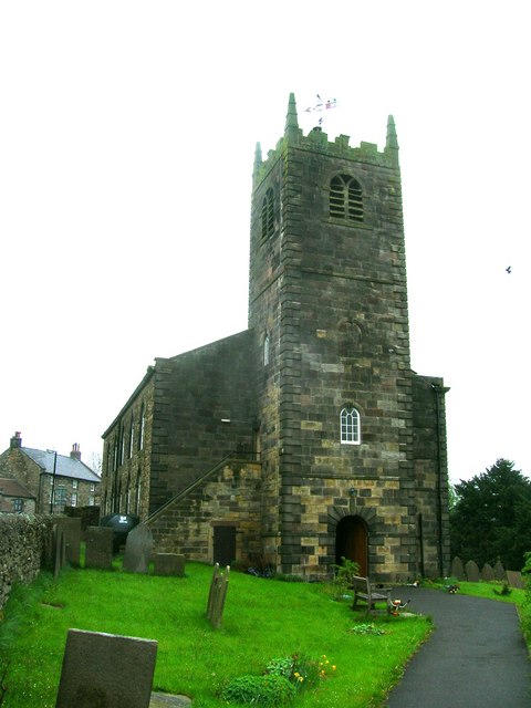
Longnor is a village in the Staffordshire Peak District, England. The settlement dates from early times, the first recorded church building being in the Middle Ages. The village was named Longenalre in the Domesday Book. Located on a major crossroads, Longnor was a significant market town in the 18th century. It lies on the north bank of the River Manifold, on a limestone ridge between the Manifold and the River Dove. Location and geography Longnor is on the B5053 main road from Cheadle to Buxton about south of Buxton. It is at a crossroads with routes to Leek and Macclesfield to the west and Bakewell to the east. West of Longnor are the Staffordshire Moorlands, with a summit at Axe Edge Moor towards the north and Morridge further south. North and east of Longnor is the White Peak section of the Peak District, with the Dove flowing in a steep-sided limestone valley of which the famous Dovedale is a small part. Longnor looks towards the Manifold but lies on the southe ... [...More Info...] [...Related Items...] OR: [Wikipedia] [Google] [Baidu] |


