Havelland Luch on:
[Wikipedia]
[Google]
[Amazon]


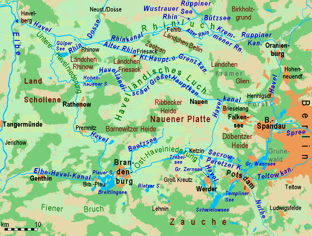
 The Havelland Luch (german: Havelländisches Luch) is a lowland area inside a bend of the River Havel west of
 The formerly marshy valley has been made suitable for agriculture by
 The Havelland Luch may be easily accessed and explored on the Havelland Cycleway. The revitalization of country tracks has further improved cycling in the area in recent years.
The Havelland Luch is crossed by the Hanover–Berlin high-speed railway. Both during the construction phase from the end of 1996 and on the completed track special conservation measures have been taken so as not to endanger the habitat of the great bustard and other species of bird.
LGB Brandenburg
Regulations for the Havelland Luch Nature Reserve
Brandenburg Environmental Reports, Vol. 13
(pdf file; 59 kB) {{Coord, 52, 36, 46, N, 12, 36, 03, E, type:landmark_region:DE-BB_dim:50000, display=title Geography of Brandenburg Nature reserves in Brandenburg Havelland


Berlin
Berlin ( , ) is the capital and List of cities in Germany by population, largest city of Germany by both area and population. Its 3.7 million inhabitants make it the European Union's List of cities in the European Union by population within ci ...
, and forms the heart of the Havelland
Geographically, the Havelland is the region around which the River Havel flows in a U-shape between Oranienburg to the northeast and Rhinow to the northwest. The northern boundary of the Havelland is formed by the River Rhin and the Rhin Canal. ...
region.
Location
The '' luch'', a former marshland, lies in a basin that is part of the Berlin ''urstromtal
An ''urstromtal'' (plural: ''Urstromtäler'') is a type of broad glacial valley, for example, in northern Central Europe, that appeared during the ice ages, or individual glacial periods of an ice age, at the edge of the Scandinavian ice sheet and ...
'', a meltwater valley that was formed here during the Weichselian glaciation
The Weichselian glaciation was the last glacial period and its associated glaciation in northern parts of Europe. In the Alpine region it corresponds to the Würm glaciation. It was characterized by a large ice sheet (the Fenno-Scandian ice sheet) ...
about 18,000 years ago. It covers an area of about .
To the east and northeast the Havelland Luch borders on a region called the '' Ländchen Glien'', to the south on the Nauen Plateau
The Nauen Plateau (german: Nauener Platte) is a low plateau in the German states of Brandenburg and Berlin. It rises above the surrounding countryside by an average of and is a largely contiguous upland area that was formed during the Saale and We ...
, to the west on the Rathenow
Rathenow () is a town in the district of Havelland in Brandenburg, Germany, with a population of 24,063 (2020).
Overview
The Protestant church of St. Marien Andreas, originally a basilica, and transformed to the Gothic style in 1517-1589, and the ...
moraine region, the '' Ländchen Friesack'' and the Zootzen. To the north it is separated from '' Ländchen Bellin'' by the ''Rhinluch
The Rhinluch is a fen landscape in the German state of Brandenburg, bisected by the river Rhin to which it owes its name. This wetland region lies north of Fehrbellin in the county of Ostprignitz-Ruppin. The upper Rhinluch covers an area of about ...
'' region.
Geology
The Havelland Luch is mainly characterized byfen
A fen is a type of peat-accumulating wetland fed by mineral-rich Groundwater, ground or surface water. It is one of the main types of wetlands along with marshes, swamps, and bogs. Bogs and fens, both peat-forming ecosystems, are also known as ...
peat soils and peat
Peat (), also known as turf (), is an accumulation of partially decayed vegetation or organic matter. It is unique to natural areas called peatlands, bogs, mires, moors, or muskegs. The peatland ecosystem covers and is the most efficient ...
soils that dried out after the land was drained. There are large areas where periglacial
Periglaciation (adjective: "periglacial", also referring to places at the edges of glacial areas) describes geomorphic processes that result from seasonal thawing of snow in areas of permafrost, the runoff from which refreezes in ice wedges and o ...
or fluviatile valley sands reach the surface. Mounds of ground moraine
A moraine is any accumulation of unconsolidated debris (regolith and rock), sometimes referred to as glacial till, that occurs in both currently and formerly glaciated regions, and that has been previously carried along by a glacier or ice she ...
, more than ten metres high, pierce the surface of the ''luch'', especially in the south, between the Nauen Plateau and the ''Ländchen Friesack''. In places, the valley sands were covered by dunes during the early post-glacial period. Such dune regions include, for example, several high points near Paulinenaue
Paulinenaue is a municipality in the Havelland district, in Brandenburg, Germany
Germany,, officially the Federal Republic of Germany, is a country in Central Europe. It is the second most populous country in Europe after Russia, an ...
in the centre, parts of the Nauen municipal forest on the eastern edge and the Zootzen on the northwestern perimeter of the ''luch''.
Great Havelland Canal
 The formerly marshy valley has been made suitable for agriculture by
 land improvement
Land development is the alteration of landscape in any number of ways such as:
* Changing landforms from a natural or semi-natural state for a purpose such as agriculture or housing
* Subdividing real estate into lots, typically for the purpos ...
since the 18th century. Numerous ditches and canals bisect those areas used mainly as arable land
Arable land (from the la, arabilis, "able to be ploughed") is any land capable of being ploughed and used to grow crops.''Oxford English Dictionary'', "arable, ''adj''. and ''n.''" Oxford University Press (Oxford), 2013. Alternatively, for th ...
or grassland
A grassland is an area where the vegetation is dominated by grasses ( Poaceae). However, sedge ( Cyperaceae) and rush ( Juncaceae) can also be found along with variable proportions of legumes, like clover, and other herbs. Grasslands occur na ...
, regulating the water levels. The most important are the Great Havelland Canal (''Havelländische Große Hauptkanal'') and the Little Havelland Canal (''Kleine Haupt- und Grenzkanal''), which both empty into the Rhin
The Rhin is a long river in Brandenburg, Germany, right tributary to the river Havel. It flows through the city Neuruppin and several lakes. A few kilometres downstream from Rhinow it flows into the Havel, about upstream from where the Have ...
.
The Great Havelland Canal is fed by additional water from the River Havel via the Nauen-Paretz Canal and the Havel Canal.
Vegetation
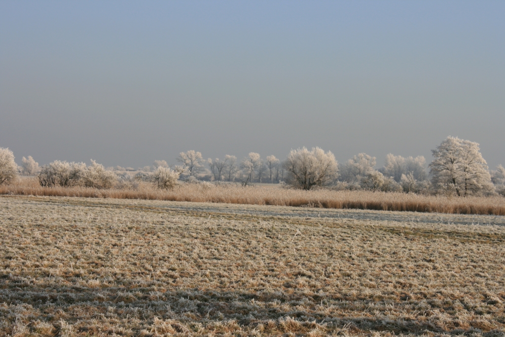
The natural vegetation of the ''luch'' was determined by its waterlogged terrain. Under such conditions an open carr fen landscape was formed. Revealingly the Slavic word ''lug'' means "marsh" as well as "meadow". Until the establishment of the present drainage system, there was a lot of bog formation. Today the countryside is dominated bygrassland
A grassland is an area where the vegetation is dominated by grasses ( Poaceae). However, sedge ( Cyperaceae) and rush ( Juncaceae) can also be found along with variable proportions of legumes, like clover, and other herbs. Grasslands occur na ...
farming. The ditches and canals are mainly bordered by poplars and alders. Occasionally there are small copses with plantation
A plantation is an agricultural estate, generally centered on a plantation house, meant for farming that specializes in cash crops, usually mainly planted with a single crop, with perhaps ancillary areas for vegetables for eating and so on. The ...
-like monocultures of grey
Grey (more common in British English) or gray (more common in American English) is an intermediate color between black and white. It is a neutral or achromatic color, meaning literally that it is "without color", because it can be composed o ...
or hybrid poplar.
Conservation
In the southwest of the Havelland Luch are ofnature reserve
A nature reserve (also known as a wildlife refuge, wildlife sanctuary, biosphere reserve or bioreserve, natural or nature preserve, or nature conservation area) is a protected area of importance for flora, fauna, or features of geological or ...
and bird reserve. Together with the Fiener Bruch and the Belziger Landschaftswiesen the nature reserve forms one of the last German refuges for the endangered great bustard
The great bustard (''Otis tarda'') is a bird in the bustard family, the only member of the genus ''Otis''. It breeds in open grasslands and farmland from northern Morocco, South and Central Europe, to temperate Central and East Asia. European po ...
. Since 1990 water has been impounded in winter and spring each year in order to flood 200 to 300 ha and waterlog a further 1,000 to 1,500 ha. As a result important all-year round roosting and breeding sites have been created for bustard
Bustards, including floricans and korhaans, are large, terrestrial birds living mainly in dry grassland areas and on the steppes of the Old World. They range in length from . They make up the family Otididae (, formerly known as Otidae). Bustar ...
s, duck
Duck is the common name for numerous species of waterfowl in the family Anatidae. Ducks are generally smaller and shorter-necked than swans and geese, which are members of the same family. Divided among several subfamilies, they are a form ...
s and cranes.
Transport
Sources
*Topographic map, 1:100,000 series, Sheets C 3538 ''Brandenburg an der Havel'' and C 3542 ''Berlin West'', both froLGB Brandenburg
Coordinates
*The coordinates refer to the centre of the village of 14715 Liepe.References
External links
Regulations for the Havelland Luch Nature Reserve
Brandenburg Environmental Reports, Vol. 13
(pdf file; 59 kB) {{Coord, 52, 36, 46, N, 12, 36, 03, E, type:landmark_region:DE-BB_dim:50000, display=title Geography of Brandenburg Nature reserves in Brandenburg Havelland