|
Triangulation (surveying)
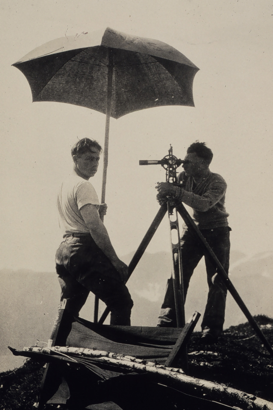
In surveying, triangulation is the process of determining the location of a point by measuring only angles to it from known points at either end of a fixed baseline by using trigonometry, rather than measuring distances to the point directly as in trilateration. The point can then be fixed as the third point of a triangle with one known side and two known angles. Triangulation can also refer to the accurate surveying of systems of very large triangles, called triangulation networks. This followed from the work of Willebrord Snell in 1615–17, who showed how a point could be located from the angles subtended from ''three'' known points, but measured at the new unknown point rather than the previously fixed points, a problem called resectioning. Surveying error is minimized if a mesh of triangles at the largest appropriate scale is established first. Points inside the triangles can all then be accurately located with reference to it. Such triangulation methods were used for accur ... [...More Info...] [...Related Items...] OR: [Wikipedia] [Google] [Baidu] |
Willebrord Snellius
Willebrord Snellius (born Willebrord Snel van Royen) (13 June 158030 October 1626) was a Dutch astronomer and mathematician, Snell. His name is usually associated with the law of refraction of light known as Snell's law. The lunar crater Snellius is named after Willebrord Snellius. The Royal Netherlands Navy has named three survey ships after Snellius, including a currently-serving vessel. Biography Willebrord Snellius was born in Leiden, Netherlands. In 1613 he succeeded his father, Rudolph Snel van Royen (1546–1613) as professor of mathematics at the University of Leiden. Snellius' triangulation In 1615, Snellius, after the work of Eratosthenes in Ptolemaic Egypt in the 3rd century BC, probably was the first to try to do a large-scale experiment to measure the circumference of the earth using triangulation. He was helped in his measurements by two of his students, the Austrian barons Erasmus and Casparus Sterrenberg. In several cities he also received su ... [...More Info...] [...Related Items...] OR: [Wikipedia] [Google] [Baidu] |
Astrometry
Astrometry is a branch of astronomy that involves precise measurements of the positions and movements of stars and other celestial bodies. It provides the kinematics and physical origin of the Solar System and this galaxy, the Milky Way. History The history of astrometry is linked to the history of star catalogues, which gave astronomers reference points for objects in the sky so they could track their movements. This can be dated back to Hipparchus, who around 190 BC used the catalogue of his predecessors Timocharis and Aristillus to discover Earth's precession. In doing so, he also developed the brightness scale still in use today. Hipparchus compiled a catalogue with at least 850 stars and their positions. Hipparchus's successor, Ptolemy, included a catalogue of 1,022 stars in his work the '' Almagest'', giving their location, coordinates, and brightness. In the 10th century, Abd al-Rahman al-Sufi carried out observations on the stars and described their positions, ma ... [...More Info...] [...Related Items...] OR: [Wikipedia] [Google] [Baidu] |
Gemma Frisius
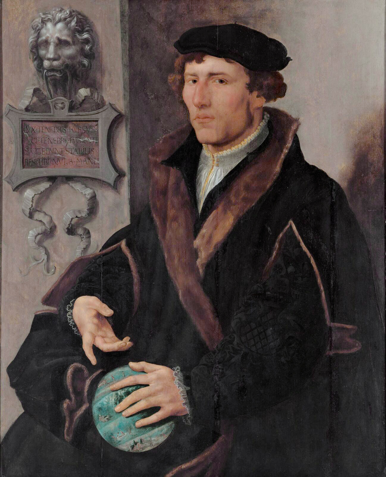
Gemma Frisius (; born Jemme Reinerszoon; December 9, 1508 – May 25, 1555) was a Frisian physician, mathematician, cartographer, philosopher, and instrument maker. He created important globes, improved the mathematical instruments of his day and applied mathematics in new ways to surveying and navigation. Gemma's rings, an astronomical instrument, are named after him. Along with Gerardus Mercator and Abraham Ortelius, Frisius is often considered one of the founders of the Netherlandish school of cartography, and significantly helped lay the foundations for the school's golden age (approximately 1570s–1670s). Biography Frisius was born in Dokkum, Friesland (present-day Netherlands), of poor parents who died when he was young. He moved to Groningen and later studied at the University of Leuven (Louvain), Belgium, beginning in 1525. He received the degree of MD in 1536 and remained on the faculty of medicine of Leuven for the rest of his life where, in addition to te ... [...More Info...] [...Related Items...] OR: [Wikipedia] [Google] [Baidu] |
Portolan Charts
Portolan charts are nautical charts, first made in the 13th century in the Mediterranean basin and later expanded to include other regions. The word ''portolan'' comes from the Italian ''portulano'', meaning "related to ports or harbors", and which since at least the 17th century designates "a collection of sailing directions". Definition The term “portolan chart” was coined in the 1890s because at the time it was assumed that these maps were related to portolani, medieval or early modern books of sailing directions. Other names that have been proposed include rhumb line charts, compass charts or loxodromic charts whereas modern French scholars prefer to call them nautical charts to avoid any relationship with portolani. Several definitions of portolan chart coexist in the literature. A narrow definition includes only medieval or, at the latest, early modern sea charts (i.e. maps that primarily cover maritime rather than inland regions) that include a network of rhumb l ... [...More Info...] [...Related Items...] OR: [Wikipedia] [Google] [Baidu] |
Jacob's Staff
The term Jacob's staff is used to refer to several things, also known as cross-staff, a ballastella, a fore-staff, a ballestilla, or a balestilha. In its most basic form, a Jacob's staff is a stick or pole with length markings; most staffs are much more complicated than that, and usually contain a number of measurement and stabilization features. The two most frequent uses are: * in astronomy and navigation for a simple device to measure angles, later replaced by the more precise sextants; * in surveying (and scientific fields that use surveying techniques, such as geology and ecology) for a vertical rod that penetrates or sits on the ground and supports a compass or other instrument. The simplest use of a Jacob's staff is to make qualitative judgements of the height and angle of an object relative to the user of the staff. In astronomy and navigation In navigation the instrument is also called a cross-staff and was used to determine angles, for instance the angle between the ... [...More Info...] [...Related Items...] OR: [Wikipedia] [Google] [Baidu] |
Latin Translations Of The 12th Century
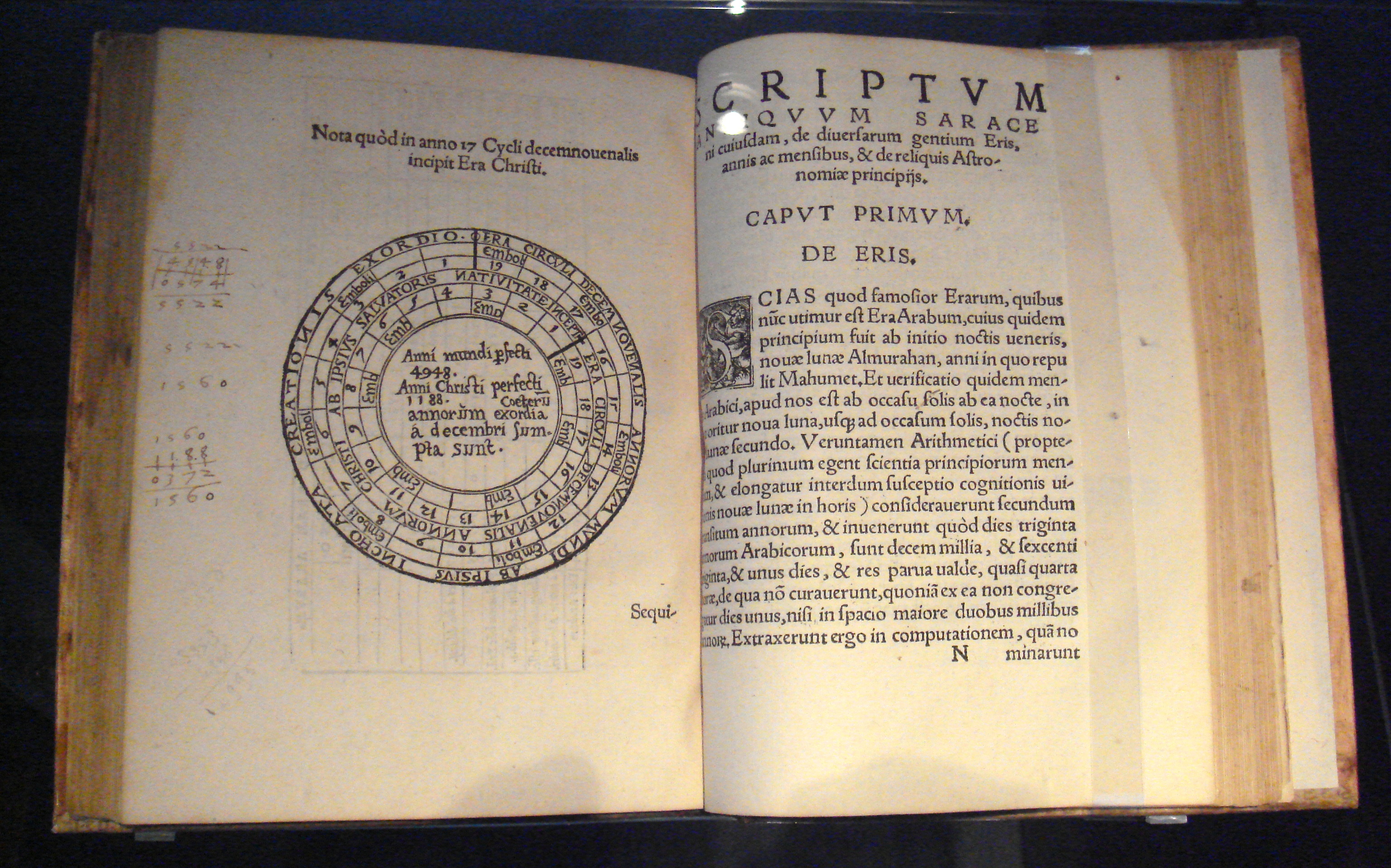
Latin translations of the 12th century were spurred by a major search by European scholars for new learning unavailable in western Europe at the time; their search led them to areas of southern Europe, particularly in central Spain and Sicily, which recently had come under Christian rule following their reconquest in the late 11th century. These areas had been under Muslim rule for a considerable time, and still had substantial Arabic-speaking populations to support their search. The combination of this accumulated knowledge and the substantial numbers of Arabic-speaking scholars there made these areas intellectually attractive, as well as culturally and politically accessible to Latin scholars. A typical story is that of Gerard of Cremona (c. 1114–87), who is said to have made his way to Toledo, well after its reconquest by Christians in 1085, because he Many Christian theologians were highly suspicious of ancient philosophies and especially of the attempts to synthesize th ... [...More Info...] [...Related Items...] OR: [Wikipedia] [Google] [Baidu] |
Abu Rayhan Biruni
Abu Rayhan Muhammad ibn Ahmad al-Biruni (973 – after 1050) commonly known as al-Biruni, was a Khwarazmian Iranian in scholar and polymath during the Islamic Golden Age. He has been called variously the "founder of Indology", "Father of Comparative Religion", "Father of modern geodesy", and the first anthropologist. Al-Biruni was well versed in physics, mathematics, astronomy, and natural sciences, and also distinguished himself as a historian, chronologist, and linguist. He studied almost all the sciences of his day and was rewarded abundantly for his tireless research in many fields of knowledge. Royalty and other powerful elements in society funded Al-Biruni's research and sought him out with specific projects in mind. Influential in his own right, Al-Biruni was himself influenced by the scholars of other nations, such as the Greeks, from whom he took inspiration when he turned to the study of philosophy. A gifted linguist, he was conversant in Khwarezmian, Persian, Ar ... [...More Info...] [...Related Items...] OR: [Wikipedia] [Google] [Baidu] |
Donald Routledge Hill
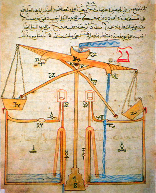
Donald Routledge Hill (6 August 1922 – 30 May 1994)D. A. King, “In Memoriam: Donald Routledge Hill (1922-1994)”, ''Arabic Sciences and Philosophy,'' Volume 5 / Issue 02 / September 1995, pp 297-302 was a British engineer and historian of science and technology best known for his translation of ''The Book of Knowledge of Ingenious Mechanical Devices'' of the Muslim engineer Ismail al-Jazari.Hill Donald(1993) Life and work Born in London, after secondary school Hill served in the British army, in the Royal Engineers from 1941 to 1946. Two years he served in the Eighth Army in North Africa until he was wounded in action in Italy. Back in England he studied Engineering at the London University, obtaining his engineering degree in 1949. In 1964 he obtained his M.Litt in Islamic History at the University of Durham, and in 1970 his PhD from the University of London. Late 1940s Hill started his career working for the Iraq Petroleum Company in Lebanon, Syria and Qatar. Back in En ... [...More Info...] [...Related Items...] OR: [Wikipedia] [Google] [Baidu] |
Ibn Al-Saffar
Abu al‐Qasim Ahmad ibn Abd Allah ibn Umar al‐Ghafiqī ibn as-Saffar al‐Andalusi (born in Córdoba, Spain, Cordoba, died in the year 1035 at Denia), also known as Ibn as-Saffar (, literally: son of the brass worker), was a Spanish-Arab astronomer in Al-Andalus. He worked at the school founded by his colleague Al-Majriti in Córdoba, Spain, Córdoba. His best-known work was a treatise on the astrolabe, a text that was in active use until the 15th century and influenced the work of Kepler. He also wrote a commentary on the Zij al-Sindhind, ''Zij as-Sindhind'', and measured the coordinates of Mecca. Ibn as-Saffar later influenced the works of Abu al-Salt, Abu as-Salt. Paul Kunitzsch argued that a Latin treatise on the astrolabe long attributed to Mashallah ibn Athari, Mashallah, and used by Chaucer to write ''A Treatise on the Astrolabe'', is in fact written by Ibn as-Saffar. The exoplanet Saffar, also known as Upsilon Andromedae b, is named in his honor. Saffar Island in Antar ... [...More Info...] [...Related Items...] OR: [Wikipedia] [Google] [Baidu] |
Astrolabe
An astrolabe ( grc, ἀστρολάβος ; ar, ٱلأَسْطُرلاب ; persian, ستارهیاب ) is an ancient astronomical instrument that was a handheld model of the universe. Its various functions also make it an elaborate inclinometer and an analog calculation device capable of working out several kinds of problems in astronomy. In its simplest form it is a metal disc with a pattern of wires, cutouts, and perforations that allows a user to calculate astronomical positions precisely. Historically used by astronomers, it is able to measure the altitude above the horizon of a celestial body, day or night; it can be used to identify stars or planets, to determine local latitude given local time (and vice versa), to survey, or to triangulate. It was used in classical antiquity, the Islamic Golden Age, the European Middle Ages and the Age of Discovery for all these purposes. The astrolabe's importance comes not only from the early developments into the study of astron ... [...More Info...] [...Related Items...] OR: [Wikipedia] [Google] [Baidu] |
Geography In Medieval Islam
Medieval Islamic geography and cartography refer to the study of geography and cartography in the Muslim world during the Islamic Golden Age (variously dated between the 8th century and 16th century). Muslim scholars made advances to the map-making traditions of earlier cultures, particularly the Hellenistic geographers Ptolemy and Marinus of Tyre, combined with what explorers and merchants learned in their travels across the Old World ( Afro-Eurasia). Islamic geography had three major fields: exploration and navigation, physical geography, and cartography and mathematical geography. Islamic geography reached its apex with Muhammad al-Idrisi in the 12th century. History Islamic geography began in the 8th century, influenced by Hellenistic geography, combined with what explorers and merchants learned in their travels across the Old World ( Afro-Eurasia). Muslim scholars engaged in extensive exploration and navigation during the 9th-12th centuries, including journeys across the Mus ... [...More Info...] [...Related Items...] OR: [Wikipedia] [Google] [Baidu] |


