|
Pasisir
''Pasisir'' is the name given to the northern coastal region of Java. Unlike the agricultural kingdoms of the hinterland, the ''pasisiran'' economy has been based on trade via the Java Sea and its cultural identity has been shaped by foreign contacts and the presence of Arab Indonesians and Chinese Indonesians. Islam was established by the time of Zheng He's explorations between 1405 and 1433 and the region was briefly united under the Demak Sultanate, Java's first Muslim kingdom. It was here that the legendary ''Wali Sanga'' lived and proselytized. Following the First Javanese War of Succession the coast East of Cirebon was ceded to the Dutch East Indies Company and briefly administered as the North-East Coastal District. The present political division of the island into the provinces of West Java, Central Java and East Java corresponds to the interior kingdoms of Sunda, Mataram and Kediri. See also *Great Post Road *North Coast Road (Java) *Peranakan The Peranakans ... [...More Info...] [...Related Items...] OR: [Wikipedia] [Google] [Baidu] |
Cirebon
Cirebon (, formerly rendered Cheribon or Chirebon in English) is a port city on the northern coast of the Indonesian island of Java. It is the only coastal city of West Java, located about 40 km west of the provincial border with Central Java, approximately east of Jakarta, at . It had a population of 296,389 at the 2010 census and 333,303 at the 2020 census. The built-up area of Cirebon reaches out from the city and into the surrounding regency of the same name; the official metropolitan area encompasses this regency as well as the city, and covers an area of , with a 2010 census population of 2,363,585; the 2020 census total was 2,603,924. Straddling the border between West and Central Java, Cirebon's history has been influenced by both Sundanese and Javanese culture as well as Arab and Chinese, and is the seat of a former Sultanate. Etymology Being on the border of Sundanese (i.e., Western Java) and Javanese (i.e., Central Java) cultural regions, many of Cirebon's ... [...More Info...] [...Related Items...] OR: [Wikipedia] [Google] [Baidu] |
Java
Java (; id, Jawa, ; jv, ꦗꦮ; su, ) is one of the Greater Sunda Islands in Indonesia. It is bordered by the Indian Ocean to the south and the Java Sea to the north. With a population of 151.6 million people, Java is the world's List of islands by population, most populous island, home to approximately 56% of the Demographics of Indonesia, Indonesian population. Indonesia's capital city, Jakarta, is on Java's northwestern coast. Many of the best known events in Indonesian history took place on Java. It was the centre of powerful Hindu-Buddhist empires, the Islamic sultanates, and the core of the colonial Dutch East Indies. Java was also the center of the History of Indonesia, Indonesian struggle for independence during the 1930s and 1940s. Java dominates Indonesia politically, economically and culturally. Four of Indonesia's eight UNESCO world heritage sites are located in Java: Ujung Kulon National Park, Borobudur Temple, Prambanan Temple, and Sangiran Early Man Site. ... [...More Info...] [...Related Items...] OR: [Wikipedia] [Google] [Baidu] |
Central Java
Central Java ( id, Jawa Tengah) is a province of Indonesia, located in the middle of the island of Java. Its administrative capital is Semarang. It is bordered by West Java in the west, the Indian Ocean and the Special Region of Yogyakarta in the south, East Java in the east, and the Java Sea in the north. It has a total area of 32,800.69 km2, with a population of 36,516,035 at the 2020 Census making it the third-most populous province in both Java and Indonesia after West Java and East Java. The official estimate as at mid 2021 was 36,742,501.Badan Pusat Statistik, Jakarta, 2022. The province also includes the island of Nusakambangan in the south (close to the border of West Java), and the Karimun Jawa Islands in the Java Sea. Central Java is also a cultural concept that includes the Yogyakarta Special Region, in turn including the city of Yogyakarta; however, administratively that city and its surrounding regencies have formed a separate special region (equivalent to ... [...More Info...] [...Related Items...] OR: [Wikipedia] [Google] [Baidu] |
Peranakan
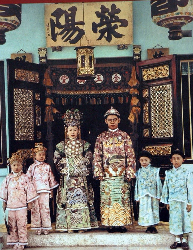
The Peranakans () are an ethnic group defined by their genealogical descent from the first waves of Southern Chinese settlers to maritime Southeast Asia, known as Nanyang (), namely the British Colonial ruled ports in the Malay Peninsula, the Indonesian Archipelago as well as Singapore. Peranakan culture, especially in the dominant Peranakan centres of Malacca, Singapore, Penang and Medan, is characterized by its unique hybridization of ancient Chinese culture with the local cultures of the Nusantara region, the result of a centuries-long history of transculturation and interracial marriage. Immigrants from the southern provinces of China arrived in significant numbers in the region between the 14th and 17th centuries, taking abode in the Malay Peninsula (where their descendants in Malacca, Singapore and Penang are referred to as Baba–Nyonya); the Indonesian Archipelago (where their descendants are referred to as Kiau–Seng); and Southern Thailand, primarily in Phuket, Tr ... [...More Info...] [...Related Items...] OR: [Wikipedia] [Google] [Baidu] |
North Coast Road (Java)
The North Coast Road ( id, Jalur Pantai Utara (Jalur Pantura)) is a road 1,430 km in length, that connects Merak and Banyuwangi along the northern coast of Java, particularly between Jakarta and Surabaya. The most part of Java north coast road was built during the reign of governor-general of the Dutch East Indies Herman Willem Daendels (1808–1811) and was originally known as the Great Post Road ( id, Jalan Raya Pos nl, De Grote Postweg). History of construction The Great Post Road was a military road which was built under the order of King Lodewijk Napoleon who ruled the Kingdom of Holland at that time. the road was intended to ease military support, e.g. transfer of soldiers, in order to defend Java from possible British invasion. It connects Anyer in western end and Panarukan in eastern end of Java. After Daendels rule, the eastern road was later extended to Banyuwangi. The Java Great Post Road consist the most parts of present Java North Coast Road. However th ... [...More Info...] [...Related Items...] OR: [Wikipedia] [Google] [Baidu] |
Great Post Road
The Great Post Road ( id, Jalan Raya Pos or nl, De Grote Postweg) is the name for the historical road that runs across Java that connects Anyer and Panarukan. It was built during the reign of Herman Willem Daendels (1808–1811), governor-general of the Dutch East Indies, using unpaid forced labor that cost thousands of lives. Construction ''La Grande Route'', as Daendels called it, was a military road which was built by the order of King Louis Bonaparte who ruled the Kingdom of Holland at that time, during the Napoleonic Wars. France was at war with England and the road was intended to support the defense of Java by, e.g. making it easier to transfer soldiers and supplies. In 1750, before the road was constructed, connections existed between Batavia (present-day Jakarta) and Semarang and onwards to Surabaya. A north-south connection between Semarang, Surakarta and onwards to Yogyakarta was also available at that time. However, heavy tropical rainfall frequently destroyed th ... [...More Info...] [...Related Items...] OR: [Wikipedia] [Google] [Baidu] |
Kediri (historical Kingdom)
Kediri Kingdom (also known as Panjalu) Javanese script : ꧋ꦥŋꦗꦭꦸ, was a ''Hindu-Buddhist'' Javanese Kingdom based in East Java from 1042 to around 1222. This kingdom is centered in the ancient city ''Dahanapura'', despite the lack of archaeological remains, the age of Kediri saw much development in classical literature. Mpu Sedah's ''Kakawin Bharatayuddha'', Mpu Panuluh's ''Gatotkacasraya'', and Mpu Dharmaja's ''Smaradhana'' blossomed in this era. The kingdom's capital is believed to have been established in the western part of the Brantas River valley, somewhere near modern Kediri city and surrounding Kediri Regency. Etymology and names Actually, the city of Daha existed before the division of the kingdom. Daha is an abbreviation of ''Dahanapura'', which means ''city of fire''. This name is listed in the Pamwatan inscription issued by Airlangga in 1042. This is in accordance with the news in '' Serat Calon Arang'', that at the end of Airlangga's reign, the center ... [...More Info...] [...Related Items...] OR: [Wikipedia] [Google] [Baidu] |
Mataram Sultanate
The Sultanate of Mataram () was the last major independent Javanese kingdom on the island of Java before it was colonised by the Dutch. It was the dominant political force radiating from the interior of Central Java from the late 16th century until the beginning of the 18th century. Mataram reached its peak of power during the reign of Sultan Agung Anyokrokusumo (), and began to decline after his death in 1645. By the mid-18th century, Mataram lost both power and territory to the Dutch East India Company (Dutch: ''Vereenigde Oost-Indische Compagnie''; ''VOC''). It had become a vassal state of the company by 1749. Etymology The name ''Mataram'' itself was never the official name of any polity, as the Javanese often refer to their realm simply as ''Bhumi Jawa'' or ''Tanah Jawi'' ("Land of Java"). ''Mataram'' refers to the historical areas of plains south of Mount Merapi around present-day Muntilan, Sleman, Yogyakarta, and Prambanan. More precisely, it refers to the Kota Gede ... [...More Info...] [...Related Items...] OR: [Wikipedia] [Google] [Baidu] |
Sunda Kingdom
The Sunda Kingdom ( su, , Karajaan Sunda, ) was a Sundanese Hindu kingdom located in the western portion of the island of Java from 669 to around 1579, covering the area of present-day Banten, Jakarta, West Java, and the western part of Central Java. The capital of the Sunda Kingdom moved several times during its history, shifting between the Galuh (Kawali) area in the east and Pakuan Pajajaran in the west. The Sunda Kingdom reached its peak during the reign of King Sri Baduga Maharaja, whose reign from 1482 to 1521 is traditionally remembered as an age of peace and prosperity among Sundanese people. According to primary historical records such as the Bujangga Manik manuscript, the eastern border of the kingdom was the Pamali River (Ci Pamali, the present-day Brebes River) and the Serayu River (Ci Sarayu) in Central Java. Most accounts of the Sunda Kingdom come from primary historical records from the 16th century. The kingdom's inhabitants were primarily the eponymous ethni ... [...More Info...] [...Related Items...] OR: [Wikipedia] [Google] [Baidu] |
East Java
East Java ( id, Jawa Timur) is a Provinces of Indonesia, province of Indonesia located in the easternmost hemisphere of Java island. It has a land border only with the province of Central Java to the west; the Java Sea and the Indian Ocean border its northern and southern coasts, respectively, while the narrow Bali Strait to the east separates Java from Bali by around . Located in eastern Java (island), Java, the province also includes the island of Madura Island, Madura (which is connected to Java by the longest bridge in Indonesia, the Suramadu Bridge), as well as the Kangean Islands, Kangean islands and other smaller island groups located further east (in the northern Bali Sea) and Masalembu Islands, Masalembu archipelagos in the north. Its capital is Surabaya, the Largest cities in Indonesia, second largest city in Indonesia, a major industrial center and also a major business center. Banyuwangi is the largest regency in East Java and the largest on the island of Java. The p ... [...More Info...] [...Related Items...] OR: [Wikipedia] [Google] [Baidu] |
North-East Coastal District
The points of the compass are a set of horizontal, radially arrayed compass directions (or azimuths) used in navigation and cartography. A compass rose is primarily composed of four cardinal directions—north, east, south, and west—each separated by 90 degrees, and secondarily divided by four ordinal (intercardinal) directions—northeast, southeast, southwest, and northwest—each located halfway between two cardinal directions. Some disciplines such as meteorology and navigation further divide the compass with additional azimuths. Within European tradition, a fully defined compass has 32 'points' (and any finer subdivisions are described in fractions of points). Compass points are valuable in that they allow a user to refer to a specific azimuth in a colloquial fashion, without having to compute or remember degrees. Designations The names of the compass point directions follow these rules: 8-wind compass rose * The four cardinal directions are north (N), east (E), s ... [...More Info...] [...Related Items...] OR: [Wikipedia] [Google] [Baidu] |
West Java
West Java ( id, Jawa Barat, su, ᮏᮝ ᮊᮥᮜᮧᮔ᮪, romanized ''Jawa Kulon'') is a province of Indonesia on the western part of the island of Java, with its provincial capital in Bandung. West Java is bordered by the province of Banten and the country's capital region of Jakarta to the west, the Java Sea to the north, the province of Central Java to the east and the Indian Ocean to the south. With Banten, this province is the native homeland of the Sundanese people, the second-largest ethnic group in Indonesia. West Java was one of the first eight provinces of Indonesia formed following the country's independence proclamation and was later legally re-established on 14 July 1950. In 1966, the city of Jakarta was split off from West Java as a 'special capital region' (), with a status equivalent to that of a province, while in 2000 the western parts of the province were in turn split away to form a separate Banten province. Even following these split-offs, West Java is ... [...More Info...] [...Related Items...] OR: [Wikipedia] [Google] [Baidu] |


