|
Morphoclimatic Zones
In climatic geomorphology, morphoclimatic zones are areas which are characterised by landforms associated with a particular climate. The geomorphological processes involved with distinct climates can have large impacts on the near-surface geology of the area. However, only some processes and landforms can be associated with particular climates, meaning that they are ''zonal;'' processes and landforms not associated with particular climates are labelled ''azonal''. Despite this, azonal processes and landforms might still take on particular characteristics when developing under the influence of particular climates. When identified, morphoclimatic zones do usually lack sharp boundaries and tend to grade from one type to another resulting in that only the core of the zone has all expected attributes. Influential morphoclimatic zoning schemes are those of Julius Büdel (1948, 1963, 1977) and of Jean Tricart and André Cailleux (1965). Büdel's schemes stresses planation and valley-c ... [...More Info...] [...Related Items...] OR: [Wikipedia] [Google] [Baidu] |
Climatic Geomorphology
Climatic geomorphology is the study of the role of climate in shaping landforms and the earth-surface processes. An approach used in climatic geomorphology is to study relict landforms to infer ancient climates. Being often concerned about past climates climatic geomorphology considered sometimes to be an aspect of historical geology. Since landscape features in one region might have evolved under climates different from those of the present, studying climatically disparate regions might help understand present-day landscapes. For example, Julius Büdel studied both cold-climate processes in Svalbard and weathering processes in tropical India to understand the origin of the relief of Central Europe, which he argued was a palimpsest of landforms formed at different times and under different climates. Sub-disciplines The various subbranches of climatic geomorphology focus on specific climatic environments. Desert geomorphology Desert geomorphology or the geomorphology of arid an ... [...More Info...] [...Related Items...] OR: [Wikipedia] [Google] [Baidu] |
Regolith
Regolith () is a blanket of unconsolidated, loose, heterogeneous superficial deposits covering solid rock. It includes dust, broken rocks, and other related materials and is present on Earth, the Moon, Mars, some asteroids, and other terrestrial planets and moons. Etymology The term ''regolith'' combines two Greek words: (), 'blanket', and (), 'rock'. The American geologist George P. Merrill first defined the term in 1897, writing: Earth Earth's regolith includes the following subdivisions and components: * soil or pedolith * alluvium and other transported cover, including that transported by aeolian, glacial, marine, and gravity flow processes. * "saprolith'", generally divided into the ** ''upper saprolite'': completely oxidised bedrock ** ''lower saprolite'': chemically reduced partially weathered rocks ** ''saprock'': fractured bedrock with weathering restricted to fracture margins * volcanic ash and lava flows that are interbedded with unconsolidated material * ... [...More Info...] [...Related Items...] OR: [Wikipedia] [Google] [Baidu] |
Canadian Arctic
Northern Canada, colloquially the North or the Territories, is the vast northernmost region of Canada variously defined by geography and politics. Politically, the term refers to the three territories of Canada: Yukon, Northwest Territories and Nunavut. This area covers about 48 per cent of Canada's total land area, but has less than 1 per cent of Canada's population. The terms "northern Canada" or "the North" may be used in contrast with ''the far north'', which may refer to the Canadian Arctic, the portion of Canada that lies north of the Arctic Circle, east of Alaska and west of Greenland. However, in many other uses the two areas are treated as a single unit. __TOC__ Definitions Subdivisions As a social rather than political region, the Canadian North is often subdivided into two distinct regions based on climate, the ''near north'' and the ''far north''. The different climates of these two regions result in vastly different vegetation, and therefore very different econ ... [...More Info...] [...Related Items...] OR: [Wikipedia] [Google] [Baidu] |
Antarctica
Antarctica () is Earth's southernmost and least-populated continent. Situated almost entirely south of the Antarctic Circle and surrounded by the Southern Ocean, it contains the geographic South Pole. Antarctica is the fifth-largest continent, being about 40% larger than Europe, and has an area of . Most of Antarctica is covered by the Antarctic ice sheet, with an average thickness of . Antarctica is, on average, the coldest, driest, and windiest of the continents, and it has the highest average elevation. It is mainly a polar desert, with annual precipitation of over along the coast and far less inland. About 70% of the world's freshwater reserves are frozen in Antarctica, which, if melted, would raise global sea levels by almost . Antarctica holds the record for the lowest measured temperature on Earth, . The coastal regions can reach temperatures over in summer. Native species of animals include mites, nematodes, penguins, seals and tardigrades. Where vegetation o ... [...More Info...] [...Related Items...] OR: [Wikipedia] [Google] [Baidu] |
Greenland
Greenland ( kl, Kalaallit Nunaat, ; da, Grønland, ) is an island country in North America that is part of the Kingdom of Denmark. It is located between the Arctic and Atlantic oceans, east of the Canadian Arctic Archipelago. Greenland is the world's largest island. It is one of three constituent countries that form the Kingdom of Denmark, along with Denmark and the Faroe Islands; the citizens of these countries are all citizens of Denmark and the European Union. Greenland's capital is Nuuk. Though a part of the continent of North America, Greenland has been politically and culturally associated with Europe (specifically Norway and Denmark, the colonial powers) for more than a millennium, beginning in 986.The Fate of Greenland's Vikings , by Dale Mackenzie Brown, ''Archaeological Institute of America'', ... [...More Info...] [...Related Items...] OR: [Wikipedia] [Google] [Baidu] |
Taiwan
Taiwan, officially the Republic of China (ROC), is a country in East Asia, at the junction of the East and South China Seas in the northwestern Pacific Ocean, with the People's Republic of China (PRC) to the northwest, Japan to the northeast, and the Philippines to the south. The territories controlled by the ROC consist of 168 islands, with a combined area of . The main island of Taiwan, also known as ''Formosa'', has an area of , with mountain ranges dominating the eastern two-thirds and plains in the western third, where its highly urbanised population is concentrated. The capital, Taipei, forms along with New Taipei City and Keelung the largest metropolitan area of Taiwan. Other major cities include Taoyuan, Taichung, Tainan, and Kaohsiung. With around 23.9 million inhabitants, Taiwan is among the most densely populated countries in the world. Taiwan has been settled for at least 25,000 years. Ancestors of Taiwanese indigenous peoples settled the isla ... [...More Info...] [...Related Items...] OR: [Wikipedia] [Google] [Baidu] |
Western Ghats
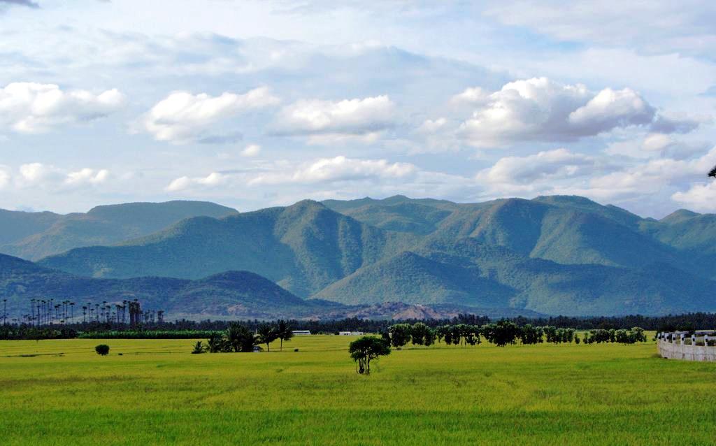
The Western Ghats, also known as the Sahyadri, is a mountain range that stretches along the West Coast of India, western coast of the Indian peninsula. Covering an area of , it traverses the states and union territories of India, states of Gujarat, Maharashtra, Goa, Karnataka, Kerala, and Tamil Nadu. The range forms an almost continuous chain of mountains along the western edge of the Deccan Plateau, from the Tapti River to Swamithoppe in Kanyakumari district at the southern tip of the Indian peninsula. The Western Ghats meet with the Eastern Ghats at Nilgiris before continuing south. Geologic evidence indicates that the mountains were formed during the break-up of the supercontinent of Gondwana. The mountains came along the west coast of India somewhere in the late Jurassic and early Cretaceous periods when India separated from the African continent. The mountains can be roughly divided into three parts: the northern section with an elevation ranging from , the middle section ... [...More Info...] [...Related Items...] OR: [Wikipedia] [Google] [Baidu] |
East Africa
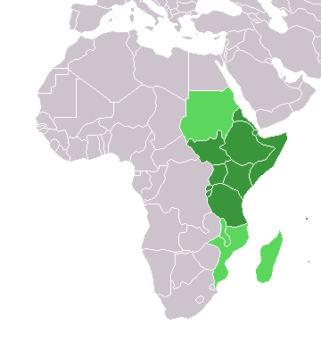
East Africa, Eastern Africa, or East of Africa, is the eastern subregion of the African continent. In the United Nations Statistics Division scheme of geographic regions, 10-11-(16*) territories make up Eastern Africa: Due to the historical Omani Empire and colonial territories of the British East Africa Protectorate and German East Africa, the term ''East Africa'' is often (especially in the English language) used to specifically refer to the area now comprising the three countries of Kenya, Tanzania, and Uganda. However, this has never been the convention in many other languages, where the term generally had a wider, strictly geographic context and therefore typically included Djibouti, Eritrea, Ethiopia, and Somalia.Somaliland is not included in the United Nations geoscheme, as it is internationally recognized as a part of Somalia. *Tanzania, Kenya, Uganda, Rwanda, Burundi, Democratic Republic of Congo and South Sudan are members of the East African Community. The firs ... [...More Info...] [...Related Items...] OR: [Wikipedia] [Google] [Baidu] |
Serra Do Mar
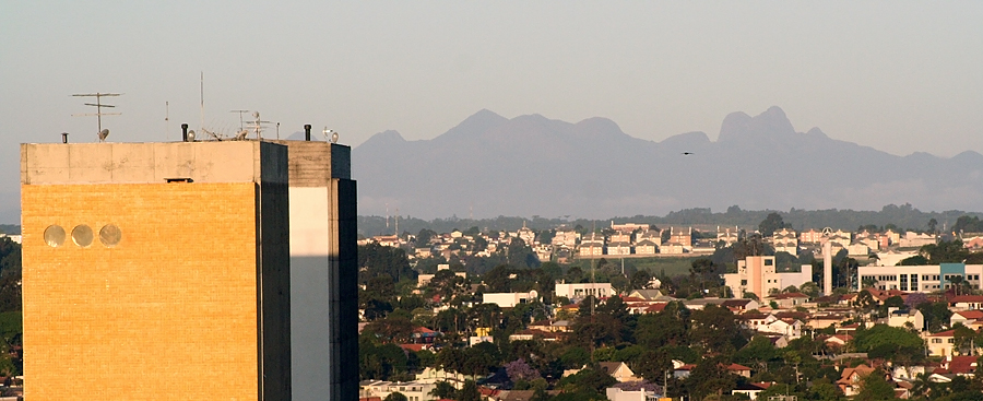
The Serra do Mar (, Portuguese for ''Sea's Ridge'' or ''Sea Ridge'') is a 1,500 km long system of mountain ranges and escarpments in Southeastern Brazil. Geography The Serra do Mar runs parallel to the Atlantic Ocean coast from the state of Espírito Santo to southern Santa Catarina,Angulo, R. J., G. C. Lessa, M. C. de Souza (2009). ''The Holocene Barrier Systems of Paranaguá and Northern Santa Catarina Coasts, Southern Brazil.'' Lecture Notes in Earth Sciences 107: 135-176. although some literature includes the Serra Geral in the Serra do Mar, in which case the range would extend to northeastern Rio Grande do Sul. The main escarpment forms the boundary between the sea-level littoral and the inland plateau (''planalto''), which has a mean altitude of . This escarpment is part of the Great Escarpment that runs along much of the eastern coast of Brazil south from the city of Salvador, Bahia. Mountain ranges The mountain ranges are discontinuous in several places and are ... [...More Info...] [...Related Items...] OR: [Wikipedia] [Google] [Baidu] |
Trans-Mexican Volcanic Belt
The Trans-Mexican Volcanic Belt ( es, Eje Volcánico Transversal), also known as the Transvolcanic Belt and locally as the (''Snowy Mountain Range''), is an active volcanic belt that covers central-southern Mexico. Several of its highest peaks have snow all year long, and during clear weather, they are visible to a large percentage of those who live on the many high plateaus from which these volcanoes rise. History The Trans-Mexican Volcanic Belt spans across Central-Southern Mexico from the Pacific Ocean to the Gulf of Mexico between 18°30'N and 21°30'N, resting on the southern edge of the North American Plate. This approximately 1000 kilometer long, 90–230 km broad structure is an east–west, active, continental volcanic arc; encompassing an area of approximately 160,000 km2. Over several million years, the subduction of the Rivera and Cocos plates beneath the North American Plate along the northern end of the Middle America Trench formed the Trans-Mexican Vol ... [...More Info...] [...Related Items...] OR: [Wikipedia] [Google] [Baidu] |
Piotr Migoń
Piotr Migoń is a Polish geomorphologist active at the university of Wrocław where he hold a chair as Professor of Geography. Migoń has specialized in the study of weathering, mass movements in mountains, long-term landscape evolution and the geomorphology of granite and sandstone areas. Most of his research has been carried out in the Sudetes and other parts of Central Europe Central Europe is an area of Europe between Western Europe and Eastern Europe, based on a common historical, social and cultural identity. The Thirty Years' War (1618–1648) between Catholicism and Protestantism significantly shaped the area' .... He is currently an International Association of Geomorphologists board member. References Year of birth missing (living people) Living people Polish geomorphologists Academic staff of the University of Wrocław {{Poland-scientist-stub ... [...More Info...] [...Related Items...] OR: [Wikipedia] [Google] [Baidu] |
Paleic Surface
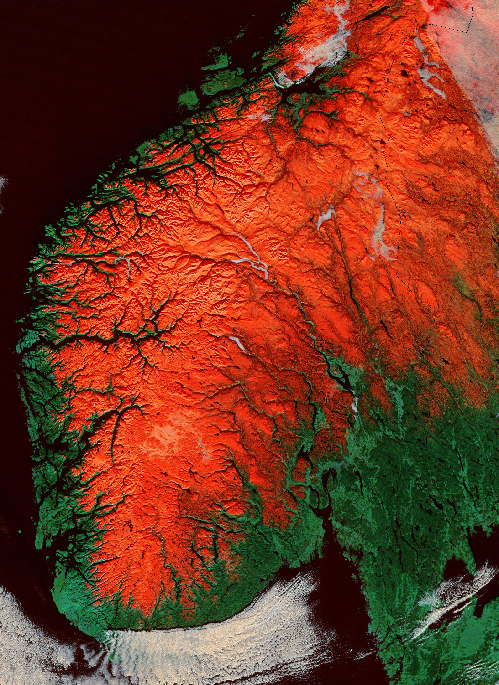
The paleic surface or palaeic surface ( no, paleiske overflaten, ) is an erosion surface of gentle slopes that exist in South Norway. Parts of it are a continuation of the Sub-Cambrian peneplain and Muddus Plains found further east or equivalent to the strandflat coastal plains of Norway. Hardangervidda, a particularly flat and elevated part of the Paleic surface formed in the Miocene at sea level. Although the tilted plateau-like topography of south Norway had been noted since the early 1800s, the first formal description was by Hans Reusch in 1901, using a denudation chronology approach invoking several of W.M. Davis’ ideas of a cycle of erosion. Reusch also coined the name ''Paleic surface''. The Paleic surface is sometimes erroneously considered equal to Norway's "pre-glacial surface" – the surface that existed in Norway just before the Quaternary glaciations. South Norway: the type area There have been various attempts at defining the subset of surfaces that comp ... [...More Info...] [...Related Items...] OR: [Wikipedia] [Google] [Baidu] |


