|
Bulli Point
Bulli Point ( mi, Te Pōporo, officially gazetted as Te Pōporo / Bulli Point) is a point on Lake Taupō, in the central North Island of New Zealand. The point is a popular spot for rock jumping. Location Bulli Point sits in Motutere Bay on the eastern side of Lake Taupō. It lies close to State Highway 1, less than one kilometre east of Motutere. Naming The name ''Te Pōporo'' is a Te Reo Māori name taken from the pā that once stood on the hill above the point. It was one of several important pā located between Motutere and Hatepe. The pā may have been named after Pōporo, a Māori name for '' Solanum aviculare'' and ''Solanum laciniatum'', a local shrub with white to blue-purple flowers, and yellow to orange fruit, sometimes called bullibulli. A point on the western side of the lake, Te Poroporo Point, also contains a word for the same shrub, ''Poroporo''. The origin of the name ''Bulli Point'' is unclear. Toitū Te Whenua's New Zealand Gazetteer suggests it ... [...More Info...] [...Related Items...] OR: [Wikipedia] [Google] [Baidu] |
Lake Taupō
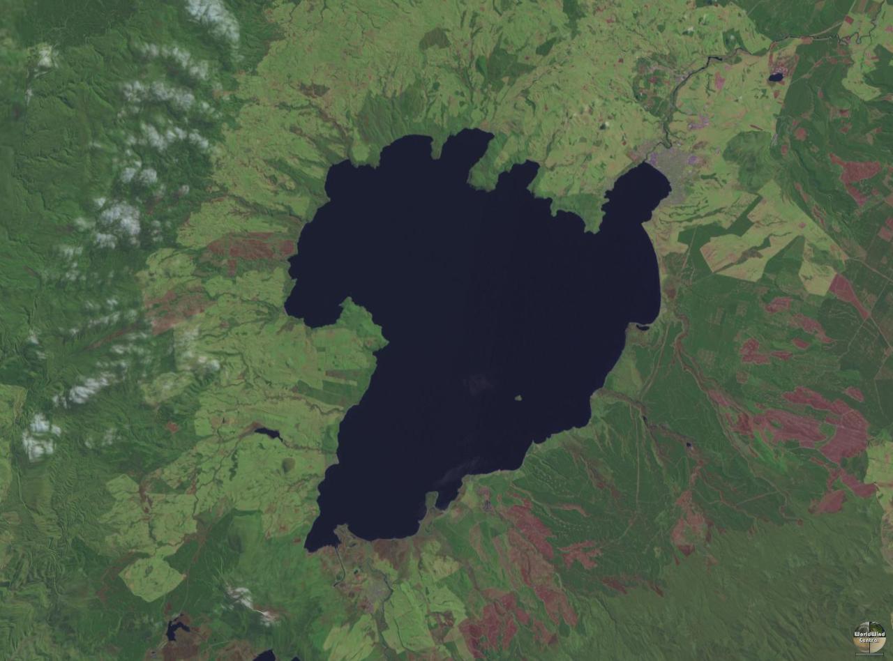
Lake Taupō (also spelled Taupo; mi, Taupō-nui-a-Tia or ) is a large crater lake in New Zealand's North Island, located in the caldera of the Taupō Volcano. The lake is the namesake of the town of Taupō, which sits on a bay in the lake's northeastern shore. With a surface area of , it is the largest lake by surface area in New Zealand, and the second largest freshwater lake by surface area in geopolitical Oceania after Lake Murray in Papua New Guinea. Motutaiko Island lies in the southeastern area of the lake. Lake Taupō has a perimeter of approximately and a maximum depth of . It is drained by the Waikato River (New Zealand's longest river), and its main tributaries are the Waitahanui River, the Tongariro River, and the Tauranga Taupō River. It is a noted trout fishery with stocks of introduced brown and rainbow trout. The level of the lake is controlled by Mercury Energy, the owner of the eight hydroelectric dams on the Waikato River downstream of Lake Taupō, usin ... [...More Info...] [...Related Items...] OR: [Wikipedia] [Google] [Baidu] |
Māori Language
Māori (), or ('the Māori language'), also known as ('the language'), is an Eastern Polynesian language spoken by the Māori people, the indigenous population of mainland New Zealand. Closely related to Cook Islands Māori, Tuamotuan, and Tahitian, it gained recognition as one of New Zealand's official languages in 1987. The number of speakers of the language has declined sharply since 1945, but a Māori-language revitalisation effort has slowed the decline. The 2018 New Zealand census reported that about 186,000 people, or 4.0% of the New Zealand population, could hold a conversation in Māori about everyday things. , 55% of Māori adults reported some knowledge of the language; of these, 64% use Māori at home and around 50,000 people can speak the language "very well" or "well". The Māori language did not have an indigenous writing system. Missionaries arriving from about 1814, such as Thomas Kendall, learned to speak Māori, and introduced the Latin alphabet. In 1 ... [...More Info...] [...Related Items...] OR: [Wikipedia] [Google] [Baidu] |
Māori History
The history of the Māori began with the arrival of Polynesian settlers in New Zealand (''Aotearoa'' in Māori), in a series of ocean migrations in canoes starting from the late 13th or early 14th centuries. Over several centuries of isolation, the Polynesian settlers formed a distinct culture that became known as the Māori. Early Māori history is often divided into two periods: the Archaic period () and the Classic period (). Archaeological sites such as Wairau Bar show evidence of early life in Polynesian settlements in New Zealand. Many of the crops that the settlers brought from Polynesia did not grow well at all in the colder New Zealand climate, although many native bird and marine species were hunted, sometimes to extinction. An increasing population, competition for resources and changes in local climate led to social and cultural changes seen in the Classic period of Māori history. This period saw the emergence of a warrior culture and fortified villages (), along wi ... [...More Info...] [...Related Items...] OR: [Wikipedia] [Google] [Baidu] |
Lorde
Ella Marija Lani Yelich-O'Connor (born 7 November 1996), known professionally as Lorde ( ), is a New Zealand singer-songwriter. Taking inspiration from aristocracy for her stage name, she is known for her unconventional musical styles and introspective songwriting. Lorde expressed interest in performing at local venues in her early teens. She signed with Universal Music Group (UMG) in 2009 and collaborated with producer Joel Little in 2011 to start recording music. Their first effort, an extended play (EP) titled '' The Love Club'', was self-released in 2012 for free download on SoundCloud before UMG's commercial release in 2013. The EP's international chart-topping single " Royals" helped raise Lorde to prominence. Her debut studio album ''Pure Heroine'' was released that same year to critical and commercial success. The following year, Lorde curated the soundtrack for the 2014 film '' The Hunger Games: Mockingjay – Part 1'' and recorded several tracks, including the sin ... [...More Info...] [...Related Items...] OR: [Wikipedia] [Google] [Baidu] |
Solanum Laciniatum
''Solanum laciniatum'' is a soft-wooded shrub native to the east coast of Australia, notably Victoria and Tasmania. It also occurs in Western Australia and New Zealand, where some authorities consider it to be introduced. It is similar to ''Solanum aviculare ''Solanum aviculare'', commonly called poroporo or pōporo (New Zealand), bumurra (Dharug), kangaroo apple, pam plum (Australia), or New Zealand nightshade, is a soft-wooded shrub native to New Zealand and the east coast of Australia. The M� ...'', with which it shares the common name kangaroo apple. The common name refers to the likeness of the leaf shape to a kangaroo paw print. This plant is currently being cultivated to produce corticosteroid drugs. Description The shrub typically grows to a height and width of and blooms between January and February producing purple blue flowers. Habitat Grows in well-drained soils in full sun or partial shade. Tolerates moderately salty winds. Is very fast growing but shor ... [...More Info...] [...Related Items...] OR: [Wikipedia] [Google] [Baidu] |
Solanum Aviculare
''Solanum aviculare'', commonly called poroporo or pōporo (New Zealand), bumurra (Dharug), kangaroo apple, pam plum (Australia), or New Zealand nightshade, is a soft-wooded shrub native to New Zealand and the east coast of Australia. The Māori names ''pōroporo'' and ''pōporo'' come from a generic Proto-Polynesian term for any Solanum species and similar berry-bearing plants. Other names used for ''Solanum aviculare'' in the language include ''hōreto'' and ''peoi''. Taxonomy and systematics ''Solanum aviculare'' was first described by German naturalist Georg Forster in 1786, from a collection in New Zealand. ''Solanum aviculare'' is similar to ''Solanum laciniatum'', with which it has been confused. Compared to ''S. laciniatum'', ''S. aviculare'' has smaller flowers (usually pale blue, sometimes dark purple, white or striped blue / white) with acute corolla lobes, it has smaller seeds, up to long, and a different chromosome number (2n = 46) and is found on the Kerm ... [...More Info...] [...Related Items...] OR: [Wikipedia] [Google] [Baidu] |
Motutere, New Zealand
Motutere is a small township on the southeastern shore of Lake Taupō in New Zealand's Waikato region.Dowling, P. (ed.) (2004). ’’Reed New Zealand atlas’’. Auckland: Reed Publishing. It lies on Motutere Bay, close to the popular diving location, Te Poporo / Bulli Point, and approximately halfway between Taupō and Tūrangi, to both of which it is connected by SH1. In the 18th century, the township was the base of Te Rangi-tua-matotoru, the paramount chief of Ngāti Tūwharetoa. Motutere is dominated by a camping site, one of the main spots for caravan camping along the shores of the lake. A popular short walking track, Waipehi Walk, begins at the settlement and offers views across the lake. " |
New Zealand
New Zealand ( mi, Aotearoa ) is an island country in the southwestern Pacific Ocean. It consists of two main landmasses—the North Island () and the South Island ()—and over 700 smaller islands. It is the sixth-largest island country by area, covering . New Zealand is about east of Australia across the Tasman Sea and south of the islands of New Caledonia, Fiji, and Tonga. The country's varied topography and sharp mountain peaks, including the Southern Alps, owe much to tectonic uplift and volcanic eruptions. New Zealand's capital city is Wellington, and its most populous city is Auckland. The islands of New Zealand were the last large habitable land to be settled by humans. Between about 1280 and 1350, Polynesians began to settle in the islands and then developed a distinctive Māori culture. In 1642, the Dutch explorer Abel Tasman became the first European to sight and record New Zealand. In 1840, representatives of the United Kingdom and Māori chiefs ... [...More Info...] [...Related Items...] OR: [Wikipedia] [Google] [Baidu] |
State Highway 1 (New Zealand)
State Highway 1 (SH 1) is the longest and most significant road in the New Zealand road network, running the length of both main islands. It appears on road maps as SH 1 and on road signs as a white number 1 on a red shield, but it has the official designations SH 1N in the North Island, SH 1S in the South Island. SH 1 is long, in the North Island and in the South Island. Since 2010 new roads have reduced the length from . For the majority of its length it is a two-lane single carriageway, with at-grade intersections and property accesses, in both rural and urban areas. These sections have some passing lanes. Around of SH 1 is of motorway or expressway standard : in the North Island and in the South Island. Route North Island (SH 1N) SH 1 starts at Cape Reinga, at the northwestern tip of the Aupouri Peninsula, and since April 2010 has been sealed (mainly with either chipseal or asphalt) for its entire length. From Waitiki Landing south of Cape Reinga, SH 1 trav ... [...More Info...] [...Related Items...] OR: [Wikipedia] [Google] [Baidu] |
Motutere Bay
{{geodis ...
Motutere may refer to one of several locations in New Zealand's Waikato Region: *Castle Rock (Waikato), a mountain which has the alternative Mãori name ''Motutere'' *Motutere, New Zealand, a township on the shore of Lake Taupõ ** Motutere Bay, an indentation in the shore of Lake Taupõ; see Motutere, New Zealand Motutere is a small township on the southeastern shore of Lake Taupō in New Zealand's Waikato region.Dowling, P. (ed.) (2004). ’’Reed New Zealand atlas’’. Auckland: Reed Publishing. It lies on Motutere Bay, close to the popular diving ... [...More Info...] [...Related Items...] OR: [Wikipedia] [Google] [Baidu] |


